History of My Office, Part I: Prehistory – 1955
When I first started working for the Anne Arundel County Public Schools Facilities Department last year, almost immediately I noticed some interesting things about the building where our offices were. You could tell that there had been a lot of modifications made to it over the years: walls had been moved around, network and telephone cables are strung near the ceiling along the main hallway, a variety of windows and doors are used throughout – things like that. Clearly, this was not a building that had been designed from the outset for the purpose it was fulfilling today.
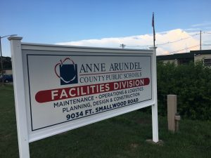
In that first week, a few of the guys asked me if anyone had taken me out back to see the “missile silos”. When I asked my boss about it (thinking that maybe this was some kind of initiation-of-the-new-guy thing) she confirmed that the campus we occupied had once been a military installation. Being the military history nerd that I am, I just had to look into the history surrounding our office. What I found was both interesting and surprising, so I figure: what better way to record that history than with a series of blog posts?
We’ll start at the beginning.
The area now known as Pasadena, MD has seemingly always been a peninsula, though the bodies of water surrounding it have not always been so large as they are today. The melting of Canadian glaciers over many thousands of years raised the sea levels to the point where most of the original native settlements are now suspected to be under water. It is believed that the current water levels have been consistent for probably the last 2,000 – 3,000 years.
When Captain John Smith came up the Chesapeake Bay in 1608, he didn’t encounter any native people in this area, but archaeological evidence points to habitation by the Powhatan tribe of the Algonquian people, who had a series of semi-permanent camps on the peninsula during that time. They would have fished, hunted, and done some limited farming. Arrowheads, tools, storage vessels (of both clay and gourd), as well as evidence of fabric have all been found in the area.
By the middle of the 17th century, European settlers had begun to move in, with all the land on the peninsula probably being claimed by the 1690s. This northern part of Anne Arundel County was then known as “Town Neck Hundred” and was heavily wooded. One of the first things to be done by the settlers was the clearing of those forests so that tobacco fields could be established. Tobacco was the cash crop of early colonial Maryland, and land owners (as well as their investors) wanted to generate healthy profits from its sale as quickly as possible. Land grant maps from the 1700s show the location of my office as being in a tract called “Poplar Plains”. Not much physical evidence remains on the landscape from that period except for Hancock’s Resolution, a house built in 1785 about 3 miles east of our department’s buildings.
Population remained sparse well into the 19th century. The 1850 census shows barely more than 2,000 people living on the entire peninsula, most of them farmers. The crops had changed though: tobacco was out, and corn was in. Some were also growing wheat, plums, apricots, and strawberries.
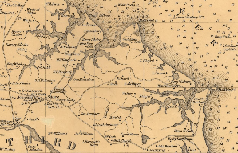
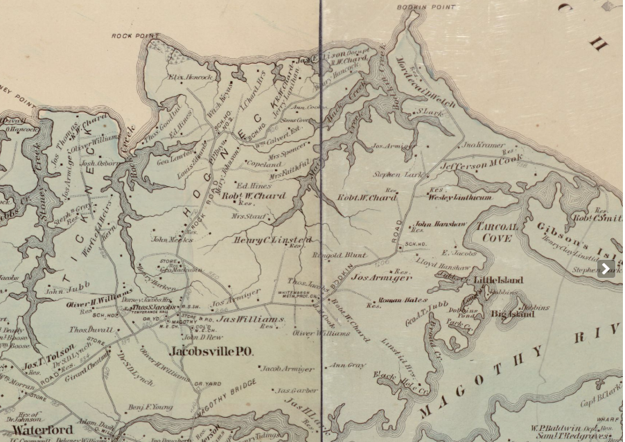
The village of Jacobsville came into existence around this time as well, centered around the present-day intersection of Mountain Road and Armiger Drive. A structure (presumably a general store) dating to the late 1850s is still visible there. Martenet’s 1860 map of Anne Arundel County shows a structure labeled “Johnson’s Store & P.O.” at that location. Between there and Rock Point (present day Fort Smallwood Park) a label for “J. Meek” marks the vicinity of our modern-day complex of buildings.
During the Civil War, southern sentiment prevailed among the people here. Though it remained with the Union, Maryland was still a slave state until November of 1864, and almost 1/3 of the residents of what is now Pasadena were slaves. Only a few men from the peninsula served with northern units in the war. More men followed their convictions and left home to join Confederate units in Virginia. Others who stayed behind were later certified by a local doctor as being “unfit” for service in order to avoid the draft that was instituted. There are also stories of men who were drafted avoiding the army by sending one of their slaves to act as a substitute in their place (people could do that back then). The numerous waterways, combined with the agricultural and political character of the area led to a sizable smuggling trade, with sympathetic farmers loading up blockade-running ships full of supplies for the Confederate forces.
In the post-war years, the loss of slave labor created problems for the farmers still trying to work the land and harvest their crops. Most seem to have started transitioning away from grains to fruits and vegetables, and these “truck farms” were able to find ready markets for those products in Baltimore and Philadelphia. Labor issues were alleviated by the wave of immigration coming from eastern Europe, especially in the 1880s. The 1878 Hopkins Map of Anne Arundel County’s Third District shows the area of our offices being held by “Robt W. Chard”. Population and structures remained sparse.
Around the turn of the century, the beaches of the peninsula became a popular tourist attraction, with many people making the trip by boat from Baltimore during the warmer months. Roads were almost nonexistent here at the time, and since these visitors were arriving at, and remaining close to the shore, they made little impact on the farms in the interior of the peninsula where our complex of buildings is located. Seemingly for decades, life went on as it always had, except that the name “Pasadena” – brought along by a group of people who had immigrated from California – was now being used to describe the area.
Fruit and vegetable farming remained very productive. By 1910, Anne Arundel County was known as the strawberry capital of the United States, and it is certain that the fields surrounding Jacobsville made their contribution to that reputation. In addition to strawberries, the plot where our offices are now located also grew a distinct breed of cantaloupes and other types of fruits and berries.
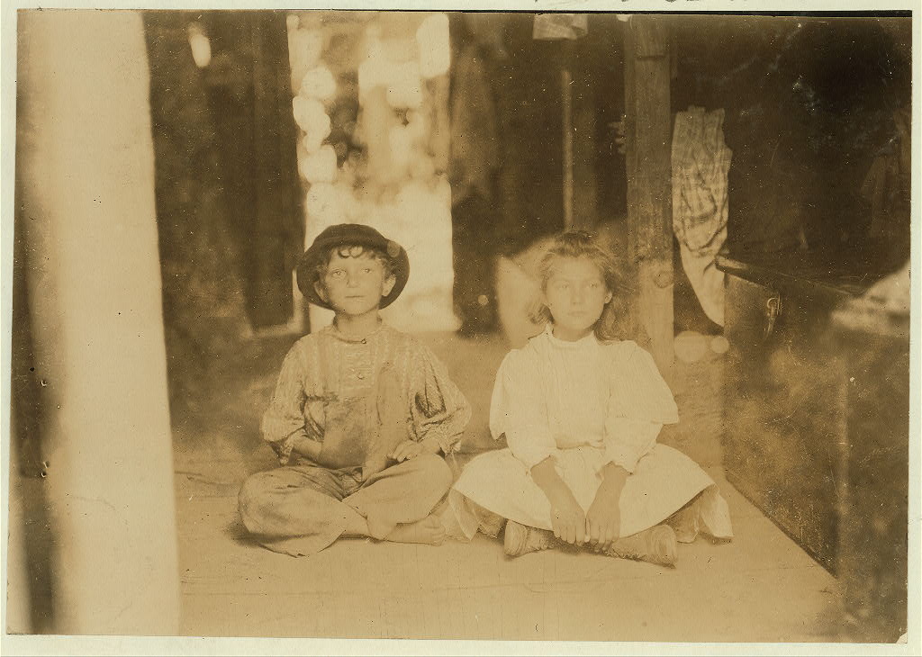
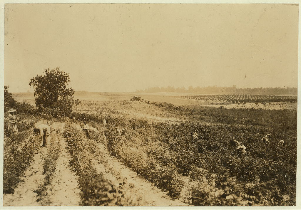
But even 45 years after the abolition of slavery, there was still a darker side to all of this agricultural abundance. Our present campus was, in 1909, part of a large operation owned by Robert Bottomley, and his farm in particular became the subject of a series of photographs by Lewis Hine, documenting the reality of child labor in America at the time. These images and thousands more that Hine would create all across the country, helped to raise public awareness and lead to the institution of child labor laws in the years that followed (Hine’s original caption accompanies each photo):
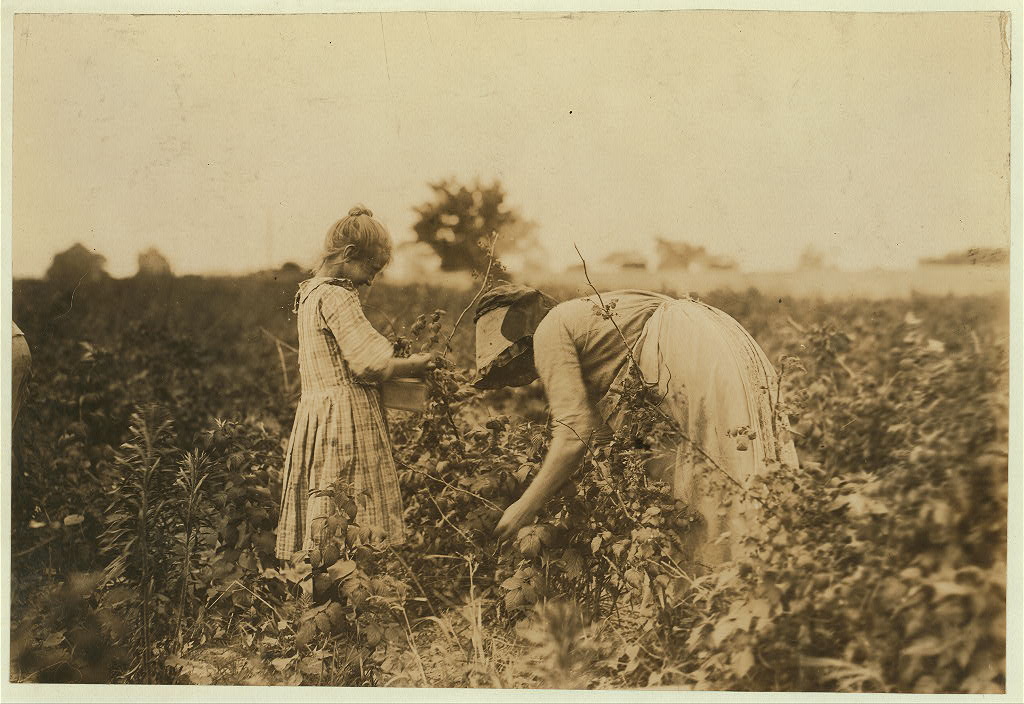
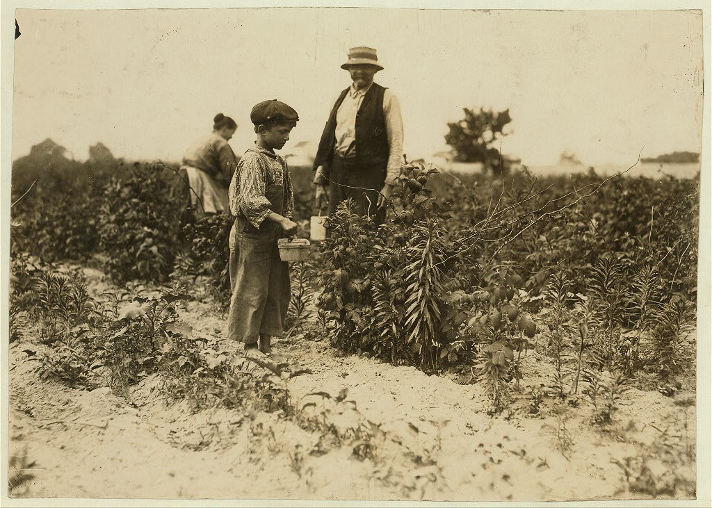
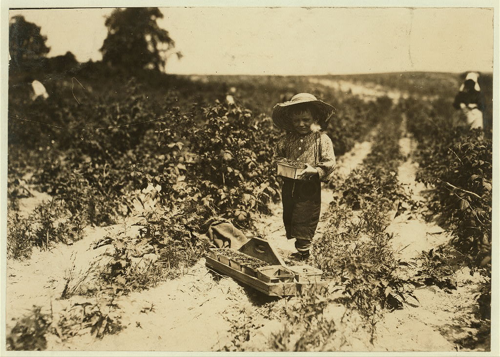
The living conditions on the farm at the time appear to be quite primitive. Immigrant families lived transient lives, never really putting down roots anywhere, but having to follow the seasons south and north looking for whatever work they could find.
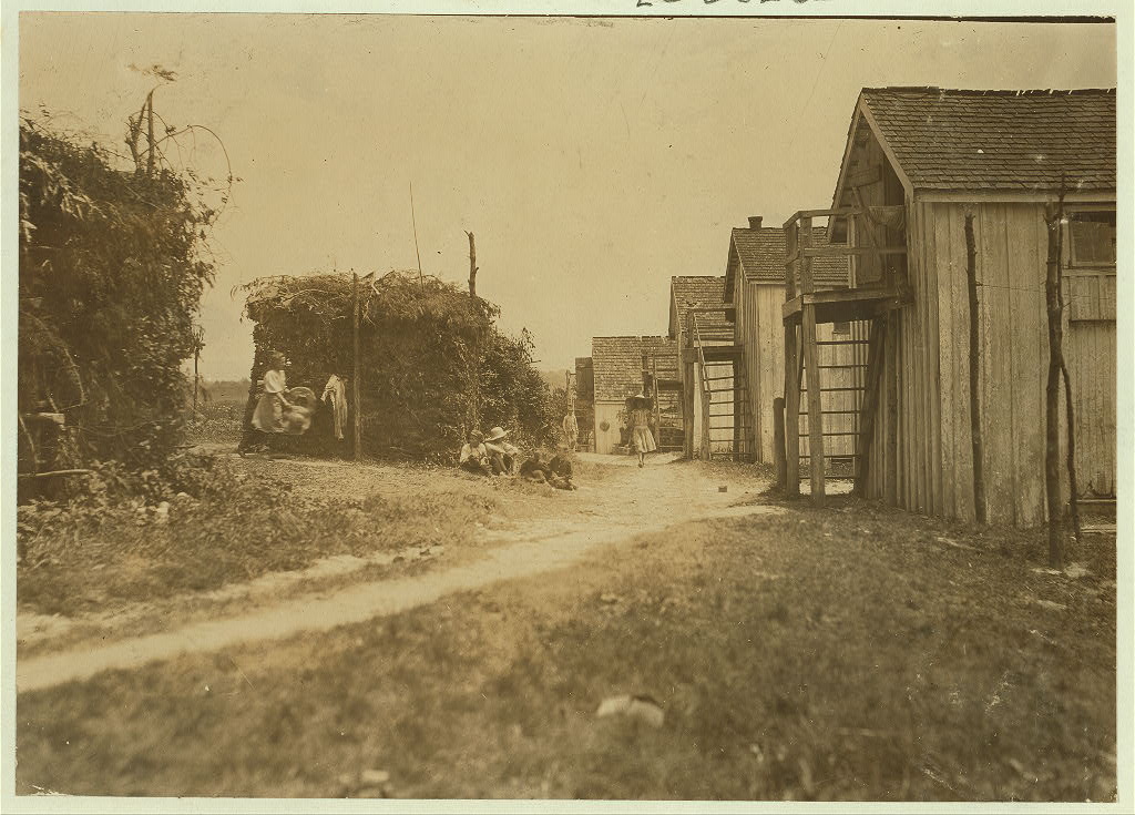
This photo shows a broader vista of Bottomley’s Farm. This is the land that would eventually become our building complex and the Compass Pointe Golf Course that surrounds us.
The pace of change began to accelerate rapidly in the 20th century. In particular, 1932 brought both the electrification of the majority of the peninsula, and the completion of Fort Smallwood Road. The advent of the automobile meant that more of the area’s farmers were purchasing trucks, and as the road system improved, they were overwhelmingly choosing to ship their produce to market over land instead of on the water by the 1950s.
But the middle of the century would bring even more changes to the Pasadena area. The threat of Soviet bombers bringing nuclear destruction upon nearby Baltimore caused the Army to start looking for ways to defend against that possibility. I’ll be exploring that topic further in the next post of the series.
Here are some useful print sources that I consulted for this post, found at the Riviera Beach Community Library:
- “The Pasadena Peninsula: A Closer Look at the Land Between Two Rivers” by Isabel Shipley Cunningham. Pasadena Business Association, Publisher, 2001
- “Strawberries, Peas & Beans: Truck Farming in Anne Arundel County” by William R. Mumford. Ann Arrundell Historical Society, Publisher, 2000
- “Discovering Our School Community” by the Fifth Grade Classes of:
- Jacobsville School, 1951-1952
- Riviera Beach School, 1951-1952; 1955-1956
Do you know how Jacobsville got its name