Battlefield Visits: Major Fights in North Carolina

A few years ago, I traveled to the Raleigh, NC area for a work conference. Of course, I wanted to check out some of the local historical sites in my downtime. There was plenty to see!


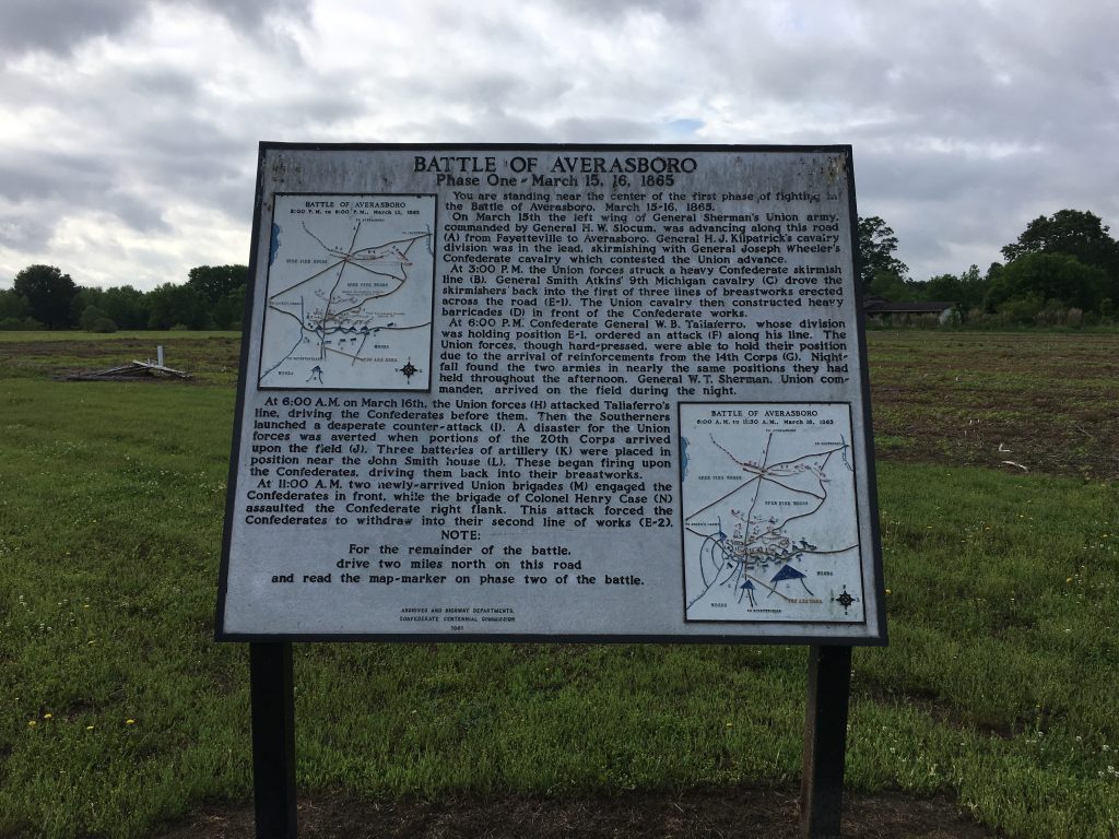
Battle of Averasboro – Civil War Battlefield #40

I got up early on Sunday morning to start my “off” day, and was able to get on the field at the Battle of Averasboro by 8:40am. Though it’s only a mile or two west of I-95, it really feels like you’re out in the country. My guess is that not much has changed since 1865.

One of the markers near the southern end of the battlefield. The action began near here. – Photo by the Author

The field is privately owned, but definitely well cared-for, with a small museum located at the northern end. Several signs make it clear that relic hunting is forbidden and outline other things that the caretakers have in place – including video surveillance.

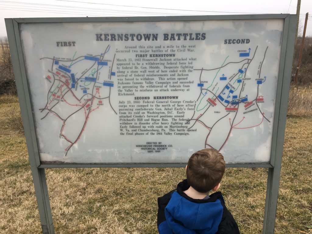
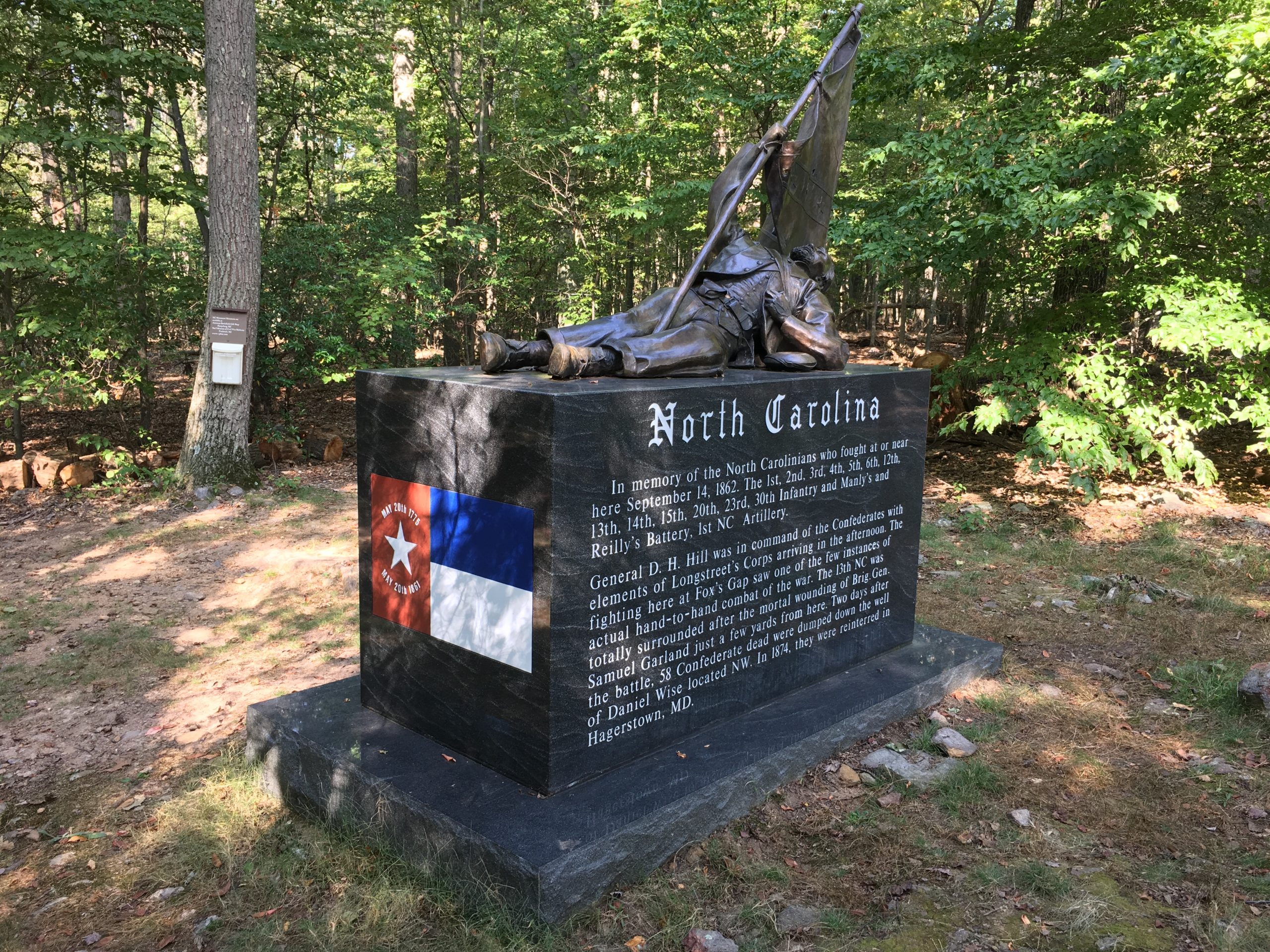
There are numerous markers and a few monuments, but they appear to be from different eras, and thus each has a slightly different way of explaining the action to visitors. For one thing, different markers seem to break the battle into a different number of stages, so I can see how it could be confusing to keep track of what all is going on for a novice. As it turns out, the action revolves around a pretty straight-forward defense-in-depth by the Confederates.

A faux 6-pounder on display outside the museum at Averasboro. Sadly there is no real artillery here. - <i>Photo by the Author</i>
A faux 6-pounder on display outside the museum at Averasboro. Sadly there is no real artillery here. – Photo by the Author

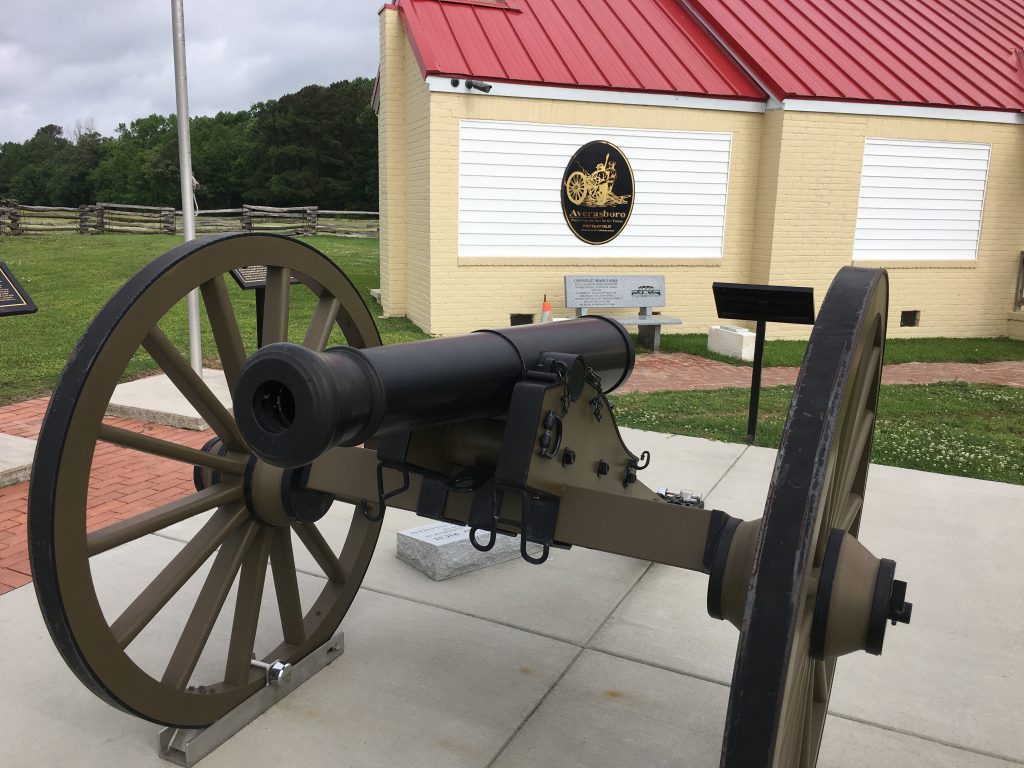
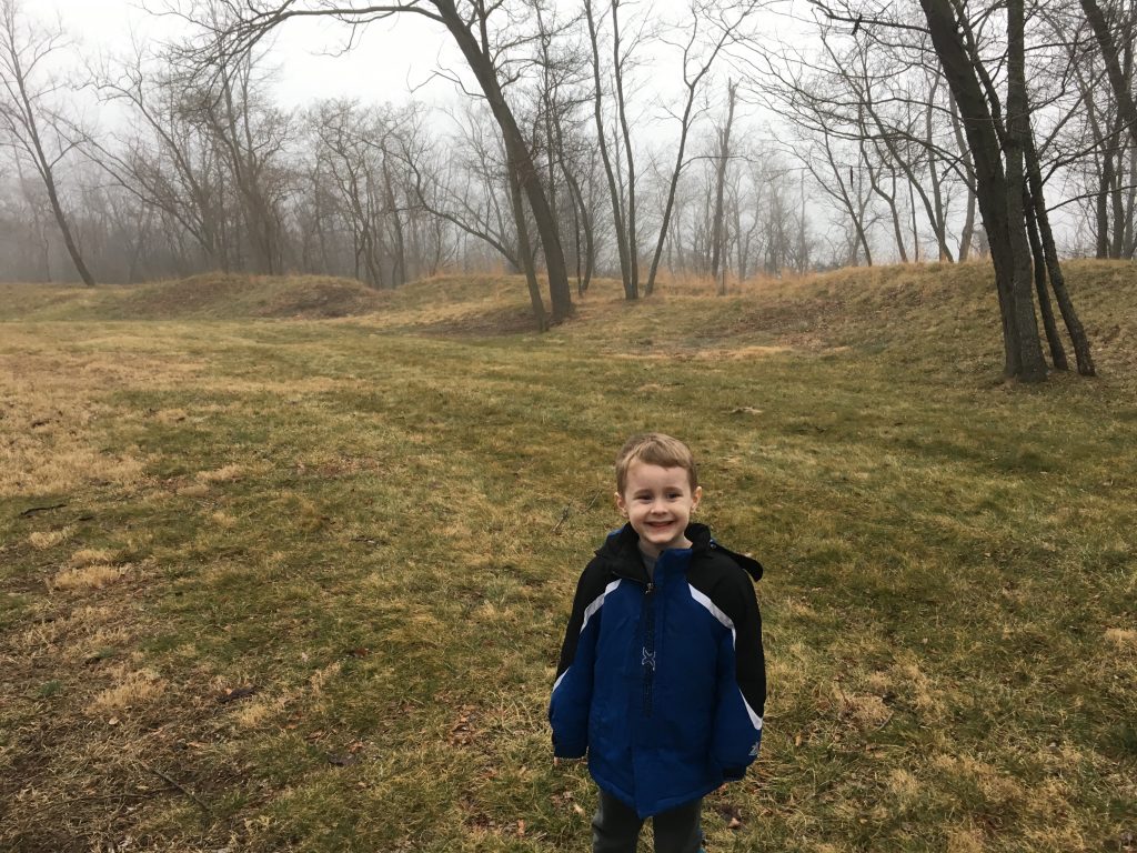
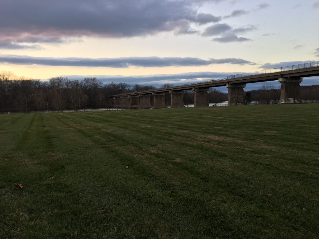
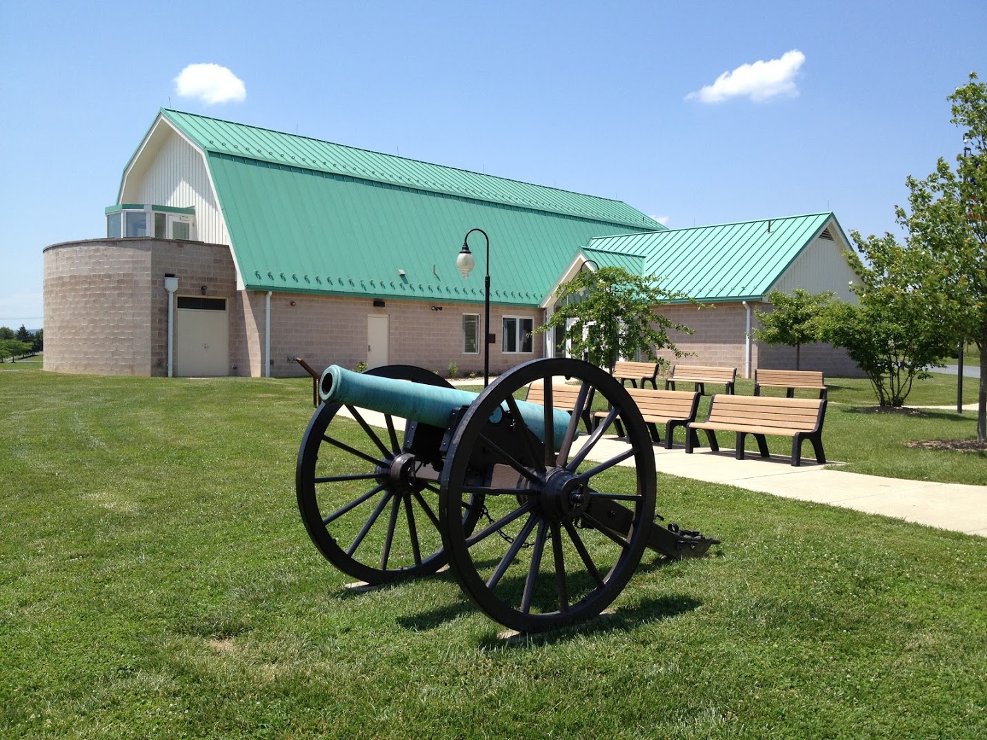
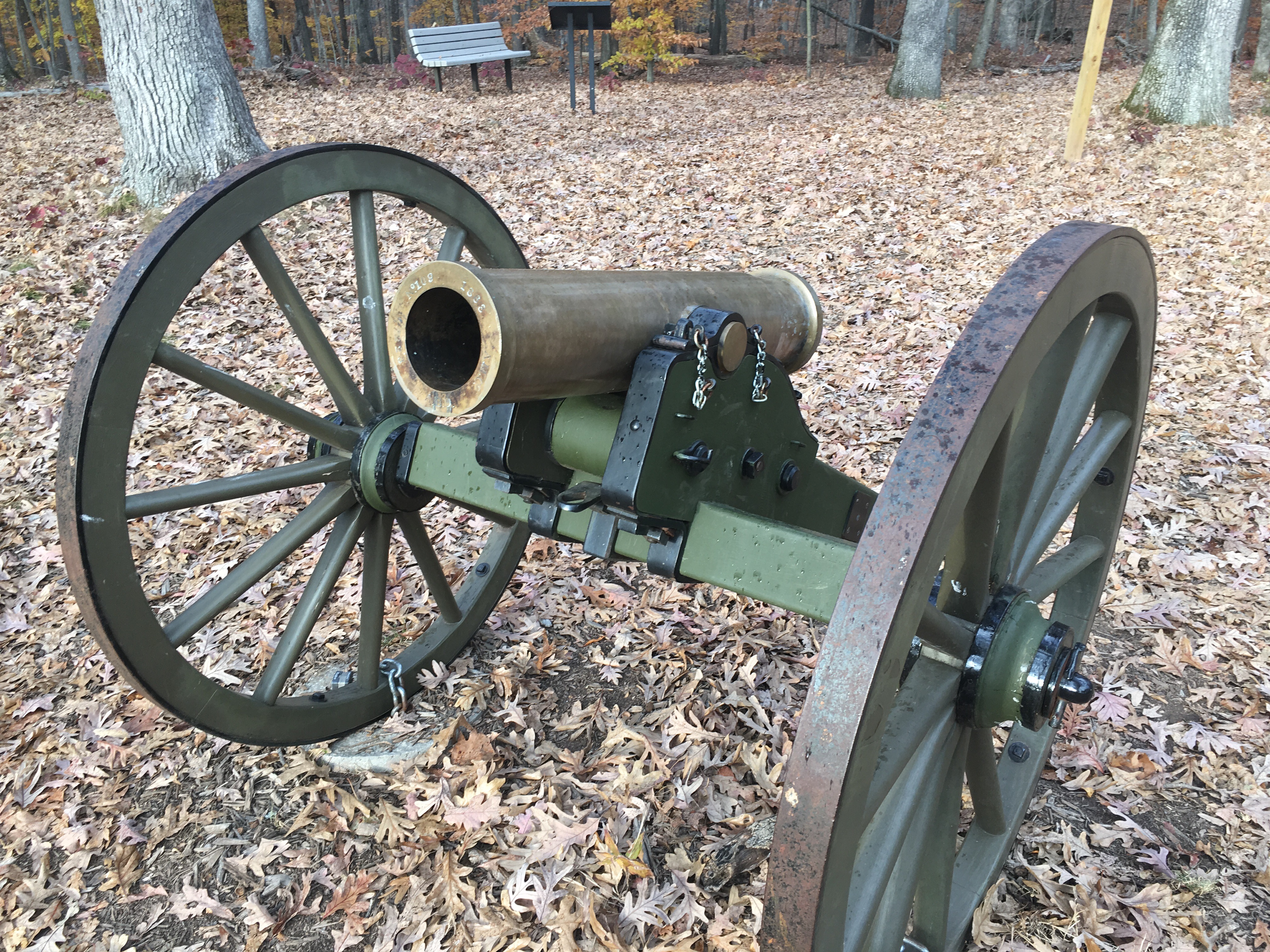
The visitors center was closed on the early Sunday morning that I visited, so I can’t tell you any impressions of it, other than to say that they have a fake artillery piece out front. Hey – at least it’s something. The other thing I took away as I drove through the field was the complete lack of distinct terrain features. Any elevation changes that exist are minuscule. Just about the only factor in the battle was the Cape Fear River that anchored the Confederate left.

On to the next site!


Battle of Bentonville – Civil War Battlefield #41

This was the main event. The Battle of Bentonville was the largest battle to ever take place in North Carolina, and was the culmination of Sherman’s march through the south, and Johnston’s attempt at defense. For me personally, this was the first battlefield I had ever visited where General Sherman had been involved. Pretty crazy to think about.

The State of North Carolina owns several pieces of the battlefield (though in many cases just enough to have a pull-off with a few wayside markers at a tour route stop) and operates those as the Bentonville Battlefield State Historic Site. Most of the field is still privately held, with modern houses occupying the bulk of that area. The spots that are preserved are quite nice, though.

Remnants of trenches built at Bentonville by Union engineers from Michigan. - <i>Photo by the Author</i>
Remnants of trenches built at Bentonville by Union engineers from Michigan. – Photo by the Author

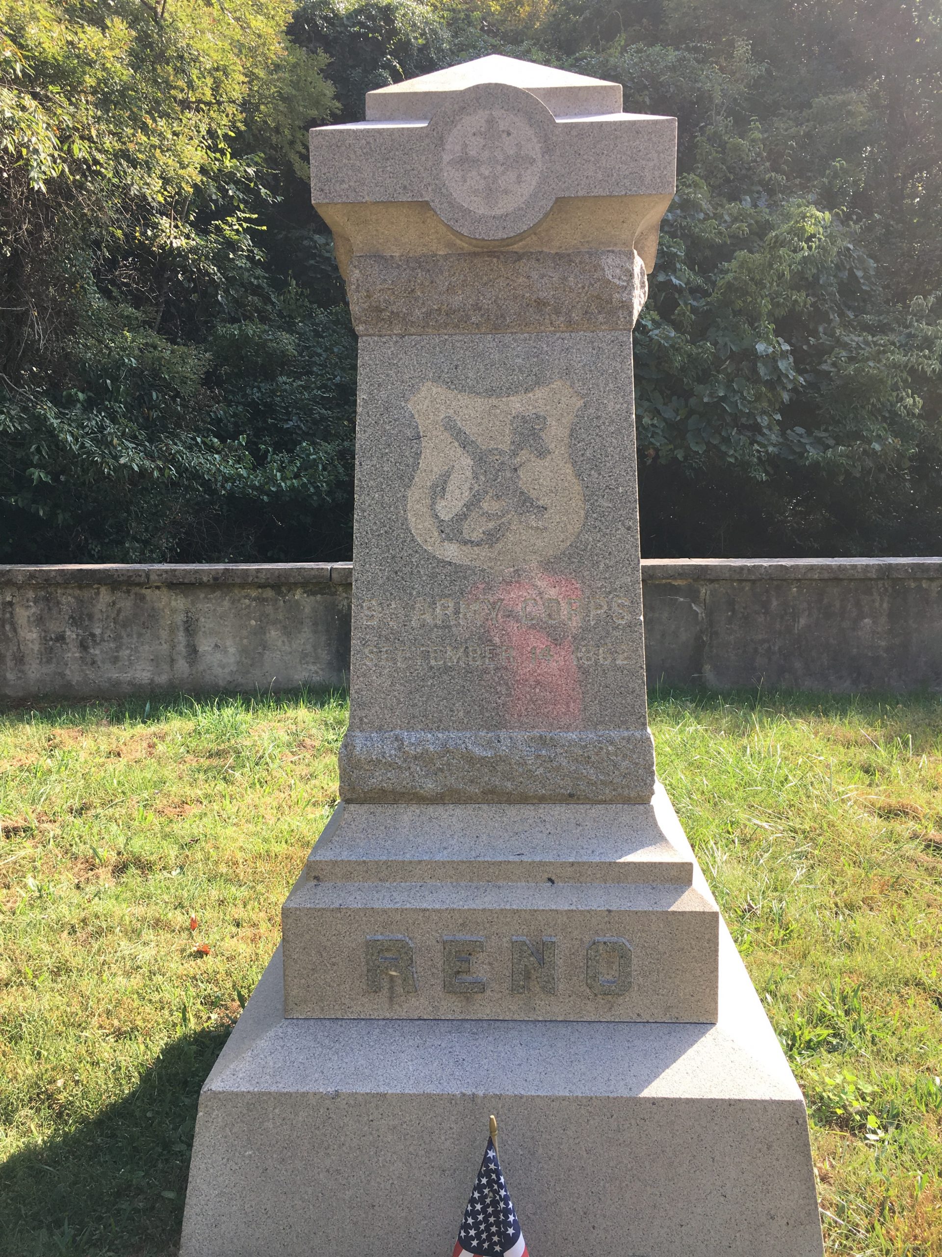
There are also numerous wayside markers that do a great job of explaining the battle action, and even a few monuments – including one of the standard Texas ones. I was able to pick up a copy of the driving tour brochure before I came, which was handy because this was another site where the visitors center was completely closed down on a Sunday morning. On the plus side, the driving tour comes with a phone-in audio narration component that really adds another dimension to the visit. All of these factors mean that you can get a very complete experience in only a couple of hours.

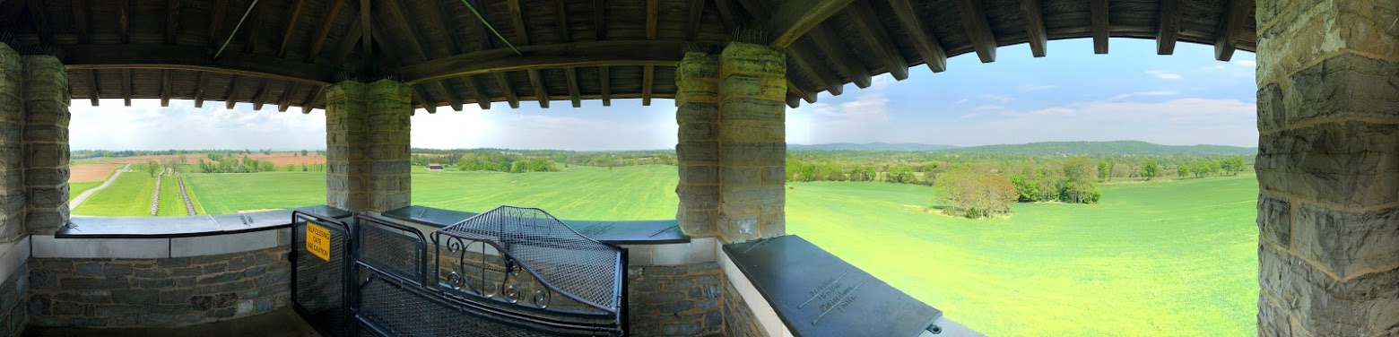
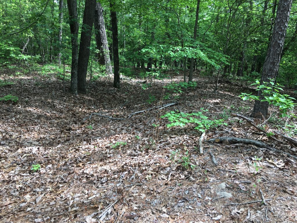
Like Averasboro, the terrain here was VERY flat – only a few small ravines and creek beds provided some cover for battlelines – and you can see that the lines seemed to form along them. Ground that is not composed of sand is swamp. It must have been miserable to fight here. I recall one of the waysides mentioning that there was significant difficulty in burying the dead – whenever they dug more than a foot or two down, the hole would fill with water.


North Carolina State Capitol

A monument to US Presidents from North Carolina: Andrew Johnson, James K. Polk, and Andrew Jackson (which is debatable). - <i>Photo by the Author</i>
A monument to US Presidents from North Carolina: Andrew Johnson, James K. Polk, and Andrew Jackson (which is debatable). – Photo by the Author

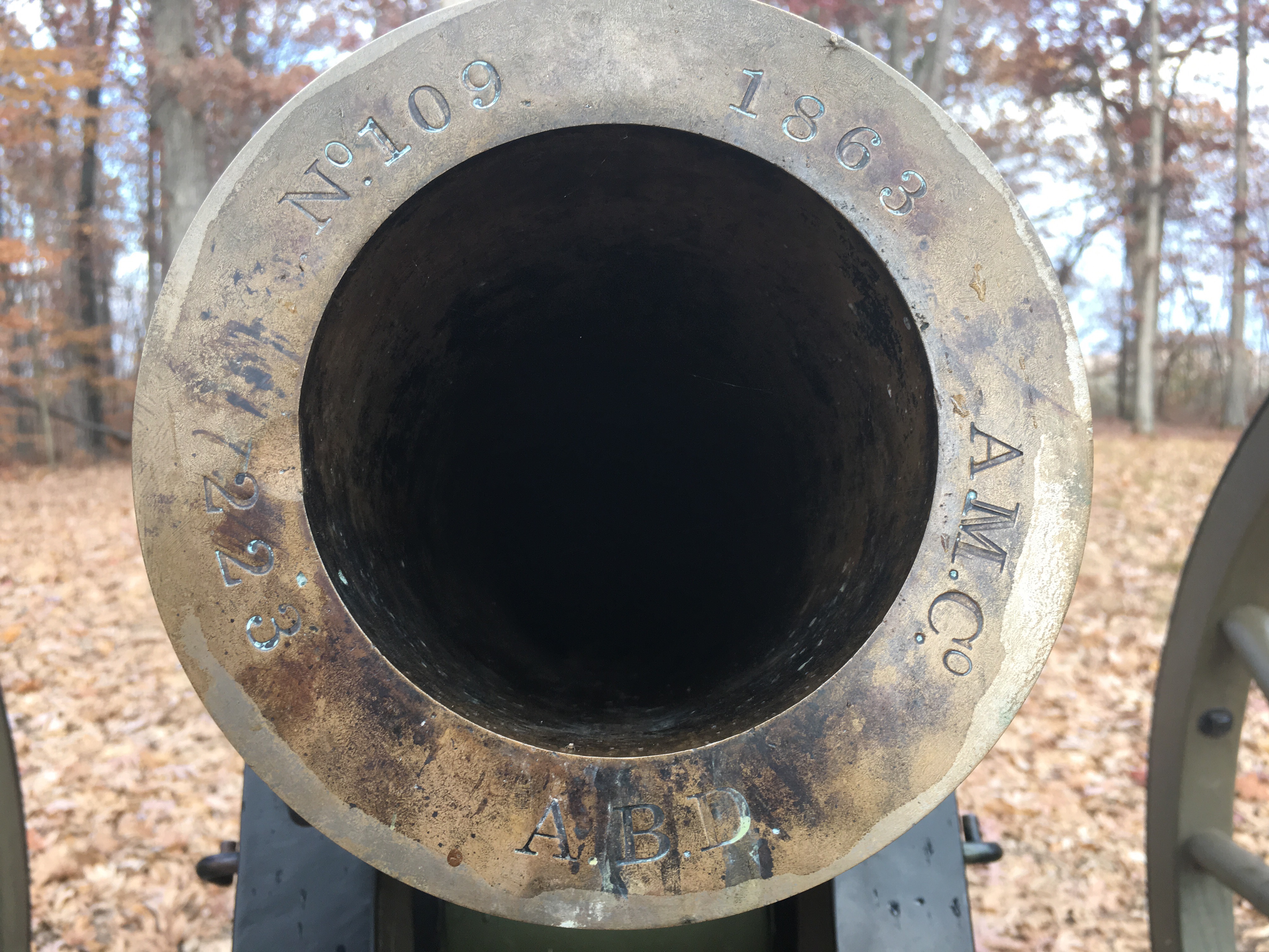
After checking in for my conference, I decided to walk around downtown Raleigh a little. The grounds of the North Carolina State Capitol had a few interesting monuments, and some real artillery in the form of Cyrus Alger and Co. siege mortars.

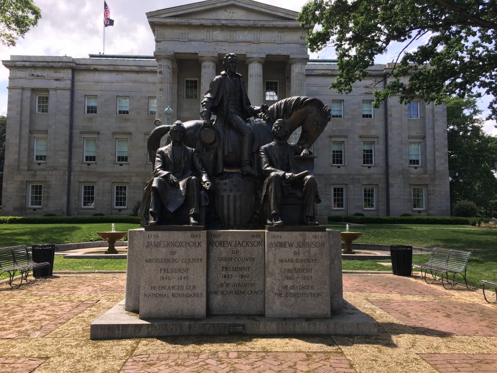
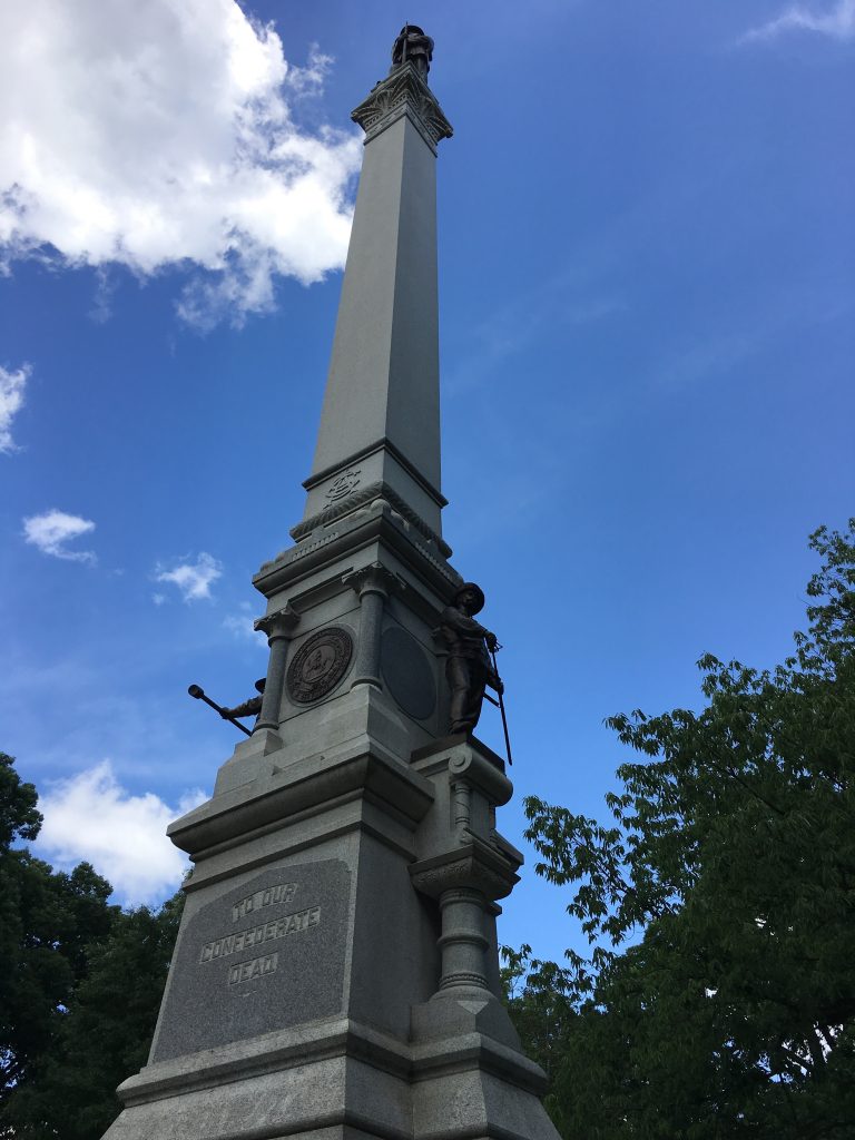
One of my favorites was a monument to US Presidents from North Carolina which included Andrew Johnson (for a Civil War connection), James K. Polk, and the debatable Andrew Jackson (who may have actually been born in South Carolina). There was also a “Lost Cause” era monument “To Our Confederate Dead” – perhaps not long for this world.

The North Carolina State monument "To Our Confederate Dead". - <i>Photo by the Author</i>
The North Carolina State monument “To Our Confederate Dead”. – Photo by the Author

Oakwood Cemetery

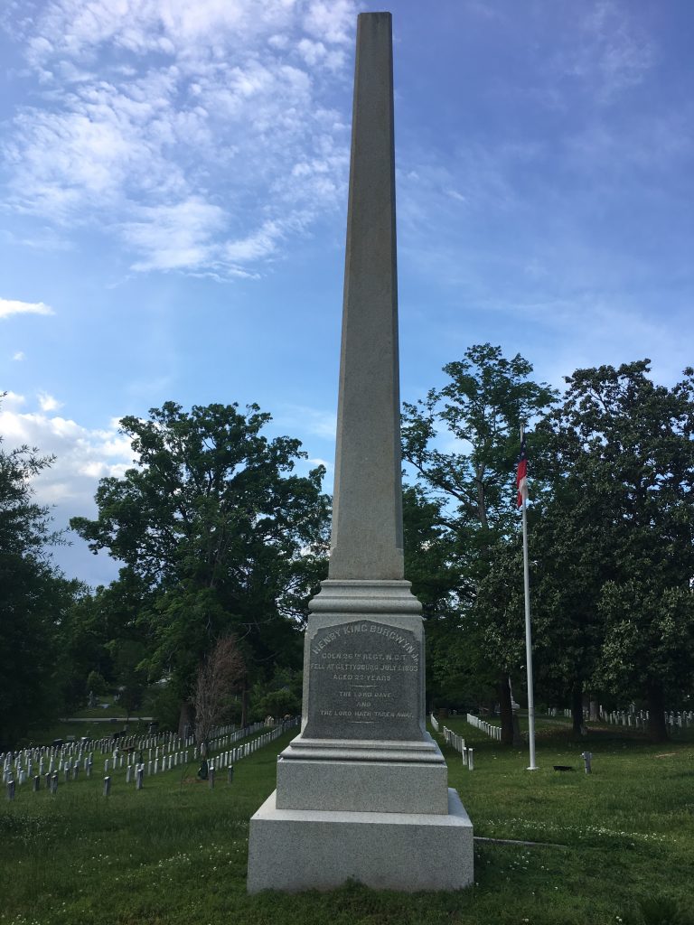
One place in downtown Raleigh that I knew I wanted to see was the Oakwood Cemetery – final resting place of Colonel Henry King Burgwyn, who was killed at Gettysburg leading the 26th NC Infantry in their famous attack against the 24th MI. Known as “The Boy Colonel”, Burgwyn was only 21 years old at the time of his death.

The grave marker for Henry King Burgwyn. - <i>Photo by the Author</i>
The grave marker for Henry King Burgwyn. – Photo by the Author

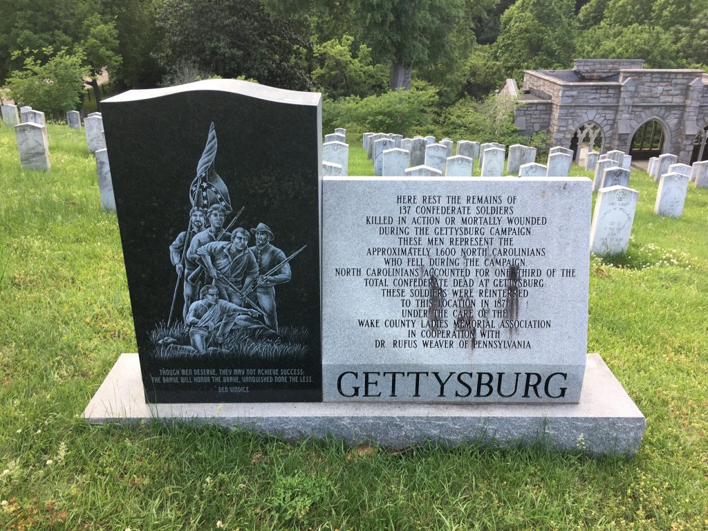
Like other prominent southern cemeteries, Oakwood has a large mass grave of Gettysburg dead, removed to what was assumed to be their home State from where they had fallen on the battlefield – probably in the 1870s. The design of the marker for this section of the cemetery mirrors the North Carolina monument present at Gettysburg today.

Marker for the mass grave of Gettysburg dead. - <i>Photo by the Author</i>
Marker for the mass grave of Gettysburg dead. – Photo by the Author

Though I only spent a few hours poking around the Raleigh area (and beyond), they were thoroughly satisfying. Hopefully I’ll be able to make a return trip some day.

Battlefield Visits: Winchester Area

Three years ago today, I took a day trip to Winchester, Virginia in order to check out some of the battlefields. My oldest son went along as well. It was the first trip there for both of us, and it remains a wonderful memory.

We had a great lunch, got to explore the local library, and my son enjoyed burning off some energy at the Shenandoah Valley Discovery Museum. There is certainly plenty to do in Winchester, but we all know what drove me there, so why not jump in?


First Battle of Winchester – Civil War Battlefield #28

This was a major victory for the Confederates during Thomas J. “Stonewall” Jackson’s famous Valley Campaign. Not much of the battlefield seems to remain, though. There is a marker near Handley High School, and another cluster farther south along the old Valley Turnpike (present-day Route 11). The landscape has changed considerably, with a lot of construction having taken place in the last 150 years.


First and Second Battles of Kernstown – Civil War Battlefield #29, 30

My son checks out the maps of the First and Second Battles of Kernstown. - <i>Photo by the Author</i>
My son checks out the maps of the First and Second Battles of Kernstown. – Photo by the Author

There is a battlefield park that incorporates a large chunk of the field, but it is only open on the weekends during May through October, so it was closed while we were there.

Luckily, the more interesting part of the field to me – the spot where Richard Brooke Garnett and the Stonewall Brigade fought behind a wall at First Kernstown – is on the other side of Route 37, south of Cedar Creek Grade at Rose Hill Farm Park. It was cool to be there and see the terrain, even if the wall there is a reproduction. My son had had enough hiking at that point, so we didn’t go back in the woods to look for the remains of the original wall.


Second Battle of Winchester – Civil War Battlefield #31

My son in the middle of the Star Fort at Second Winchester. Very cool! - <i>Photo by the Author</i>
My son in the middle of the Star Fort at Second Winchester. Very cool! – Photo by the Author

The Second Battle of Winchester took place on the road to Gettysburg. A Confederate corps under the command of Richard Ewell attacked and completely overwhelmed the Union garrison in town under Robert Milroy. Milroy made the decision to try to sneak out of town overnight, and much of his force was captured in the process. But we’ll talk about that later.

I was thrilled to learn that the Star Fort – central to Milroy’s defenses – still exists! We got to explore it a little, and I even got some photos of the newly-installed (at the time) markers so they could be included in the Historical Marker Database. Probably the coolest part of the trip for me.


Battle of Rutherford’s Farm – Civil War Battlefield #33

The field of the Battle of Rutherford’s Farm has been completely changed. It is now a shopping center north of Winchester. At least there is a small cluster of markers in the parking lot to tell visitors of the area’s importance during the 1864 Shenandoah Valley Campaign.


Skirmish at Stephenson’s Depot

While not an “official” battle, I tend to think of the Battle of Stephenson’s Depot as being a separate action from the Second Battle of Winchester. This is the spot where about half of Milroy’s fleeing Union command was captured by Confederate forces under Edward “Allegheny” Johnson. There are a few markers near where the railroad depot was (though when we visited, one was damaged to the point of being missing) and even a monument close by.


Third Battle of Winchester – Civil War Battlefield #32

Third Winchester was the bloodiest battle that took place in the Shenandoah Valley area, but you’d never know it if you visited the field today. I parked in the lot right off of Redbud Road and took a hike through woods, across fields, and over Redbud Run to the famed Middle Field. It made for a very pleasant 3-mile round trip. A monument to Battle’s Alabamians had just recently been erected on the field during my last visit, so that was pretty cool to see. By far though, my favorite part was this lovely tree-lined path just before the Middle Field.

This perfectly serene tree-lined path at the Third Winchester battlefield looked like something out of a movie. - Photo by the Author
This perfectly serene tree-lined path at the Third Winchester battlefield looked like something out of a movie. – Photo by the Author

All-in-all, it was a great trip. A model for many more I’d take in the years ahead.

Battlefield Visits: Small Actions in Maryland

While there were many important events happening in Maryland concerning the War of the Rebellion, the Civil War Sites Advisory Commission identified only seven “official” battlefields here in my native state. There are a few that you may know of (and that I’ve covered here already – Antietam, Monocacy, and South Mountain) but some of the smaller ones remain under-the-radar for most folks (and even for some #CivilWarNerds). Today, I’ll be writing about those.


Battle of Boonsboro – Civil War Battlefield #24

The battlefield as seen from where the wayside markers are. - <i>Photo by the Author</i>
The Boonsboro battlefield as seen from where the wayside marker is. – Photo by the Author

After the Battle of Gettysburg, the Confederates started to pull back toward Virginia. The weather was bad, and it took a long time for them to retreat across southern Pennsylvania and through Maryland. Several small actions took place along the way – mostly involving cavalry units fighting each other. The Battle of Boonsboro was just such an action.

There is a wayside marker in the parking lot of Boonsboro Antiques and Collectibles that explains the action that took place mostly across the road. This rather messy engagement wasn’t much more than a delaying action for the Confederates.

The Washington Monument on South Mountain is just <i>barely</i> visible from the battlefield, as it would have been in 1863. - <i>Photo by the Author</i>
The Washington Monument on South Mountain is just barely visible from the battlefield, as it would have been in 1863. – Photo by the Author

Battle of Williamsport – Civil War Battlefield #25

Not really a single battle as much as a drawn-out series of small pokes and prods, the Battle of Williamsport was the final piece of the Confederate retreat following Gettysburg.

The bridge that carries modern-day Route 11 is roughly in the location where the Confederates crossed the Potomac in Williamsport. - <i>Photo by the Author</i>
The bridge that carries modern-day Route 11 is roughly in the location where the Confederates crossed the Potomac in Williamsport. – Photo by the Author

There are numerous markers surrounding Williamsport that discuss the various stages of the combat there. With no major action taking place, it is hard to direct you to any one place. I found a walk along the C&O Canal to be quite nice when I visited, as it affords an opportunity to learn about a little more than just the Civil War history of the area. One of the major visitors centers is located near the site of the Confederate crossing.


Battle of Folck’s Mill – Civil War Battlefield #57

The Battle of Folck’s Mill was a very minor action near Cumberland, Maryland. Mostly an artillery duel, it was fought by local militia protecting the city of Cumberland from a Confederate raid late in the war.

Sadly, what is left of the field is extremely difficult to access. The mill itself still exists – at least as ruins – but it is surrounded by highways and private property. You would never know it was there. There are some wayside markers located on the grounds of the Ali Ghan Shriner’s Hall that discuss the action, but the terrain has been completely changed by the modern highways and interchanges in the area. The approaches and artillery positions have been completely obliterated, so a fair amount of imagination is needed on a visit.


Battle of Hancock – Civil War Battlefield #58

Surprisingly, this is the ONLY “official” battle of Thomas J. “Stonewall” Jackson’s Bath-Romney Campaign in the winter of 1862. Hard to believe since there was really no combat during the Battle of Hancock. Jackson showed up on the Virginia (present-day West Virginia) side of the Potomac and hurled some artillery rounds at the Union troops in town. After a couple of days, he moved on. Simple as that.

There are markers explaining some of the action on the Maryland side of the river, along the C&O Canal. The town itself has some character, and if you’re there on a day they’re open, the Hancock Town Museum is worth a visit.

Battlefield (Re)Visits: Ball’s Bluff 158th Anniversary

I’ve visited Ball’s Bluff a few times, but this past year I had the chance to be there for the 158th anniversary of the battle. A small but loyal group of local #CivilWarNerds puts on a reenactment and even an artillery demonstration.

Artillery fires in commemoration of the 158th anniversary of the Battle of Ball’s Bluff. – Video by the Author

I’ve written about my impressions of Ball’s Bluff before, so feel free to check that post out, too.

Battlefield Visits #26: South Mountain

This prelude to the Battle of Antietam was fought in three mountain gaps along South Mountain in Maryland. Confederate forces were able to delay approaching Union units long enough for Lee to concentrate his army and set up a defense around Sharpsburg.

The North Carolina Monument on the South Mountain Battlefield. - <i srcset=
Photo by the Author” width=”800″ height=”600″> The North Carolina Monument on the South Mountain Battlefield. – Photo by the Author

Campaign: Maryland Campaign – This battle took place just before Antietam, the major battle of the campaign.

CWSAC Rating: “B” – Having a direct and decisive influence on a campaign.

How to Get There: Since the fighting took place in multiple unconnected mountain gaps, there is no one place to go to see the battlefield. Driving along Alt. US 40 between Middletown, MD and Boonsboro, MD will take you through Turner’s Gap – the northernmost section of the battlefield.

For on the Field: For the newbie, download the American Battlefield Trust’s Antietam Battle App. It will really enhance your tour experience. Folks who want serious military history should pick up the US Army War College’s Guide to Antietam. I can’t recommend this book highly enough for its excellent tour of the field.

The Reno Monument on the South Mountain Battlefield. - <i srcset=
Photo by the Author” width=”768″ height=”1024″> The Reno Monument on the South Mountain Battlefield. – Photo by the Author

What I Love: There are a few things that make South Mountain unique.  Fox’s Gap is probably my favorite section, with the Reno and North Carolina monuments. The War Correspondents Memorial is a major landmark as well. While you may encounter the occasional AT hiker, or family picnic, it’s generally a pretty peaceful field.

The War Correspondents Memorial on the South Mountain Battlefield. - <i srcset=
Photo by the Author” width=”768″ height=”1024″> The War Correspondents Memorial on the South Mountain Battlefield. – Photo by the Author

What I Don’t: While it is a fairly small field in terms of total acreage, it is spread out as small pockets over a wide area, so it takes some time to explore.

Final Thoughts: South Mountain is one of those hidden treasures among Civil War battlefields. It is integral to the Antietam campaign, and fairly well-preserved and well-monumented, but it doesn’t get a lot of visitation outside of AT hikers and the occasional family picnic. It’s a nice spot for  serene contemplation.

Other Resources:

Official CWSAC Battle Summary – South Mountain

American Battlefield Trust – South Mountain

Wikipedia – The Battle of South Mountain

Battlefield Visits #23: Monocacy

Keeping it close to home for me, the next battlefield on my list is Monocacy. This engagement is commonly referred to as “The Battle that Saved Washington”, and while it was a strategic victory for the Union forces, the single-day action was tactically a loss. Maj. General Lew Wallace (in command of the VIII Corps, and later the author of Ben-Hur) successfully delayed Lt. General Jubal Early‘s advance long enough for elements of the VI Corps to move from the trenches of Petersburg to reinforce the defenses of Washington.

As a bonus, this park also preserves the spot where Special Order 191 was discovered by a couple of Union soldiers during the Maryland Campaign, so there is also some Antietam interest here.

I wrote about my first visit to this battlefield in a post a few years ago.

A beautiful Revere Copper Co. Napoleon outside of the visitors center. - Photo by the author
A beautiful Revere Copper Co. Napoleon outside of the visitors center. – Photo by the author

Campaign: Early’s Washington Raid and Operations Against the B&O Railroad – This was the first battle of the campaign.

CWSAC Rating: “B” – Having a direct and decisive influence on a campaign.

How to Get There: The battlefield is located in western Maryland just south of Frederick, about an hour away from Baltimore. Modern day I-270 cuts the battlefield in half, but there is no direct access from the interstate. I use MD-355 to get there.

The Visitors Center is located at 5201 Urbana Pike, Frederick, MD 21704. There is no entrance fee, but you should stop there to pick up a brochure and get oriented. There’s a small gift shop, and a very well-done museum upstairs. The one real piece of artillery on the field is also located by the entrance – a beautiful Revere Copper Co. Napoleon. All other cannons on the field are reproductions.

For on the Field: You’re going to want to have a guide of some sort when you’re at Monocacy. There are not a lot of monuments, markers, or waysides, so having a way to interpret what you’re looking at becomes critical. Definitely get the park map / brochure for this one. Another wonderful resource that the park has put together is a freely-available audio tour of the field in mp3 format. If you’re going to use this (and you should) be sure to download it ahead of time as cell phone coverage can be spotty on the field.

What I Love: For me, Monocacy is the closest battlefield to home, so if I want to get a quick Civil War history experience, or take friends and family to something that’s a little off the beaten path, this battlefield is a good option. The field is usually pretty empty, and there are plenty of opportunities for non-historical activities. They have a few trails laid out that take the visitor along the Monocacy River, there’s a cool railroad junction and bridge that train nerds would enjoy, and some neat old farm buildings that are quite photogenic.

Some of the structures on the Best Farm. - Photo by the author
Some of the structures on the Best Farm. – Photo by the author

What I Don’t: Being such a small field, there isn’t that much to see. There are some moving pieces in the battle, so it isn’t boring to learn about, but it’s not as expansive a topic as something like Gettysburg or Antietam. As I stated above, there aren’t a lot of monuments or markers, so you’re kind of on your own while you’re out on the ground.

Final Thoughts: While Monocacy doesn’t get the attention of other nearby fields, it’s worthy of at least a quick visit. Antietam fans will appreciate the connection to Special Order 191, and Gettysburg fans will want to see the nearby place where Maj. General George Meade received the order to take command of the Army of the Potomac.

Other Resources:

Official CWSAC Battle Summary – Monocacy

American Battlefield Trust – Monocacy

Wikipedia – Battle of Monocacy

Battlefield Visits #2: Antietam

Antietam is another battlefield that is close to home for me. My family went there a few times when I was a child, but it didn’t leave the impact that Gettysburg did. There are many monuments dotting the field, and I feel like the battle is easier to understand than Gettysburg. For starters, the field is smaller than Gettysburg, and the action basically moves from one side of the field to the other as the battle progresses. This is also a single-day battle (albeit the bloodiest single day in American history). I’ve been to Antietam probably about a dozen times.

View from the observation tower on the Bloody Lane.
View from the observation tower on the Bloody Lane. – Photo by the author

Campaign: Maryland Campaign – This was the major battle of the campaign.

CWSAC Rating: “A” – Having a decisive influence on a campaign and a direct impact on the course of the war.

How to Get There: The battlefield is located in western Maryland just outside of Sharpsburg. It’s about 90 minutes from Baltimore. I usually arrive on the field by way of MD-34 through Boonsboro (which will also have an entry in this series).

The Visitor Center is located at 

For on the Field: For the newbie, download the American Battlefield Trust’s Antietam Battle App. It will really enhance your tour experience. Folks who want serious military history should pick up the US Army War College’s Guide to Antietam.

What I Love: Like Gettysburg, this battlefield is close to home for me. It is fairly well marked with monuments, and is small enough that one can get a feel for the action pretty quickly.

Thanks to organizations like the American Battlefield Trust, who have been working to buy-up land in recent years, more of the battlefield is publicly-accessible than ever before. Even as recently as 15 years ago, the NPS hardly owned any of the battlefield itself – they mostly just held the roads running through the battlefield. Just as one example, it is now possible to walk across the field that the II Corps divisions of French and Richardson traversed to assault the Bloody Lane.

The observation tower on the Bloody Lane is very cool, and the other major landmark – the Burnside Bridge – is serenely beautiful. It’s never seemed very crowded on the field when I’ve gone, though the exception to this seems to be their annual Memorial Illumination (which I’ve not yet had the chance to attend).


My boys on the banks of Antietam Creek, near the Burnside Bridge.
My boys on the banks of Antietam Creek, near the Burnside Bridge. – Photo by the author

What I Don’t: Probably the only downside to Antietam is the entrance fee. Currently, it’s $5/person or $10/car, but it’s been on the rise in the last few years. If you have an NPS annual or lifetime pass, they will accept those.

Final Thoughts: While the battle was indecisive tactically, it was close enough to a Union victory to allow Lincoln to feel like he had the freedom to announce the Emancipation Proclamation. September 17, 1862 was also the bloodiest single day in American history. Both of these facts come together to net Antietam an “A” level priority in the CWSAC survey, and make it a must-see for any Civil War enthusiast.

Other Resources:

Official CWSAC Battle Summary – Antietam

American Battlefield Trust – Antietam

Wikipedia – Battle of Antietam

Battlefield Visits #1: Gettysburg

I have to start this series with the battlefield that started it all for me – Gettysburg. It’s my first historical love, in a very real way.

Numerous volumes have been written about the battle. Absolutely everyone who was involved (at least on the Union side) wanted to have a monument there – even units who never made it to town. It is THE battle of the Civil War in the popular mind. All of these things come together to make a visit to Gettysburg a MUST for any Civil War buff. As of this writing, I have been to Gettysburg 57 times.

Looking at The Devil's Den from Little Round Top.
Looking at The Devil’s Den from Little Round Top. – Photo by the author

Campaign: Gettysburg Campaign – This was the major battle of the campaign.

CWSAC Rating: “A” – Having a decisive influence on a campaign and a direct impact on the course of the war.

How to Get There: Gettysburg is located in south central Pennsylvania. It’s about 90 minutes from Baltimore. When I go, I usually either take MD-97 through Westminster and Littlestown, or US-15 to the Emmitsburg Road. The view as you enter the battlefield from the south along the Emmitsburg Road is breath-taking. As students of the battle know, 10 roads converge in Gettysburg – the key reason the battle was fought there – so there are plenty of ways to go.

The Visitor Center is located at 1195 Baltimore Pike, Gettysburg, PA 17325. From there, you can get a brochure with the auto tour map and directions. If you’re so inclined, you can also hire a Licensed Battlefield Guide there.

For on the Field: There are a few resources that I always love having with me when I’m at Gettysburg. For the newbie, download the American Battlefield Trust’s Gettysburg Battle App. It will really enhance your tour experience. If you’re more interested in a book-based tour, my favorite is The Complete Gettysburg Guide by J. David Petruzzi. Folks who want serious military history should pick up the US Army War College’s Guide to the Battle of Gettysburg.

What I Love: As I stated, Gettysburg was the place that sparked my interest in history. I have a special connection with it for that reason. The new visitor’s center is beautiful. It’s very easy to find information on the battle – from the thousands of monuments on the field, to the countless books, articles, blog posts, documentaries, and even movies – you can develop as full a picture of the fighting as you have time for. The smaller places that make up the field are also legendary: The Railroad Cut, The Devil’s Den, The Wheatfield, The Peach Orchard, Little Round Top, Culp’s Hill, and on and on.

The view from Cemetery Ridge in the late afternoon.
The view from Cemetery Ridge in the late afternoon. – Photo by the author

What I Don’t: There’s not a lot to get upset about, honestly. It can get crowded in the summertime. And the “tourists” – especially the ghost tour crowd – can make the more serious buffs roll our eyes.

Final Thoughts: Everyone should go to Gettysburg. For the real Civil War nerds, this should not even be a question.

Other Resources:

Official CWSAC Battle Summary

American Battlefield Trust – Gettysburg

Wikipedia – Battle of Gettysburg

Battlefield Visits: The Map

In my last post, I kicked off a new series and talked about my goal of visiting all the CWSAC Battlefields.

One of the first things I did to help me accomplish this was to create a custom Google Map of all the places that I needed to visit (I am a computer and map nerd, you know). I’m embedding a copy of that map here in case it is useful for someone else. This is what the principal battles of the Civil War looked like, geographically:

I’m pretty good about updating the map as I go on trips. Sites marked in green have been visited at least once, while sites in red are on the to-do list.

Full disclosure: I created this map myself based on a best guess of where several of these battlefields are located after looking at the CWSAC reports and various other resources on the web and in books. There may be inaccuracies on sites I haven’t visited yet. No warranty, and your mileage may vary. 😉

Battlefield Visits #27: Ball’s Bluff

On Wednesday afternoon, I was lucky enough to be in the Leesburg, VA area on a day trip with my family, and had some time to check out a field I’d never been to: Ball’s Bluff.

The battle itself was a fairly small action as Civil War battles go, but is more significant because of who was there and what happened to them. One of the men killed was Col. (and Senator) Edward D. Baker – the only U.S. Senator to be killed in combat – and his death prompted his friends in Congress to take a heavier interest in the war effort, leading directly to the creation of the Joint Committee on the Conduct of the War.

The park that encompasses the battlefield (well, most of it anyway) is owned by the Northern Virginia Regional Parks Authority, and is well-maintained. There is also heavy volunteer involvement, with free tours being run on the weekend during the warmer months, and plentiful maps and brochures available at the parking lot. You can tell that the local Civil War nerds take great pride in this place. It is small, but very well marked with monuments and waysides. There is a network of trails leading visitors through the phases of the battle and key terrain features. It’s really nice.

Among the commemorative features are representations of the three artillery pieces that the Union army brought to the field from across the river. Two of those three are reproductions, but there is an actual Mountain Howitzer there as well – I had never seen one in person and was pretty excited about it.

An actual Ames Manufacturing Co. Mountain Howitzer on the field at Ball’s Bluff.

The specs are as follows:

The muzzle markings on the Mountain Howitzer at Ball’s Bluff.

So clearly this weapon could not have been present for the actual battle in the fall of 1861, but it was nice to see it stand-in. Hazlett’s Field Artillery Weapons of the Civil War has this serial number listed as being owned by Kennesaw Mountain NBP in Georgia, so I assume it is here on loan. Very nice of the National Park Service to do that if that’s the case.

If you’re in the area, it’s definitely worth a visit. The hiking trails are nice, and if you’re at all interested in the history, you can’t beat actually being on the field. I can tell you that I’d be pretty uncomfortable with my back against that bluff and a few regiments of Confederates bearing down on me!