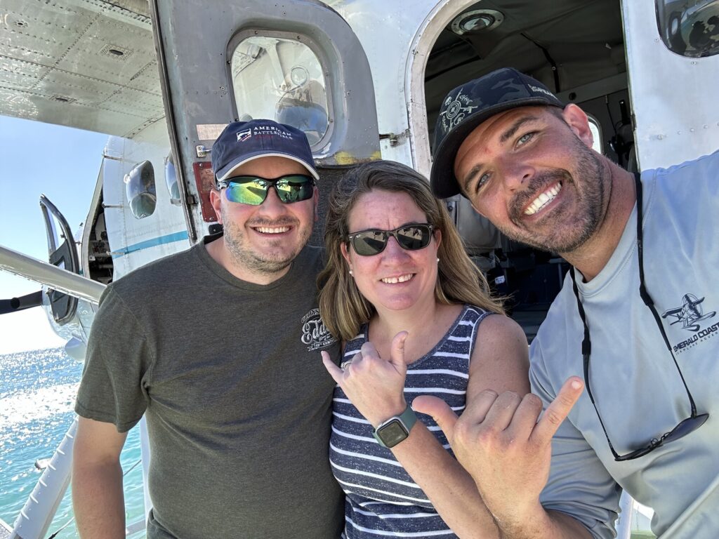
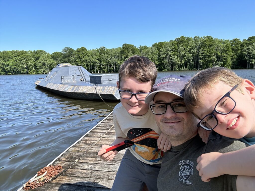
Even though I was nervous, I had been waiting for this for a long time.
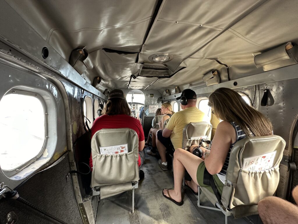
We had booked ourselves on a seaplane to the Dry Tortugas National Park. Regular readers probably know that I have aviophobia, but that I’ve been getting better through more and more exposure to flight. After all, we had flown down to Key West in the first place. This would be about a 35 minute flight, and relatively low altitude, to a place that I really wanted to visit. Emily also helped keep me together.
Waiting to board the plane. – Photo by the author
The short story is: I’m SO glad we did this! It was probably the most incredible trip I’ve ever been on.
Our pilot, Britt, did a quick safety overview with us and helped us get our gear loaded. We brought a bag with a change of clothes and some snorkeling equipment. The company also provided a cooler with some drinks.
I was in the very back of the plane. All set for take-off! – Photo by the author
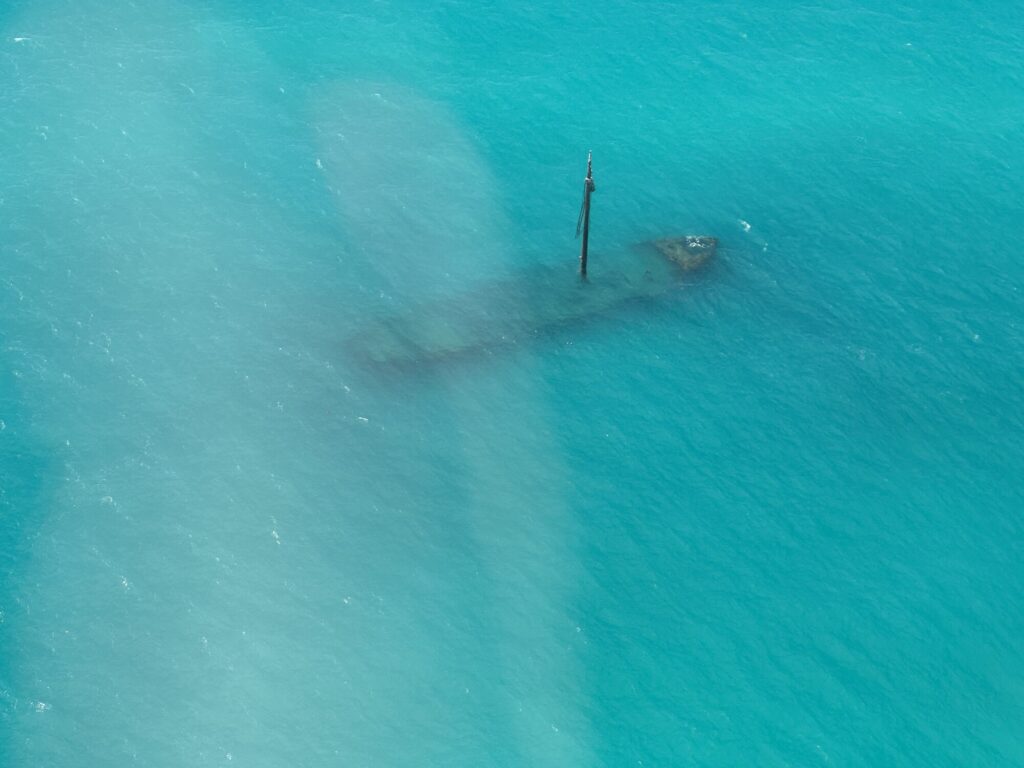
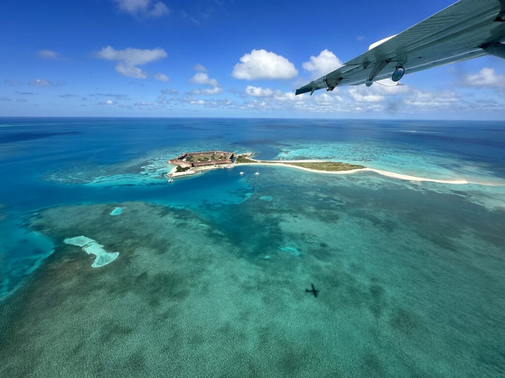
We took off in the de Havilland DHC-3 from Key West International Airport and turned west, flying just off the southern part of Key West. This was the smallest plane I’ve ever flown in, and the first with a turboprop. We all had headsets on that piped in some music and allowed Britt to play tour guide along the way, describing the various outlying keys that we were passing over, as well as a few shipwrecks. He did his best to point out marine life, but I had a hard time spotting it, though I did see some turtles on the way back.
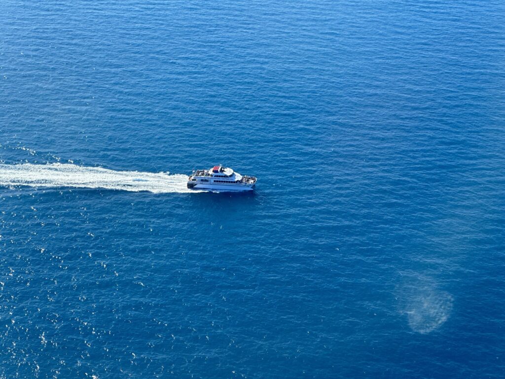
We flew over the wreck of the Arbutus. – Photo by the authorThe best part about taking the seaplane is beating the ferry boat! – Photo by the author
Britt brought us in for an expert landing on the lagoon, and we taxied over the the beach where the seaplanes back in to drop us off. We managed to get a few cool photos there thanks to Britt.
Emily attempts to be as cool as our pilot. – Photo by Captain Britt
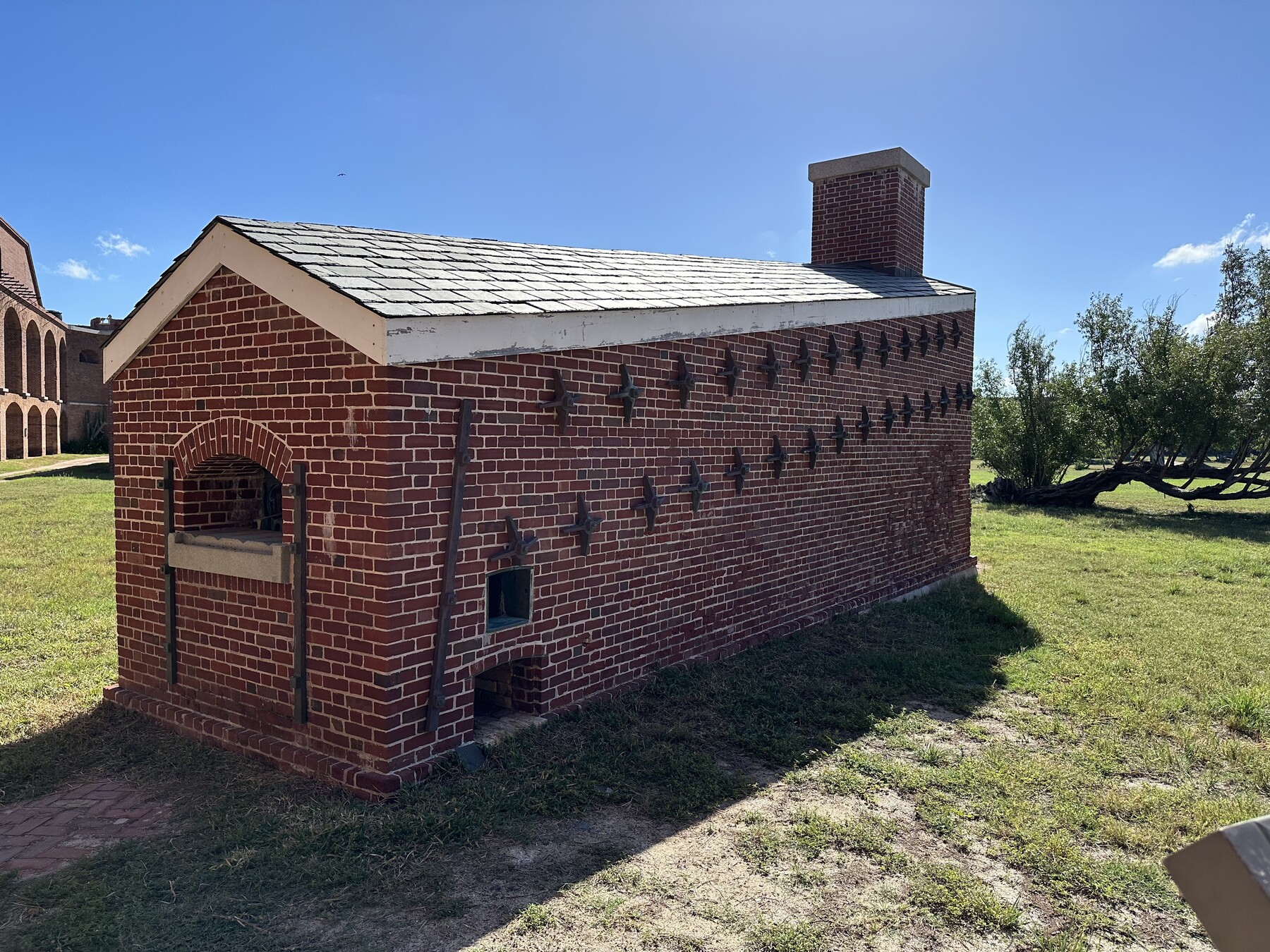
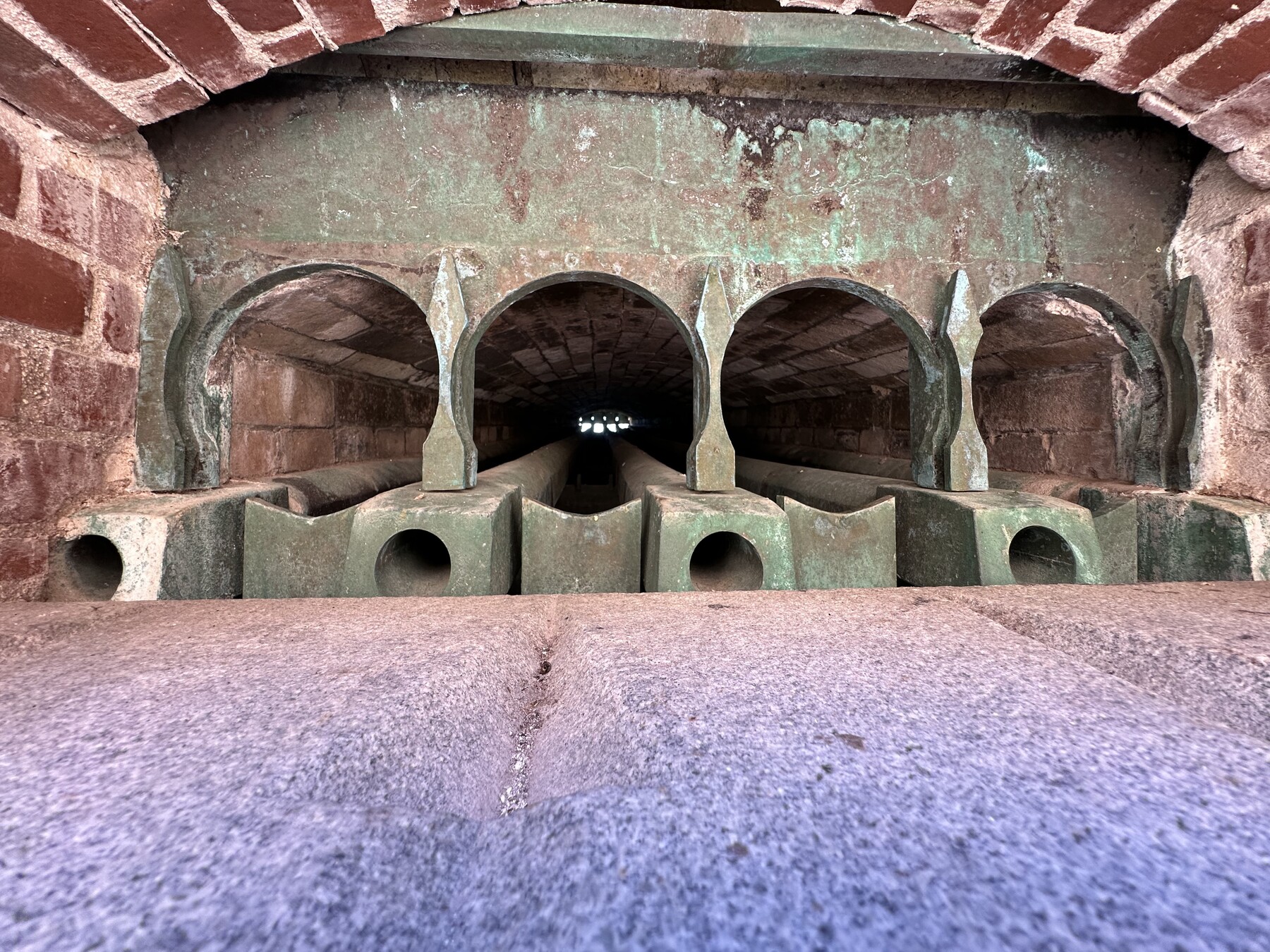
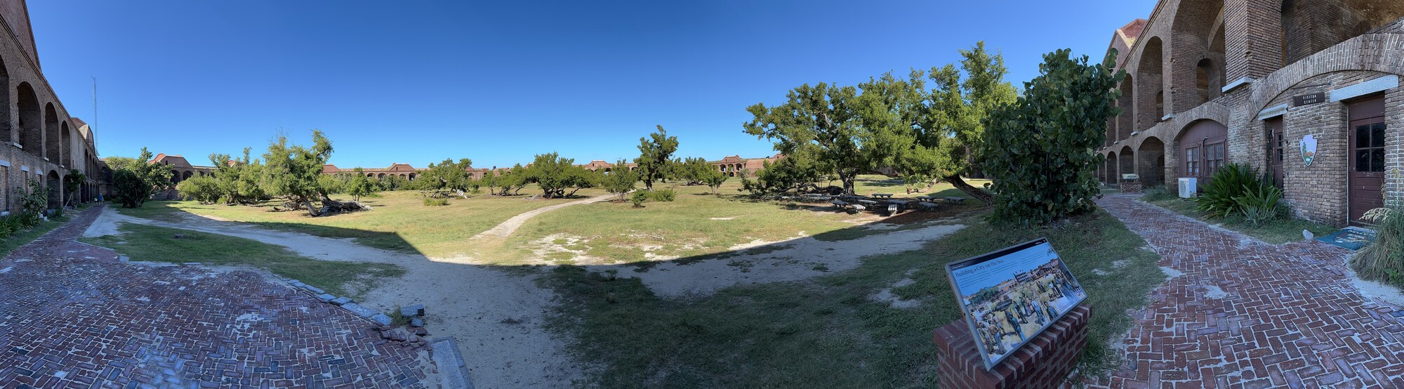
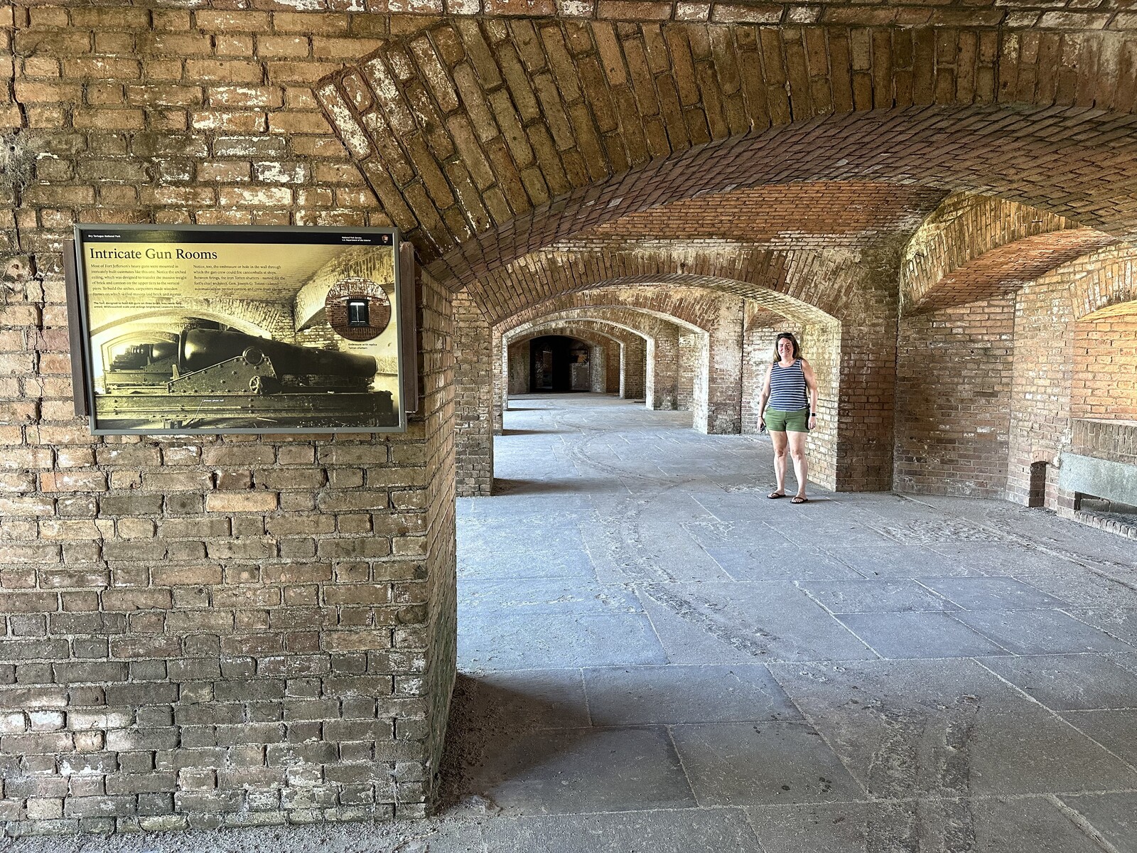
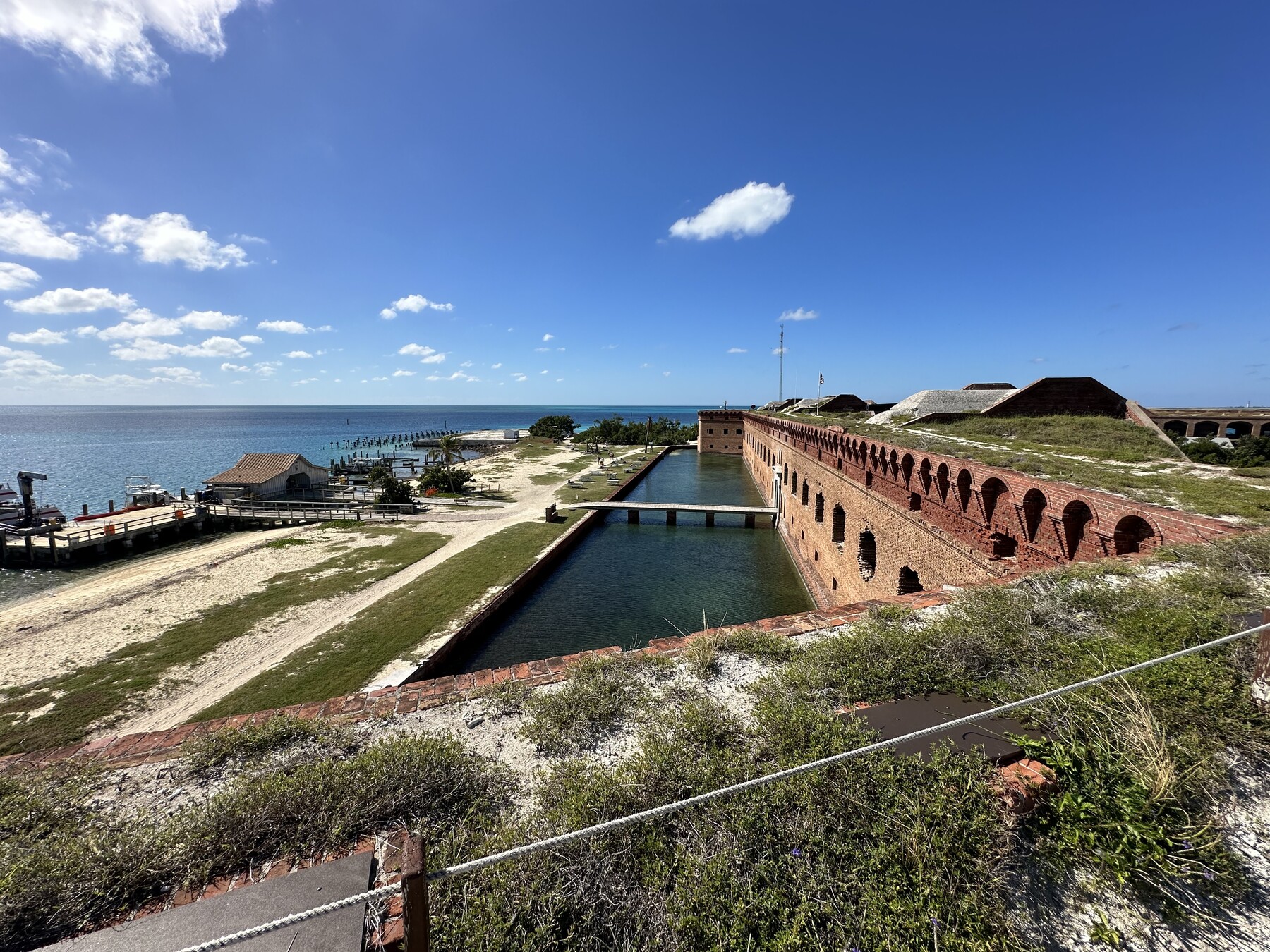
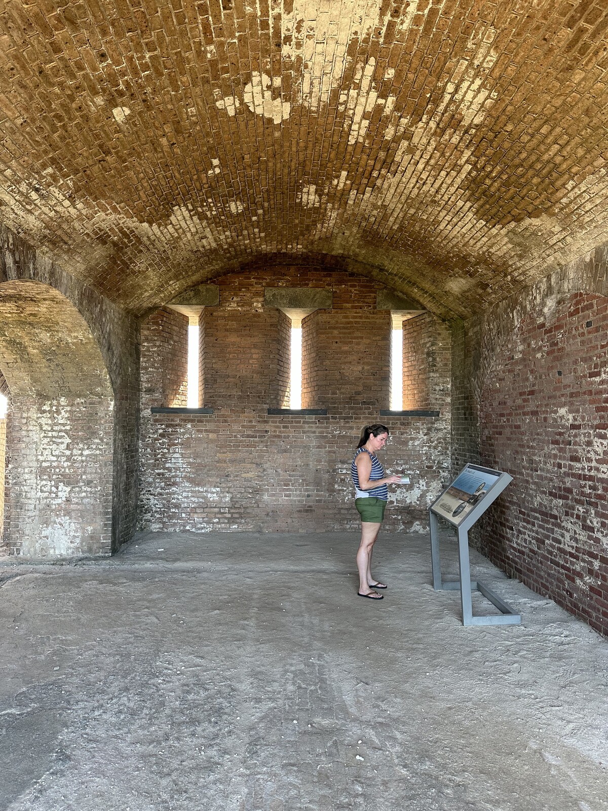
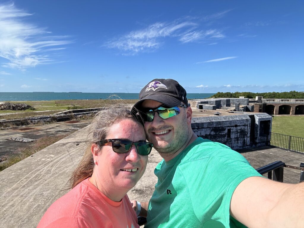
Once we got on the island, Emily and I toured Fort Jefferson – in my eyes, the main attraction here. This is another Third System fort, and it was never fully completed. It is huge – certainly larger than Fort Delaware. Several of the structures inside – the barracks and officers’ quarters come to mind specifically – are now just foundations, as they were deemed to be too unsafe for the public and torn down years ago. The hot shot furnace has been restored and is in really good shape. That was cool to see.
The restored hot shot furnace. – Photo by the authorInside the hot shot furnace. – Photo by the author
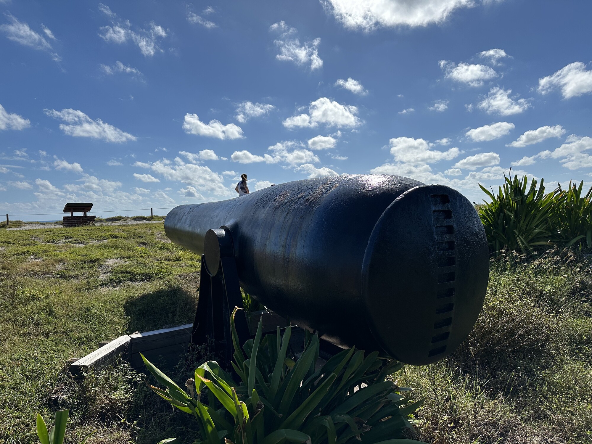
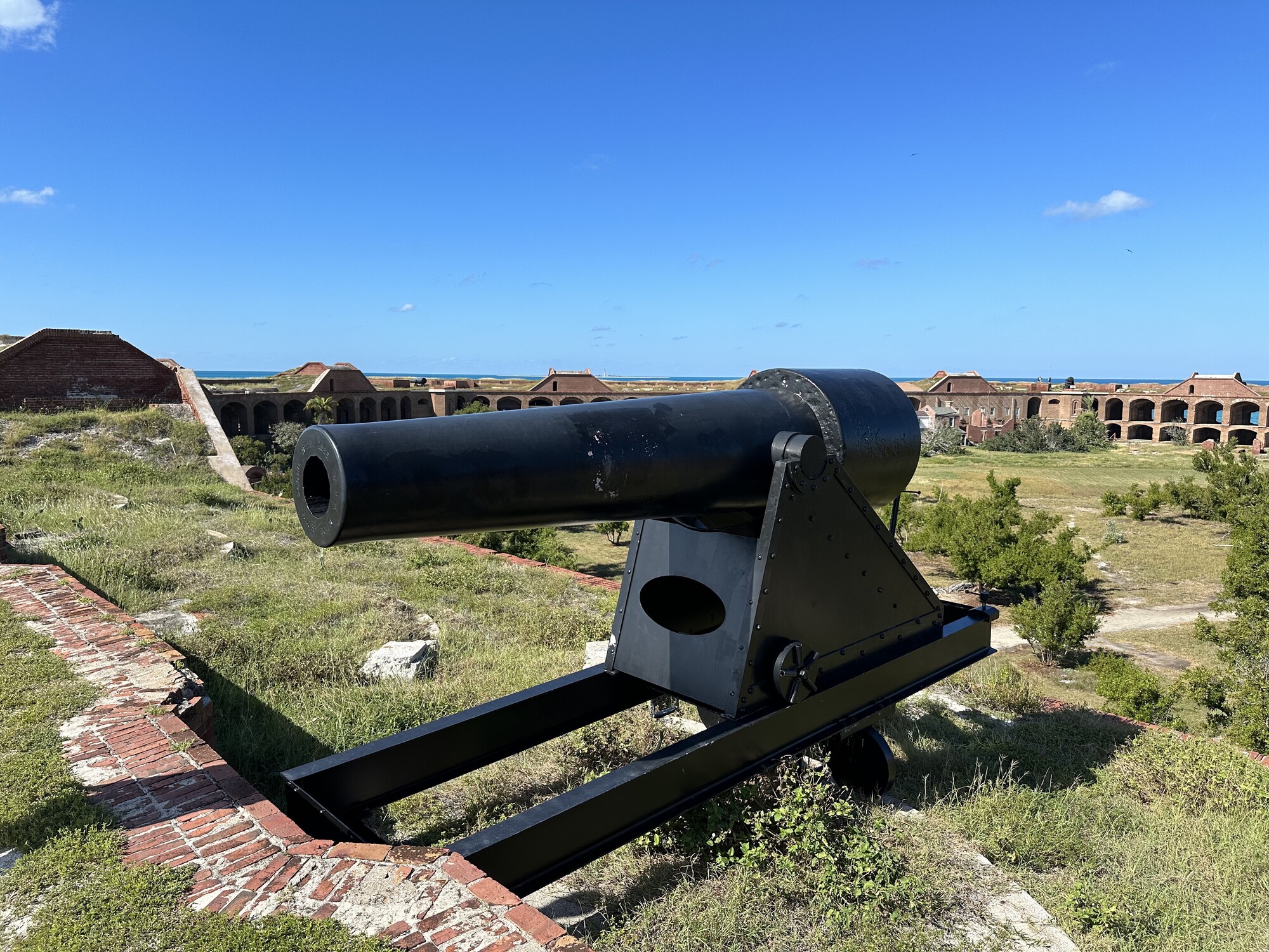
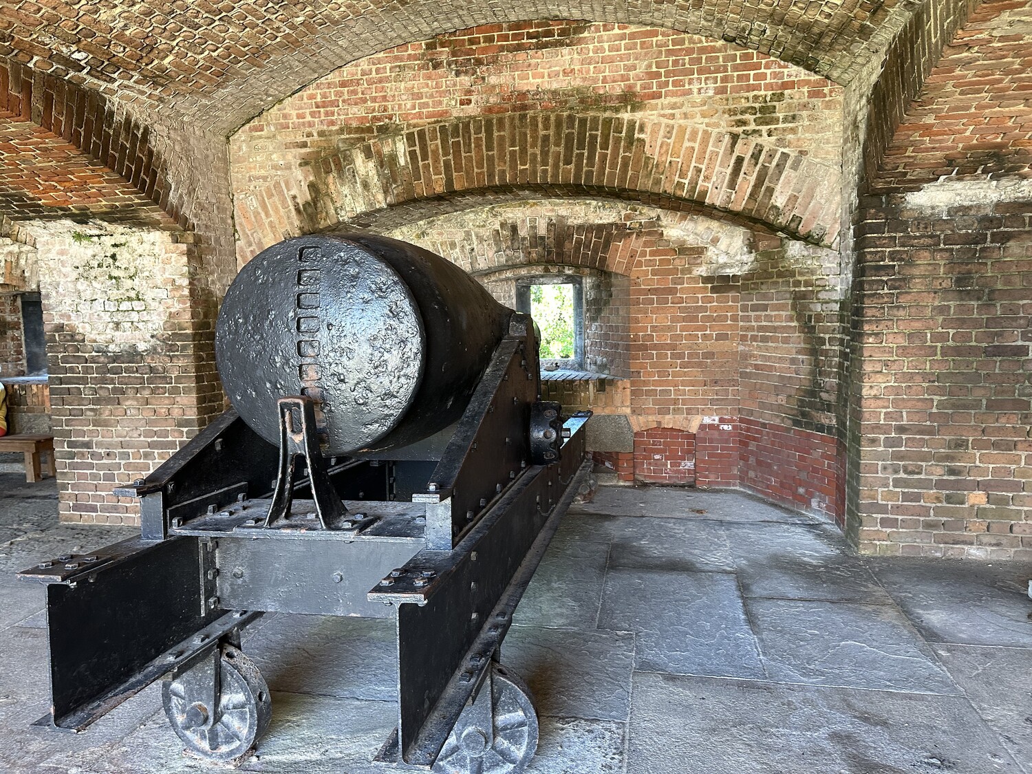
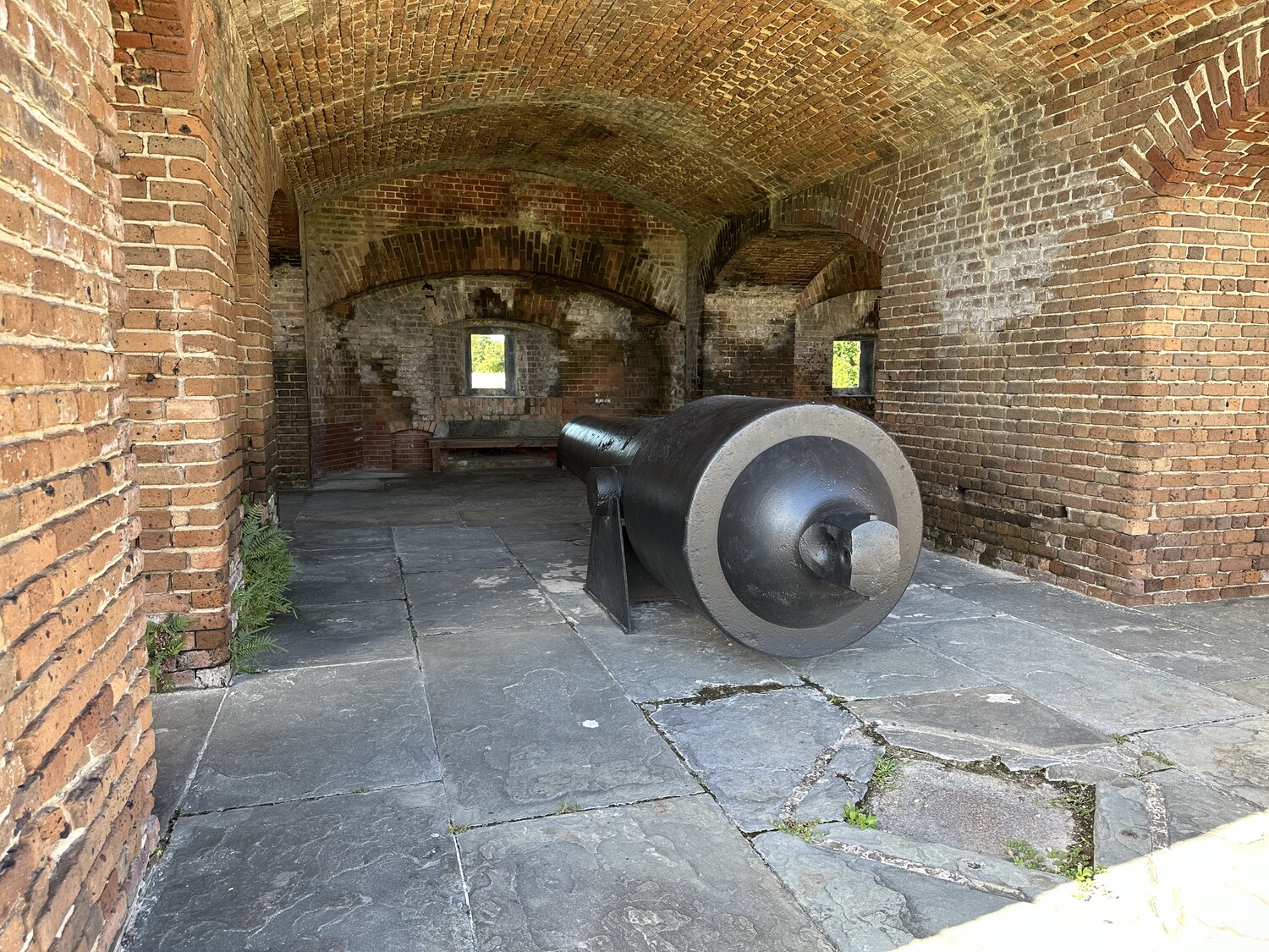
There were a few large seacoast guns – I saw Parrotts and Rodmans – along the ramparts. The most famous part of the tour is the cell where Dr. Samuel Mudd was held after the Civil War for his role in the Lincoln Assassination Conspiracy. He was pardoned a few years later by President Andrew Johnson, largely because of the medical help he provided to the garrison here during an outbreak of yellow fever in 1867.
The view inside the fort from near the visitors center / gift shop. – Photo by the authorEmily in the casemates. – Photo by the author#RampartSelfie – Photo by the authorView from the rampart looking southwest. – Photo by the authorA Rodman gun. – Photo by the authorA large seacoast Parrott rifle. – Photo by the authorThe cell where Dr. Mudd was held. – Photo by the author
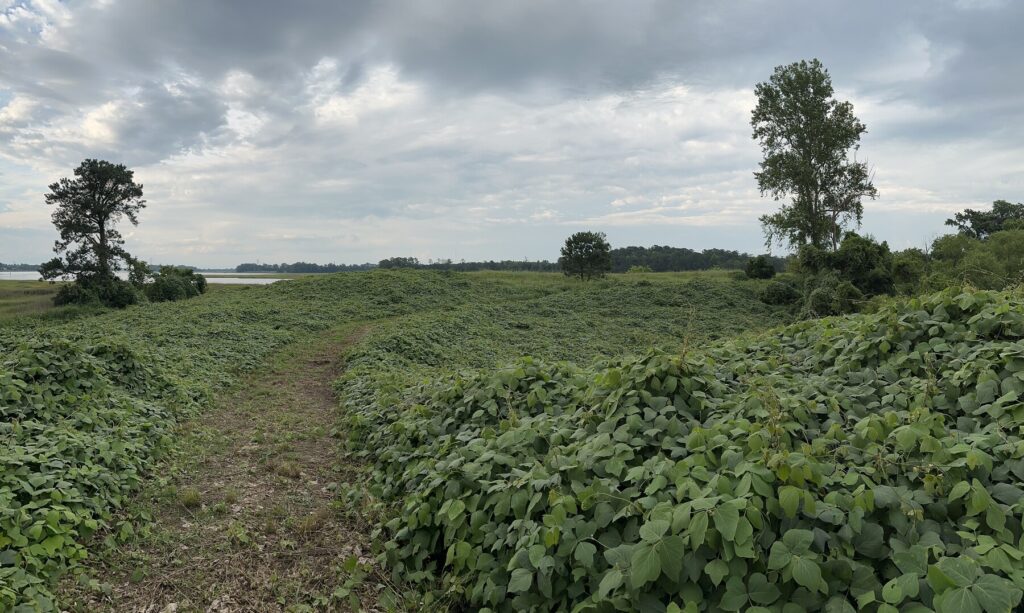
The name of these islands – Dry Tortugas – comes from the fact that turtles nest here (tortugas is Spanish for “turtles”) and there is no natural fresh water source. In order to support a large fort and all the people that come with it, the structure was built with subterranean cisterns under the casemates. These were designed to collect rainwater. Unfortunately, as the fort was built ever higher, the weight of the walls caused cracks to form in the cisterns and several were flooded with seawater, making them useless. Ultimately, this is why the fort failed and was never finished. There simply wasn’t enough fresh water for the garrison that the fort required.
These days, the NPS has a small staff that lives on the island and has not only water, but weekly pizza deliveries from the seaplane, and even Starlink Internet.
Starlink comes to the Dry Tortugas. Maybe it isn’t so remote after all… – Photo by the author
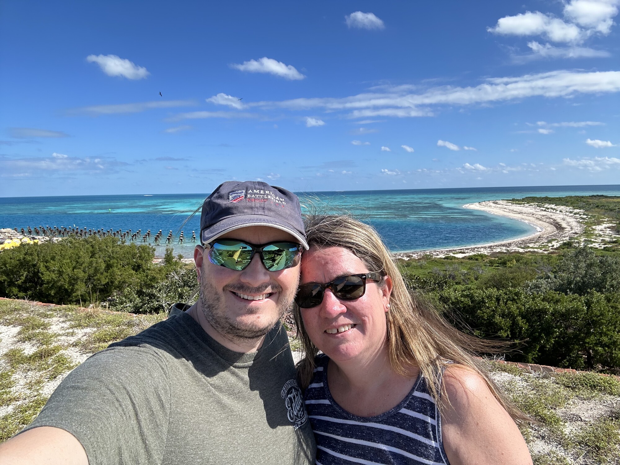
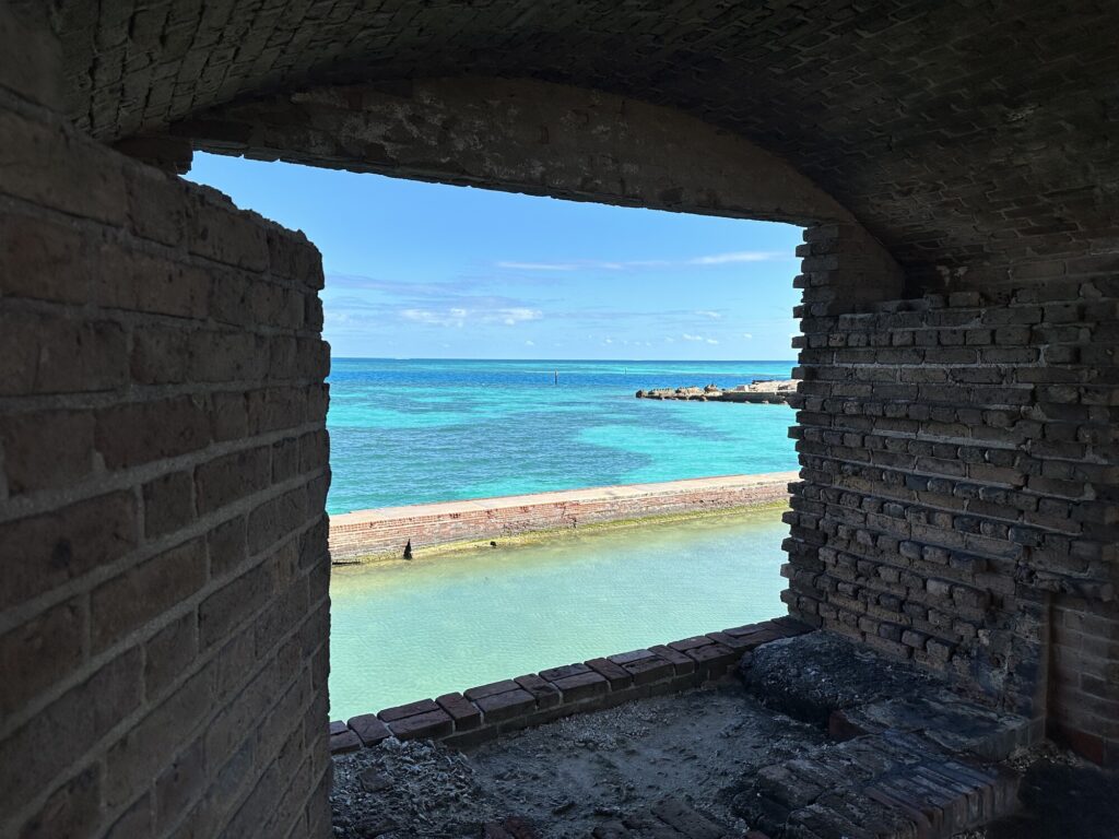
As you can imagine, views in every direction from the fort were incredible. It’s a little piece of paradise.
The scenery is gorgeous. – Photo by the author
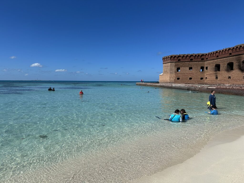
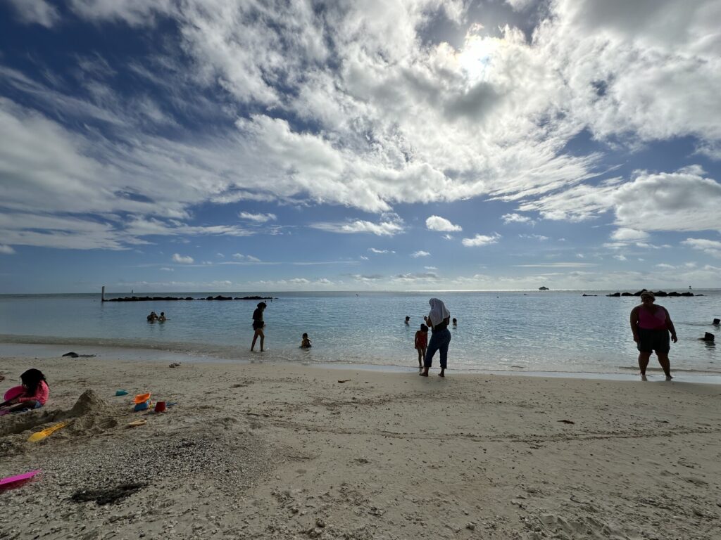
When we finished in the fort, Emily and I had a bit to eat from the food we brought and walked over to the South Swim Beach and tried out some snorkeling. There was a ton of variety of sea life there, and it was really cool to swim right through huge schools of fish along the fort’s seawall.
The snorkeling beach with the fort in the background. – Photo by the author
Before too long, it was time to get back to the seaplane and head back to Key West. I decided to shoot a video while we were taking off.
Taking off from Fort Jefferson. – Video by the authorGoodbye, Fort Jefferson! – Photo by the author
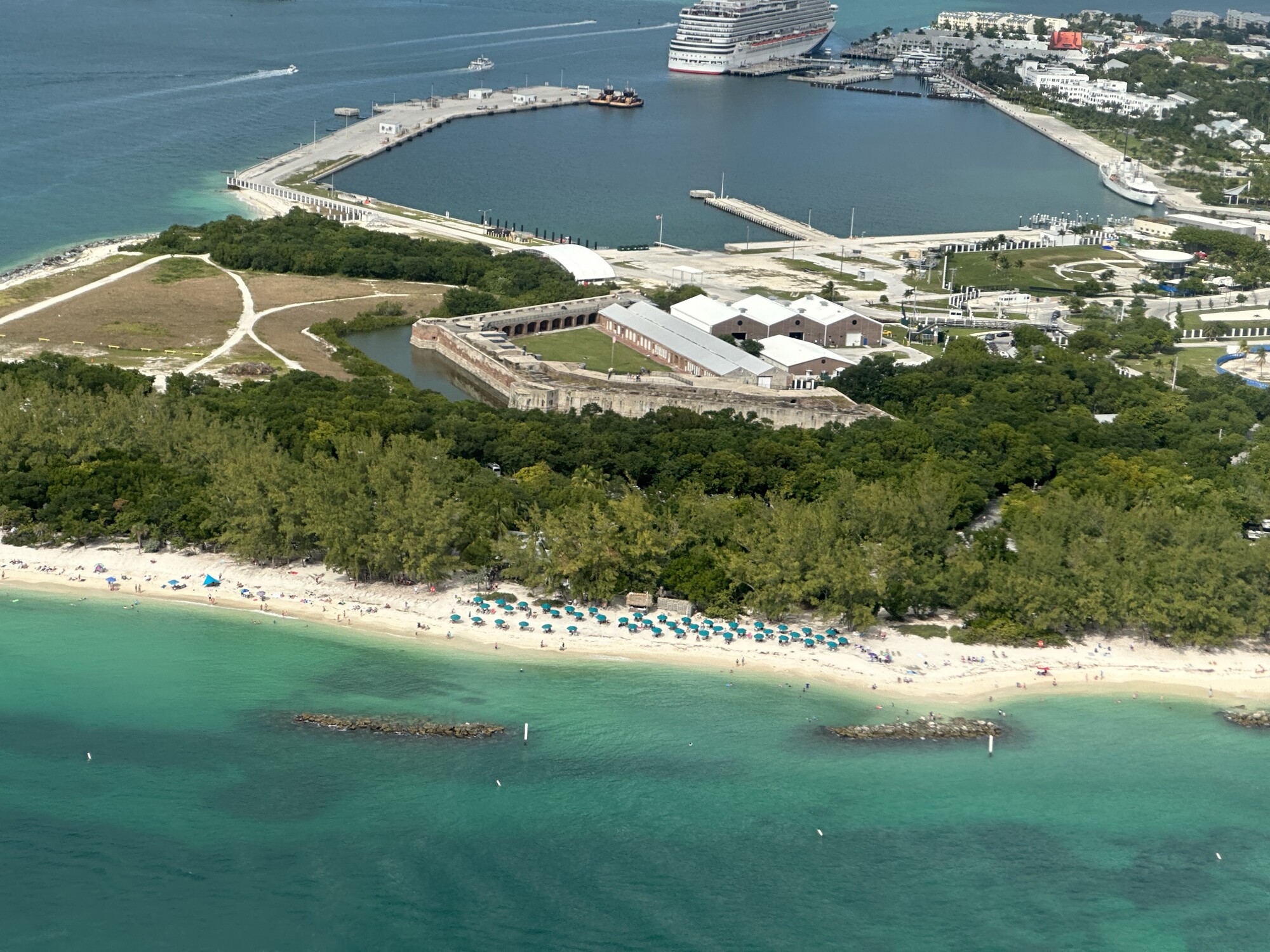
As we approached Key West, I got the chance to get some cool aerial photos of the island. It was nice to see Fort Zachary Taylor again.
Fort Zachary Taylor – which we had visited two days prior – looked great from the air! – Photo by the authorHey – that’s our hotel! – Photo by the author
Obviously, we made a safe landing at the airport, and made our way back to the hotel. It was without a doubt one of the most amazing experiences I’ve ever had. I’m so grateful that we were able to do it together!
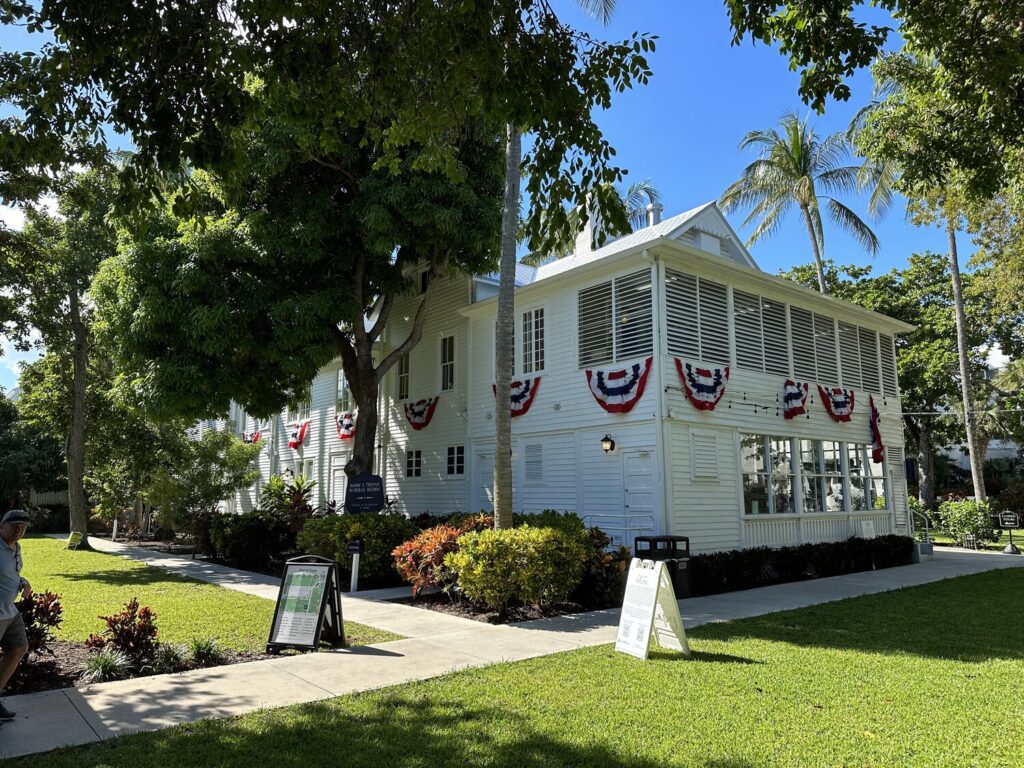
When we were planning our trip initially, this was one of those places that jumped right out at me. We made a reservation for one of the morning tours at Truman’s Little White House and made our way up to that side of the island.
Exterior view of the “Little White House” – Photo by the author
Originally built as housing for officers on the Naval base in 1890, this house ended up being associated with President Truman because of a vacation ordered by his doctor. Truman had been feeling ill and was advised to go somewhere warm in November of 1946. FADM Chester Nimitz had recently visited Naval Station Key West and knew that this house was available. Truman felt so invigorated here, that he made it a regular part of his presidency – spending something like 10% of his time in office here.
One of the things that I found interesting about the house itself is that it was originally situated on waterfront property, but over the years the island has been expanded by depositing fill from dredging operations. The west side of the island changed a lot because of this.
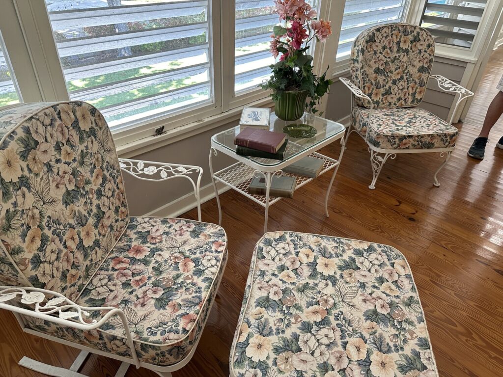
Our tour guide, Chet, was awesome. He had a lot of really great stories, and made us feel welcome. Many of the furnishings in the house are original to the Trumans’ time here. The whole interior decorating scheme is very 1950s. Parts of it felt like it could have been my grandmother’s house.
I swear I have seen these very chairs at my grandparents’ house! – Photo by the author
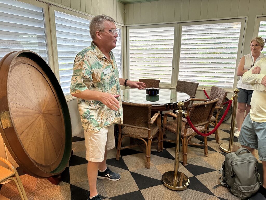
One of the highlights of the tour was this custom card table, built by some of the guys on the Naval Station for Truman to use. He apparently enjoyed playing cards with guests that would come down – in fact, it seemed like the whole atmosphere here was very relaxed – I can see why Truman loved it so much. The story is that it was seen as very uncouth for the President to be seen playing cards, so a top was made to be fitted over the card playing surface for when the press was around.
Chet talks about the card table. The top cover rests behind him. – Photo by the author
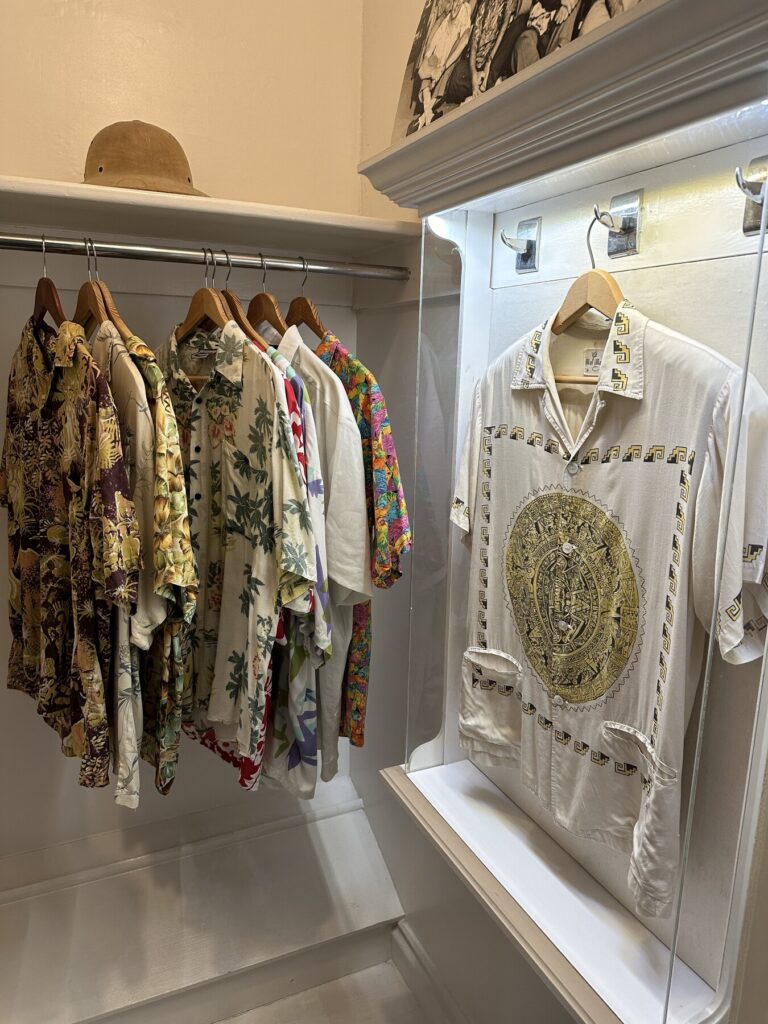
The other thing that was interesting was that a company in Miami (I believe) had heard about Truman’s frequent vacations here and send him some Hawaiian shirts they made. Truman decided that this was to be the “Key West Uniform” and all the staffers were encouraged to participate. They even have one of the original shirts that Truman wore still in their collection.
The case on the right holds a shirt that Truman actually wore in Key West. – Photo by the author
Truman’s personal office and bedroom upstairs were pretty cool. His wife and daughter slept in the next room over – the idea being that if there was some emergency in the middle of the night, his family would not be disturbed. Mrs. Truman didn’t travel down here very often though, as she thought this was more of a hangout spot for the “boys.”
Truman’s bed in Key West. – Photo by the author
There were some notable historical events that took place here. In 1948, this is where the plan to consolidate the Department of the Navy and the Department of War into the Department of Defense was devised. Much later, in 2001, Secretary of State Colin Powell chose to host peace talks between Armenia and Azerbaijan here. When asked why, he said that it was because of his tremendous respect for Truman, who had made a very personal impact on his life by desegregating the US military.
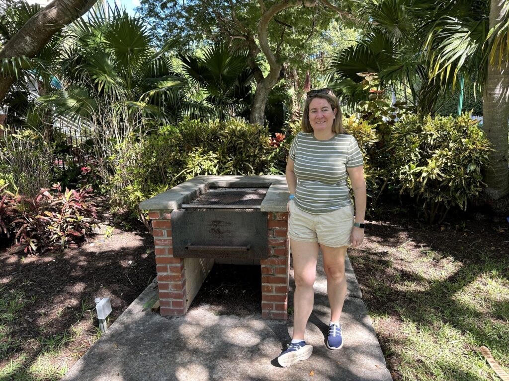
Once our tour was finished, I was able to get a photo of Emily out front with Truman’s grill. He was known to use the fine silver as a tray for hot dogs. Now I feel like I need to take her to visit Eisenhower’s house!
Emily with Truman’s grill. – Photo by the author
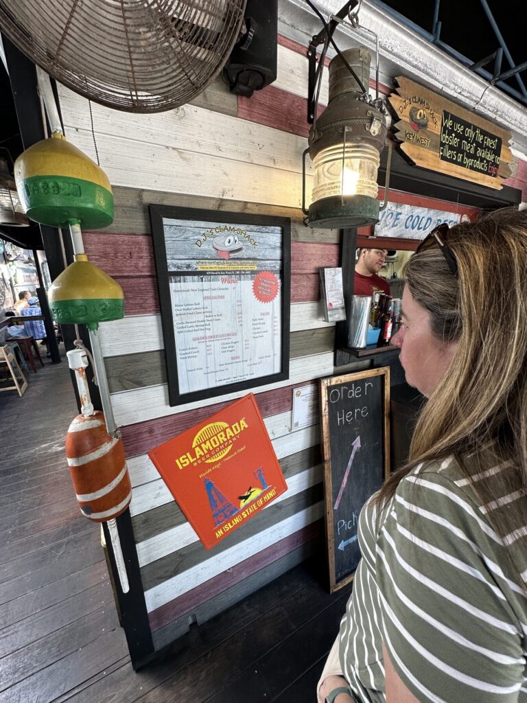
Lunch at DJ’s Clam Shack
My wife Emily is definitely a foodie, and the number of options for restaurants on Key West was nearly overwhelming. I think we need to make a return trip just to try out some other places.
Emily inspects the menu at DJ’s Clam Shack – Photo by the author
In the end, Emily chose to go with their famous fried clams. I had some chicken fingers. We split an order of sweet potato fries. It was all delicious.
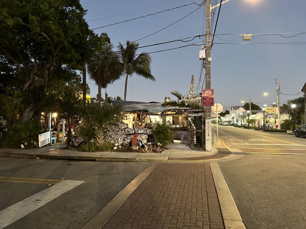
Dinner at Bo’s Fish Wagon
When we told people we were going to Key West, we got a ton of recommendations. One of the loudest was from my boss – herself a frequent visitor to the island – about a little joint that she thought Emily would really like. We had to check out Bo’s Fish Wagon.
Bo’s Fish Wagon, on the northern side of the island. – Photo by the author
I’ll be honest, the look of the place from the outside was…interesting. I ended up getting a hotdog (because I’m boring) and some really great black beans and rice on the side. Emily got fish tacos with crispy fries, and said that the fish was some of the freshest she had ever had.
We walked around the seaport district for a while and then headed back to the hotel. The big adventure of our honeymoon was planned for the next day, and we needed to be well-rested.
Emily and I on the ramparts at Fort Zachary Taylor. – Photo by the author
The historical highlight of today was the trip over to Fort Zachary Taylor, a third system fort on the west side of the island. Sadly, it was heavily modified during the Endicott period. It was shortened, and several of the big seacoast guns were dumped into the new concrete as fill. You can still see several of them poking out. It’s a little sad.
A panorama showing some of the old guns poking out of the concrete. – Photo by the author
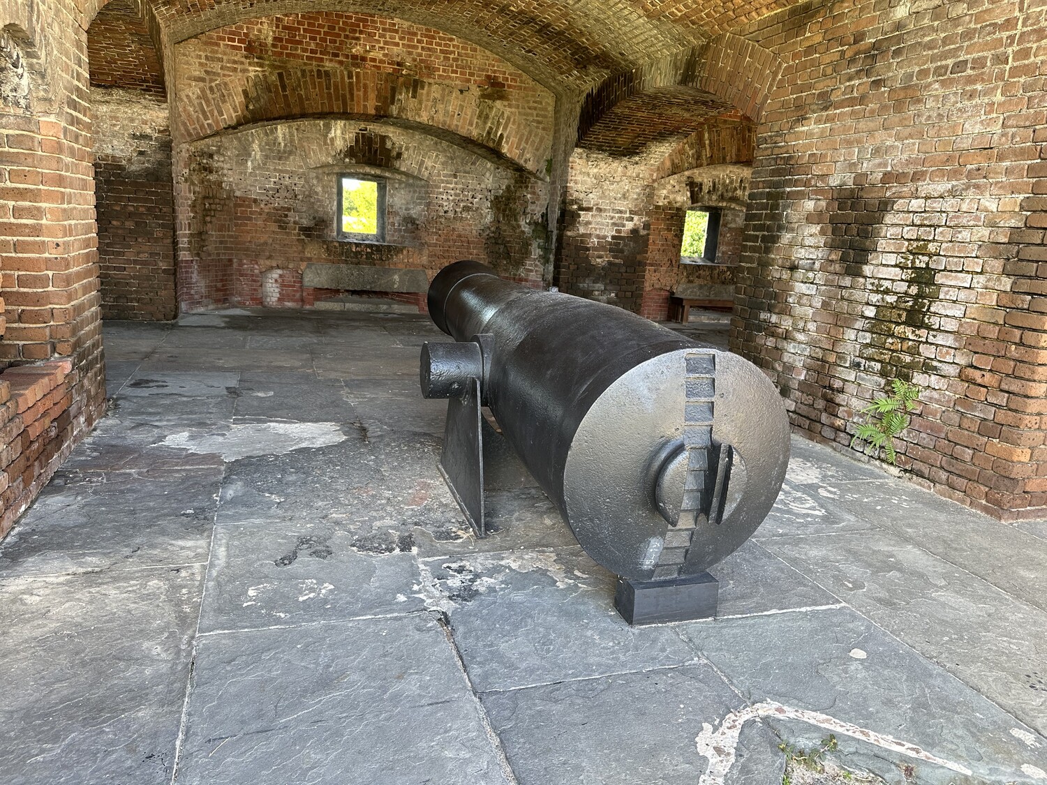
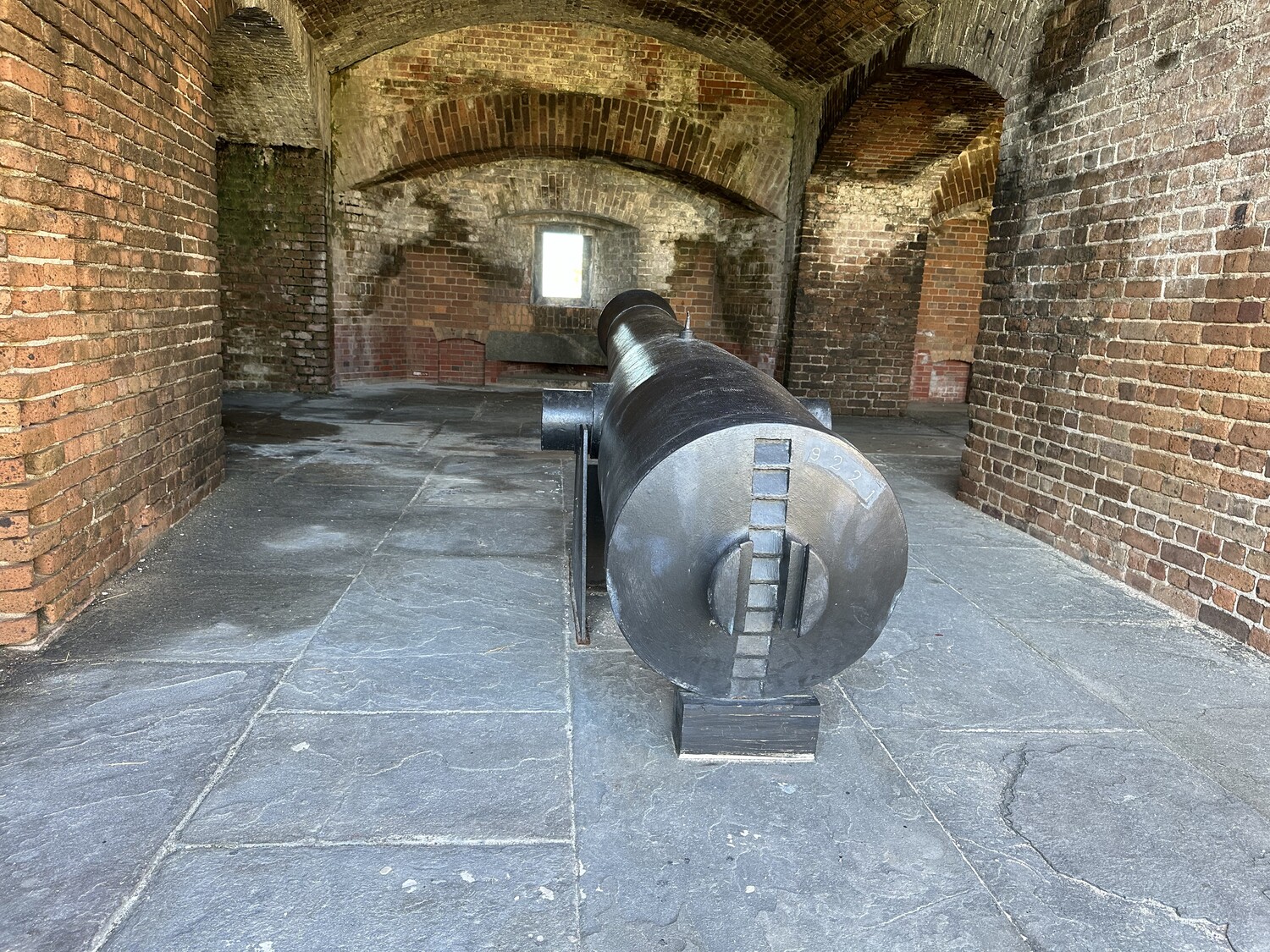
Luckily, there has been some preservation work done to recover some of the pieces after the fort was incorporated into a state park. Those recovered guns are on display in the fort today. It’s a cool collection of Columbiads, Rodmans, and Parrotts.
An 8-inch Columbiad. – Photo by the authorA 10-inch Columbiad. – Photo by the authorA Rodman gun. – Photo by the authorA Parrott rifle. – Photo by the author
On the day we were there, a living history group was camped out with some artifacts. That was pretty cool.
After scoping out the history, we walked over to the other side of the park and enjoyed some time on the nicest beach on Key West.
A little beach time was relaxing. – Photo by the author
One of the things that we decided in the run up to our wedding was that we weren’t going to take a honeymoon immediately after. We had wanted to go to Key West because it seemed like it was a good compromise location for us – it’s a tropical island, but it has a lot of interesting history. Since we knew that was where we were headed, Emily thought it would be good to avoid hurricane season, and have a time when we wouldn’t be with my boys for a fairly extended period. The week before Thanksgiving met all the criteria.
We flew out of PHL on November 16, and got settled in pretty easily to our resort. The next day, we would start doing some tourist things.
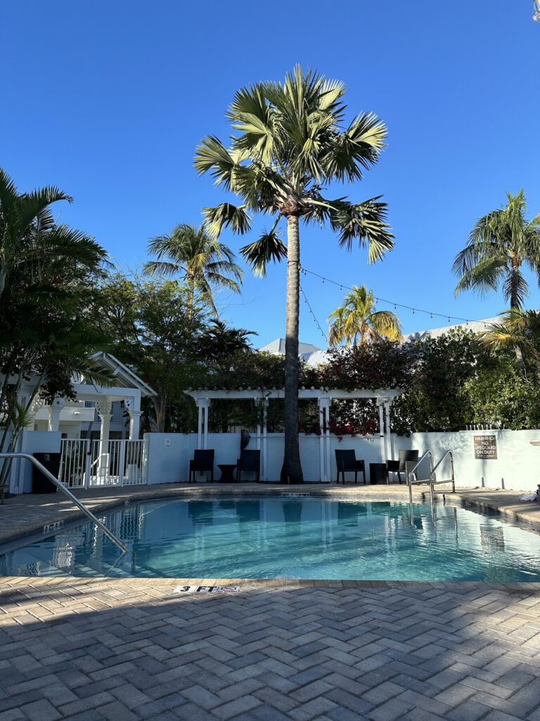
Our resort was lovely. – Photo by the author
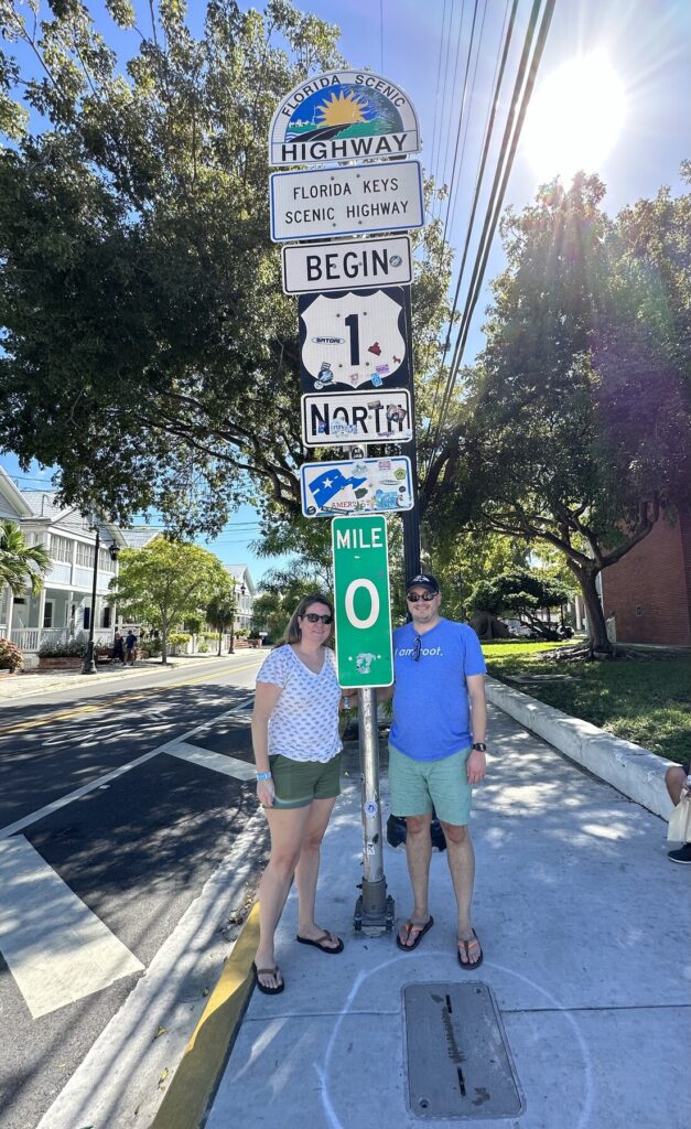
After getting a really lovely brunch at Bagatelle, we walked over to the “Mile Marker 0” sign for US-1, and got the requisite photos.
Emily and I at “Mile Marker 0” – Photo by a fellow tourist
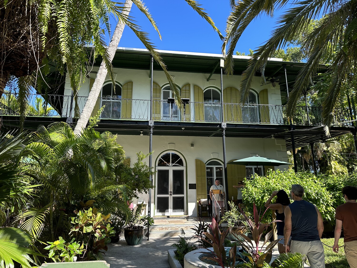
Continuing to walk south along Whitehead Street, we came to the Hemingway Home and Museum. While it didn’t necessarily light either of us up on its face, several people we had talked to had recommended checking it out. We took the leap, and the tour was much cooler than we were expecting. There were lots of stories involving alcohol and various affairs. Hemingway certainly led a tortured life.
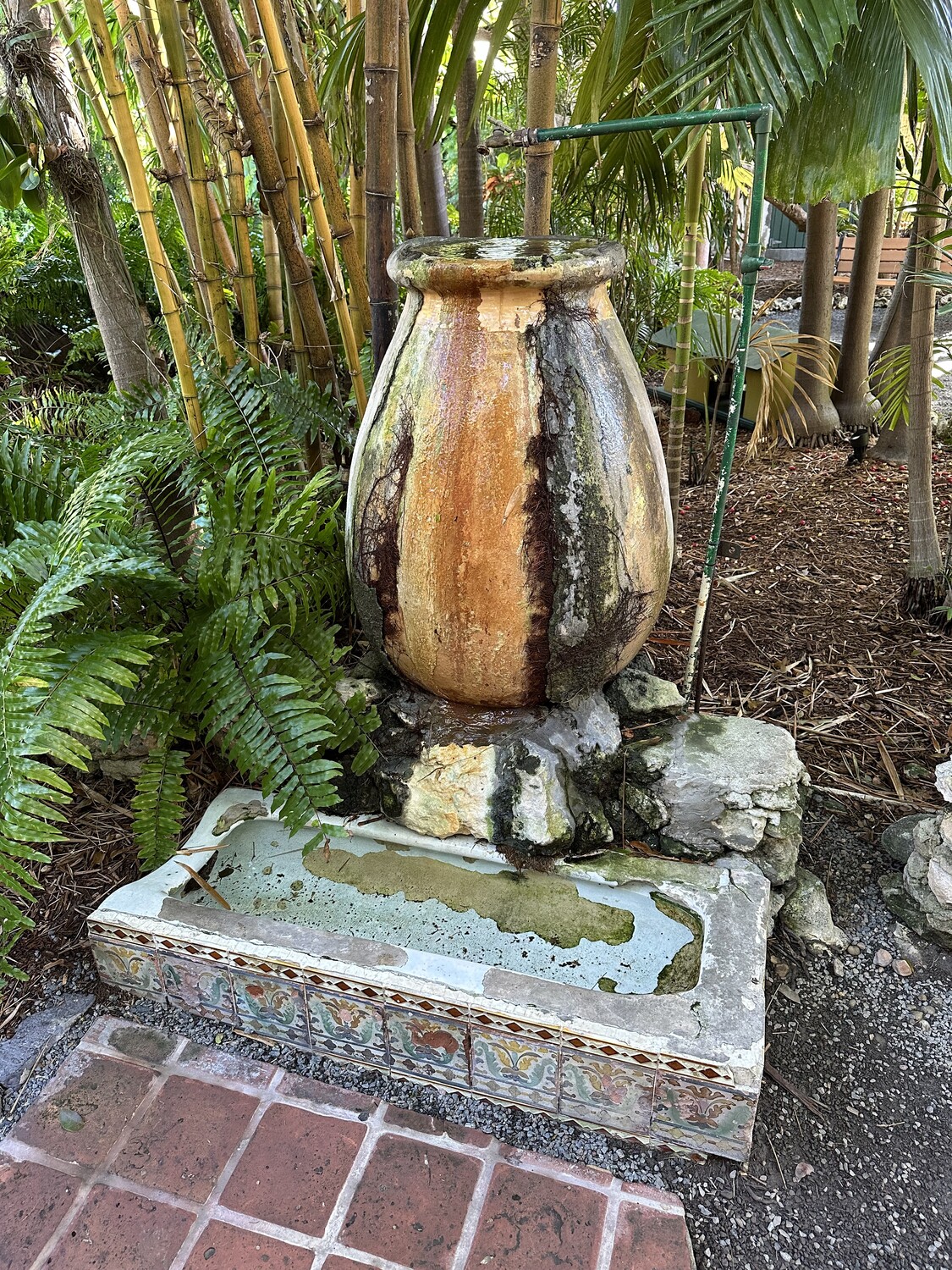
Hemingway’s House in Key West. – Photo by the authorMy favorite story from Hemingway was about this fountain, that began as a urinal at a local bar. Hemingway apparently dragged it down the street himself. – Photo by the author
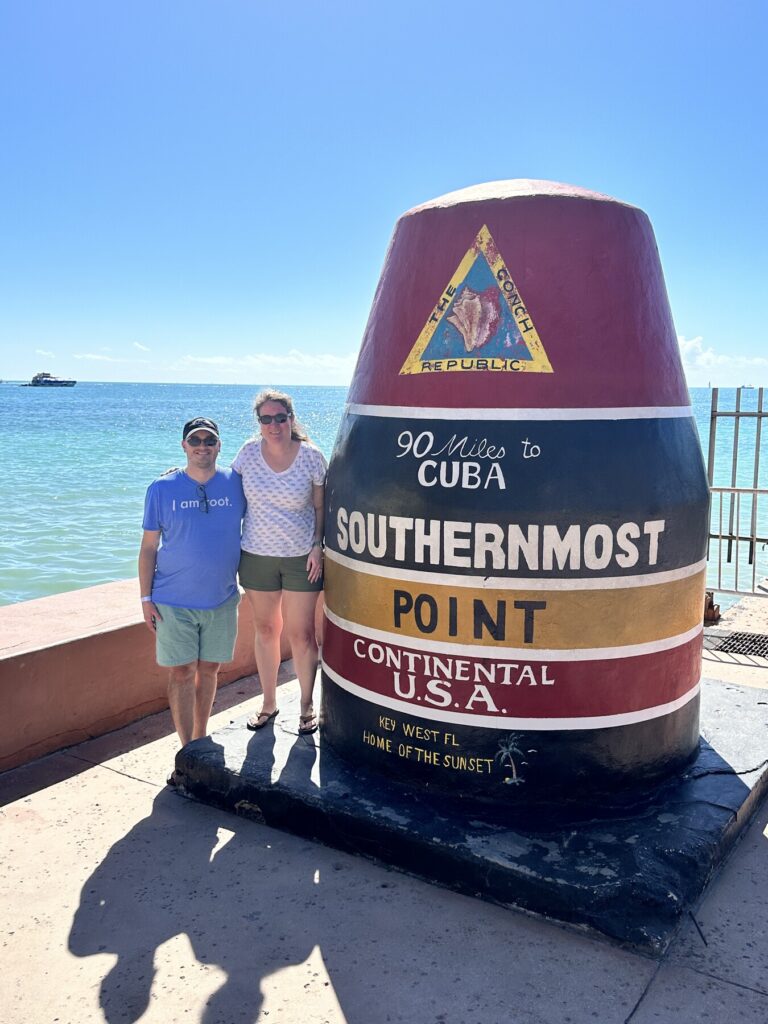
Once we reached the bottom of Whitehead Street, we were at the famous “Southernmost Point” marker, where we only had to wait in line for a few minutes to get our second tourist photo of the day. I’m very aware that this is nowhere near the actual southernmost point in the continental US, but it’s just one of those things you have to do on Key West. I found myself reading the historical marker for the underwater communications cable to Cuba while we waited in line. Apparently, this line carried the very first international phone call. Cool stuff.
Our ultra-touristy photo from the “Southernmost Point”. – Photo by a fellow tourist
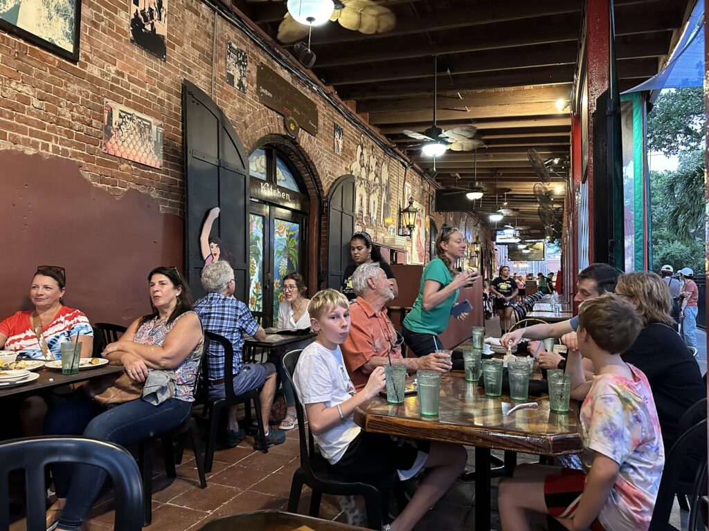
Just from walking around the “downtown” area for a while, Cuba and the Navy really seem to dominate the history and culture here. Many of the buildings seem to have begun their lives as structures to support the Navy or some aspect of international trade. This was particularly evident as we had dinner that night just off Mallory Square in an old building that had been turned into a Cuban restaurant.
Cuban dinner near Mallory Square. – Photo by the author
While we were at dinner, we would experience the only rough spot of the week. The power went out on the island as we were finishing and then a hard rain storm came through. After maybe 20-30 minutes, things came back to life, we were able to settle our bill, and we made our way back to the hotel.
Emily and I had gone up to visit her Nana at the senior living community that she moved in to. We planned to have dinner together in their dining room and just enjoy the company.
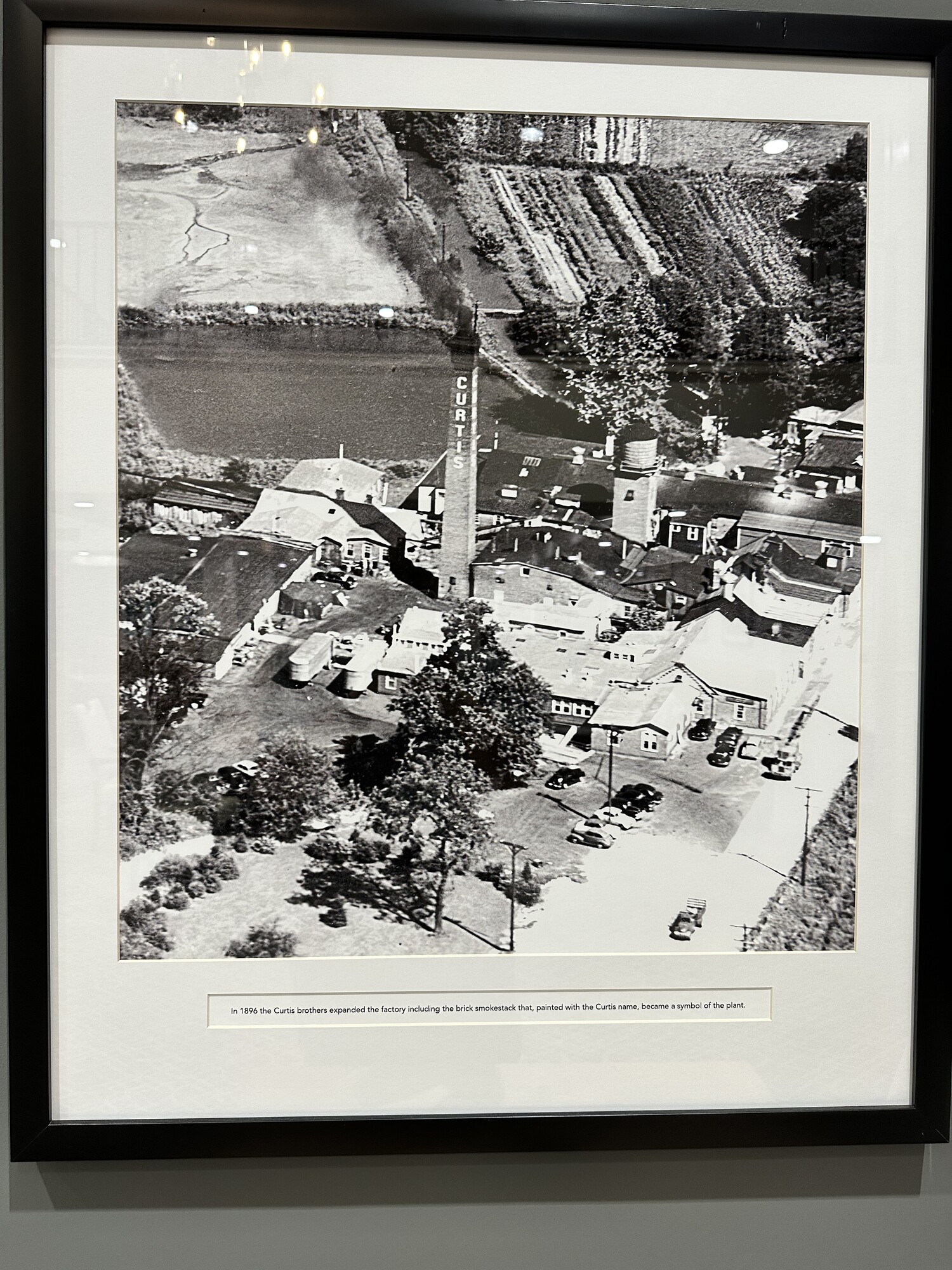
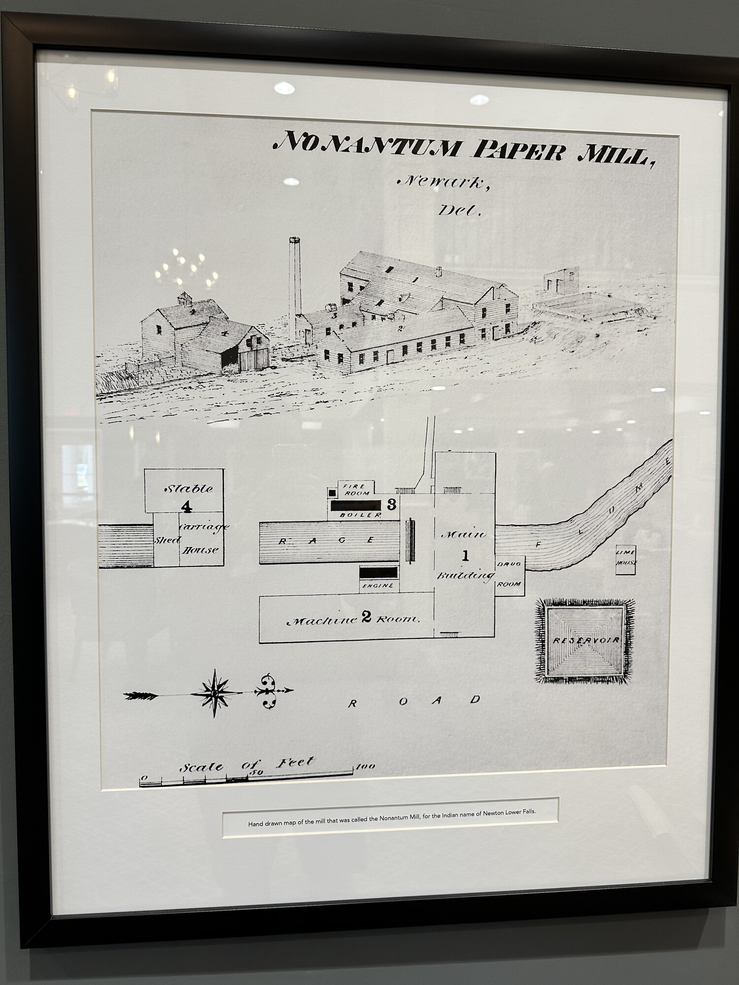
As we were waiting for our food, I noticed a series of prints hanging on the wall depicting various aspects of the papermaking process. Some of the prints were photos and maps labeled as from the “Nonantum Paper Mill”. It piqued my interest because of the excellent lecture from Scott L. Mingus that I attended a few years ago on the History of Papermaking.
An aerial photo of the paper mill hanging in the dining room. – Photo by the authorAn old map of some of the mill buildings. – Photo by the author
The three of us got to talking about it at dinner, and the ladies told me that the old mill was nearby on the aptly-named Paper Mill Road. Emily agreed to drive over to check it out when we were finished with our visit.
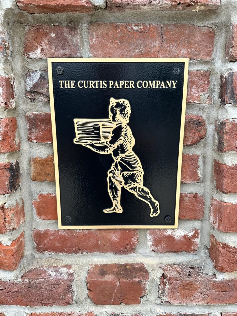
A plaque with the brand of the Curtis Paper Mill is at the site today. – Photo by the author
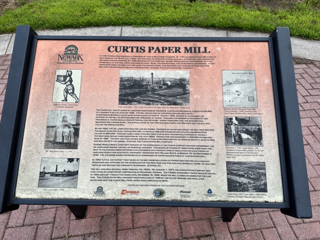
The City of Newark converted the site into a park several years ago. The mill had closed down in 1999. None of the old buildings still exist, but I think the mill race is still there – I need to go back to investigate further. A wayside marker told the story of the mill – and I was able to add it to the HMDB during my visit.
The Curtis Paper Mill wayside marker. – Photo by the author
Most notably, during WWII about 50% of the output of the mill was used by the United States Federal Government or for lend-lease. In fact, the paper that the Japanese Instrument of Surrender was printed on was made right there at that now-unassuming spot in Newark, DE.
I feel like I say it all the time, but history is all around us if you give yourself the chance to stumble onto it.
After our wedding, we spent a week as a family in Stone Harbor, NJ – mostly enjoying the beach and some great food. It is a favorite vacation spot for Emily, and the place has grown on all of us.
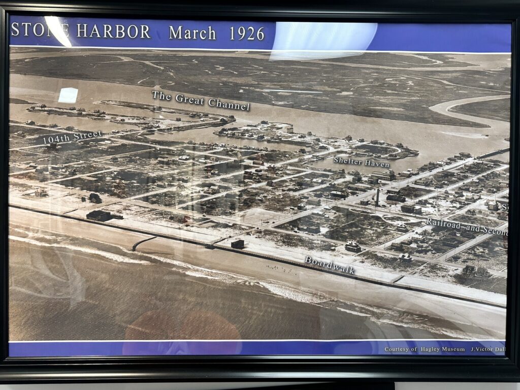
One of the things that I’ve wanted to do for a while is check out the local history museum. On this day, I was able to sneak down into town for an hour or so with the boys as a bit of a change of pace.
A cool old aerial photo of the town. It was not nearly as built-up as it is today. – Photo by the author
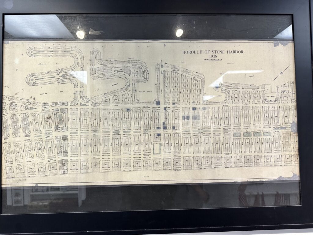
They have lots of maps, a timeline on the wall, and assorted artifacts. The docent there let the boys do a scavenger hunt activity. He said that much of the early history of the town involved “the mob” who had bought land there to make smuggling alcohol down from Canada by boat easier. A colorful story, for sure.
You can probably guess that I LOVE an old map! – Photo by the author
Railroads bringing tourists from Philadelphia also factored heavily early on. None of that infrastructure remains today, but the tracks were originally where the grass “islands” are in 2nd Ave. today. The station / yard for the railroad was between 2nd Ave. and Pennsylvania Ave.
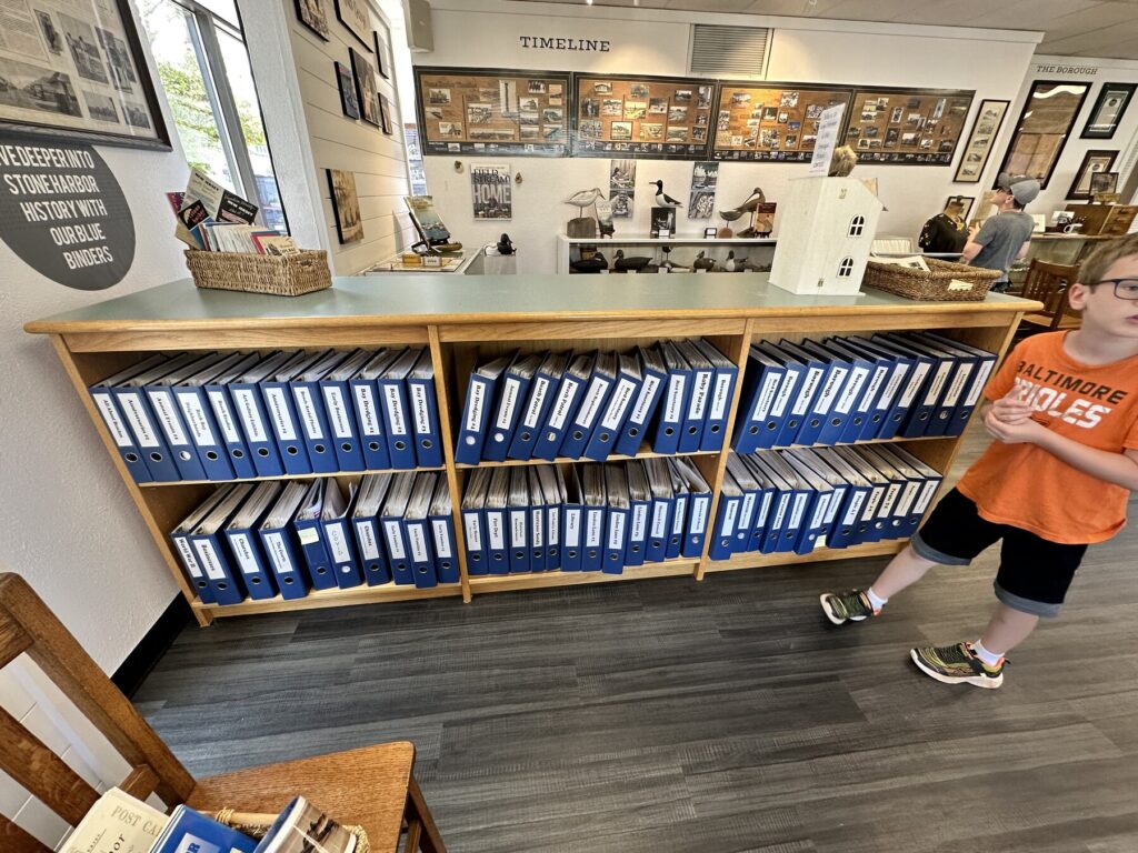
The museum also has binders full of newspaper clippings and old photos, organized by street. It would be fun to get lost in that research library for a while.
Binders full of materials make for a cool research library. – Photo by the author
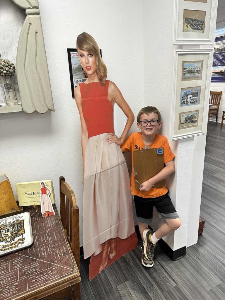
Isaac enjoyed getting a photo with the Taylor Swift cut-out they had. She is something of a local celebrity as she spent summers here as a kid. Both boys were able to talk the docent into giving them old 2010 beach tags (he didn’t put up much of a fight) as rewards for their scavenger hunt. These were prized by the boys because the design incorporates a plane on it.
Isaac hanging out with local celebrity, Taylor Swift. – Photo by the author
Not bad at all for a free museum. I plan to be back!
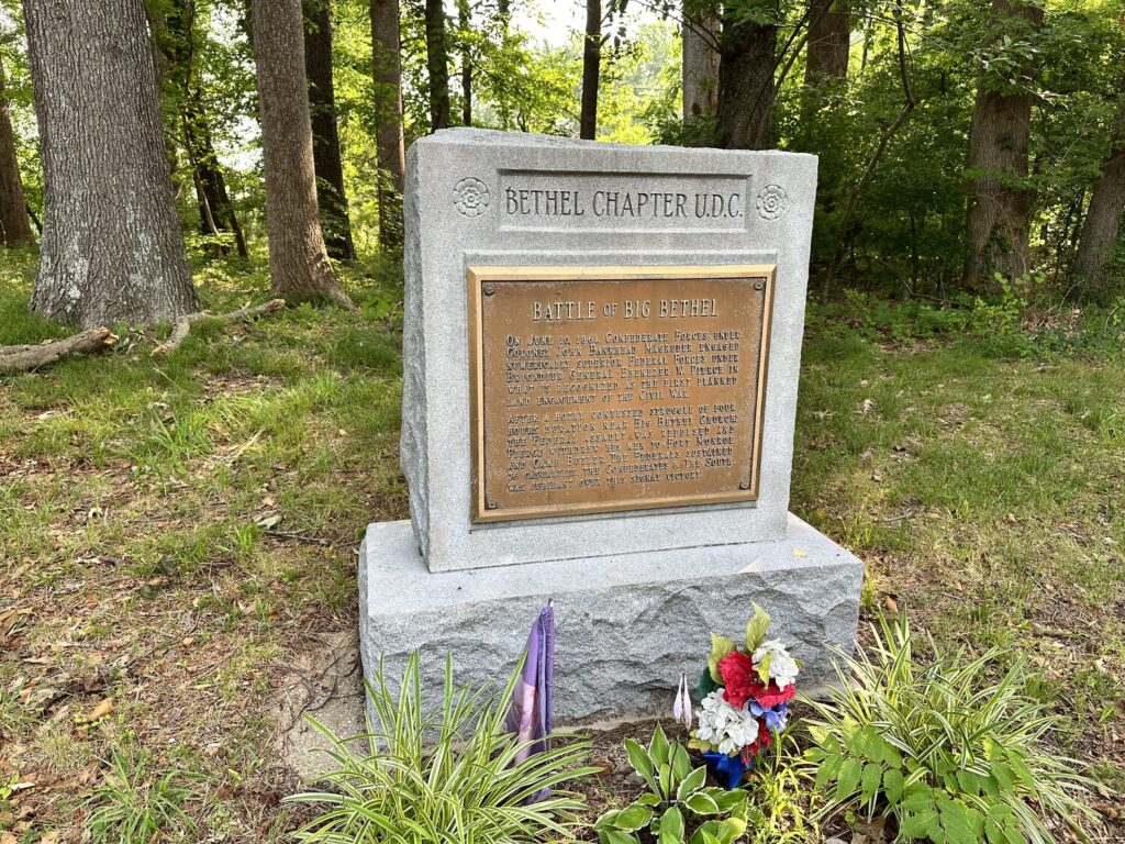
Since it occurred on June 10, 1861, some people consider the Battle of Big Bethel to be the first “real” land battle of the Civil War; that all the actions that came before were merely “skirmishes.” I don’t fall into this camp. For me, the Battle of Philippi (which I visited as battlefield #84 for me, all the way back in April of 2019) holds that title.
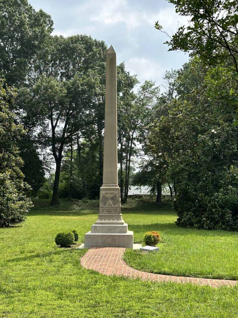
One of the monuments at the Big Bethel Park. – Photo by the author
Either way, this was an early foray up the peninsula by a small Union force from Fort Monroe that was halted by some well-placed Confederate defenses. The rebels repelled multiple attacks and put up some counterattacks of their own, causing the Federal troops to retreat back to the safety of the fort. Union losses were 76 men in total – including some who were caught in an incident of friendly fire. As this was still early in the war, the Union 3rd NY infantry was still wearing their original gray militia uniforms. Men of the 7th NY mistook them for flanking rebels and opened fire, wounding dozens of their compatriots.
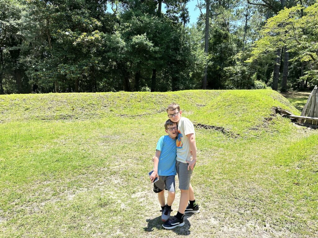
Today, almost none of the battlefield is still left. It is now neighborhoods – including housing for nearby Joint Base Langley/Eustis – and a large chunk has been covered by the modern Big Bethel Reservoir. There is a small park on the south side of the reservoir – maybe an acre or two – that has *14* monuments and markers on it! One of the most densely marked fields I’ve ever seen.
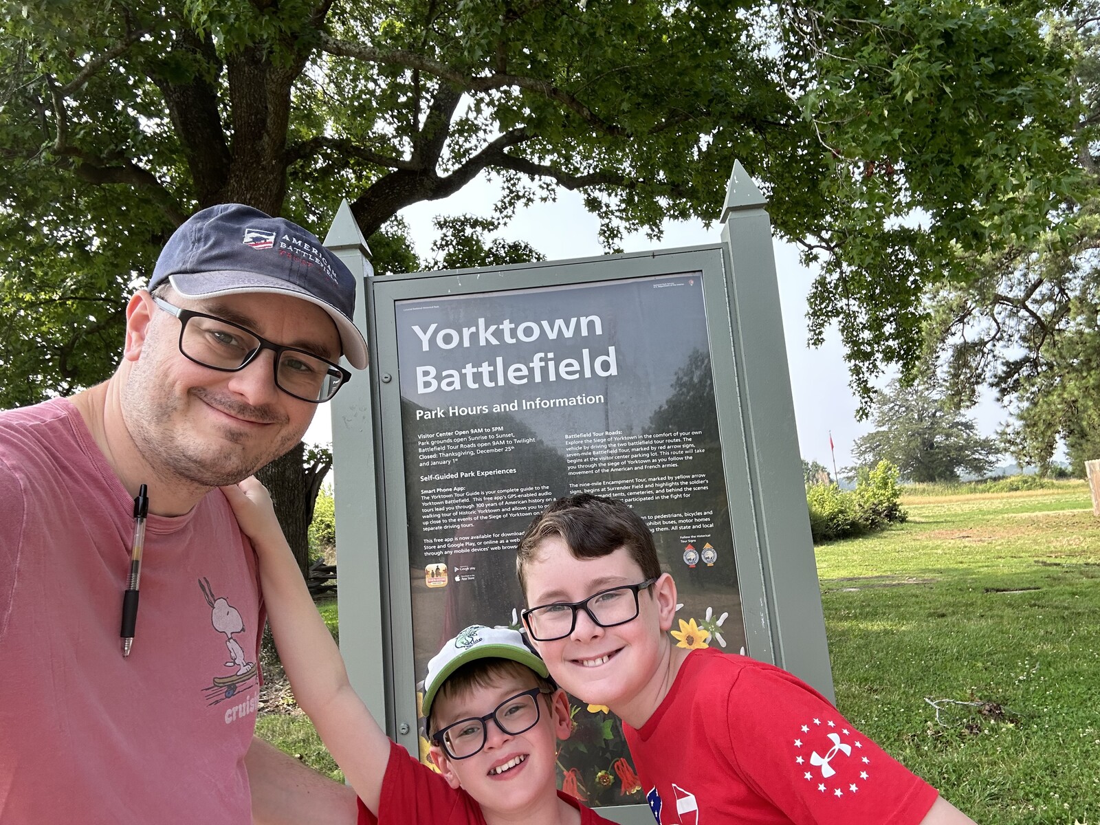
Colonial National Historical Park – Yorktown
Yorktown. There’s obviously Revolutionary War history here, but also some Civil War (which I’ll touch on in a minute).
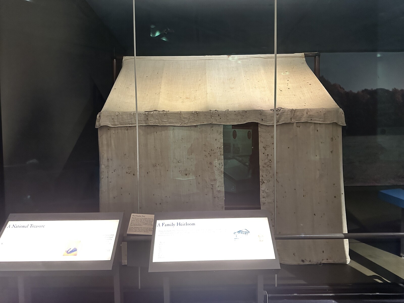
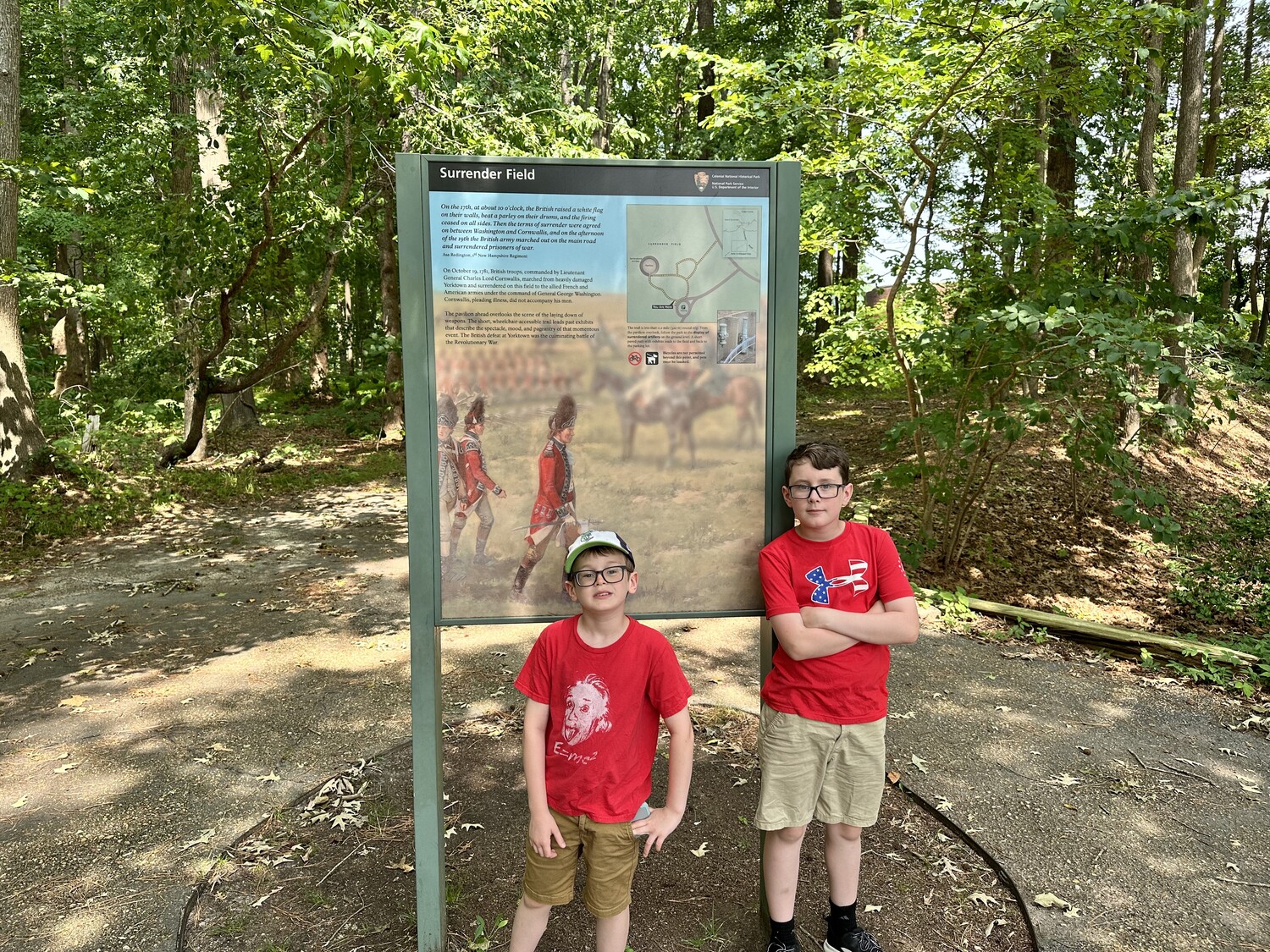
We saw the film here, went through their nice museum (that included original tents used by George Washington!) and toured the field. Between this and Saratoga, we’ve now seen two British surrender sites. We also did the Junior Ranger program here.
#SignSelfie outside the visitors center. – Photo by the authorOne of Washington’s tents in the museum. – Photo by the authorThe boys at the site of the British surrender. – Photo by the authorLooking over the field where the surrender took place. – Photo by the author
Siege of Yorktown – Civil War Battlefield #175
Maj. Gen. George McClellan wanted to capture Richmond, and rather than assaulting “overland” (as Grant would successfully do 2 years later), he opted for a mostly naval approach. He landed his army at Fort Monroe and marched north along the peninsula.
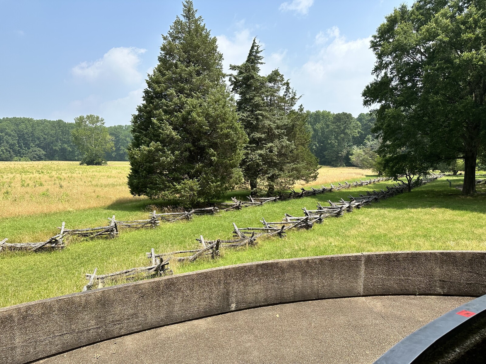
The Confederates had converted some of the old British earthworks from the Revolutionary War and extended them to cover the ground from the York to the James River. When McClellan arrived, he became concerned about the fortifications here (and also paranoid that he was somehow outnumbered) so he spent weeks amassing the largest collection of siege artillery that had ever been assembled in America up to that point. The Siege of Yorktown was on. By the time he was ready to attack though, the few Confederates that were here had fallen back to a new line near Williamsburg. McClellan had given them plenty of time to prepare.
Some of the fortifications at Yorktown were re-used by the Confederates. – Photo by the author
The NPS doesn’t do much to interpret the Civil War actions here – they focus on the Revolutionary War. If you ask at the front desk, they can give you an additional pamphlet that discusses the Civil War actions at various stops along their normal tour route.
Colonial National Historical Park – Jamestowne
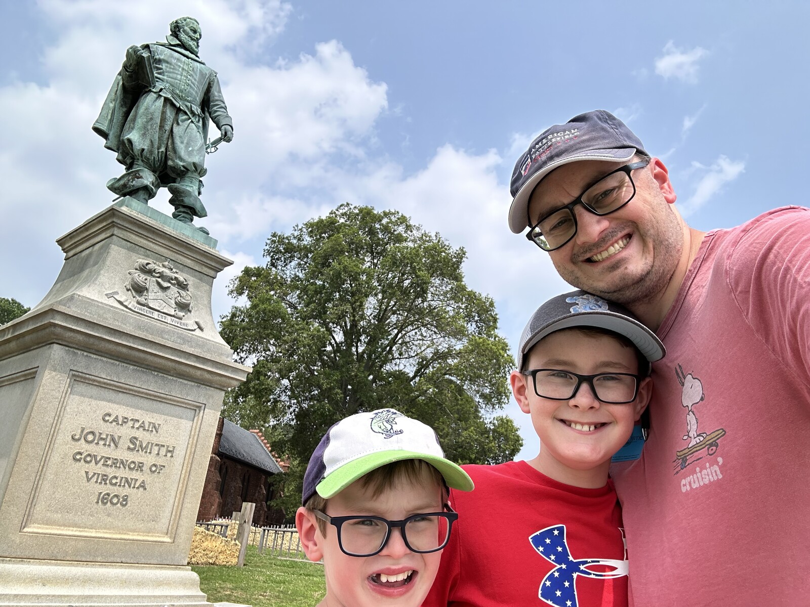
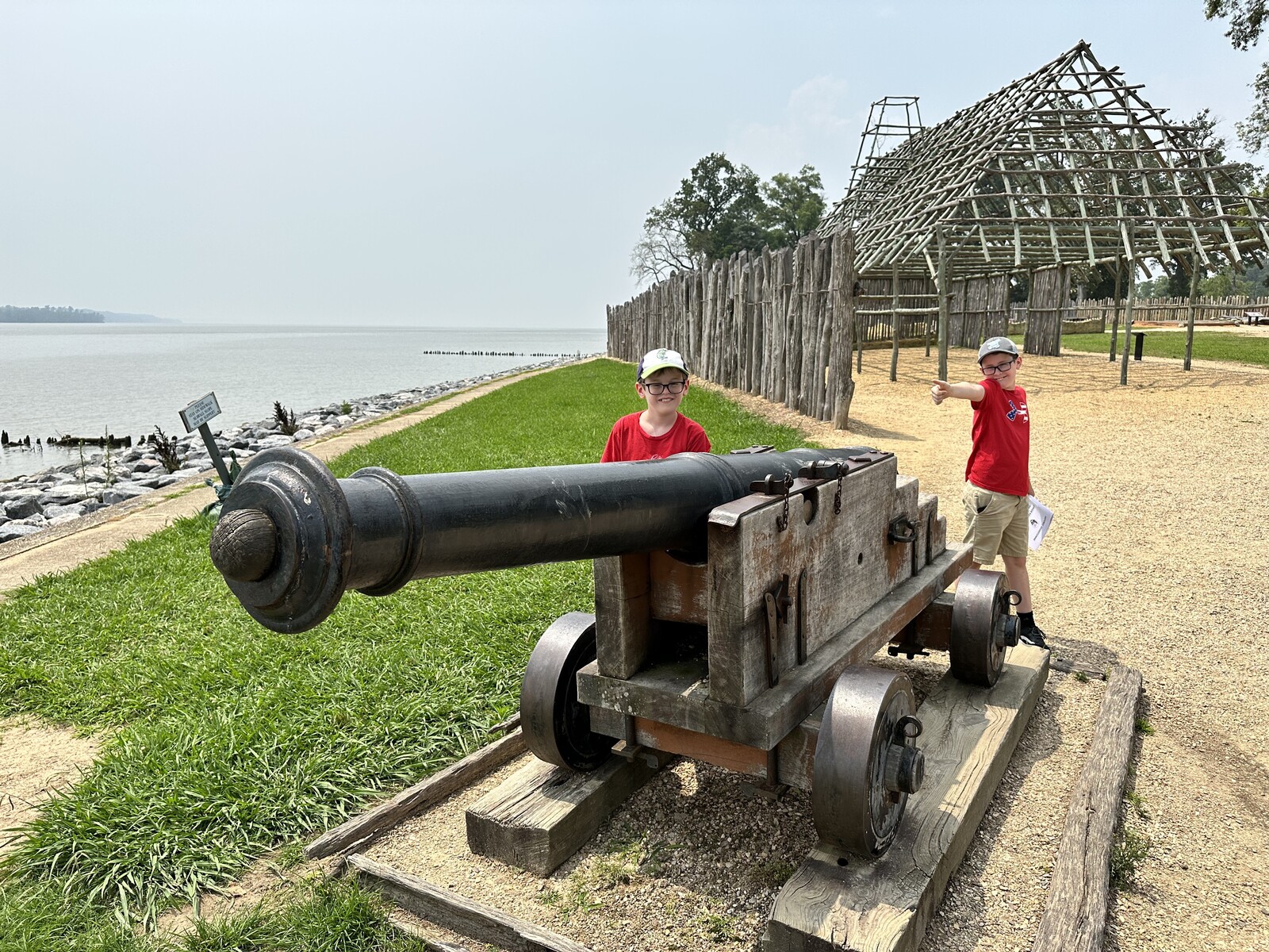
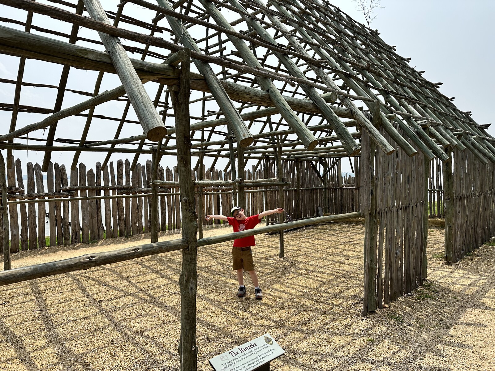
Jamestowne. Very cool to see the actual spot of the first permanent English colony in America. The museum here had a lot of relics that were found during archaeological digs in the past few decades. They have learned enough through that process that they’ve begun reconstructing the site as it would have originally appeared, though some of the original site has been eroded away by the James River.
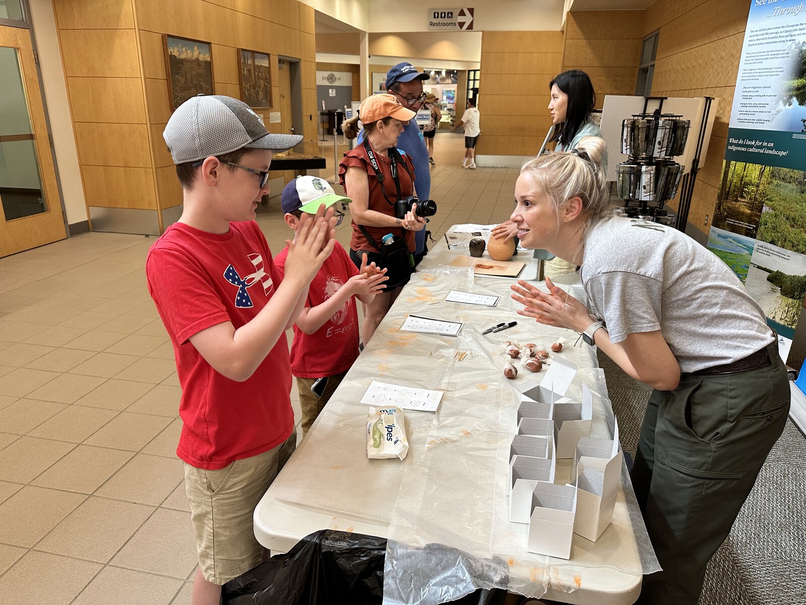
Getting a selfie with Governor John Smith. – Photo by the authorJamestowne has everything – even artillery! – Photo by the authorIsaac explores the reconstructed barracks. – Photo by the authorMaking some pottery with a ranger. – Photo by the author
In addition to the usual Junior Ranger program, the boys got to get their hands dirty making some pottery with a ranger. The decking across the wetlands also made for some good nature exposure. John spotted a baby turtle down in the marsh.
Battle of Williamsburg – Civil War Battlefield #176
Moving forward from Yorktown, the Union army attacked the Confederate defenses here at Williamsburg on May 5, 1862. In back-and-forth fighting, no conclusive advantage was gained. The Confederates pulled back toward Richmond overnight.
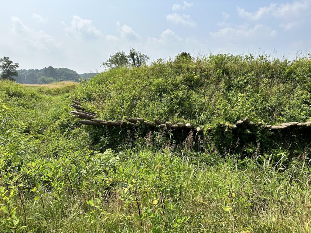
A Confederate monument at Fort Magruder. – Photo by the author
The site of Fort Magruder at the Battle of Williamsburg – including what look like some of the earthworks – is preserved, but the fenced-in area has plenty of “No Trespassing” signs. We were able to get some photos from the fence line.
Battle of Eltham’s Landing – Civil War Battlefield #177
While half of McClellan’s army attacked the Confederate fortifications at Williamsburg, Brig. Gen. William B. Franklin’s division was sent by boat up the York River to Eltham’s Landing in an attempt to get in behind the rebel lines. Confederate Gen. Joseph E. Johnston had troops in place to watch for such a move and was able to attack with John Bell Hood’s brigade the day after the Union troops landed. The Federals fell back toward the landing, and the gunboats that had escorted their landing fleet were able to provide covering fire. The rebels disengaged, and the Federals didn’t follow them. The Battle of Eltham’s Landing was another inconclusive fight.
Today, there is a wayside and a small parking area near the heart of the battlefield.
The Confederates approached the Battle of Eltham’s Landing along this road. – Photo by the author
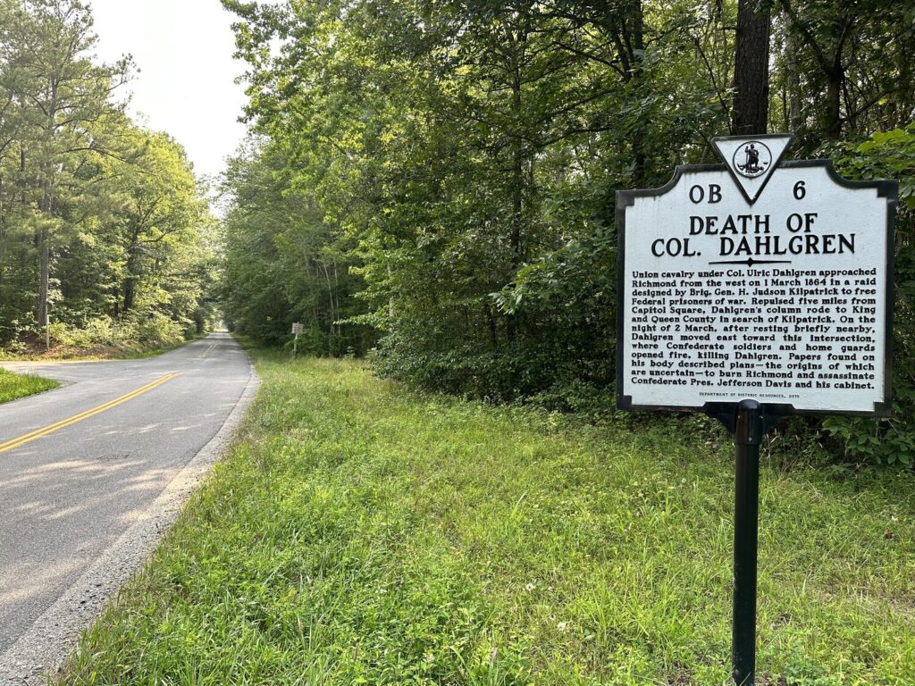
The marker at the site of Col. Dahlgren’s death. – Photo by the author
As his men tried to find their way north again, they were attacked by elements of the 9th VA cavalry here at the Battle of Walkerton. Several of them were captured, and Col. Dahlgren (son of the Father of American Naval Ordnance, RADM John A. Dahlgren) was killed. Confederates alleged that they found papers on the young Dahlgren’s corpse that ordered him to burn Richmond and assassinate Confederate President Jefferson Davis. The Lincoln administration denied the authenticity of these orders, but the entire “Dahlgren Affair” remains a point of some controversy to this day.
There is a single, lonely marker at the site where Col. Dahlgren was killed to commemorate this small, but quite consequential fight.
After 6 days visiting dozens of battlefields and historic sites across 3 states, that’s a wrap for our “Epic Man Trip”!
We stopped at my brother’s new house in Aquia Harbor, VA and had dinner with his family, before we made our way back home to Delaware later that night. It was an awesome trip.
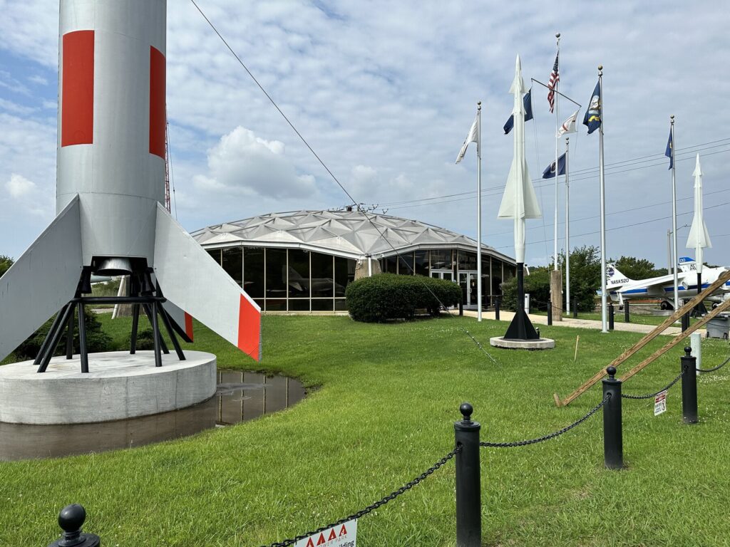
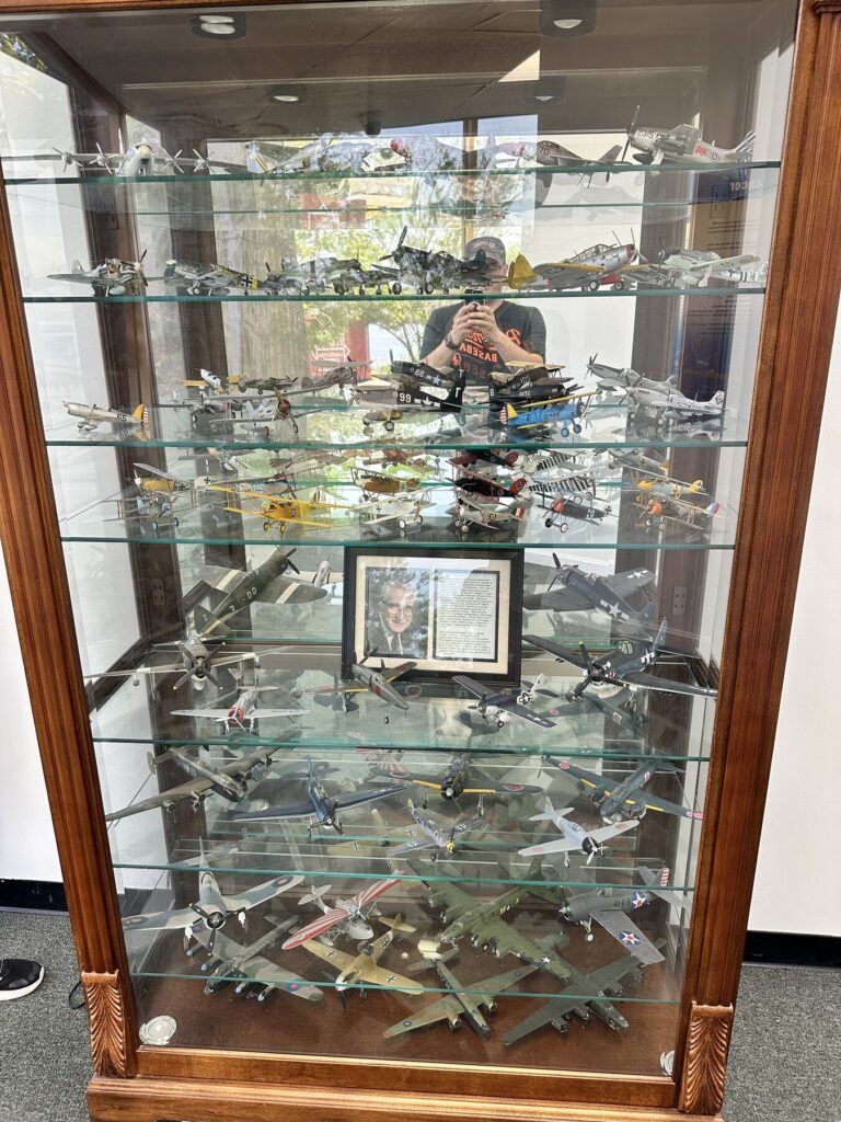
The museum at the Air Power Park. – Photo by the author
This is a very cool city park in Hampton. Sadly, the outdoor aircraft display was closed because of construction, but the totally free museum here had HUNDREDS of model aircraft that people have built and donated. They also have an aviation-focused library, and some informational signs. The curator talked to us for a while, and you could tell that he really loved the subject matter.
Just a few of the hundreds of aircraft models that have been donated to the museum. The boys LOVED these! – Photo by the author
As a bonus for me, the entrance to the museum is flanked by two Nike Ajax missles – like the ones that were stationed at my office when it was first built.
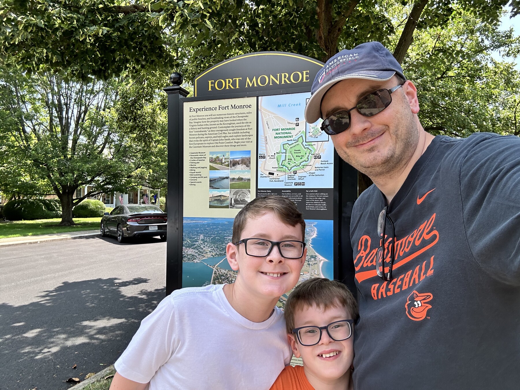
Fort Monroe
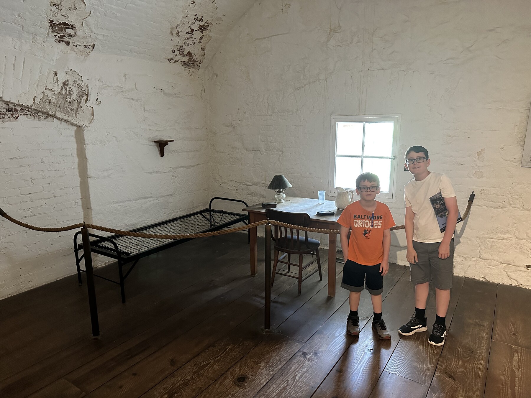
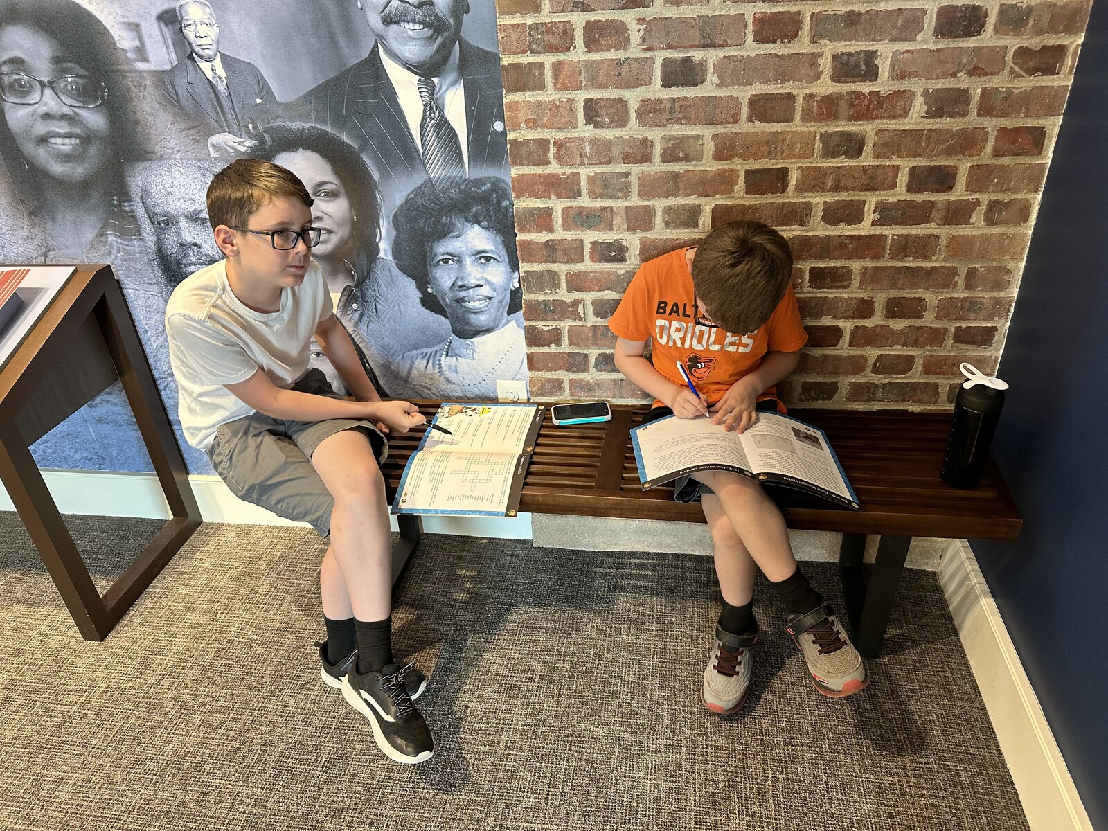
Fort Monroe. Lots of history here. While there were no Civil War battles fought here, this is one of the first places that was used as a “contraband” camp during the war. Confederate President Jefferson Davis was also held here after he was captured. The museums at the visitors center, as well as the Casemate Museum, were all awesome.
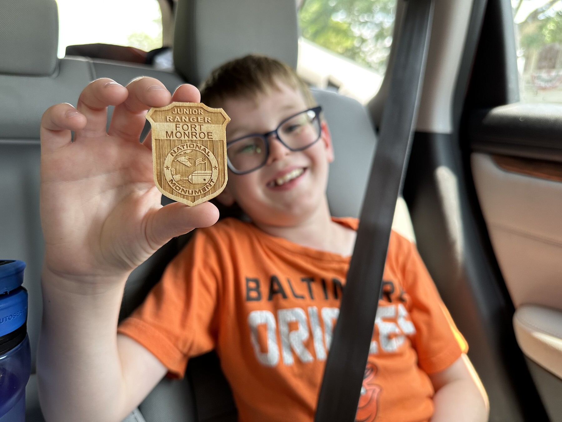
#SignSelfie – Photo by the authorThe boys in the cell that housed Jefferson Davis. – Photo by the authorWorking on those Junior Ranger books in the museum. – Photo by the authorIsaac proudly holds his Fort Monroe Junior Ranger badge. – Photo by the author
This is another site that is operated through some kind of joint partnership with a local group and the NPS doing different things. They have a Junior Ranger program here that the boys participated in, so that was good. And it was cool to be able to drive around such a large Third System fort.
Norfolk Naval Base Cruise
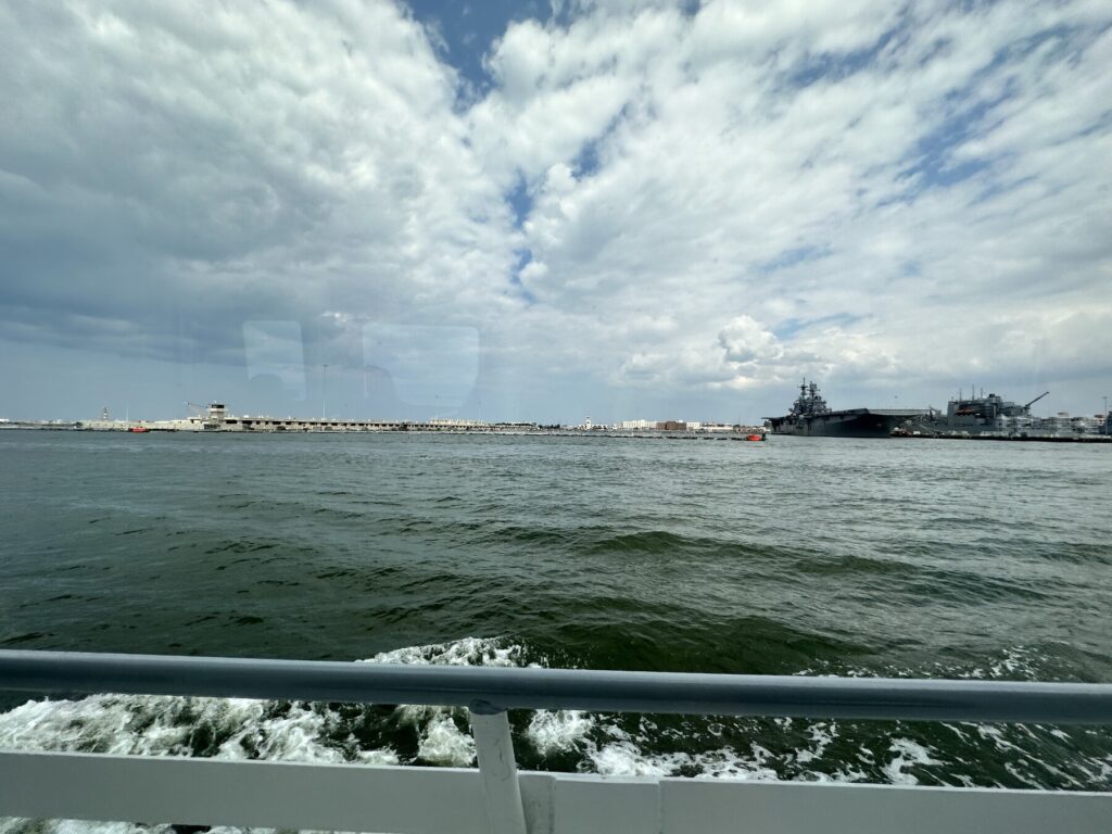
After grabbing some lunch, we took a tour of Norfolk / Hampton Roads by boat about the Victory Rover. Norfolk has the largest naval base in the world. It’s impressive to see not only the fleet, but all the other infrastructure that goes into supporting it.
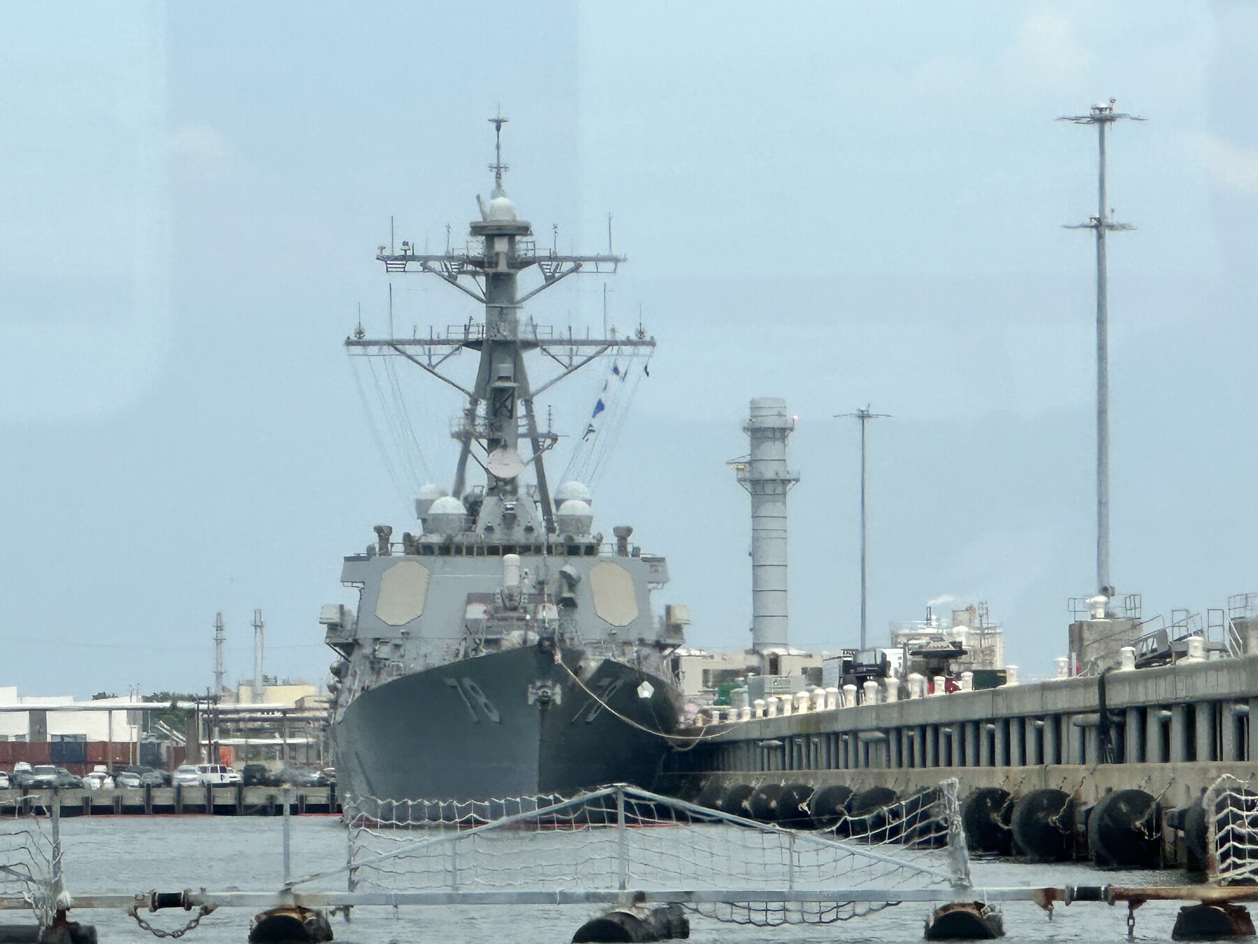
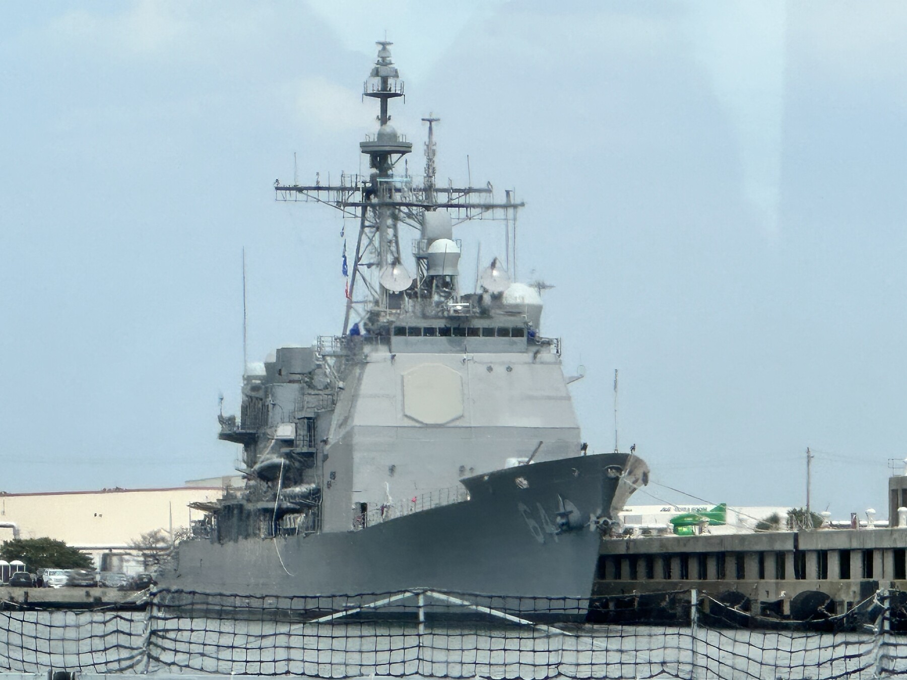
The USS Porter at Norfolk. – Photo by the authorThe USS Gettysburg. – Photo by the author
The captain / narrator was very good about explaining what we were seeing as we went past – including the sites of some old forts and all the modern facilities. We got to see some LHDs in dry dock, some Arleigh Burke-class destroyers (including the USS Porter, named in part for Civil War Admiral David Dixon Porter), and some Ticonderoga-class cruisers (including the USS Gettysburg). None of the aircraft carriers were in port, though – they’re quite busy these days. As we were turning around to head back, we did get to see a Los Angeles-class submarine heading out to sea.
Battle of Sewell’s Point – Civil War Battlefield #173
The earliest naval fight of the war, the Battle of Sewell’s Point was between the gunboat USS Monticello and Confederate shore batteries that had been constructed on Sewell’s Point (now part of the Norfolk Naval Base). Over a few days, shots were fired by both sides, with very little effect. Combined casualties were less than 10 men.
Confederate batteries were here on Sewell’s Point. – Photo by the author
I was able to get a photo of the area that the batteries were in while we were on our harbor cruise.
Norfolk Tides
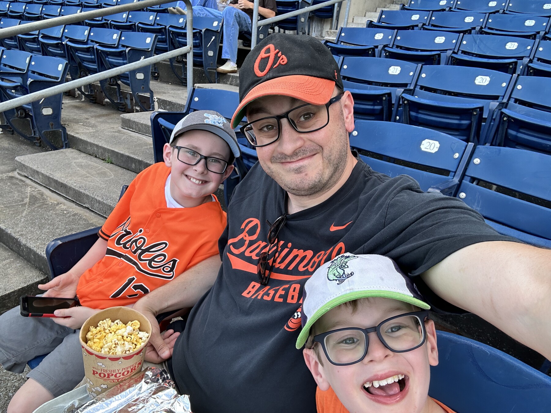
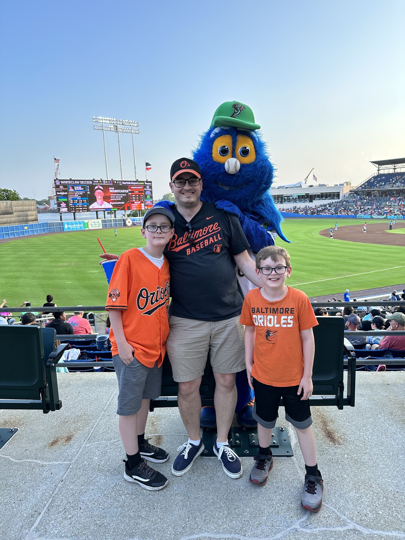
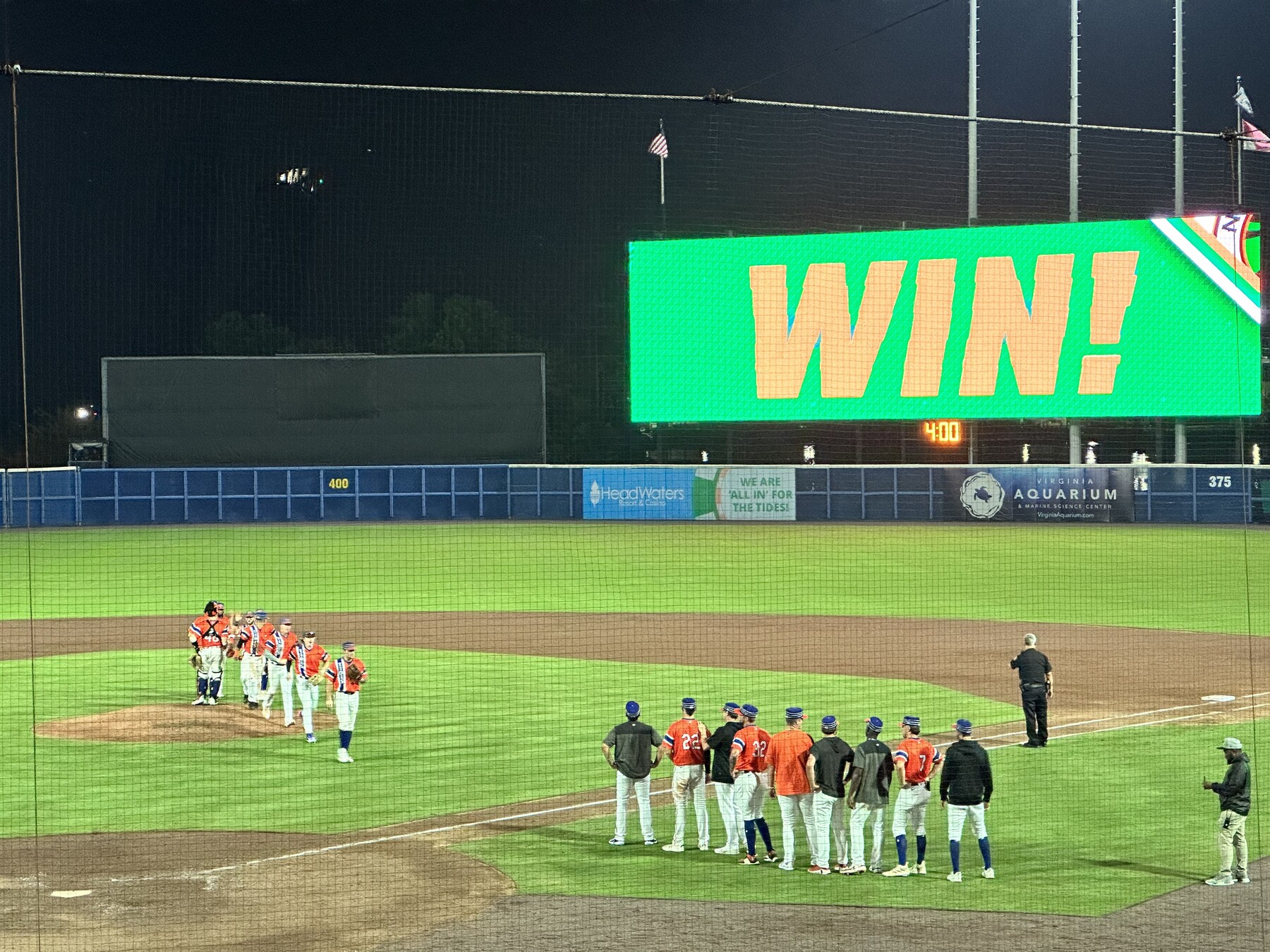
Being native Baltimoreans, my boys and I are Orioles fans. So I couldn’t pass up the chance to see their Triple-A affiliate, the Norfolk Tides, while we were in town.
#SeatSelfie at Harbor Park! – Photo by the authorWe also got a photo with the mascot! – Photo by a helpful fanTides win! – Photo by the author
Also, it was $0.50 hotdog, popcorn, and soda night. That’s already a win and a dinner solution! Toward the end of the game they announced the attendance: 10,213, with 24,697 hot dogs sold.
The next morning, we got up and had a quick breakfast at the hotel. It was about a 20 minute drive over to our first stop of the day.
Battle of Plymouth – Civil War Battlefield #167
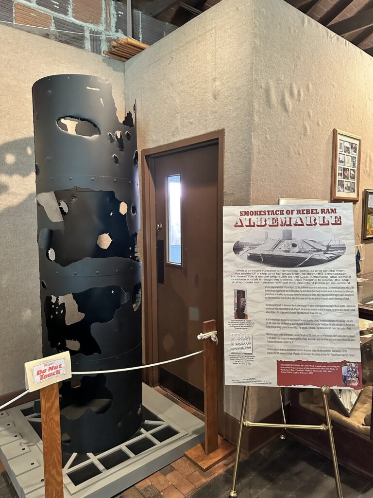
There is a small museum in the town of Plymouth, NC and we spent a few minutes checking out their displays and artifacts. They have a lot of artillery rounds and bullets, as well as buttons and small camp items that were found during digs at known local army camp sites. The 3/8 scale model of the CSS Albemarle that they have floating in the Roanoke River was a highlight for us.
Some of the artifacts in the town museum include part of the smoke stack of the Albemarle – Photo by the author
As for the Battle of Plymouth, Union forces had occupied the town and were using it as a base of operations in the area. Confederates decided to re-take it, and a combined land and naval attack using the ironclad ram CSS Albemarle succeeded in destroying the Federal warships while Confederate Maj. Gen. Robert F. Hoke’s division of North Carolinians and Virginians forced the occupying Union troops out of town.
We just had to get a selfie with the model Albemarle! – Photo by the author
Battle of Albemarle Sound – Civil War Battlefield #168
After helping to take back the town of Plymouth, the CSS Albemarle made her way out into Albemarle Sound on May 5, 1864 and found a small fleet of 8 Union gunboats waiting for her. Over the course of the day, the Albemarle held her own against multiple attacks from the gunboats. Attacks involving artillery, ramming, and even attempting to use a net to tangle her propulsion system all failed against the Albemarle. Though badly damaged, she was able to escape back to Plymouth. This fight was a stand-off, but it kept the Confederate naval weapon bottled up in port.
The Battle of Albemarle Sound took place out in these waters. – Photo by the author
Eventually, a raid led by William B. Cushing would succeed in detonating a naval mine (what they would have called a “torpedo” in those days) under the Albemarle and lead to her sinking.
We didn’t go across to Edenton, NC (where there is at least a wayside about this battle) for road trip routing reasons. We were able to get a photo from near where the action actually took place at the Waterside Resort.
Battle of Roanoke Island – Civil War Battlefield #169
In February of 1862, Union Maj. Gen. Ambrose Burnside was tasked with closing off the Outer Banks to Confederate shipping. As part of that effort, he landed 13,000 troops on the southern end of Roanoke Island and fought his way north. This action became known as the Battle of Roanoke Island. After flushing the rebels from the other forts on the island, the final fighting happened here at Fort Huger. The overwhelmed Confederates had no choice but to surrender.
The view looking out on Croatan Sound from near the spot of Fort Huger. – Photo by the author
We stopped at Pineapple Beach – right off of US-64‘s William B. Umstead Memorial Bridge – to get a few photos and check out the markers. The visitors center at Fort Raleigh National Historic Site – which we would be visiting next – has some info on the fighting here, as well as the Freedmen’s Colony that was established once the island was under Federal control.
Posing in the reconstructed Fort Raleigh – Photo by the author
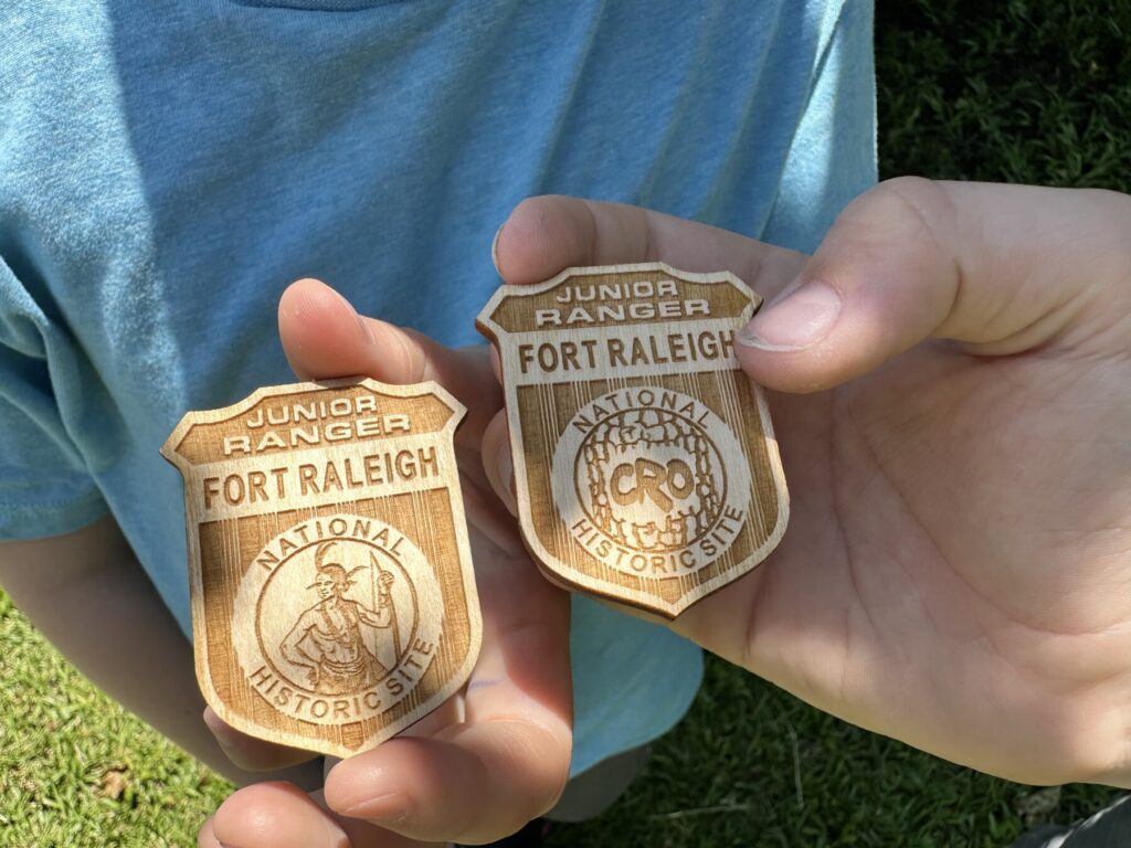
We browsed the museum in the visitors center – critical to the completion of their Junior Ranger program – and checked out the movie, and the reconstructed Fort Raleigh. The rangers were very friendly, and in addition to awarding the boys their badges, gave us bonus Junior Ranger books for the Underground Railroad Network to Freedom. Those would come in handy a little later.
Fort Raleigh has two different designs for their Junior Ranger badges. The boys got one of each. – Photo by the author
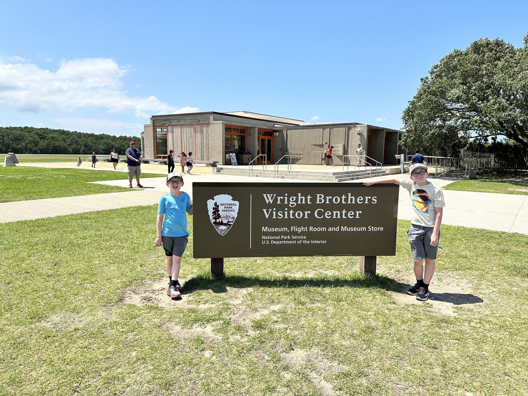
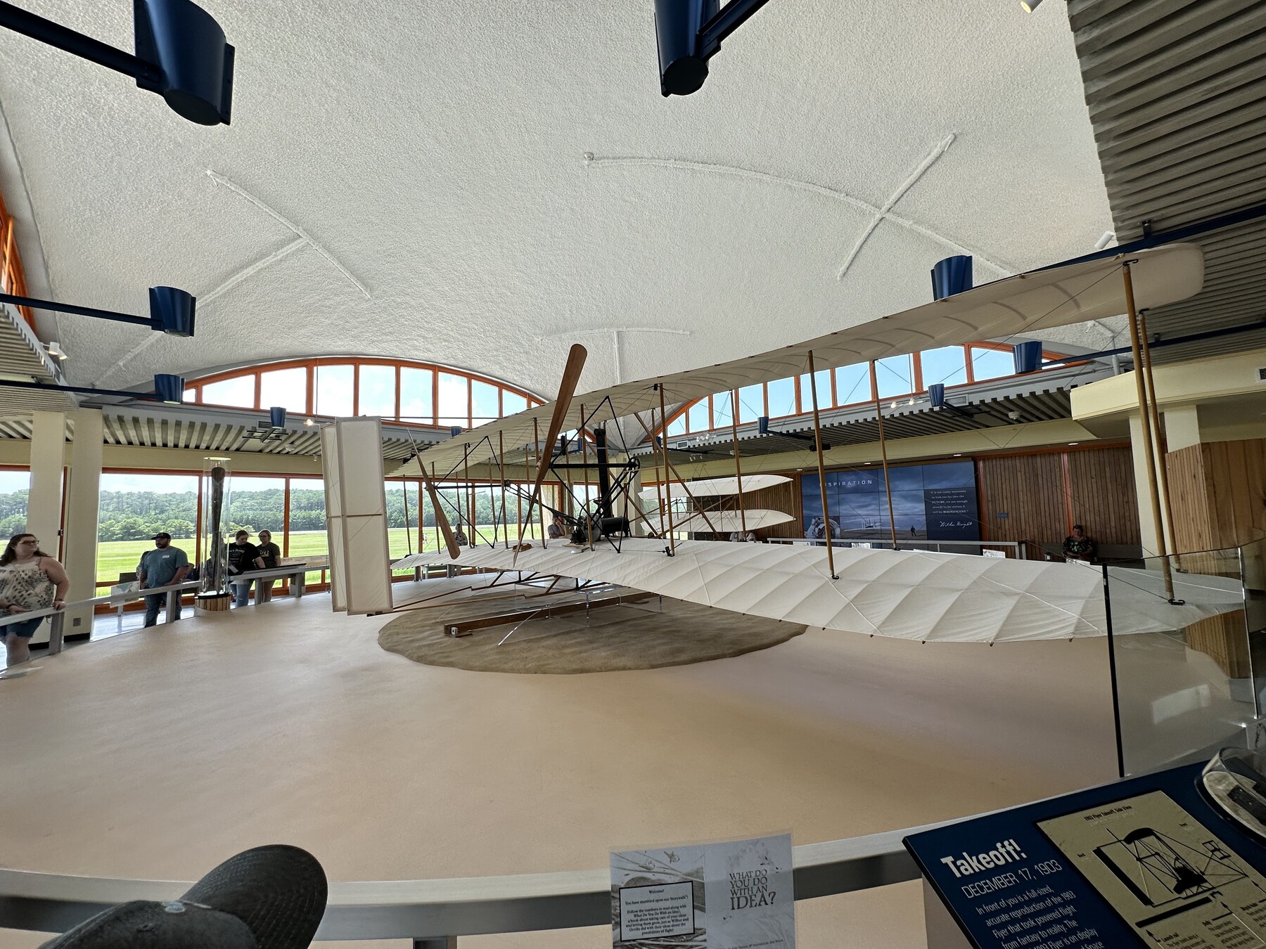
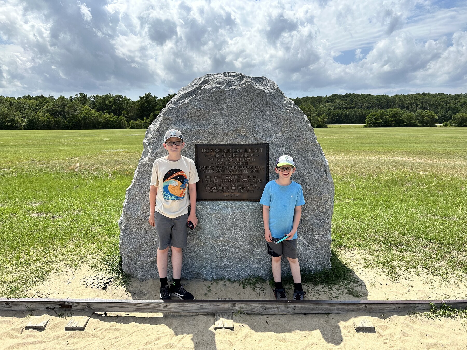
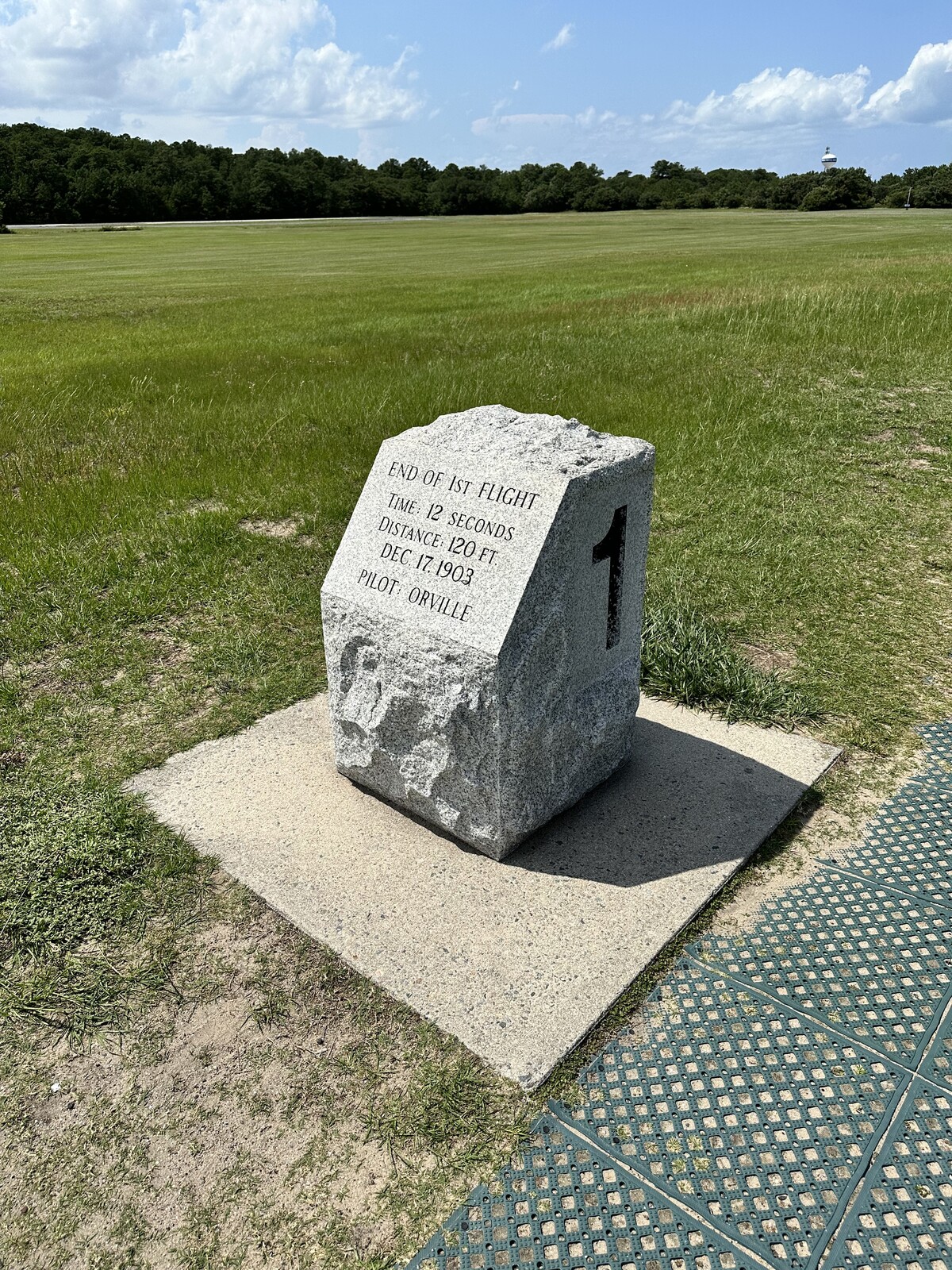
There is a very nice museum in the visitors center that talks about the brothers’ lives and especially their constant experimentation with powered and controlled flight. The 1903 Wright Flyer they display here is only a replica, but they have a few real pieces of the aircraft that were used here. I guess I’m starting to get over my aviophobia, because it was pretty magical to stand on the ground where it actually happened.
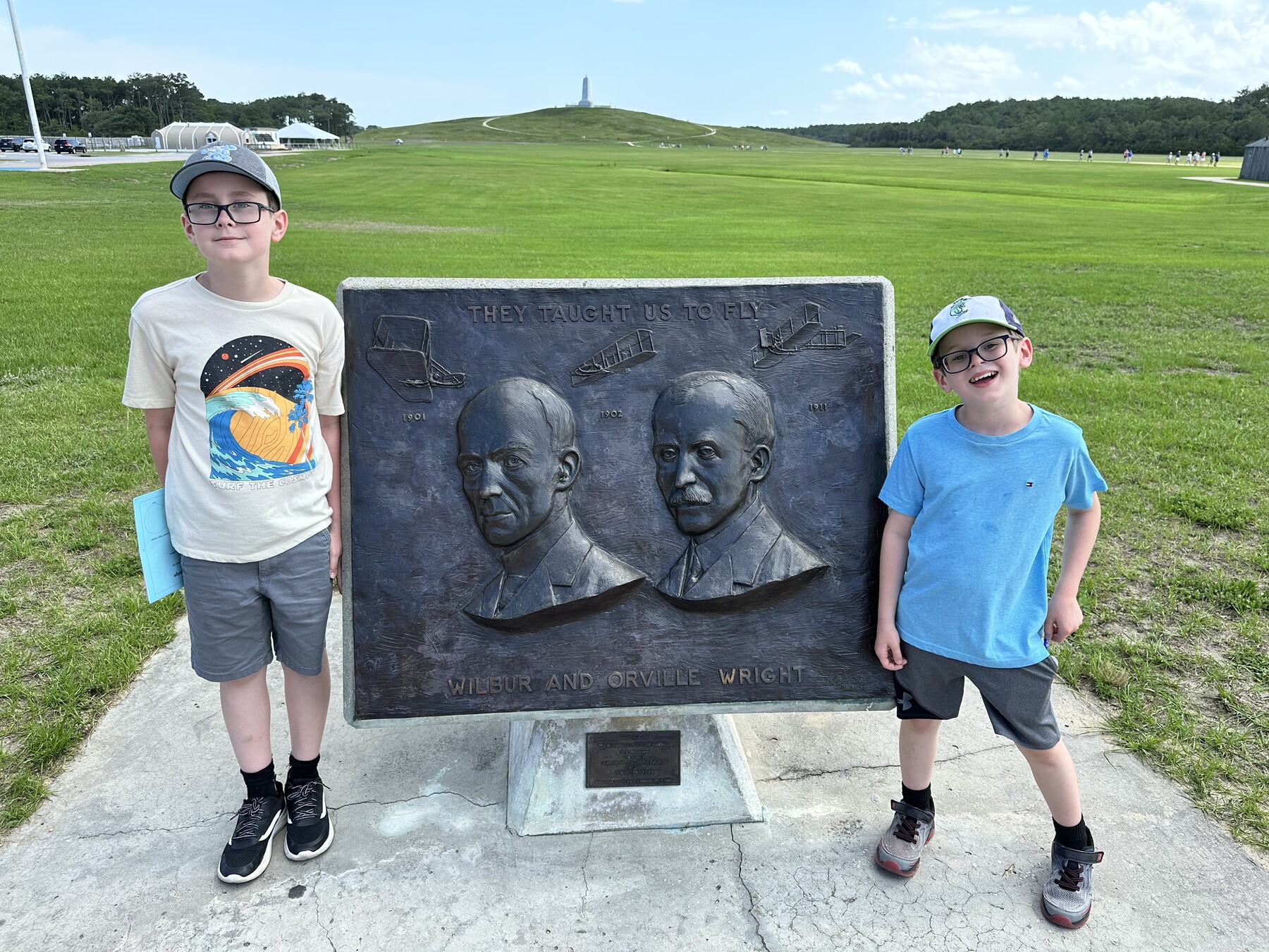
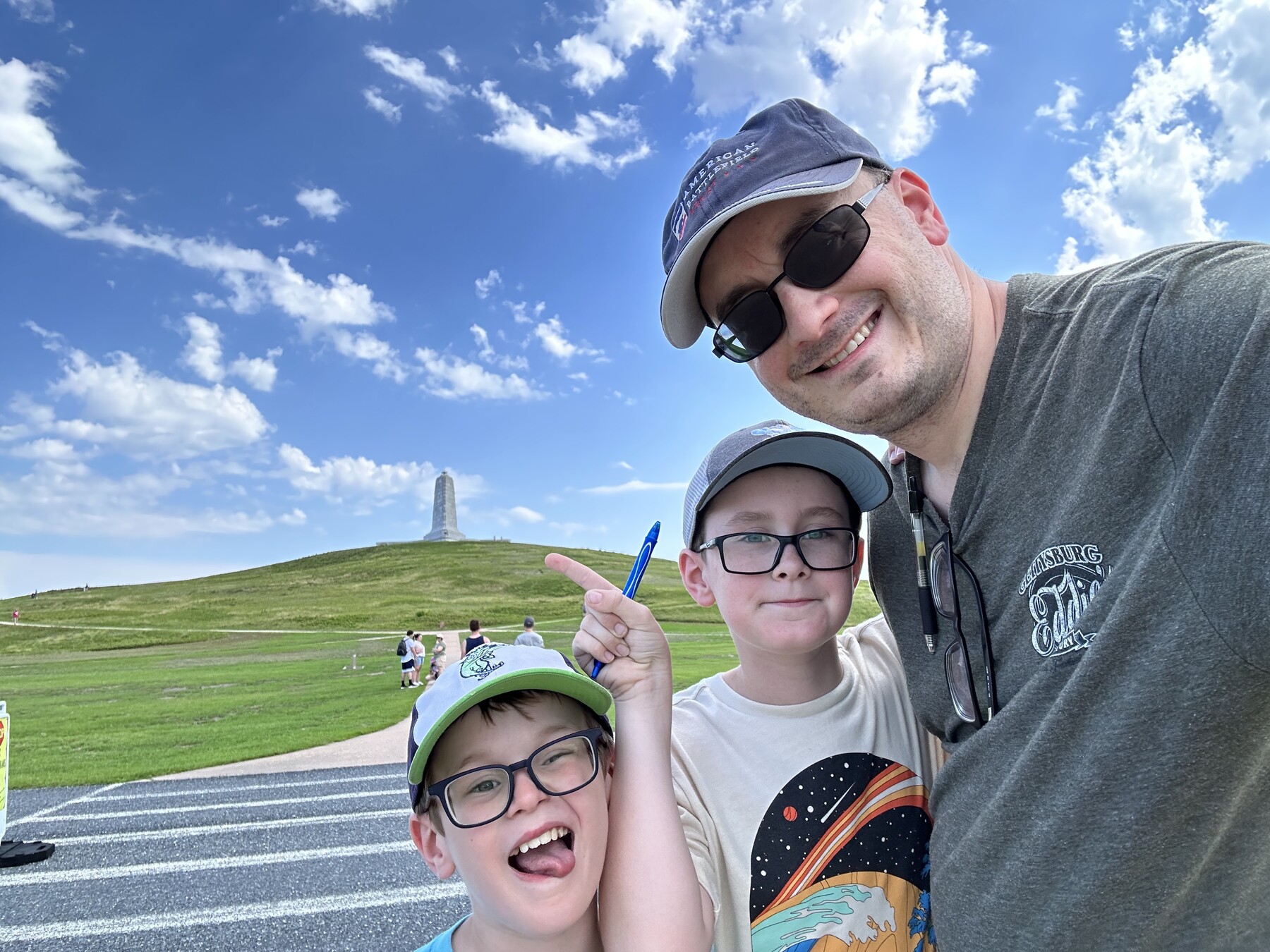
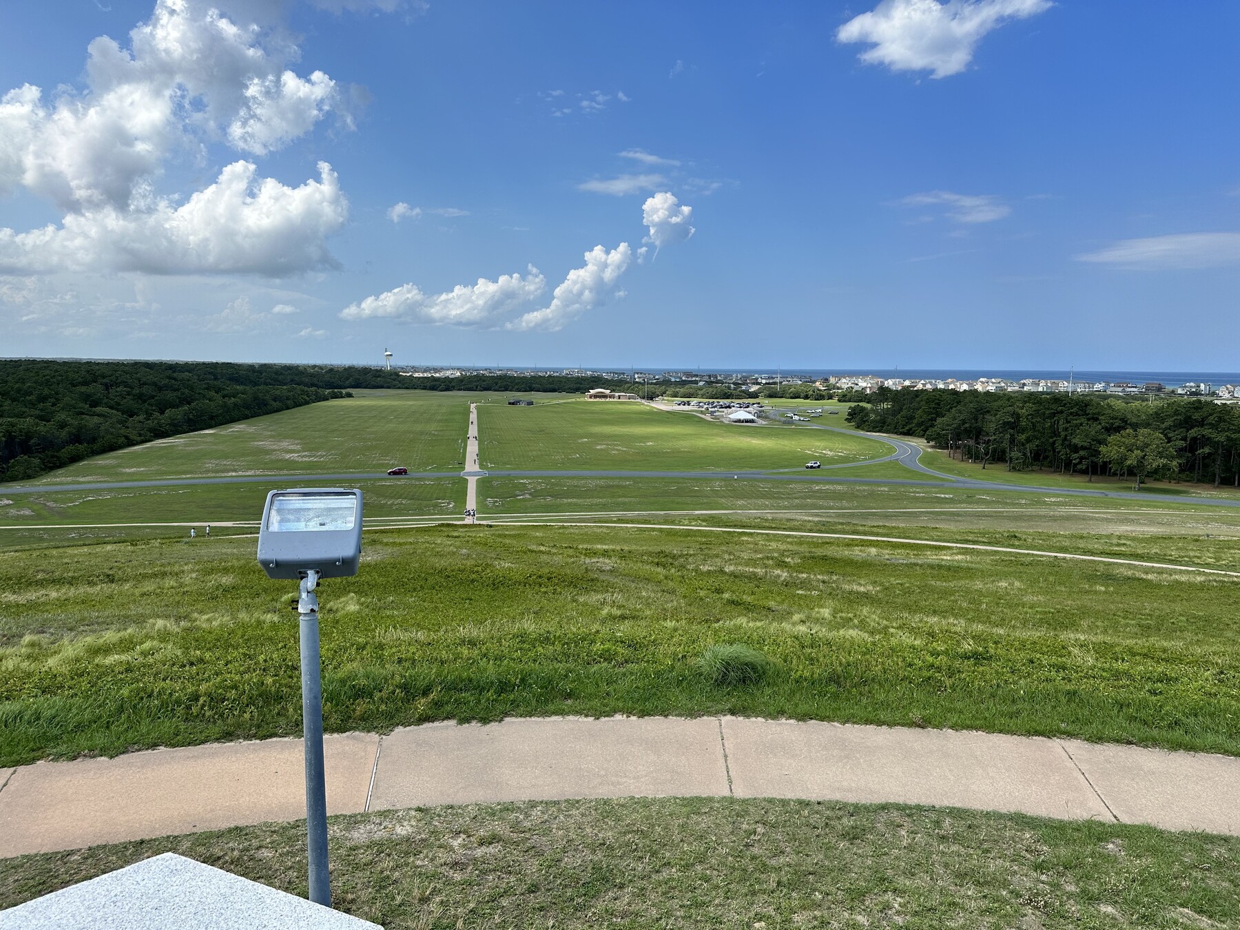
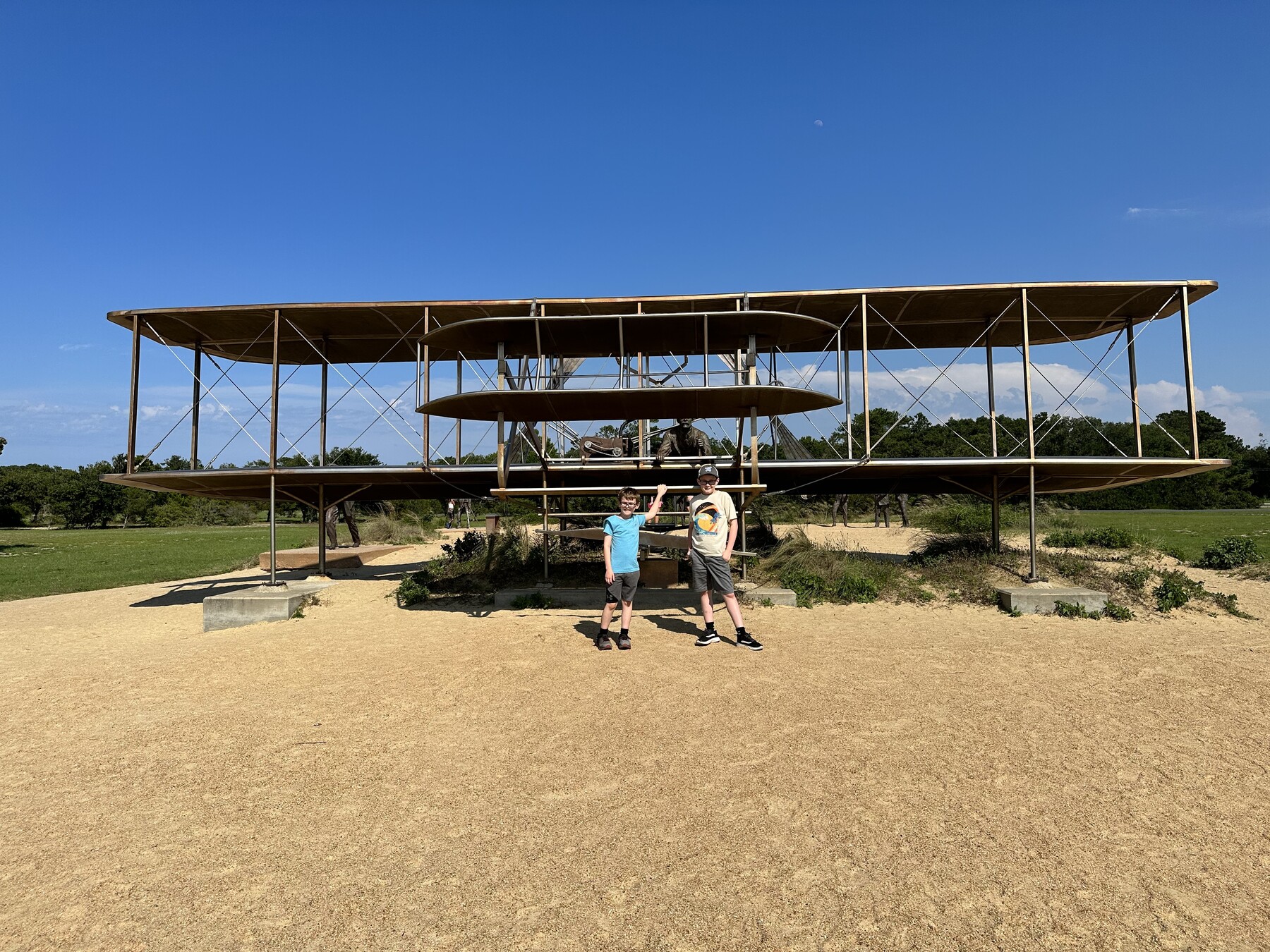
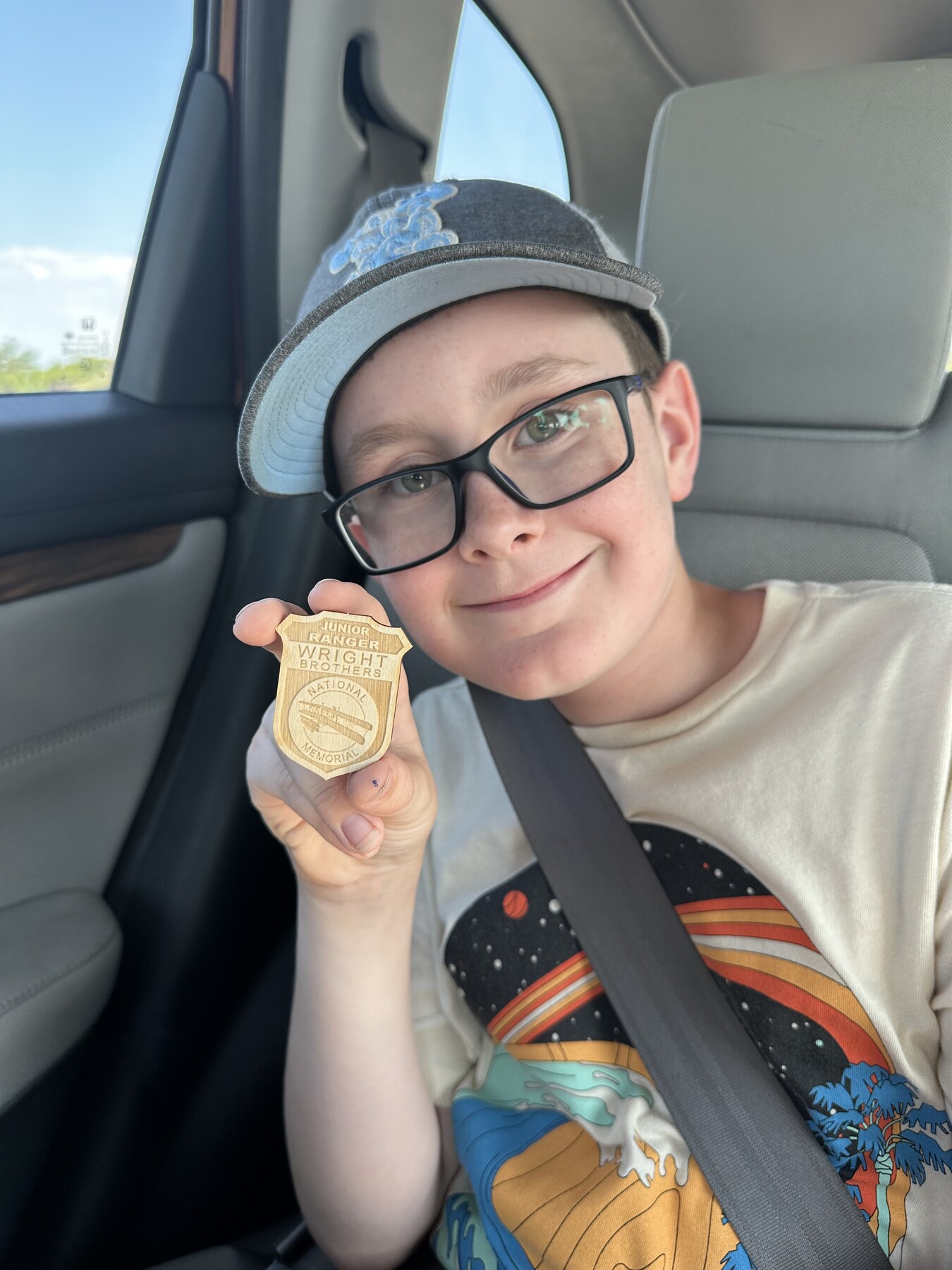
Posing with the sign out in front of the visitors center. – Photo by the authorThe reproduction 1903 Wright Flyer. – Photo by the authorMy brothers with the brothers. – Photo by the authorStanding at the spot where it actually happened. – Photo by the authorThe first flight ended here. – Photo by the author#MonumentSelfie! – Photo by the authorThe view from the top of Big Kill Devil Hill. Awesome! – Photo by the authorThe boys with the sculpture that depicts the first flight. – Photo by the authorJohn with his latest Junior Ranger badge. – Photo by the author
We made the hike up Big Kill Devil Hill so the boys could get their photo with the monument at the top. The view was very impressive.
After our visit, John told me that this was his favorite Junior Ranger badge so far because of the image of the Wright Flyer on it.
Battle of South Mills – Civil War Battlefield #170
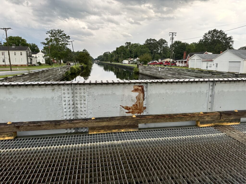
There was concern among the Union commanders in North Carolina that the canal through the Great Dismal Swamp could be used to transfer rebel ironclads from Norfolk down to Albemarle and Pamlico Sounds. This would threaten the Federal troops in the area. In reality, there were no such ironclads, but the CSS Virginia at the Battle of Hampton Roads had created a lot of fear.
The canal at South Mills. – Photo by the author
To counter this supposed threat, Brig. Gen. Jesse L. Reno was sent with about 3,000 troops to destroy locks along the canal at the Battle of South Mills. Unfortunately, Reno opted for an overnight forced march, so when his troops arrived and encountered only about 900 Confederate troops, they were already exhausted and confused. They wasted hours trying to outflank the southerners, and ultimately left without doing any real damage to the canal.
There is a wayside that talks about the action next to the canal in the town of South Mills.
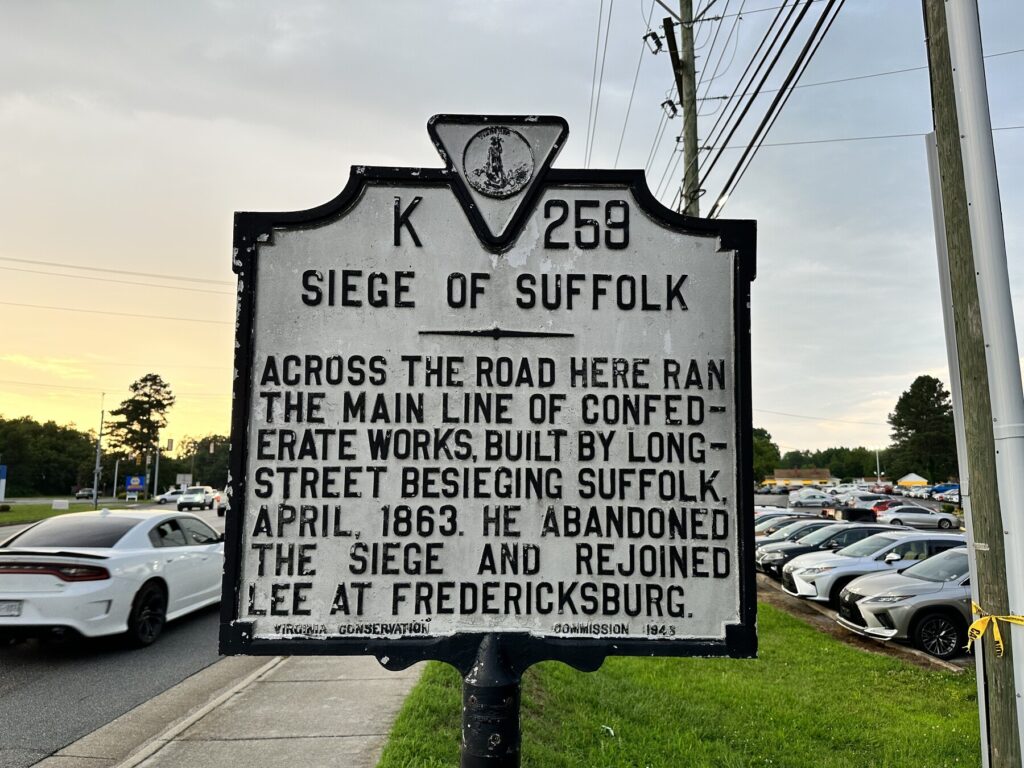
Siege of Suffolk – Civil War Battlefield #171
The “official” battles around Suffolk, VA are a little confusing. The CWSAC seems to list them multiple different ways, with at least two different “Battles of Suffolk” being contained within an over-all “Siege of Suffolk“. For my purposes, I’m listing the “Battle” as being the action at Hill’s Point, while the “Siege” is the action at the Norfleet House. As I learn more about these actions, I hope to get more clarity.
Union troops had occupied Suffolk – mainly as a way to protect land approaches to Norfolk – since the spring of 1862. The following year, Confederates under Lt. Gen. James Longstreet were in the area attempting to gather food and supplies. Longstreet decided to lay siege to the Union forces in order to keep them from interfering with those foraging operations. He was never able to truly *cut-off* Suffolk, but he did keep the Union troops occupied.
A roadside marker describes some of the action around Suffolk. – Photo by the author
A rebel artillery battery was constructed across the Nansemond River from here, at the Norfleet House, to discourage and destroy Union supply ships from coming upstream. While they succeeded in disabling at least one such craft, Union gunboats as well as artillery positions that were constructed here forced the Confederates to abandon their position.
Within a few weeks, Longstreet was ordered to rejoin Gen. Robert E. Lee‘s Army of Northern Virginia at the start of the Battle of Chancellorsville, ending the siege. Though he never captured Suffolk, he was successful in gathering supplies. It’s unclear who the winner was here.
I wasn’t able to get a great photo at the spot that the Union artillery occupied. The area is now a neighborhood, and I didn’t want to get in anyone’s backyard.
Battle of Suffolk – Civil War Battlefield #172
The Battle of Suffolk here at Hill’s Point / Fort Huger is probably the most interesting of the actions around the Siege of Suffolk in the spring of 1863.
Fort Huger was another hastily-built earthwork fort along the Nansemond River that was meant to stop Federal supply ships. On April 19, Federal batteries opened fire on the fort all day, hoping to weaken the defenses there. Just as night was beginning to fall, about 300 Union soldiers landed from river boats near the fort, and assaulted the earthworks from the rear. The fort fell, and over a hundred rebel prisoners were taken.
The remains of Fort Huger at Hill’s Point. – Photo by the author
The fort amazingly still exists. The boys and I walked down close to it to get a photo (earthworks are notoriously hard to photograph, so you may need some imagination). For many years, the remains of Fort Huger were contained within a golf course, but the property is now being converted into a neighborhood. There is still construction happening here, but the fact that there is a path laid out gives me some hope that the remains of the fort may be preserved. I know there is a local group that is active in trying to put together tours. Hopefully they are making some noise.
We got packed up and checked out of the hotel with plenty of time. We were easily able to make it over to Patriot’s Point for our 10:30am ferry ride to…
Fort Sumter
The Civil War began here at Fort Sumter as the Confederates opened fire on the Federal garrison on April 12, 1861.
This is my second visit (I came here on a family vacation when I was in high school), and the first for the boys. Coming out here takes us (roughly) to the site of four Civil War battlefields, and it’s the best place to view two others:
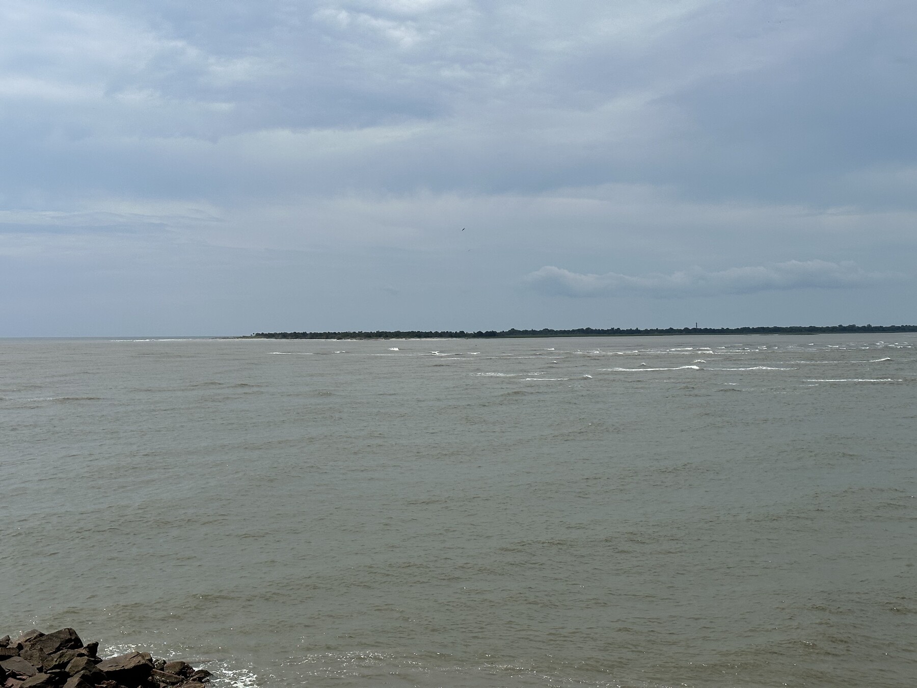
A note on my battlefield numbering here – since I had visited the site when I was younger and not as much of a Civil War nerd, I consider that to be my visit for tracking purposes for the actions involving Fort Sumter. The two battles that took place on Morris Island were unknown to me at the time, and the area where they took place is now, sadly, under the Atlantic Ocean. This is as close as I’m reasonably able to get to them.
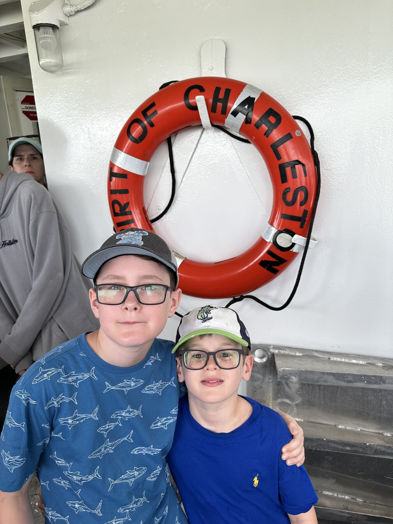
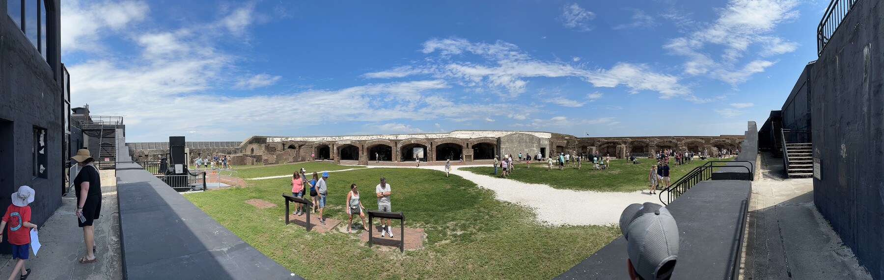
It’s a really pleasant and smooth 35-minute boat ride out from Patriot’s Point, and the hour we spent on the island felt like about 5 minutes. It’s an awesome place.
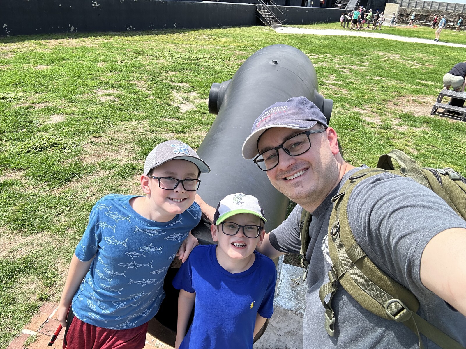
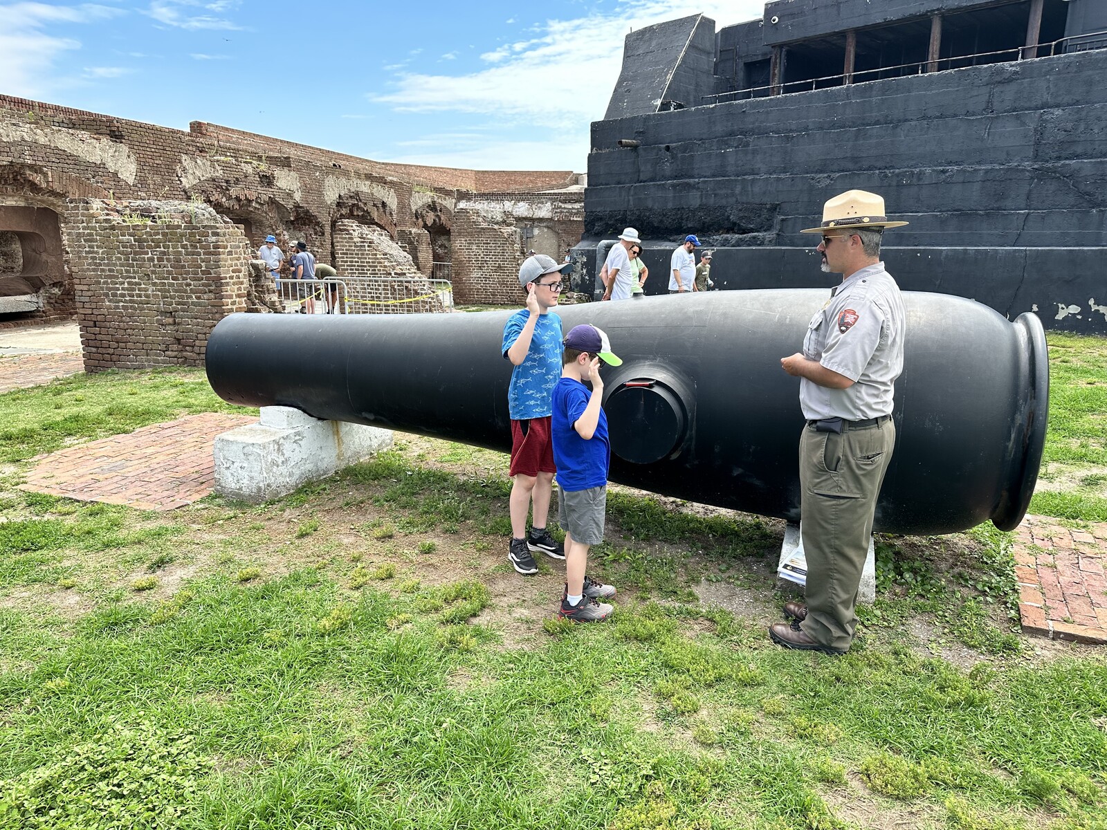
Aboard the Spirit of Charleston for the ride out to Fort Sumter. – Photo by the authorPanoramic view of the parade ground at Fort Sumter. – Photo by the authorThe view toward Morris Island – where Fort Wagner was – from Fort Sumter. – Photo by the author#FortSelfie – Photo by the authorThe boys being awarded their Junior Ranger badges. – Photo by the author
The boys were able to earn their Junior Ranger badges for Fort Sumter National Monument and had a ceremony to award them in front of some of the heavy artillery. The ranger suggested the site and I think it’s super cool!
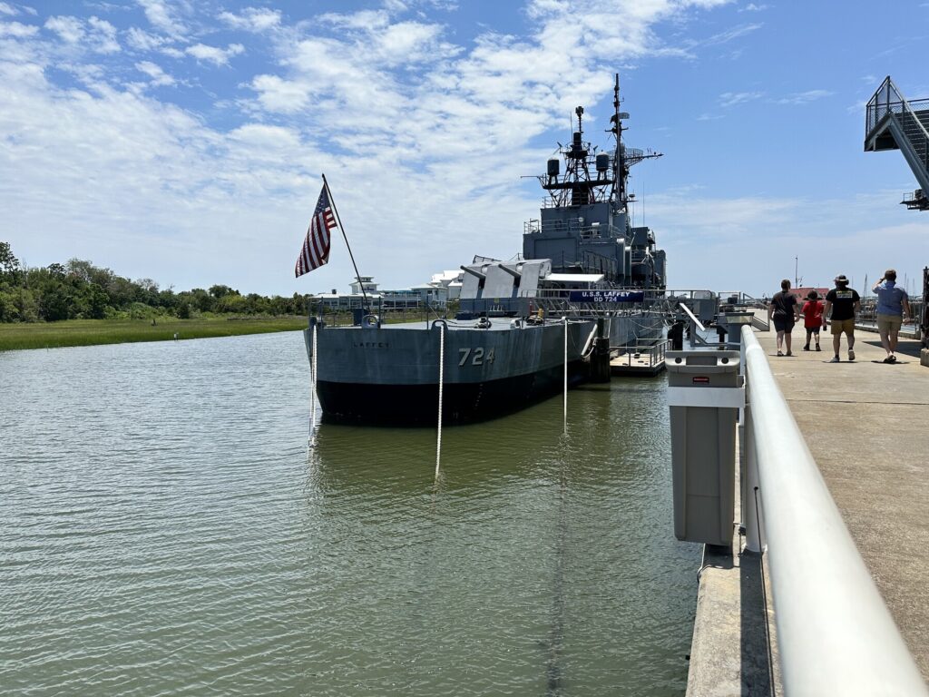
USS Laffey (DD-724)
We started our visit at Patriot’s Point with the USS Laffey, an Allen M. Sumner-class, WWII-era destroyer, that is also known as “The Ship that Wouldn’t Die” as she took 4 bomb hits and 6 kamikaze attacks near Okinawa and – obviously – survived. She continued to serve into the Vietnam-era.
The Laffey as we approached to board her. – Photo by the author
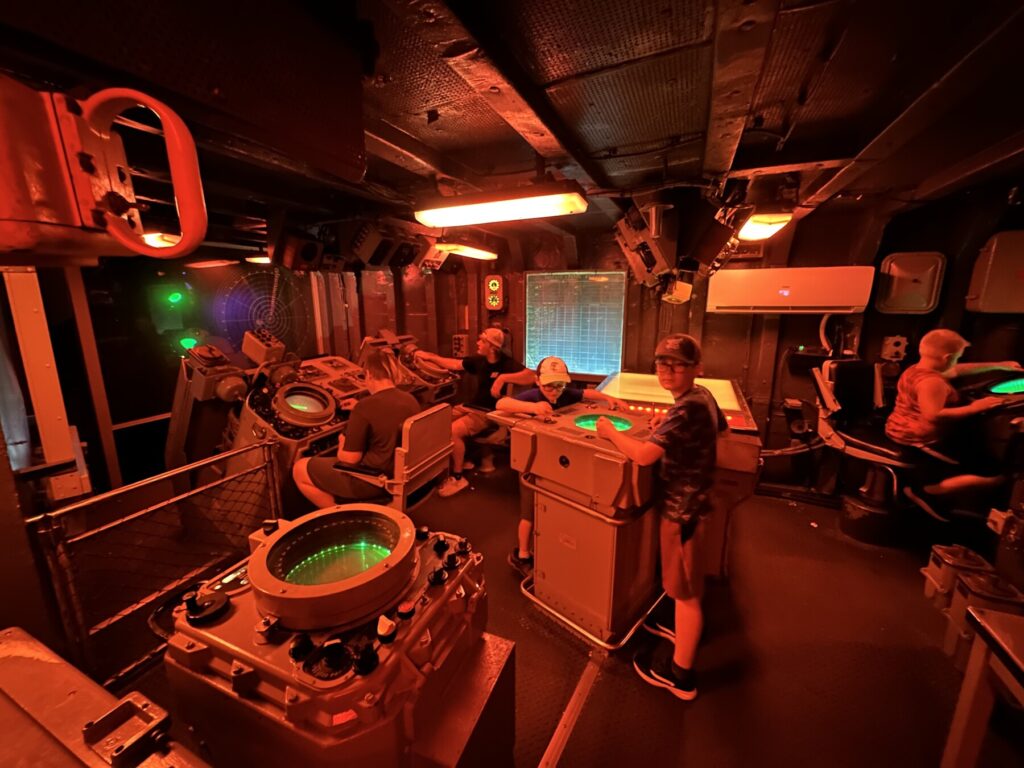
While John was really anxious to get on to that other ship here, both boys ended up having a good time. We spent about 45 minutes touring the Laffey. There are a number of interactive exhibits aboard, including a really cool Soviet submarine hunting simulation in the CIC. Isaac in particular wanted to do that experience over and over!
Tracking Soviets in the CIC. – Photo by the author
USS Yorktown (CV-10)
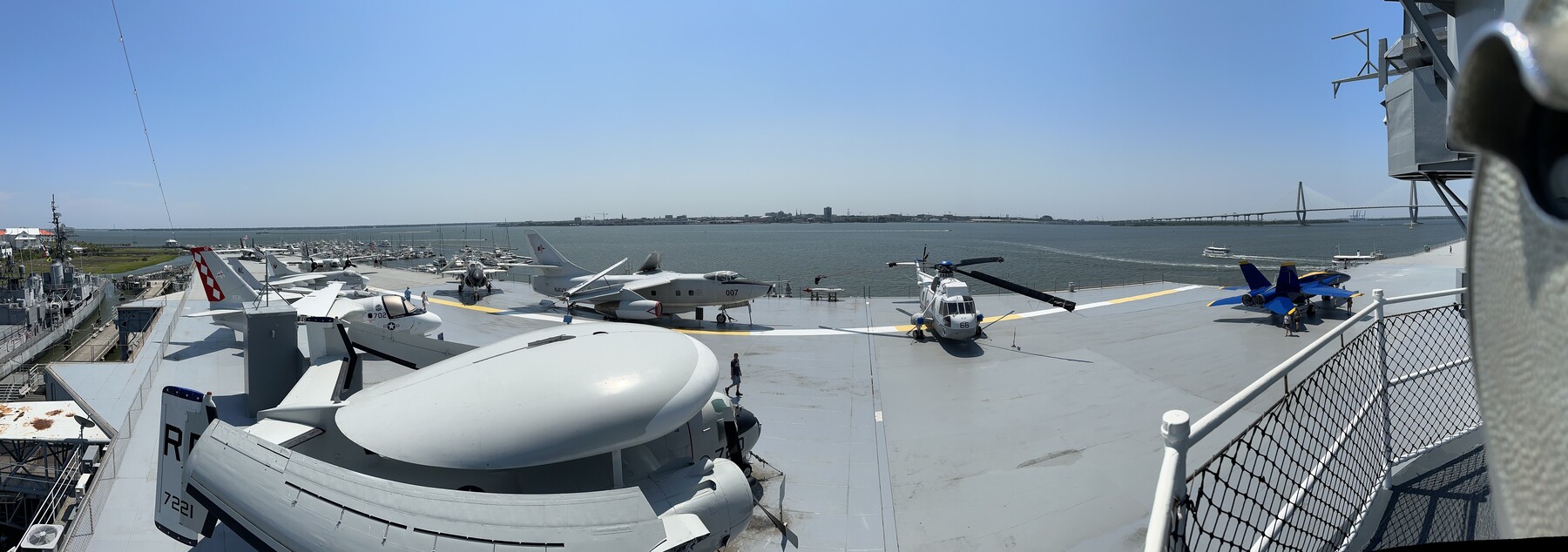
At last, it was time for the main event – the USS Yorktown, an Essex-class aircraft carrier from WWII that, like the Laffey, had a service that extended into the Vietnam-era. She was heavily modified in the years after WWII, and that is mostly how she is presented today. The most obvious upgrade is her angled flight deck.
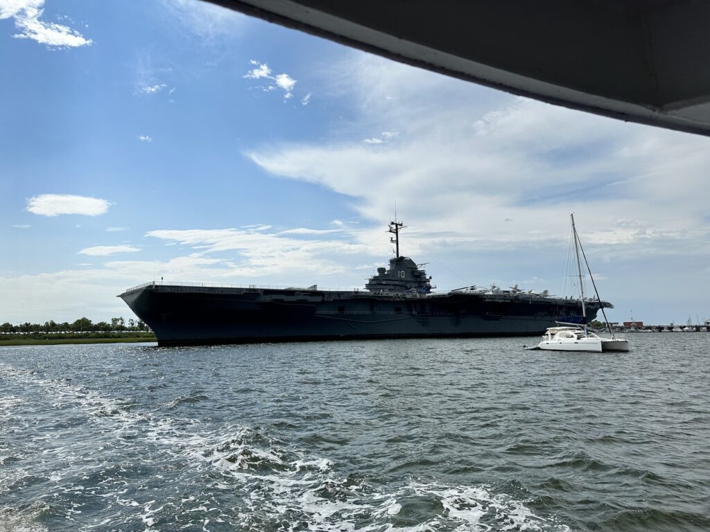
We had a great view of the Yorktown from our ferry out to Fort Sumter. – Photo by the author
John was extremely excited about this ship, and really wanted to get to the aircraft and the flight deck. He had to practice a little patience as we worked through all 4 tour routes that were offered. While we’re here we might as well see everything, right? It was a lot of fun for me to see the different aspects of the tour that excited the boys. I was a little surprised by this, but they really enjoyed all the aircraft models in the museum section of the ship.
As we were walking on the flight deck, John came close to tripping over one of the arresting cables. We had a bit of a laugh over that not being exactly the kind of landing he was looking for.
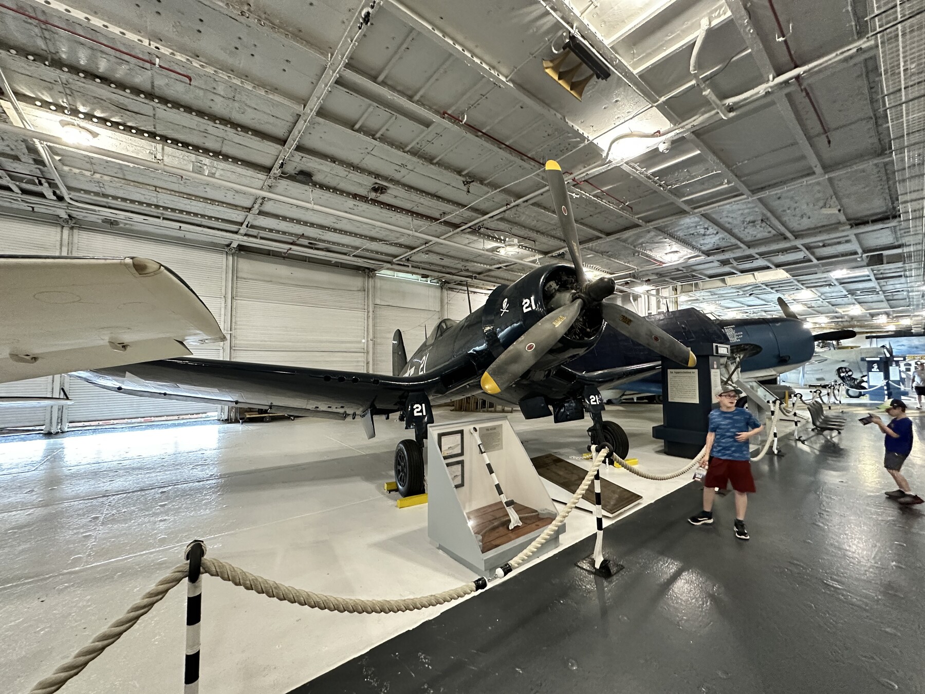
I took a ton of photos on the Yorktown – it was really hard to narrow down what to post here. This one is well worth the visit if you’re in the Charleston area.
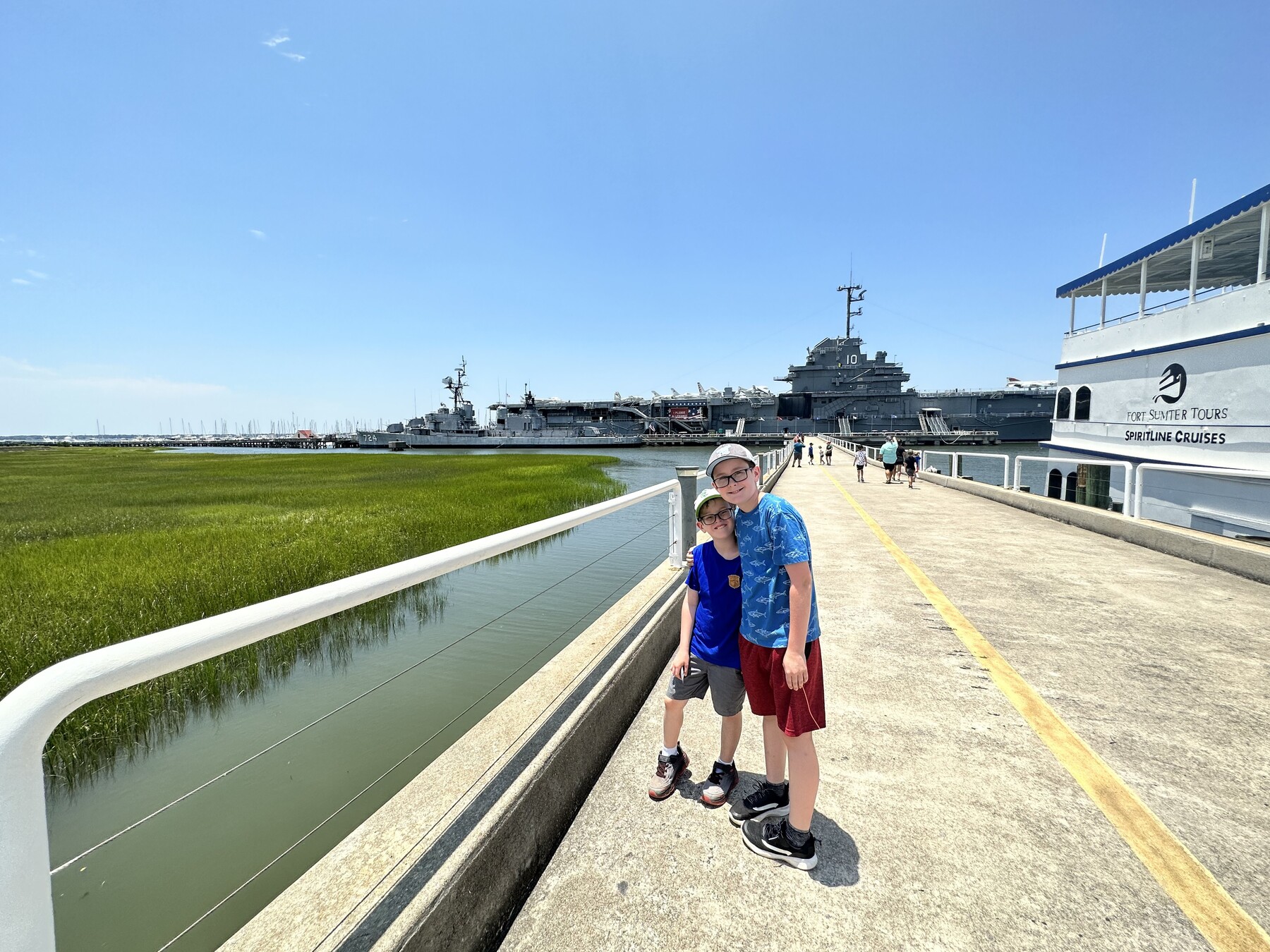
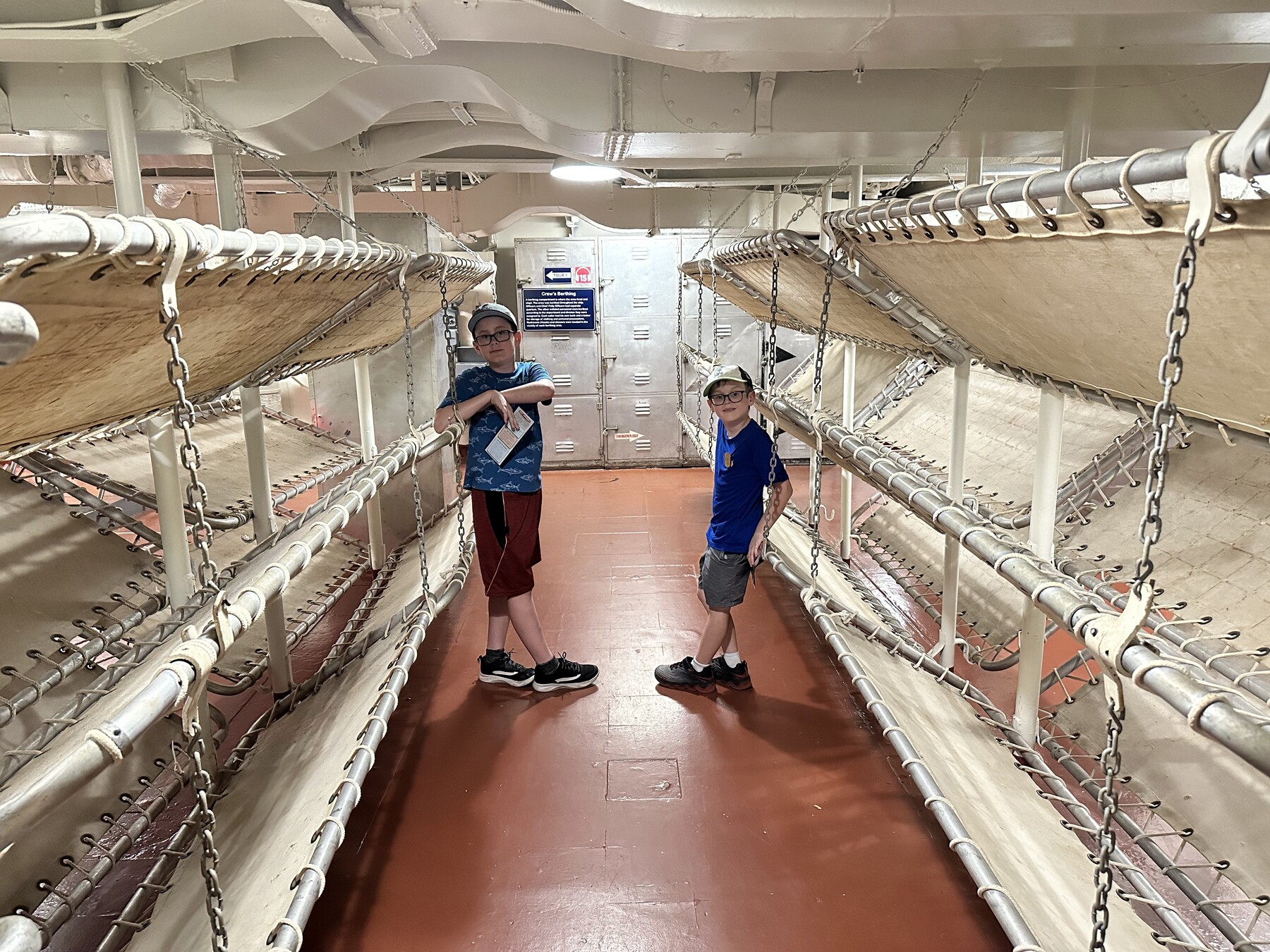
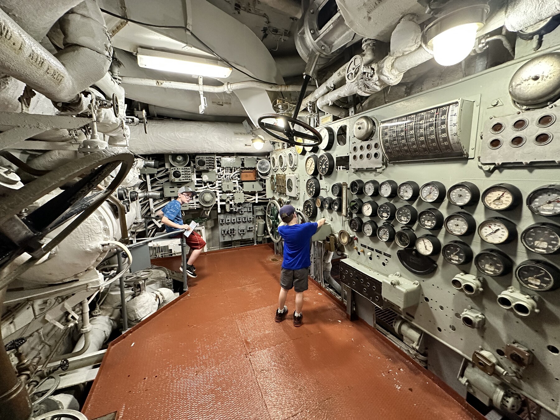
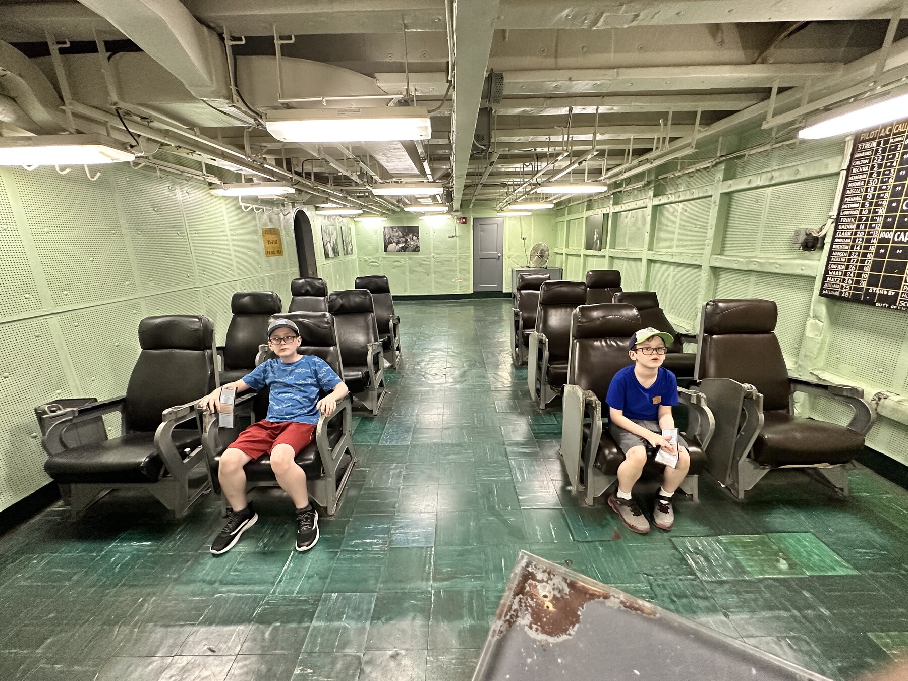
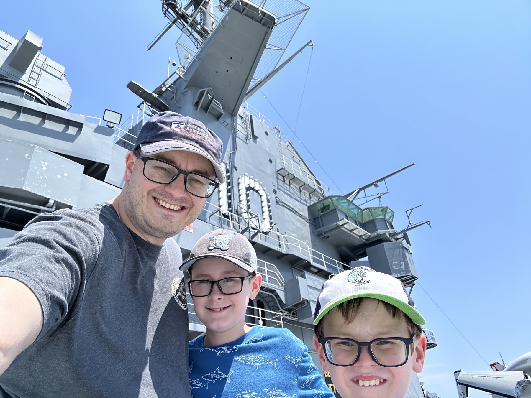
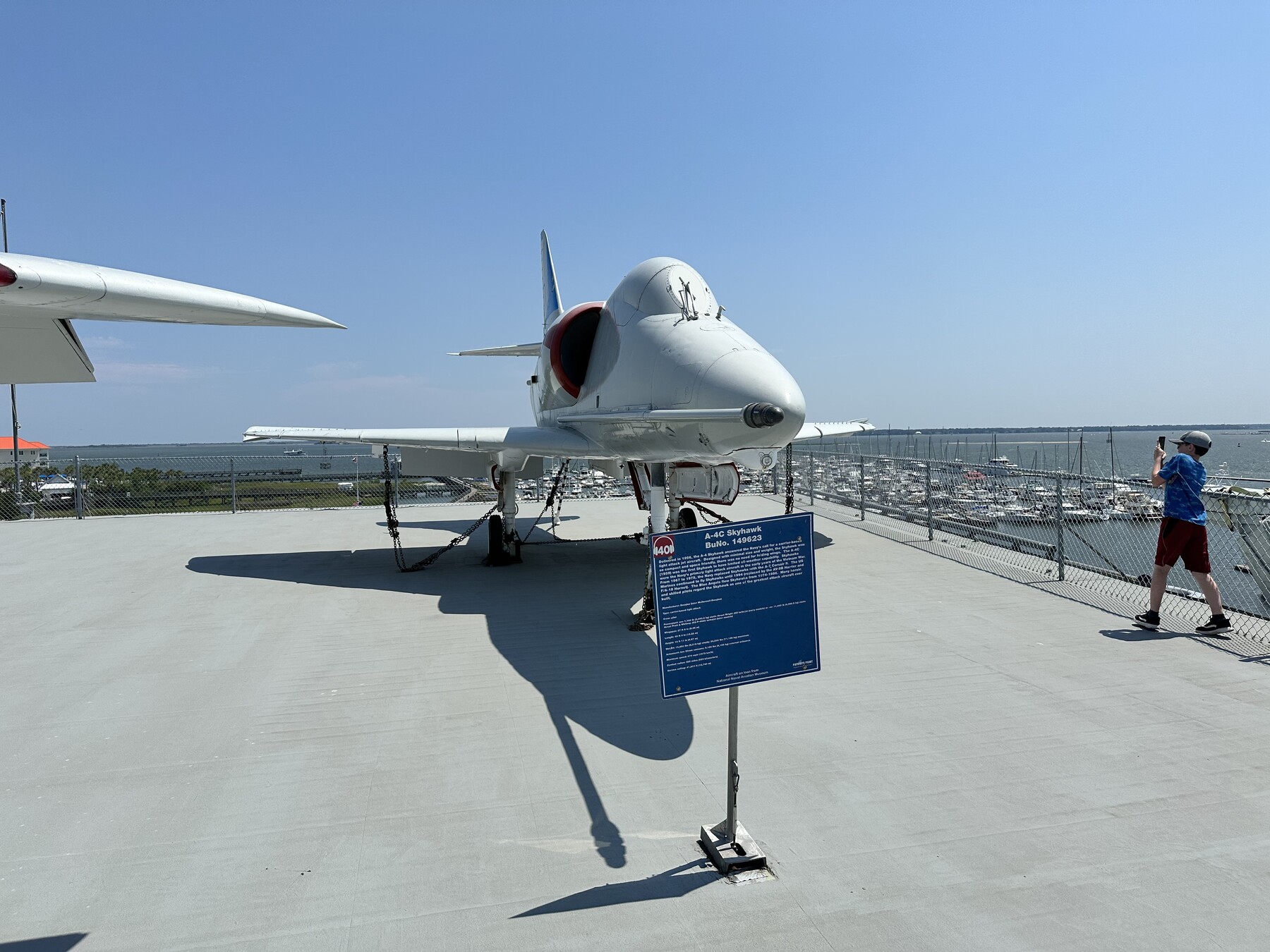
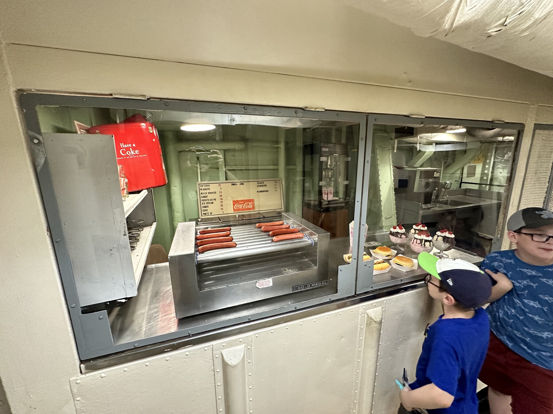
On our way out to see the Laffey and the Yorktown. – Photo by the authorThe boys checking out the crew berthing spaces on the Yorktown. – Photo by the authorIsaac loves all the controls and gauges in the engine room. – Photo by the authorJohn’s favorite WWII Navy fighter – the F4U Corsair. – Photo by the authorGetting our briefing in the ready room. – Photo by the author#FlightDeckSelfie – Photo by the authorJohn taking a load of pictures of his favorite Navy jet – the A4 Skyhawk. – Photo by the authorPanoramic shot of the flight deck from above on the “island”. – Photo by the authorThe carrier’s snack bar was a popular attraction on the tour. – Photo by the author
The trip from Charleston to our next stop, Williamston, NC, took several hours and the boys slept most of the way. We got dinner once again at Buc-ee’s, and made it to our hotel just before midnight.