We got up and had a nice breakfast at the hotel. It was raining, but we decided to take our chances and roll downtown.
The first stop I wanted to take the boys to was the old Out of Town News near Harvard. Of course, this meant that I had to explain the concept of a newsstand to them, but I also got to share the story of how Microsoft had been started there. It wasn’t the best experience since it was still raining, and there wasn’t anywhere great to park, but it was some history that is more on the nerdy side.
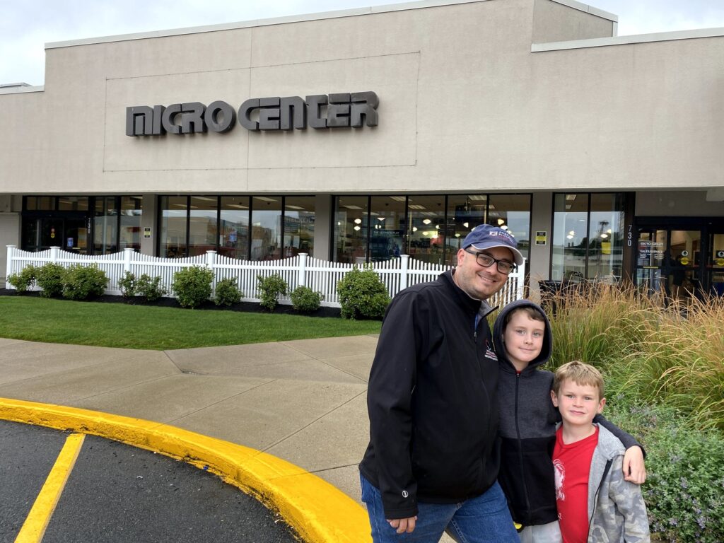
Microcenter is always a hit with my crew. – Photo by Karen Michener
From there, we stopped over at the Cambridge Microcenter – always a favorite store for us. And to be at the one where the MIT folks shop was a treat. It was fun to browse around there, and we were even able to pick up some inexpensive oversized golf umbrellas while we were there. Who would have guessed?
I then took the boys by MIT. Due to COVID-19, we couldn’t really go in any of the buildings, but we were allowed to check out their extremely nerdy bookstore. I especially liked their rather creative “MIT” t-shirts, but they didn’t carry them in the boys’ sizes. Bummer. Both boys were able to pick out postcards that they sent back to their mom – something of a tradition for us now.
One of the nerdiest t-shirts imaginable at the MIT bookstore. – Photo by the author
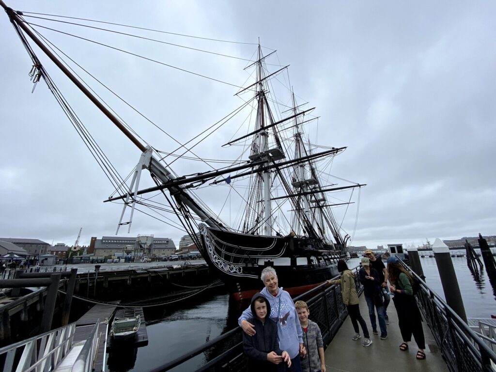
But it wasn’t a complete waste. After passing through security, we were able to go aboard the USS Constitution – the oldest commissioned warship still afloat in the world. It was very cool to be able to explore her and speak with the sailors who keep her in such good shape while sharing her history with the public.
The boys pose with “Nene” in front of the USS Constitution. – Photo by the author
We crossed over into Boston and drove by the Old North Church, and made our way to Faneuil Hall for a late lunch. “Nene” was able to find “fried clams with bellies” that she was very excited about – it was a taste of home for her.
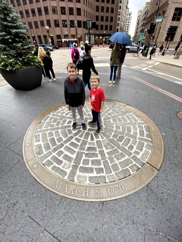
Around the corner, we were able to visit the Old State House, and the site of the Boston Massacre in front of it, which the boys had been reading about in school. It isn’t quite how you picture it since modern-day Boston is certainly more built-up than it was during 1770.
The boys at the site of the Boston Massacre. – Photo by the author
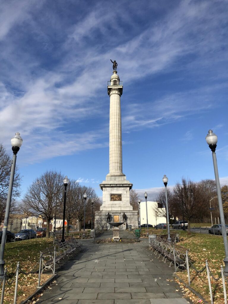
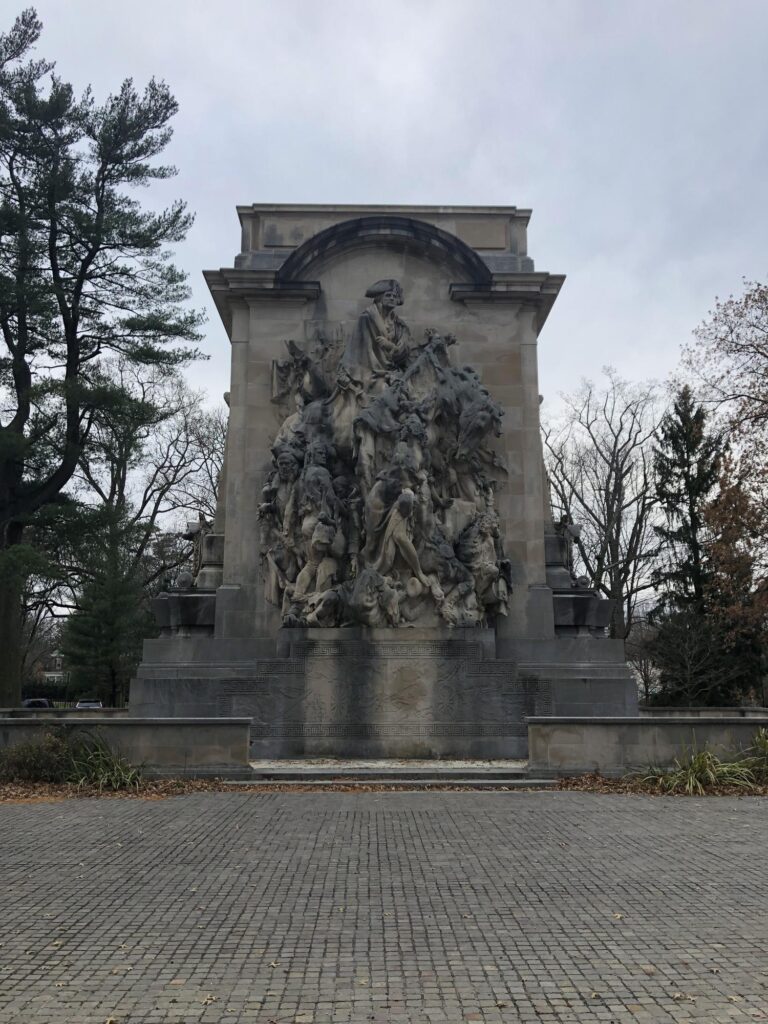
On our way out of town, we drove around Boston Common (and especially to see the monument to the 54th MA) and even got to see Fenway Park. The rest of the evening was spent hanging out at the hotel – including finishing up those Junior Ranger books – and then having dinner at the Burlington Mall food court. There would be more to do in the morning.
This is going to be a fairly long post because we’re about to cover a lot of ground.
Back in the summer of 2021, I had a rare weekend without my boys. My now-wife Emily suggested that it might be nice to do a battlefield trip. I suggested visiting the Fredericksburg / Richmond area since I’d been reading Gordon C. Rhea’s excellent series of books about the Overland Campaign, and besides: Fredericksburg is a cool town with some nice restaurants.
I booked a hotel and got dinner reservations at Fahrenheit 132 downtown. We had an absolutely amazing dinner there on Friday night, and strolled around the town a bit. The next day was going to be all about battlefield stomping.
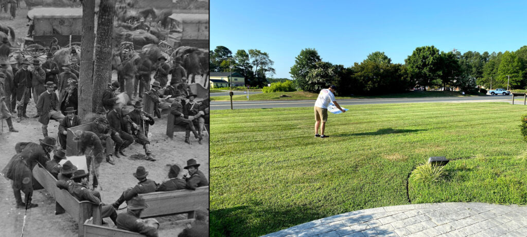
This is where Lt. Gen. Ulysses S. Grant and Maj. Gen. George G. Meade planned out the next phase of the campaign. This is also the site of the only known photos taken of both of these generals together. Emily was nice enough to help me attempt to re-create one of them, and we had a little fun with it. Standing in the footsteps of Grant is becoming something of a tradition for me.
On the left, Grant hunched over a pew with Meade seated and reading a map. My approximation of Grant’s position on the right. – Photo by Emily Skillman
Battle of North Anna – Civil War Battlefield #135
It had been 665 days since my last “new” battlefield visit. It felt good to get out and explore something again!
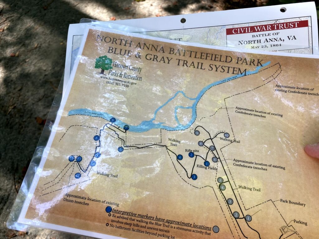
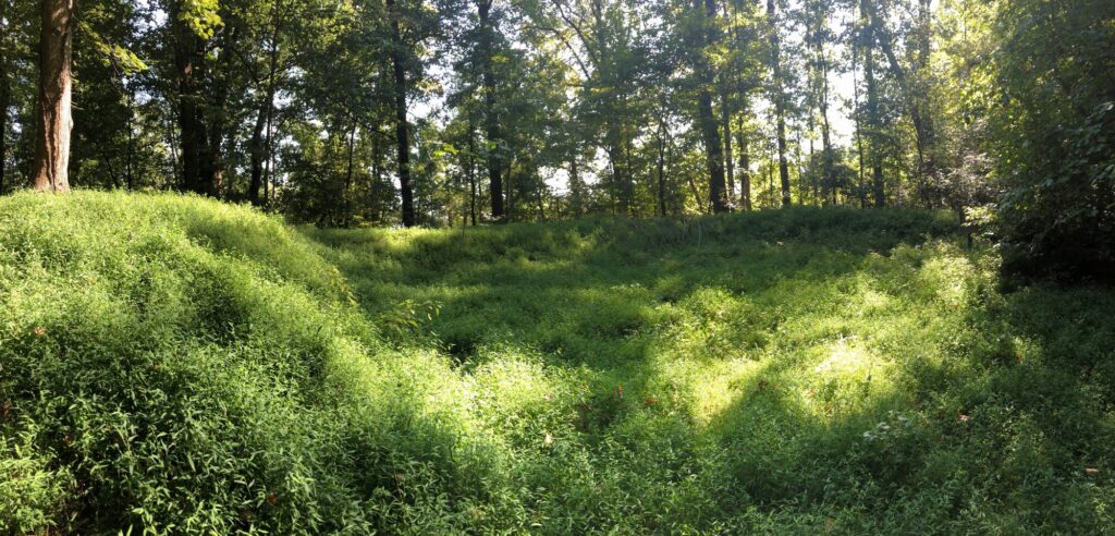
I had been dreaming about seeing the site of the Battle of North Anna for years. The field is somewhat preserved today – at least a lot of the earthworks are – by a county park. Emily and I hiked along the “grey trail“. The earthworks here are well-preserved and just seemed to go on and on. Definitely among the nicest I have seen.
I came prepared with maps. There are a few trails at North Anna. – Photo by the author
The site of Brig. Gen. Ledlie’s ill-advised attack was nasty – gullies and breastworks – no wonder it was a slaughter. The view of the river at Ox Ford was also imposing. Gen. Robert E. Lee’s great “inverted V” trap was indeed formidable.
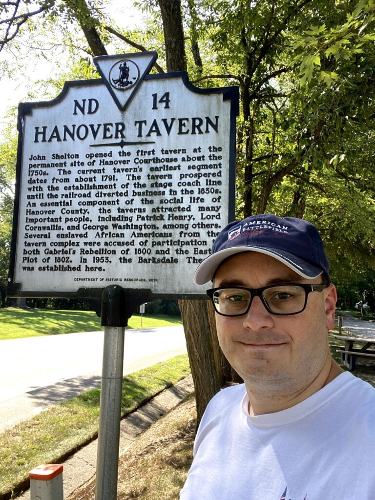
Battle of Hanover Court House – Civil War Battlefield #136
#SignSelfie at Hanover Tavern. – Photo by the author
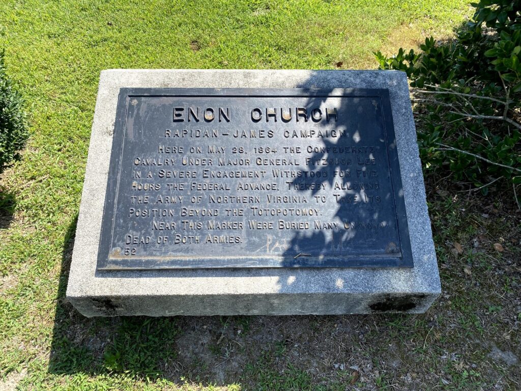
This one was not part of the Overland Campaign, but it was along the route we were taking and I hadn’t visited yet. Elements of both armies passed through this area multiple times during the war as well.
One of the markers at Enon Church – Photo by the author
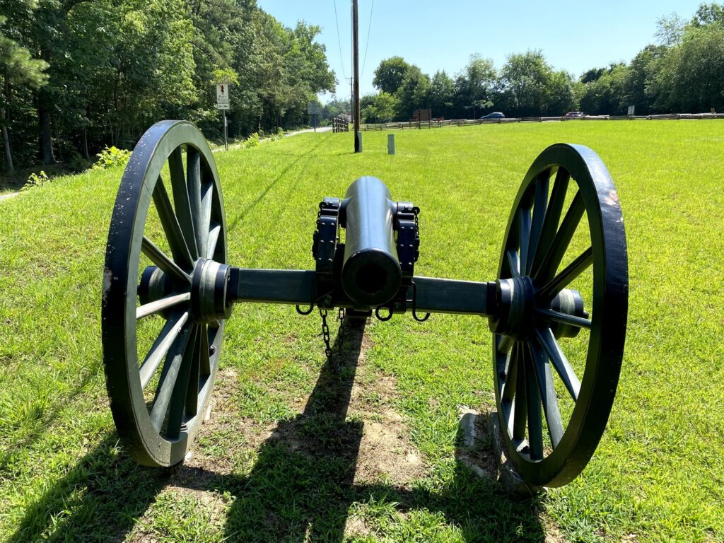
Battle of Totopotomoy Creek – Civil War Battlefield #138
A small section of the Battle of Totopotomoy Creek is preserved by the NPS around the “Rural Plains” house (where Patrick Henry was married). We attempted to walk along a trail there, but it was very hot and not well-marked, so we turned back.
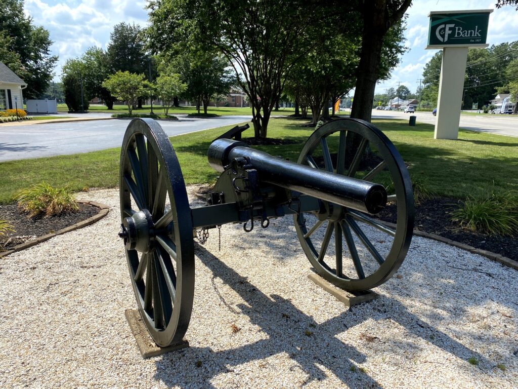
Real artillery at Totopotomoy Creek. – Photo by the author
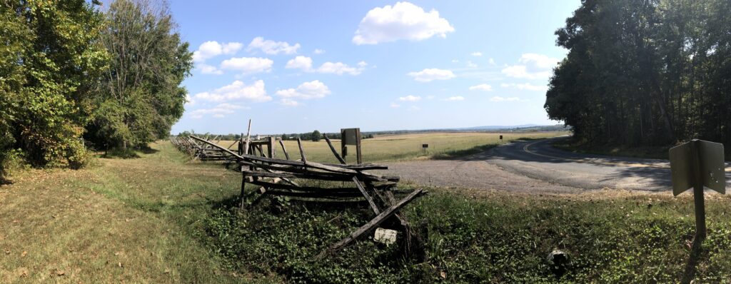
Another cavalry battle involving George Armstrong Custer, the Battle of Old Church didn’t have any markers or preservation at all. We drove through the center of the field – along McClellan Road – and it was pretty easy to see where the original Union defensive line would have been.
Battle of Cold Harbor – Civil War Battlefield #140
The Battle of Cold Harbor is another place where the NPS has preserved a small section of a massive field. There’s a lot more still to be done here, with the American Battlefield Trust always on the lookout for ways to preserve every acre they can.
There is a nice Visitor Contact Station here – though we weren’t allowed inside because of COVID-19. A couple of rangers had a canopy set up out front and were handing out maps, Junior Ranger materials, and answering questions.
Emily checks out a wayside marker at one of the Cold Harbor auto tour stops. – Photo by the author
We picked up a map and did the short 4-stop auto tour. It was nice, but I wonder how much visitation a satellite site like this gets.
Second Battle of Deep Bottom – Civil War Battlefield #141
We drove through most of the field of the Battle of Glendale on the way to our next stop. The fighting here was part of the earlier 1862 Seven Days Battles, so it wasn’t the focus of this trip. I didn’t stop for any of the markers, mainly because it didn’t seem like there was anywhere safe to pull off and read them.
The NPS also no longer runs a Visitor Contact Station out here, so that makes it harder.
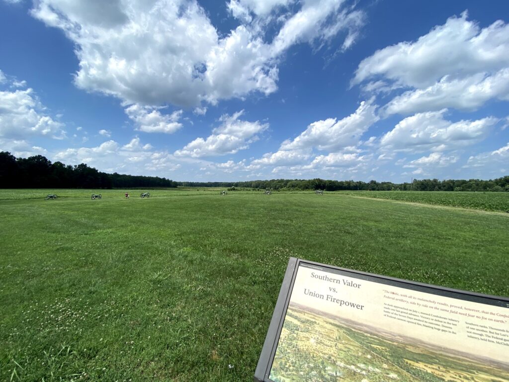
Battle of Malvern Hill – Civil War Battlefield #143
I know that I just got done saying that I wasn’t focusing on the Seven Days Battles during this trip, but I decided to add the Battle of Malvern Hill to the itinerary after reading about Henry Hunt’s masterful use of artillery here.
Looking out across the field where the Confederate assault on Malvern Hill took place. It’s a gorgeous place. – Photo by the author
Honestly, it isn’t that much of a hill, but the approaches that the Confederates used were absolutely murderous. I don’t know how anyone survived those assaults. Thanks to Hunt’s artillery, the Union army could safely retreat from their failed campaign against Richmond.
First Battle of Deep Bottom – Civil War Battlefield #144
We found a wayside describing some of the action of the First Battle of Deep Bottom near where the Union pontoon bridge had been constructed. There is a small park there today.
The Union army had a pontoon bridge here. – Photo by the author
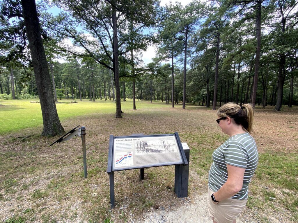
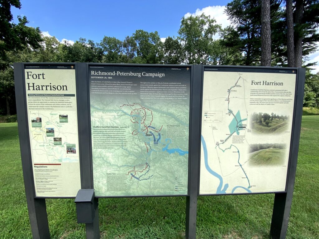
Battle of Chaffin’s Farm / New Market Heights – Civil War Battlefield #145
Stopped at Fort Harrison which had a few markers to describe the Battle of Chaffin’s Farm / New Market Heights. The earthwork fort is fairly well-preserved, and Emily enjoyed this spot as it was pretty easy to visualize what happened here.
A very nice set of NPS markers at Fort Harrison. – Photo by the author
Battle of Darbytown and New Market Roads – Civil War Battlefield #146
This is where the names of the fights start to get a little repetitive and confusing.
Battle of Fair Oaks and Darbytown Road – Civil War Battlefield #148
There was no marker here – nor was there a safe place to pull off. I did see a marker for Fort Lee in the vicinity of where I think the Battle of Fair Oaks and Darbytown Road took place, but to be honest, all of these fights seem to overlap and get confused.
Battle of Oak Grove – Civil War Battlefield #149
I know – here is another of the Seven Days Battles, but as I was driving through the area anyway, I decided to check of the Battle of Oak Grove.
This field is now completely consumed by Richmond International Airport. I guess the airport has to go somewhere, but it’s a shame to wipe out a historical battlefield in the process.
There is a marker and a few cannons along the airport entrance road that commemorate the fighting, but I couldn’t visit them as the entire area is littered with “NO PARKING” signs.
Battle of Seven Pines – Civil War Battlefield #150
Just to make it an even 150 – and because it was right along our route anyway, I stopped at the Battle of Seven Pines – another of the Seven Days Battles. This one was basically a bonus.
There isn’t much left of this field, but the lines seem fairly well marked with roadside signs. We saw one of the typical VA stone markers outside of the local library.
We saw a lot on our 1-day trip. In fact, 16 battlefields in one day is a personal record for me that I doubt I’ll ever top. Emily was a really great travel partner. I’m lucky to have her.
The day after we visited Fort Ticonderoga, we got to see the site of a British surrender during the Revolutionary War: Saratoga National Historical Park.
At the time of our visit, the visitors center was closed for renovations, so we had to settle for a picnic table on the back porch staffed by NPS volunteers. They were very helpful in getting us oriented, including give our crew maps and Junior Ranger books. My brother and his girls had never done a Junior Ranger program before, so it was fun to be able to do that together – even if it did bring out a little bit of competition between all of us. 🙂
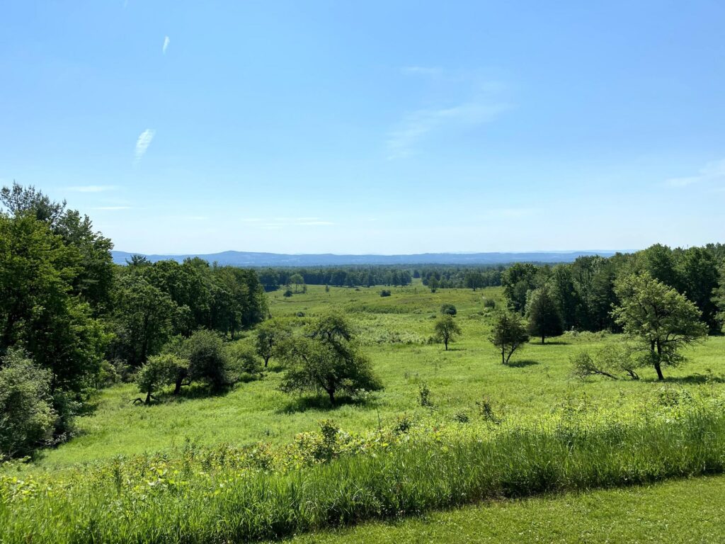
The scenery at Saratoga is unbelievable. – Photo by the author
After a little bit of discussion, we planned our route: a truncated version of the standard auto tour.
Stop 1: Freeman Farm Overlook – The views here were awesome.
Stop 2: Neilson Farm – A helpful volunteer was manning the house here and helped orient us.
Stop 3: American River Fortifications – Really incredible views here.
Stop 6: Balcarres Redoubt
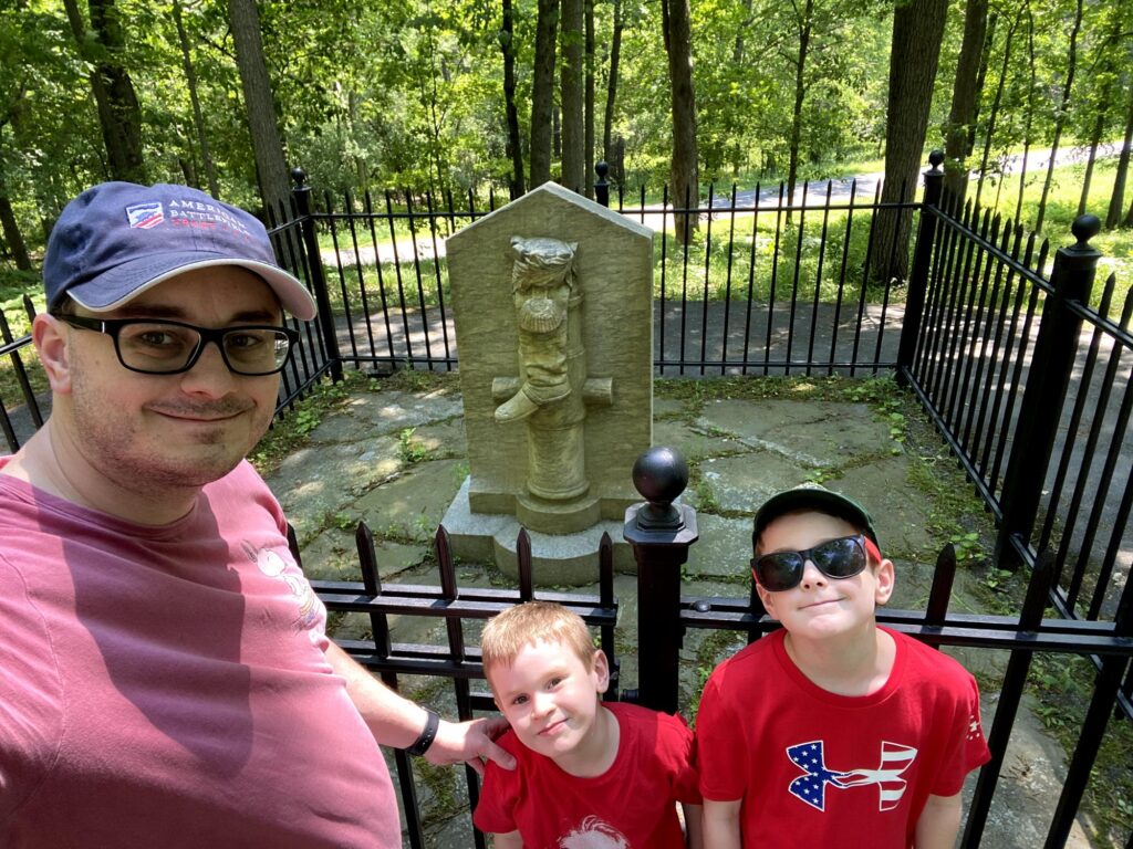
Stop 7: Breymann’s Redoubt – The “Boot Monument” was the highlight here.
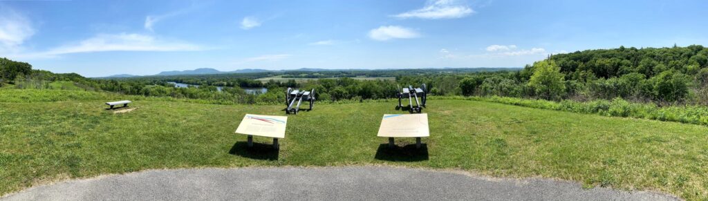
Stop 9: The Great Redoubt – If you can believe it – even more incredible views!
The boys and I posing in front of the “Boot Monument” commemorating he-who-shall-not-be-named. – Photo by the author
It seems that this park – like Kennesaw Mountain – gets used mainly for the hiking and biking trails, though it was certainly not as crowded as Kennesaw was during our time there.
We lingered a while at Stop 9, using the picnic tables to finish working on our Junior Ranger books. The kids all had a good time with that, and we rewarded at the end with a very cool wooden badge.
View of the Hudson River valley from Stop 9. Just lovely. – Photo by the author
We continued south to one more historical stop on our road trip.
Since my brother had moved to upstate New York, and had done a little of his own history tourism, he invited me to join him and his girls on a trip through some of the historical sites north of him. We coordinated on an itinerary and set a date.
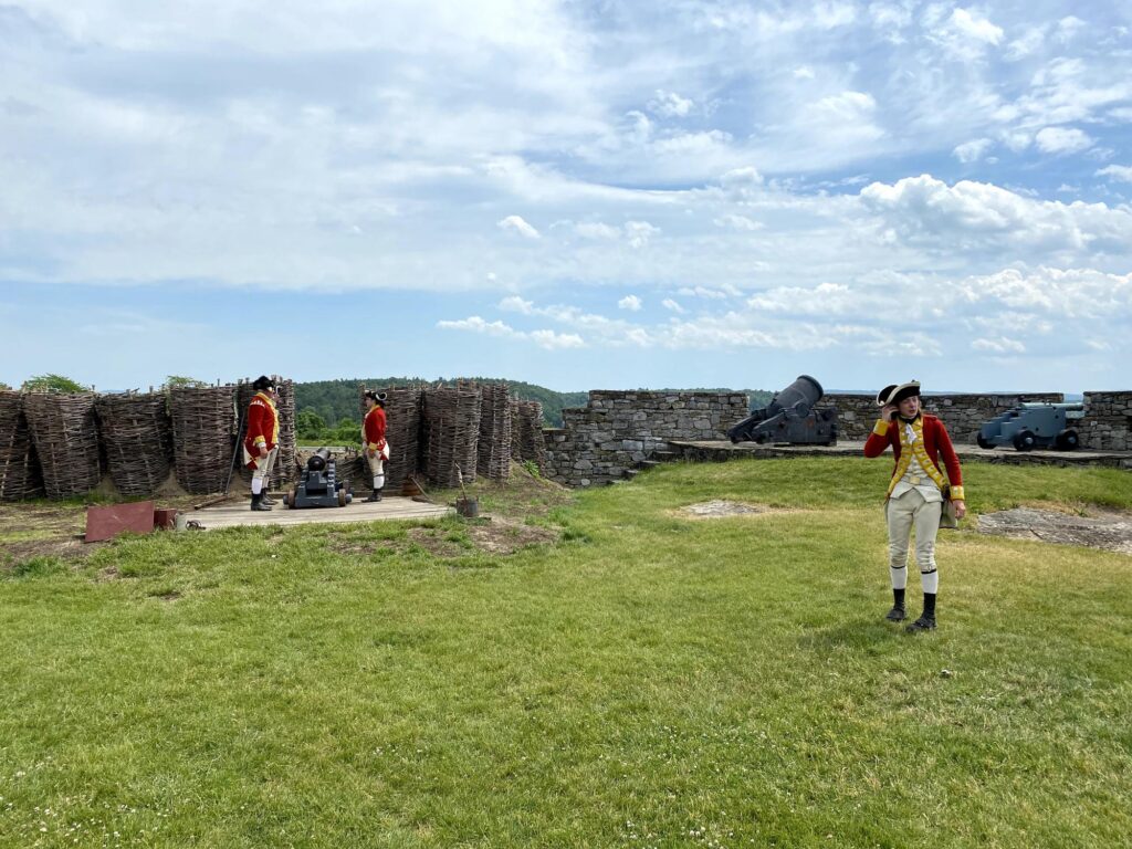
Our first stop was going to be the farthest north that my boys had ever been: Fort Ticonderoga. This was going to be a first visit for all of us except for my brother, so I wasn’t quite sure what to expect, but it was a really beautiful place. After a few hours in the car, we arrived just in time for a really well done artillery demonstration.
These redcoats put on a pretty good artillery demo. – Photo by the author
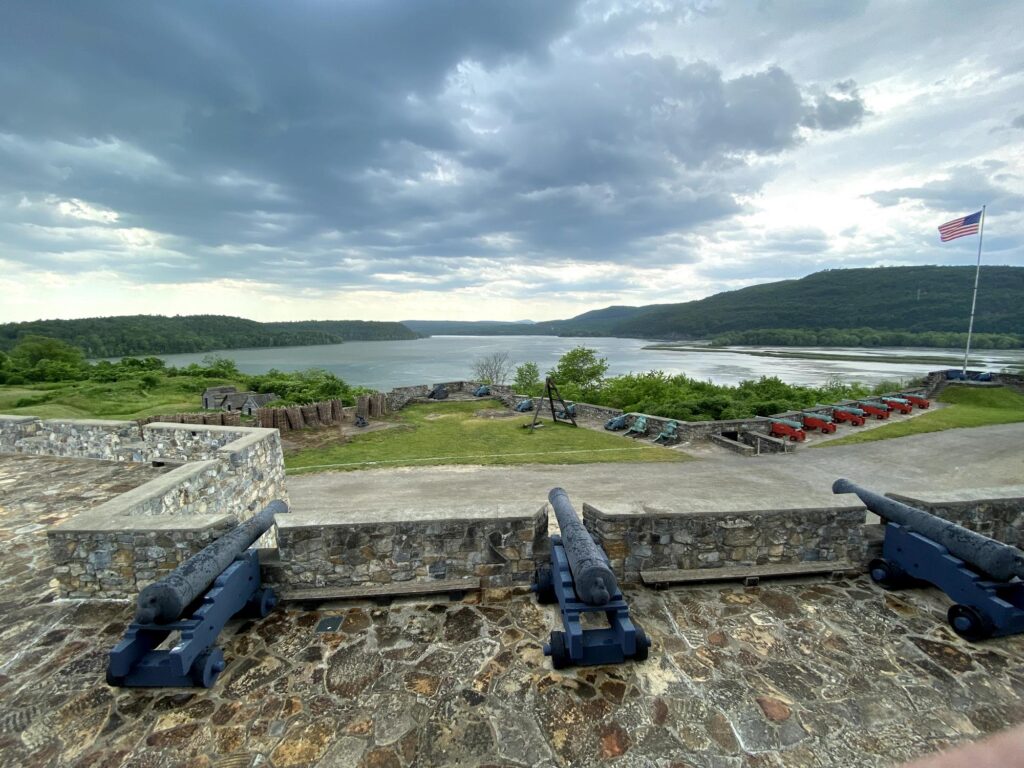
While the fort and scenery are beautiful, it has a less-than-successful history. It seems that no one – not the French, British, nor Americans – was ever able to really defend the place from attack. It changed hands constantly almost from the time it was built. Part of the issue is that the fort is dominated by nearby Mt. Defiance.
My favorite photo from Fort Ticonderoga shows Mt. Defiance on the right and some cool artillery. – Photo by the author
The fort has quite a collection of French and British artillery dating from the 1730s – 1750s at various spots around the structure. The barracks-turned-museum also holds some pretty cool artifacts and is well put together.
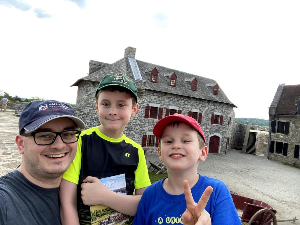
#FortSelfie! My crew poses with the parade ground in the background. – Photo by the author
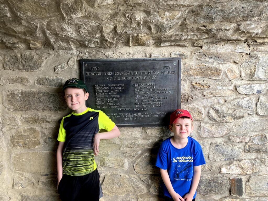
One of the coolest parts for me was the plaque at the entrance to the fort that lists all the famous historical figures whose footsteps you are about to walk in. I just had to get a photo of my guys rubbing shoulders with these greats.
Impressive company for my boys! – Photo by the author
After a few hours, we had seen all that we could, and my brother suggested heading over to Mt. Defiance to get the perspective from there. It was a long road up to the top – and I appreciated the cell tower up there – a mixing of history with modernity. The view was very impressive, and a small shelter at the summit had a few waysides to give more context for the actions that took place around Ticonderoga.
The view from Mt. Defiance. Ticonderoga is on the left, and those mountains in the distance are in Vermont. – Photo by the author
It was a great start to an awesome weekend road trip with more historical nerdery to come!
This was a quick drive-through as our family was on our way back from visiting the beach in Stone Harbor, NJ. Because of traffic, we took a different route than normal, and ended up crossing over the modern bridge at the site.
There is a roadside marker here describing the action of the Battle of Quinton’s Bridge, but the ground is all private property, and I didn’t have a safe place to pull off and even take my own photo. While the field is probably mostly intact, I have to imagine that the approaches are somewhat different than they were in 1778.
Back in 2019, I was invited by my brother to spend Thanksgiving with his family in New York. Since I had the Wednesday before off of work, I thought I’d make a day of it and hit a few interesting historical sites along the way. I left the house around 8:30am and started north.
Battle of Paoli
I titled this post as being about the Ten Crucial Days, and Paoli is not part of that campaign, but it was along my route and I had wanted to visit for a while. A few months before, I had learned about how “Mad” Anthony Wayne had been inspired by the sneak attack tactics that the British had used against him at Paoli and repeated those at Stony Point.
The monument to the 53 American soldiers who are buried here. The monument itself is over 200 years old, so it is being preserved. – Photo by the author
Despite the fact that there are baseball diamonds and tennis courts on part of the property, the field of the Battle of Paoli is well preserved by a small park. There are numerous monuments to the action that took place here, as well as a good number of waysides that help the visitor to understand. There is even a re-creation of the fence line and disabled artillery piece that factored so heavily here. This is a place that deserves to be visited.
Looking toward the site of the American encampment, past the disabled artillery piece. – Photo by the author
Old Barracks Museum / Trenton, NJ
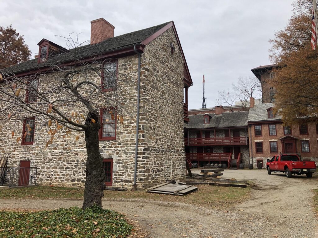
Modern Trenton looks nothing like it did in the winter of 1776-1777. Only a few small pieces of that time remain. One of those is the Old Barracks Museum. Dating from 1758, this structure was built by the British to house troops during the French and Indian War. It is the only one that is left of five similar structures that were built across the colonies.
The Old Barracks Museum was a highlight of this roadtrip. – Photo by the author
I took a tour – I was the only member of my “group” that day – and it was very informative. The tour guides dress in period clothing and even adopt something of a character. In addition to showing you through the different rooms of the structure, they emphasize its use as a hospital, and highlight the successful smallpox inoculation program that was carried out. There is also a good museum here with some exhibits about the Battle of Trenton.
The main part of the fighting in Trenton happened in two parts – both areas are not far from the barracks. There is a large monument at the top of the hill where the American artillery was placed, but that neighborhood is a little rough and run down. I feel like the monument has seen better days, sadly.
The Trenton Battle Monument – complete with plywood door. Kind of sad. – Photo by the author
The second battle that took place here – the Battle of Assunpink Creek – took place toward the bottom of the hill. There’s a small park there, but it’s hard to get a sense of the action because of all the modern construction.
Battle of Princeton
A short distance north of Trenton is the town of Princeton. The Battle of Princeton was arguably the climax of the Ten Crucial Days.
A view of the field at Princeton, from the Colonnade Monument. – Photo by the author
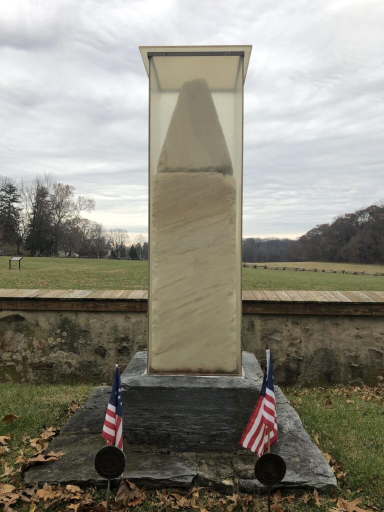
The field itself is small, and there are a few waysides, but they barely mention the battle action. The museum was closed during my visit – perhaps that would have helped. The monuments here are mainly to Brig. Gen. Hugh Mercer who was mortally-wounded here. I also took the opportunity to go up into town, where the impressive Princeton Battle Monument dominates the town square.
The Princeton Battle Monument – Photo by the author
It was here in Princeton that my trip took a turn from “history nerd” to “regular nerd”. There was plenty of history still left to see on my journey north, but it would take a decidedly more modern and technological character from here on out. And that’s a story for the next post.
I had a weekend to myself, and there were a few events that I wanted to attend: a show by the amazing comedy bluegrass band The Cleverlys, and a 155th anniversary hike / tour around the field of the Battle of Fisher’s Hill that I posted about before. Both were taking place that weekend in the Shenandoah Valley, so why not visit a few more battlefields while I’m on the way?
Battle of Aquia Creek – Civil War Battlefield #130
There is a park with a marker right at the landing. This site is mostly interpreted for its later use as a logistical hub for several Union campaigns. Across the street, there is a small park that is used for Native American ceremonies. Up on the hill nearby, there is an artillery position that was used by the Confederates during the Battle of Aquia Creek.
The remains of the Confederate artillery position at the Battle of Aquia Creek. – Photo by the author
I decided to drive down through Fredericksburg, with a stop at the Chancellorsville Visitor Center to see if they had any information about my next stop. Turns out that they had a brochure describing a driving tour. As a bonus, I got to drive through the Wilderness battlefield along the way, too.
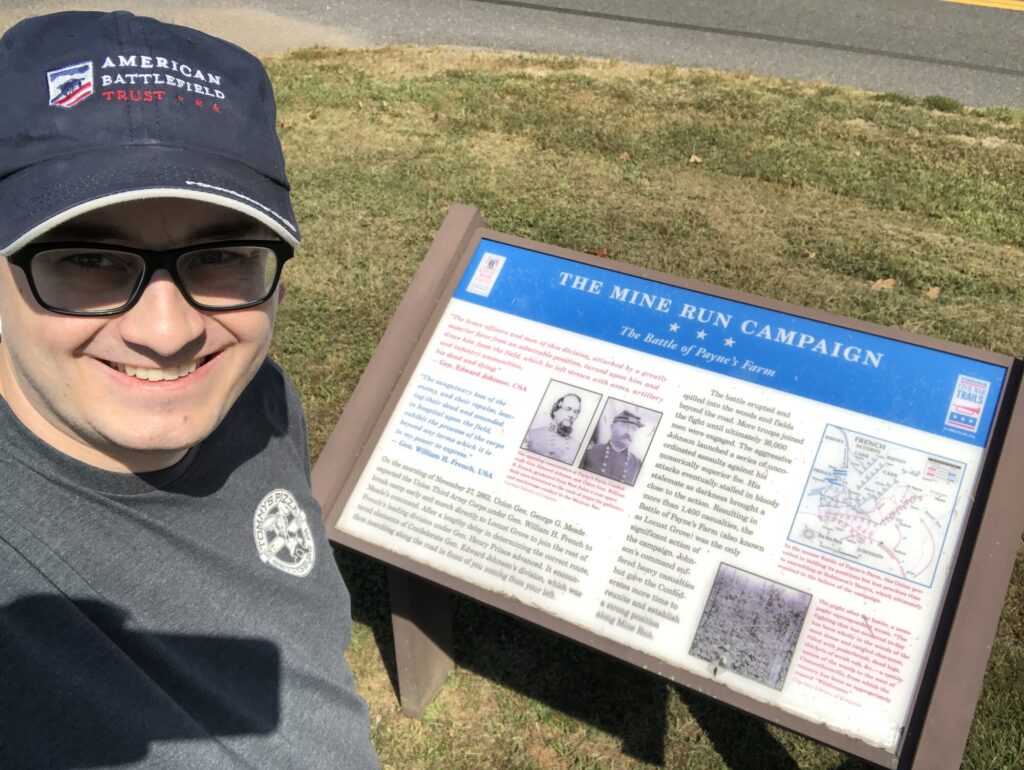
Battle of Mine Run – Civil War Battlefield #131
I stopped by the Payne’s Farm site of the Battle of Mine Run that the American Battlefield Trust has preserved in the last few years. They appear to have a nice interpretive trail laid out here, but it was very overgrown at the time of my visit. I didn’t push too far. I might return to try in colder weather.
#SignSelfie with one of the waysides at Mine Run. – Photo by the author
It was disappointing to see that there is no interpretation along Mine Run where the Confederate line ended up. This was, indeed, “The Great Battle Never Fought“.
Battle of Morton’s Ford – Civil War Battlefield #132
The Battle of Morton’s Ford is a bit of a strange one. I believe that this is the first battlefield that I’ve visited with absolutely no interpretation of any kind. No roadside markers. You just have to know where you’re going and what you’re looking at.
The field is all privately-held, and the closest access is along a gravel road called Horseshoe Road. I believe I was able to pick out the old road trace that led down to the ford itself, but there is little else here.
Battle of Cedar Mountain – Civil War Battlefield #133
Another field where the American Battlefield Trust has taken the lead with preservation is the Battle of Cedar Mountain. They have a set of trails with some good interpretive markers along the way. I particularly enjoyed the view across the field from the gate.
Cedar Mountain is a lovely place. – Photo by the author
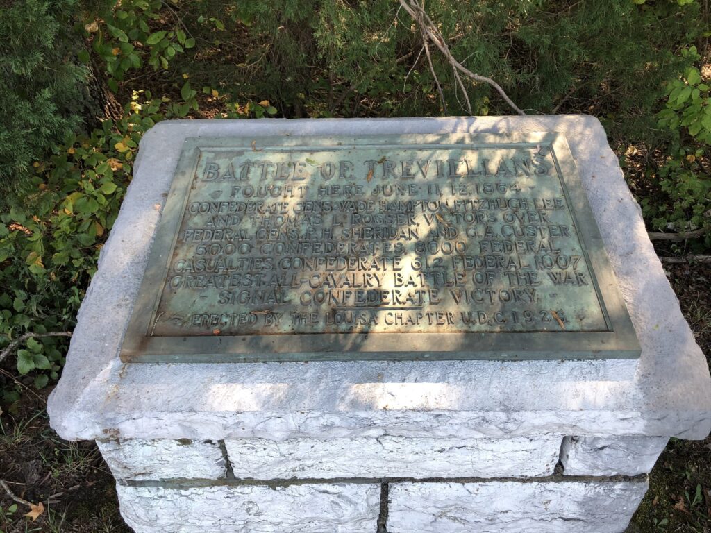
Battle of Trevilian Station – Civil War Battlefield #134
Being a Custer fan, the Battle of Trevilian Station has been on my radar for a while. There is a web-based driving tour, and I did part of it because of time constraints. There are numerous monuments and markers in the vicinity of the old railroad station where Custer had his “first last stand”.
One of the typical markers at the Battle of Trevilian Station. – Photo by the author
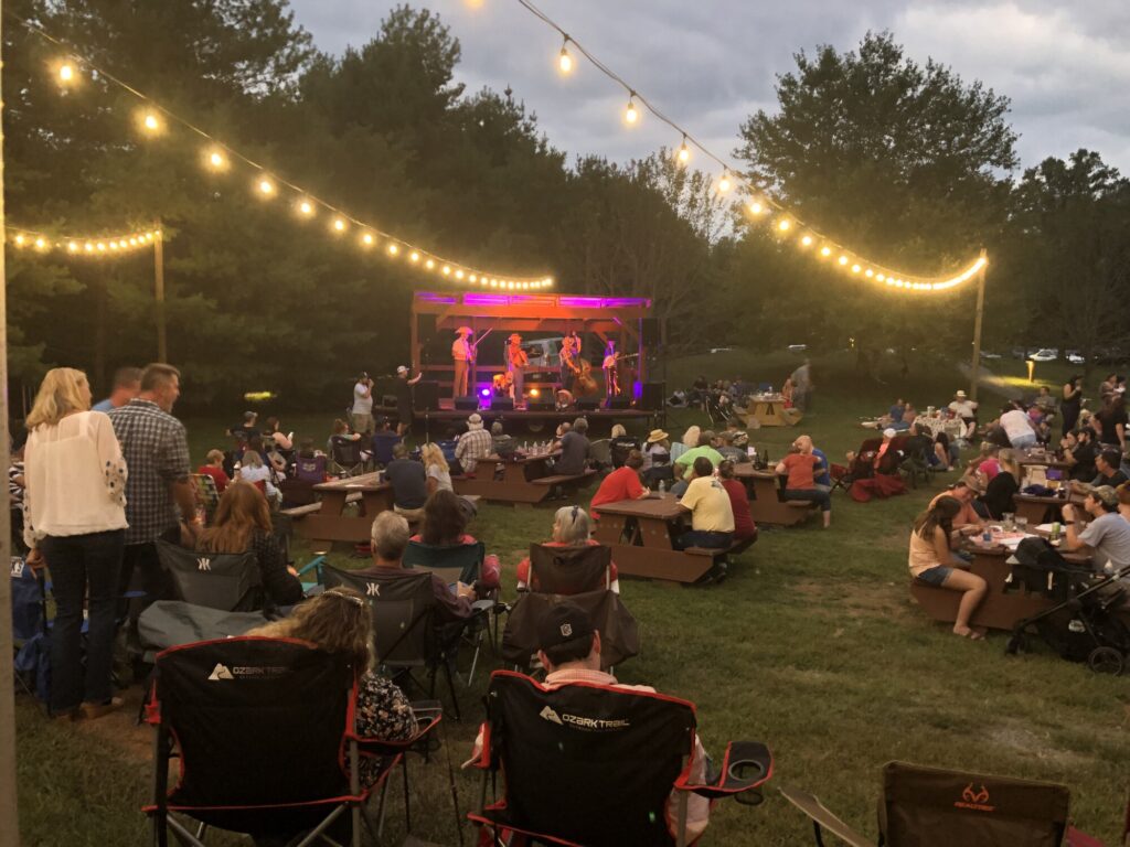
As it was getting late in the afternoon, and I’d seen all the fields that I had planned on, I had to make my way down to Bold Rock for the Cleverlys’ show. It was a great way to end the day!
The Cleverlys put on a great show! – Photo by the author
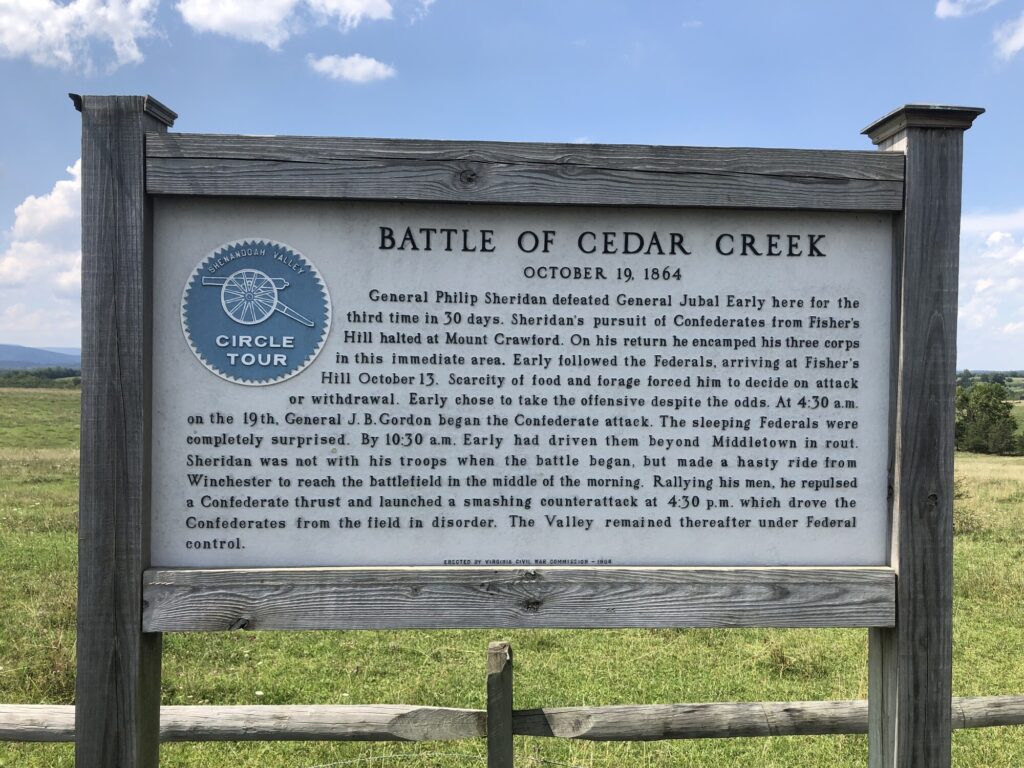
While on another road trip to visit Chattanooga – this time with more family members along, including my two boys – I decided that it would be nice to finally visit the site of the Battle of Cedar Creek. I could check it out for myself, and the boys could get another Junior Ranger badge. That’s fun for everyone!
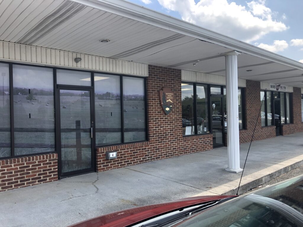
The Visitor Contact Station at Cedar Creek and Belle Grove National Historical Park. – Photo by the author
Cedar Creek and Belle Grove National Historical Park is a fairly new unit in the NPS – having only been established in late 2002. During our visit, it felt like a site that was still trying to figure itself out. For instance, the visitor contact station is at a strip mall in Middletown, VA. This is the only NPS site in the Shenandoah Valley, so I think they are trying to tell the whole story of bothcampaigns, with Cedar Creek as the climax of all that activity.
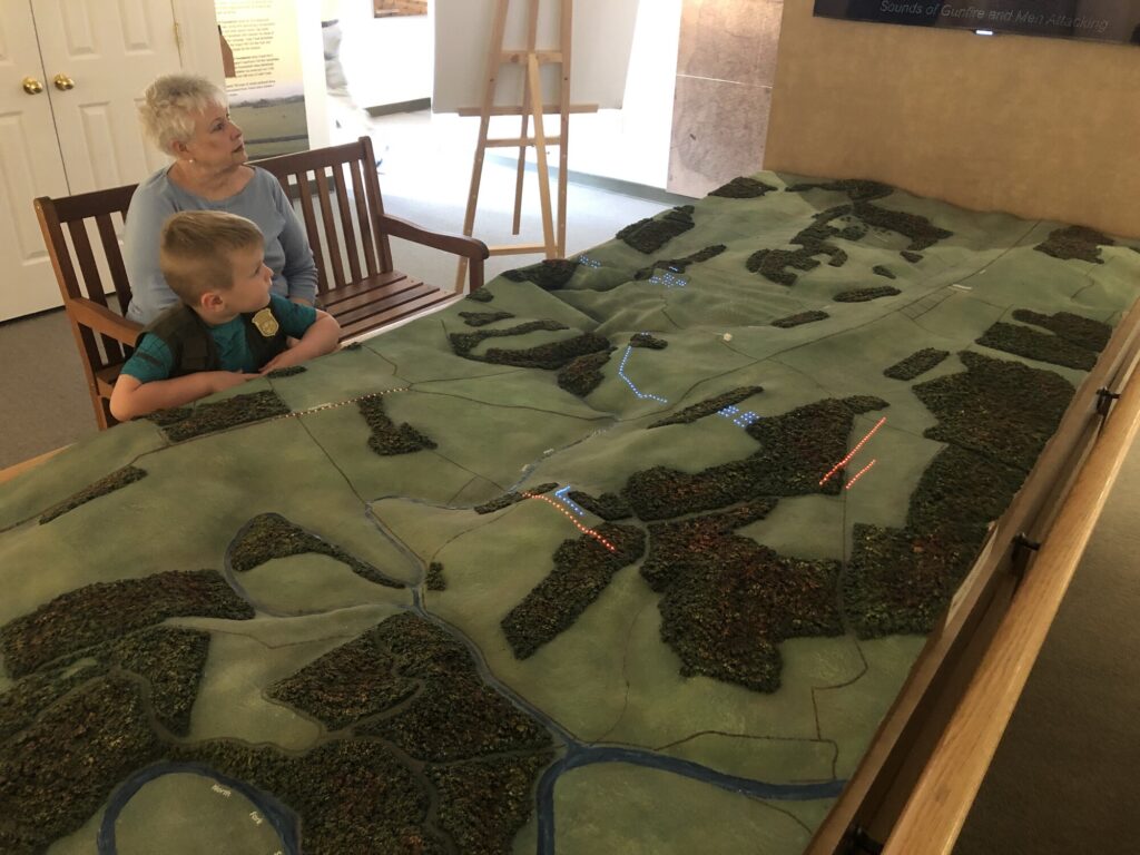
The visitor contact station had some cool museum stuff – including some interactive “try on” pieces for the boys. And you’ve got to love any battlefield with an electric map!
Isaac and “Nene” examine the electric map! – Photo by the author
During our visit, I felt like the driving tour was a little rough, but thorough. The terrain here is gorgeous with rolling hills and valleys, and it isn’t too hard to imagine what it would have been like in the mid 19th century. It’s also pretty easy to see how the Confederates’ approach during their early morning attack would have been effectively covered by the lay of the land.
The standard Shenandoah Battle Plaque out on the field during the driving tour. – Photo by the author
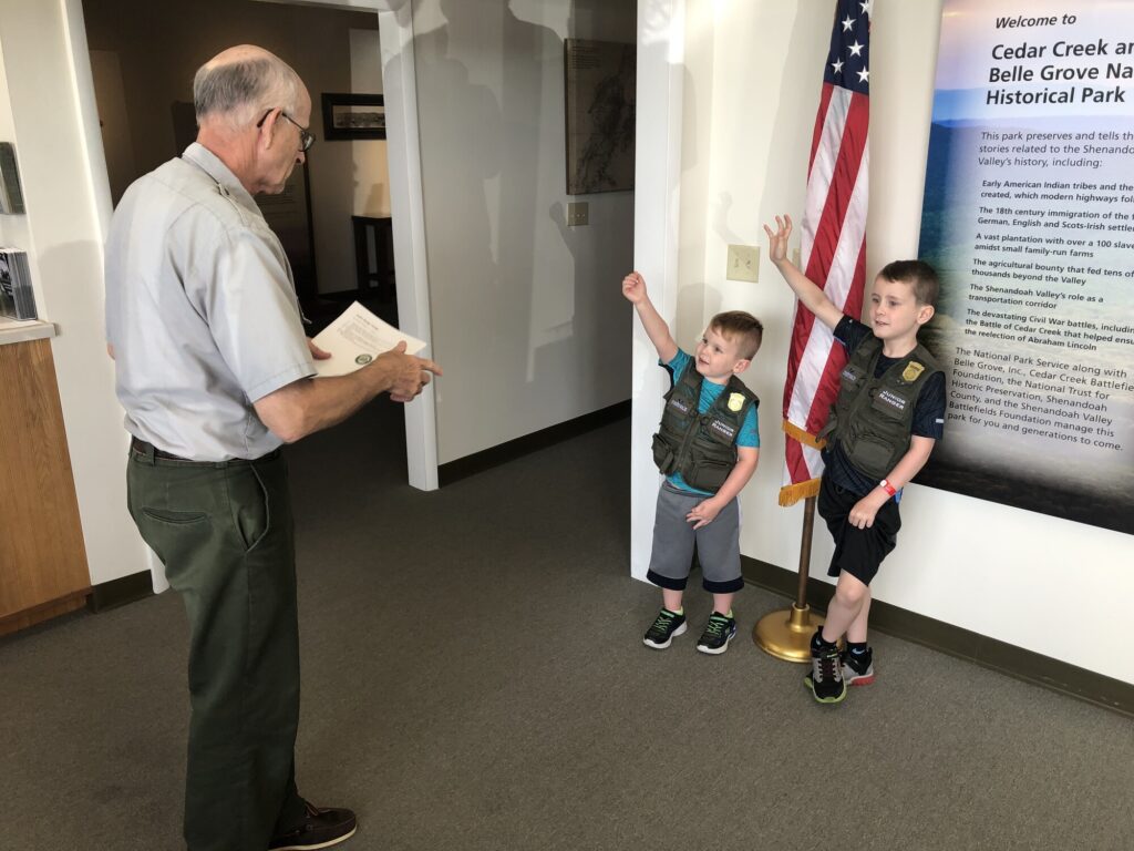
Back at the contact station, I helped the boys work through their Junior Ranger books and struck up a conversation with the ranger about all things Civil War – including my goal of seeing all the battlefields. Like most rangers I’ve encountered on these visits, he was a pleasure to speak with – I could have stayed there all day. Eventually, the boys had their books checked, got sworn in, and made a nice memory with their dad, and their “nene” and “baba”.
Swearing in the Junior Rangers. – Photo by the author
I had a great time visiting Chattanooga and driving the route of the Atlanta Campaign with my nephew, but every history nerd road trip has to come to an end eventually. As I made my way back home, I stopped at a few more battlefields that I’d never visited.
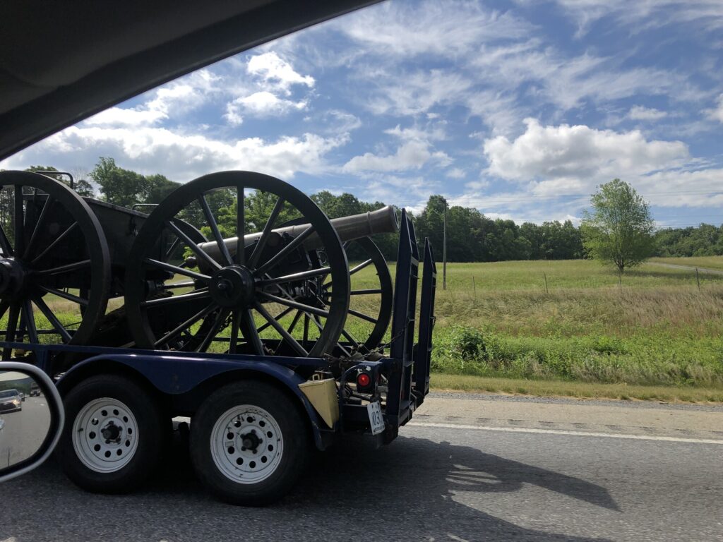
As a bonus, I even got to see some reenactment artillery being towed up I-81 along side me.
It’s always an adventure driving down the Shenandoah Valley! – Photo by the author
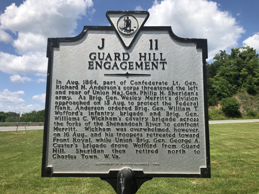
Battle of Guard Hill – Civil War Battlefield #126
There is one marker to the Battle of Guard Hill within the cluster of markers along US-522 near the base of Guard Hill. The position is definitely elevated above Front Royal, and you can readily see the defensive advantages. Even so, Union cavalry was able to prevail, sweeping the rebels back toward town.
The marker to the battle along US-522. – Photo by the author
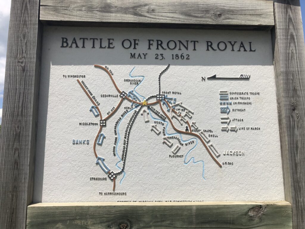
Battle of Front Royal – Civil War Battlefield #127
If you wanted to avoid the fighting during the Civil War, the lower Shenandoah Valley was NOT the place to be. There were constant battles, raids, occupations, and even burnings throughout this area from 1861-1865.
Nice map of the Battle of Front Royal. – Photo by the author
There are some markers discussing this action near the Guard Hill one in that standard “Shenandoah Valley” style – with more embossed maps on large, vertical boards. In the town square near the courthouse there are more markers and a good wayside. I found this fight to be particularly interesting as it is another field with Maryland vs. Maryland action.
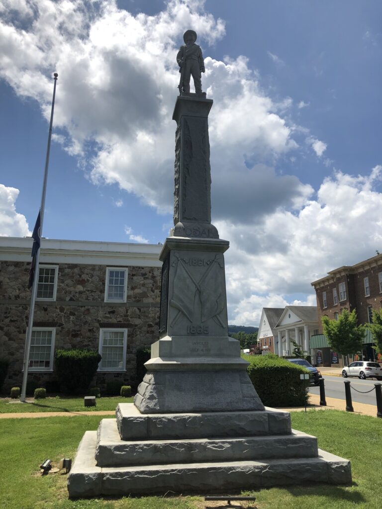
Confederate Memorial in the town square in Front Royal. – Photo by the author
Battle of Manassas Gap – Civil War Battlefield #128
There is a single wayside in the park and ride on Dismal Hollow Road to tell the story of the Battle of Manassas Gap, and it does that pretty well, I think. The gap is visible behind you from that location.
My one quibble would be that the wayside declares this battle to be the final action of the Gettysburg Campaign, but I feel like that was over as soon as the Confederates got back across the Potomac River.
Since I was still in town – and largely done with the Atlanta Campaign – I decided to go back and really properly do Chickamauga since the only other time I had visited, I didn’t really know what I was doing. Luckily, my nephew was game.
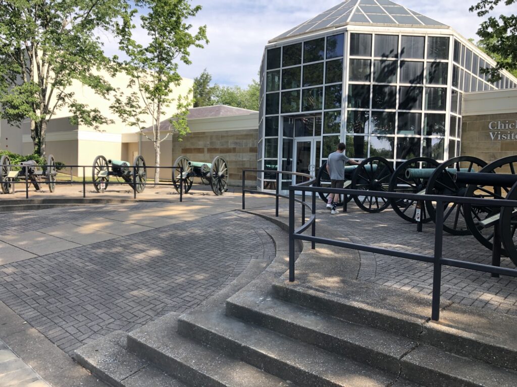
The entrance to the visitors center at Chickamauga – Photo by the author
We started, appropriately enough, at the visitors center. There is a great display of artillery out front, so I got to nerd out with my nephew about that. Around the side, they even have a mountain howitzer. Very cool! For the rest of the day, my nephew tried his hand at identifying the cannons – and he did pretty well!
After orienting ourselves, we did the standard auto tour. What really impressed me about the place was the old War Department tablets. There are similar monuments at Gettysburg – one for each corps, division, brigade, and battery. Here at Chickamauga, though, each unit has multiple tablets, at places where they fought or maneuvered. With enough time, you can follow the movements of individual units – with some markers even being hidden in the middle of the woods. It’s wild. I could spend a lot of time here.
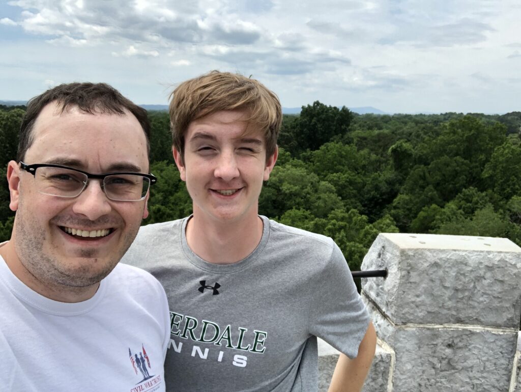
One highlight of this visit was that I was able to get over my acrophobia enough to climb the Wilder Brigade Monument Tower. It honestly wasn’t that bad since the spiral staircase is enclosed. The view from the top was pretty cool.
We took a selfie at the top of the Wilder Tower. – Photo by the author
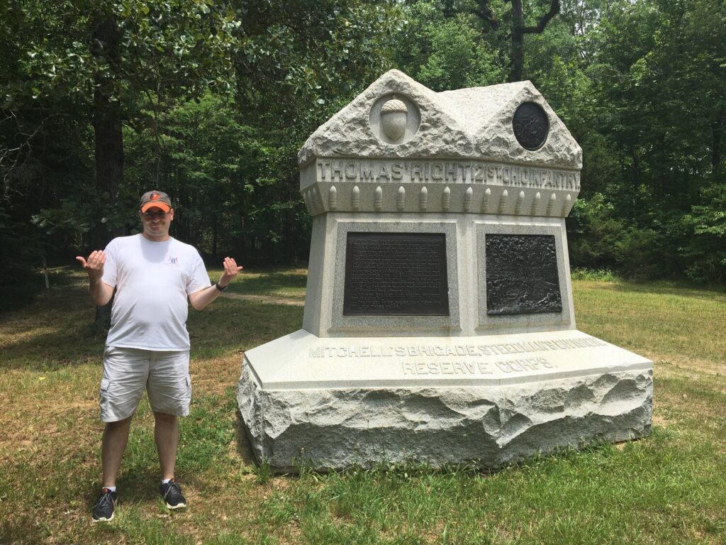
The farthest “off the beaten path” we went, was to the far right of Maj. Gen. George Henry “The Rock of Chickamauga” Thomas’ line to find the monument to the 121st OH. My old high school buddy, Jim, had sent me a photo years ago of him shaking his fist at the marker. I really wanted to give a proper response. Being able to do that along with my nephew was a really special memory.
My response on behalf of Thomas’ men. – Photo by my nephew
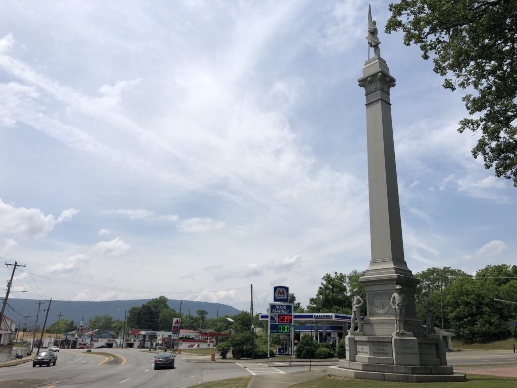
Missionary Ridge
The Iowa Monument marks the start of the road along Missionary Ridge. Lookout Mountain is in the background. – Photo by the author
After a quick stop for lunch, we headed north. I wanted to actually drive along Missionary Ridge and see what was left of the field. There’s not much – it’s mostly very expensive houses now. The route is utterly littered with War Department plaques, but I doubt anyone ever reads them. There is no where safe to pull off and park near the vast majority of these monuments and markers. You’d almost have to walk along the road to take them all in, and it’s a narrow road. I don’t think that would be very safe.
There are a few spots called “reservations” where there is about a block or so of “park.” While there weren’t very many of these to stop at, the views when you did were awesome. Not as good as Lookout Mountain, but better than your average Civil War battlefield.
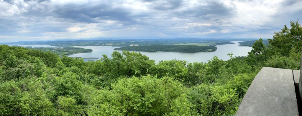
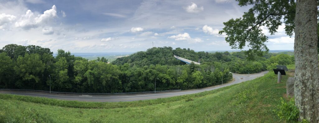
Panorama of the view to the north from the Bragg Reservation. – Photo by the author
I had a great visit to Chattanooga and Atlanta. It was time to get on the road back to Baltimore. But there were a few more spots to hit along the way.