Once again, we were able to get going from Chattanooga pretty early in the morning. I was really looking forward to finishing off the Atlanta area battlefields, and was pretty sure we were going to be able to do it. The universe had other plans.
Battle of Kennesaw Mountain – Civil War Battlefield #120
We were able to arrive at the NPS site for the Battle of Kennesaw Mountain by about 10am. It was a Wednesday morning. The parking lot was absolutely PACKED. Was I here on the battle anniversary or something? No that wasn’t until June 27th – almost a month away. What was going on?
My nephew and I got parked in a massive overflow lot about a half-mile away. Even that was filling up fast. What is the deal here? Either way, we were all set to start our visit by checking out the museum in the visitors center.
As we approached the building, I noticed that they had posted hours: they opened at 9am, but there is a separate vestibule with restrooms that opens at 7:30am. That seems a little odd. When we got into the main information desk, I asked the ranger about it. As it turns out – or so he told me – Kennesaw Mountain gets more visitation than ANY other NPS Civil War battlefield. This is because it is set right in the midst of the Atlanta suburbs, and is overwhelmingly used by joggers who like to run up the mountain. I would come to find out just how many in a little while.
The museum was pretty good. Being the only NPS site along the Atlanta Campaign, they tell the story of the whole campaign here – not just Kennesaw Mountain’s part. After checking out all the exhibits, we made the hike back to the car to begin the auto tour. Stop 1 was the top of Kennesaw Mountain itself.
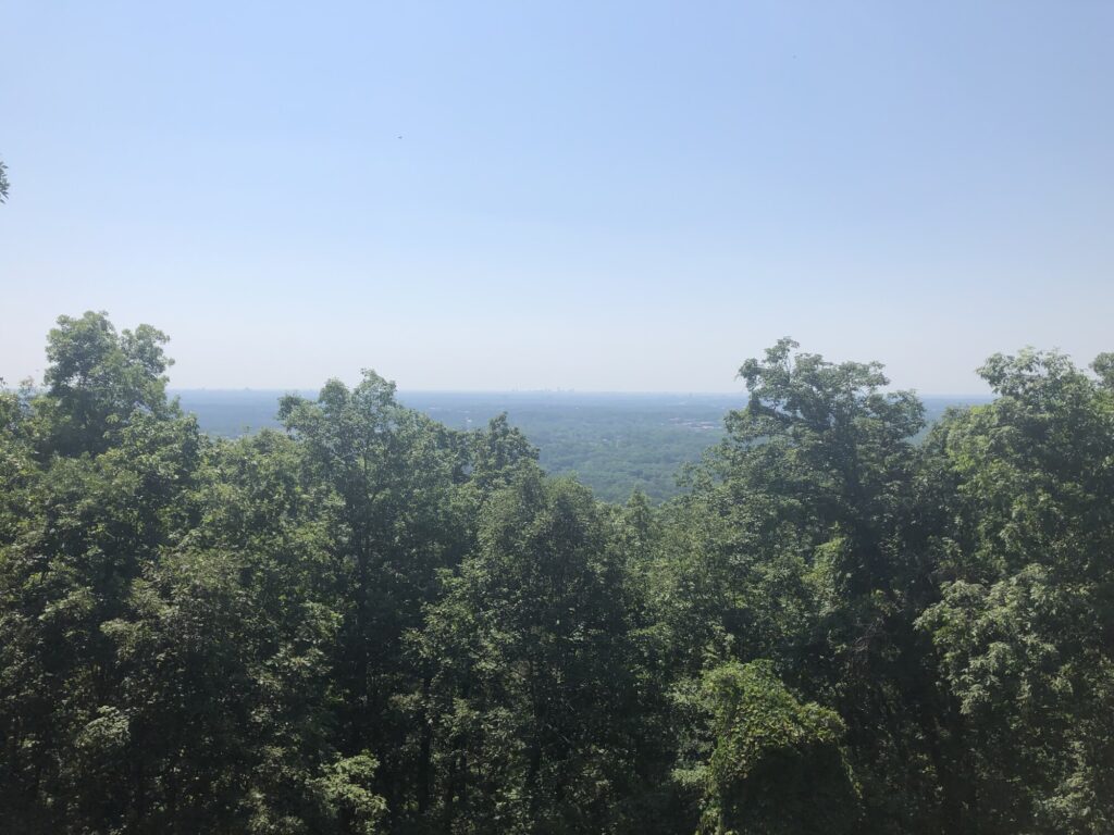
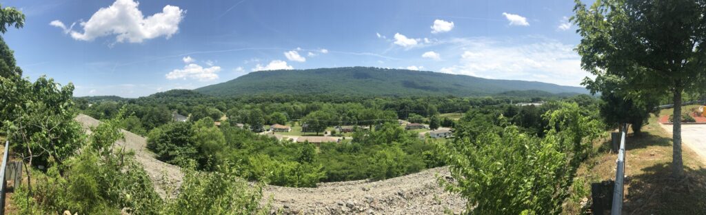
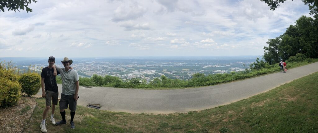
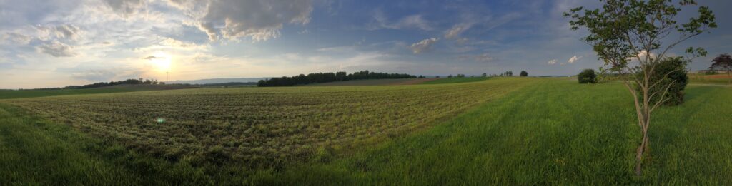
There’s a two lane road up the mountain, but it was absolutely choked with joggers – most of whom did not want to move to the side of the road, and several of whom gave me irritated looks as I drove past them – as if I was using the park the wrong way or something. It is the most bizarre experience I have ever had on a battlefield. At the top, we parked and walked a trail along the ridge. There are a few artillery pieces up there, and one can see the skyline of downtown Atlanta if it’s a clear enough day – it was for us.
The skyline of Atlanta is just visible in the haze at center. – Photo by the author
We had to fight our way back down the mountain with the joggers, but once we moved on to the second stop and beyond, we barely saw another soul on the battlefield. I suppose it is nice that people visit, but it really seems to me like the vast majority of them are missing the point of the place.
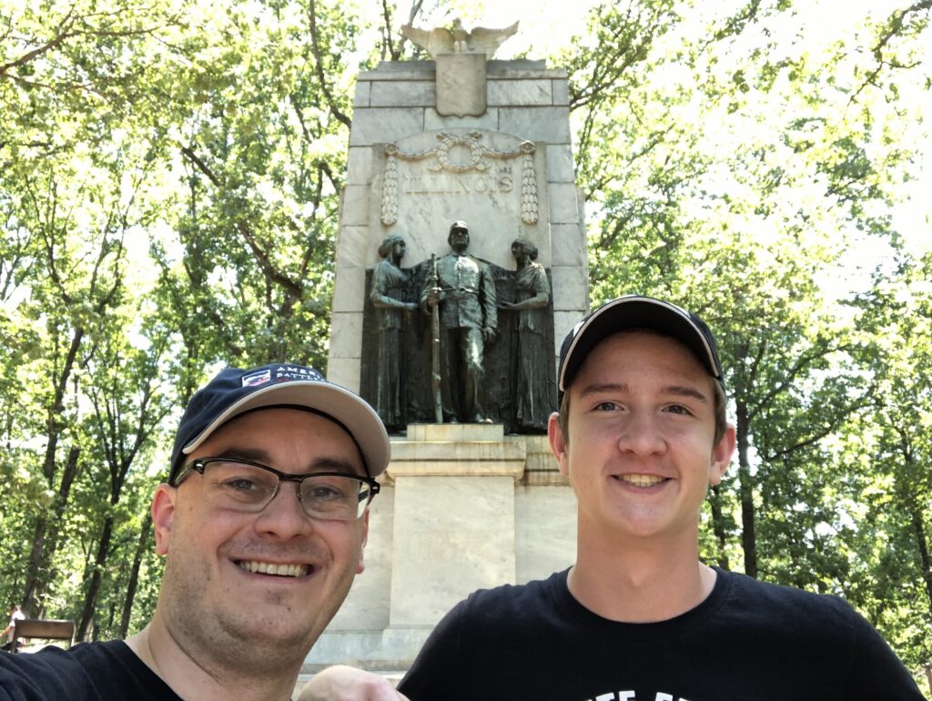
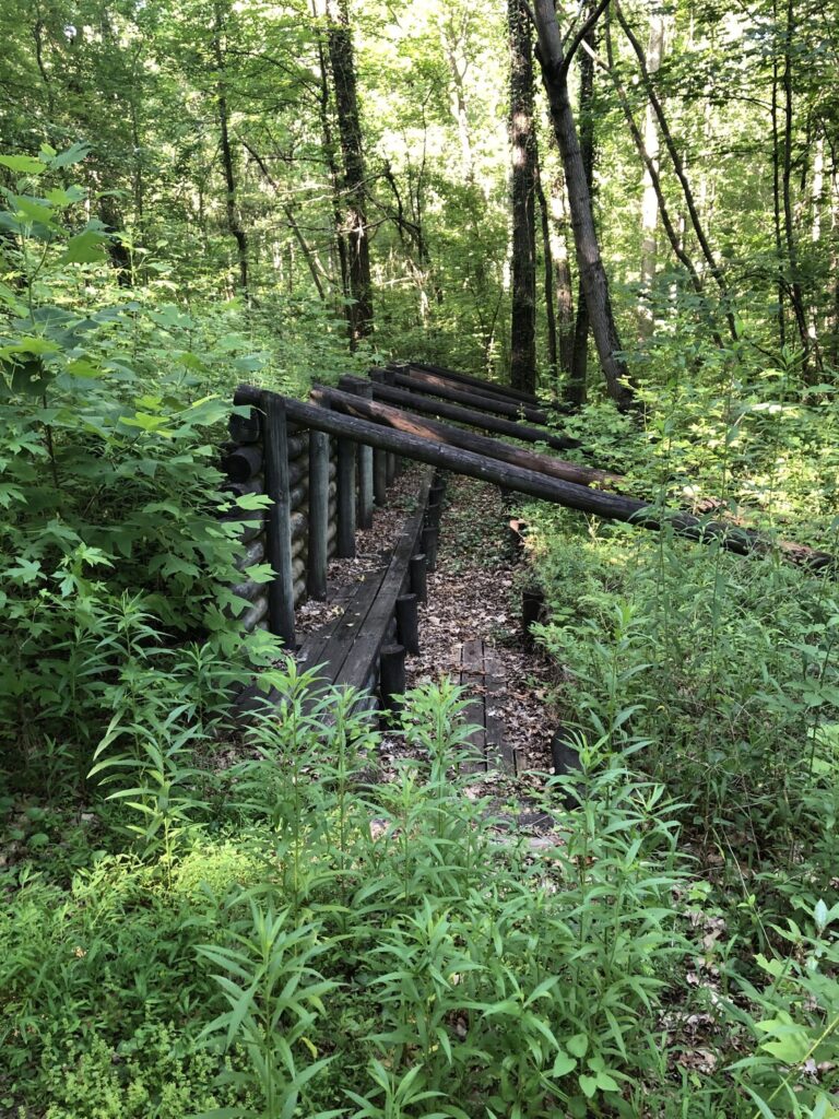
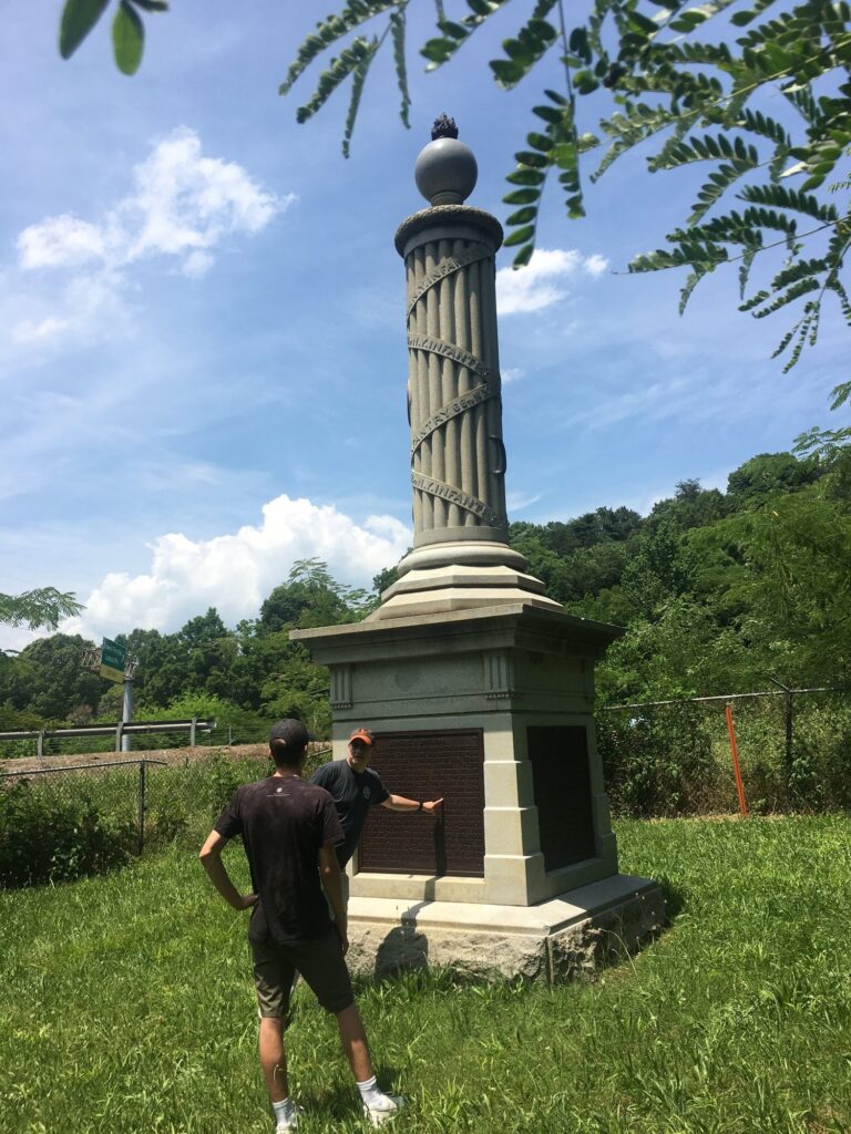
The hike to the Illinois Monument was the one big highlight of our visit to Kennesaw Mountain. – Photo by the author
And part of me feels like the NPS has largely caved to that user base here. It certainly could be that the visit started with a bad experience and that colored the rest of it for me, but I honestly found the auto tour to be somewhat hard to follow, and the stops to be not well-interpreted. The one exception was the Illinois Monument, which we hiked to along the route of the Union attack. That was a really nice moment. Apart from the initial stops, the place is oddly peaceful. It’s one of the strangest battlefields I’ve visited so far.
Battle of Kolb’s Farm – Civil War Battlefield #121
While the CWSAC considers the Battle of Kolb’s Farm to be a separate action, the site is included as the final stop on the Kennesaw Mountain auto tour route.
There are a few markers here, and the field seems to be mostly intact – though the modern road intersections are larger than they were in 1864. Sadly, the disappointment continued, as one of the NPS waysides here had Brig. Gen. John White Geary’s name misspelled on a battle map as “Greary”. It was fitting, I suppose.
Atlanta History Center
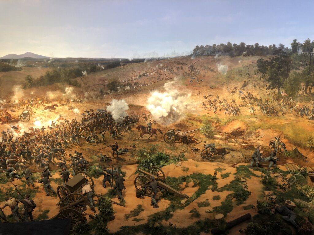
It was time to finally head into Atlanta. I had been looking forward to seeing the newly-restored Atlanta Cyclorama at the Atlanta History Center ever since I heard about it online. I’ve been to see the Gettysburg one several times, and being able to see the only other surviving cyclorama is pretty cool. The restoration looked great – complete with a diorama as it would have been presented back in the late 19th century.
The Atlanta Cyclorama. – Photo by the author
The rest of the museum was great as well. They have a Civil War section that contains some cool weapons, along with the coat that Maj. Gen. John B. Gordon wore at Appomattox. At the time, they also had a large exhibit about the history of BBQ, which I’m sure my now-wife would have loved.
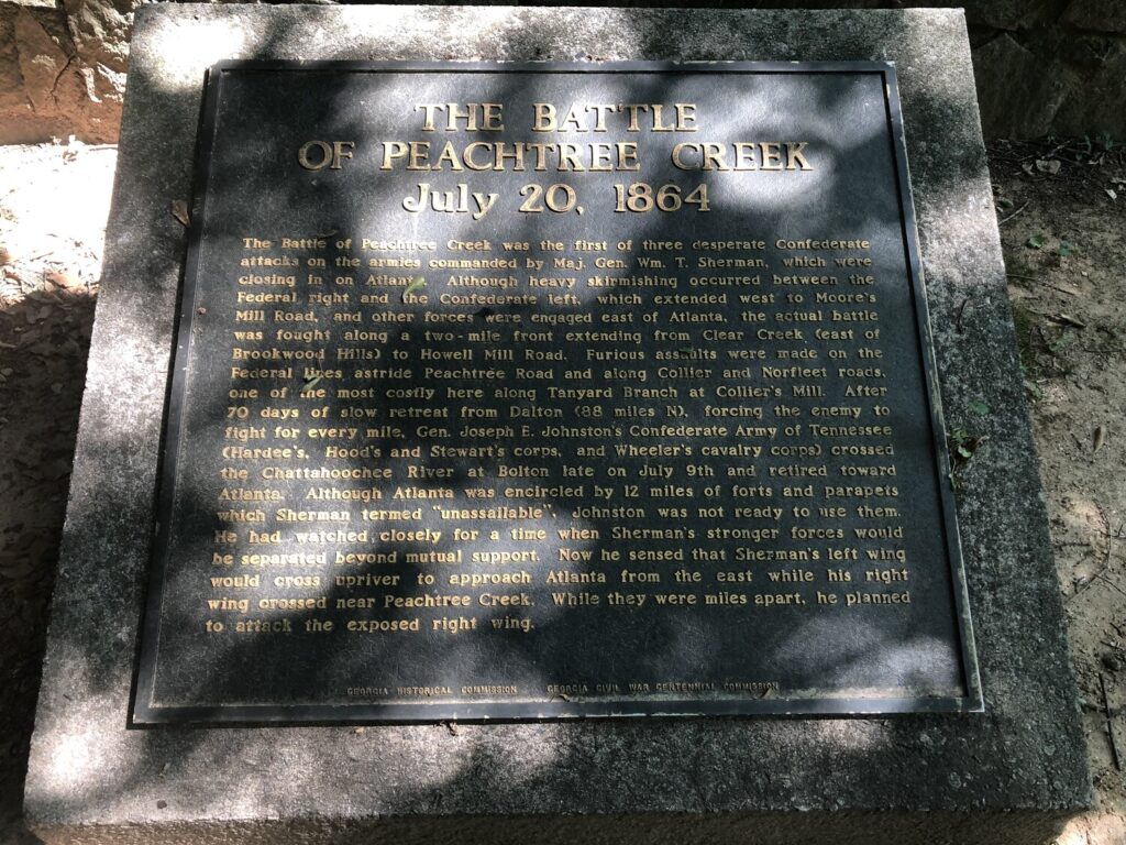
Battle of Peachtree Creek – Civil War Battlefield #122
As I mentioned in previous entries, the battlefields in modern metro Atlanta are all obliterated now by the sprawl of neighborhoods radiating from the city. Only small parcels here and there exist to memorialize these actions. The Battle of Peachtree Creek is an excellent example of this.
One of the tablets in the small neighborhood park that commemorates the battle. – Photo by the author
We visited Tanyard Creek Park, where a few markers exist in a variation of the “pocket park” from before. While the story is told on the tablets, the modern visitor simply can’t visualize what the fighting here was like. It’s a theme that will continue through the rest of our day.
That said, the park itself is lovely and peaceful with some trails. We walked down to Tanyard Creek and the rush of the water was calming. I’ve started to record the sound of the streams at all the battlefields that I visit, and I particularly enjoyed this one.
Battle of Utoy Creek – Civil War Battlefield #123
The landscape of the Battle of Utoy Creek is completely gone. We had no trouble finding the twomarkers that exist along Cascade Road, but they are entirely surrounded by neighborhoods that did not exist 150 years ago.
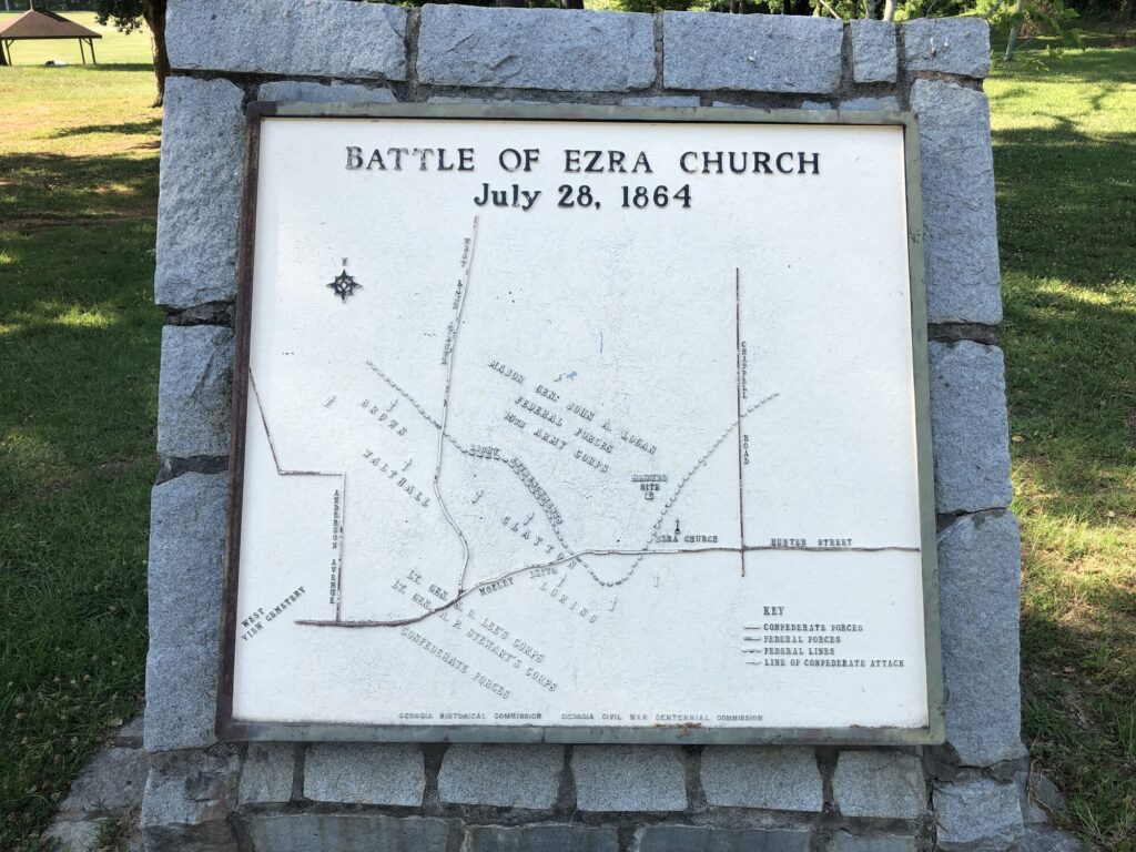
Battle of Ezra Church – Civil War Battlefield #124
The Battle of Ezra Church also has a small “pocket park” adjacent to the C.A. Scott Recreation Center, with several tablets attempting to explain the action to the modern visitor. Once again, though, nothing of the field remains as it was in 1864.
What can I say? I love a tablet with an embossed map. – Photo by the author
Battle of Atlanta – Civil War Battlefield #125
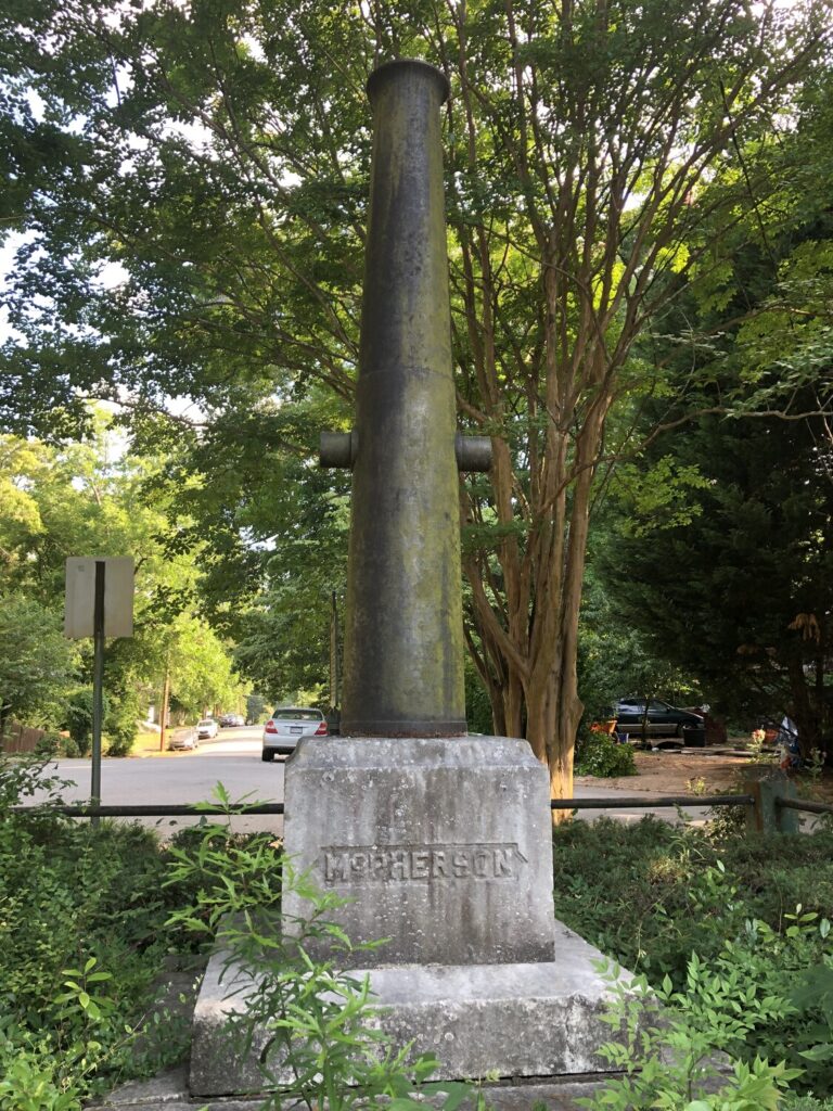
The action that the cyclorama was made to portray. And again, modern Atlanta has just wiped the field of the Battle of Atlanta right off the map. In addition to being packed with neighborhoods, modern I-20 bisects the battlefield and makes it impossible to visualize.
A vertical cannon marks the approximate spot of Maj. Gen. McPherson’s death. – Photo by the author
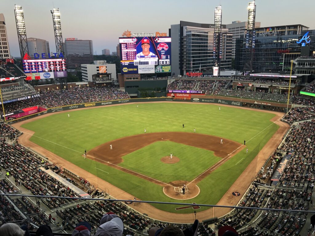
As we were driving down toward the Atlanta History Center, we passed by what was at that time Sun Trust Park – now Truist Park – where the Atlanta Braves play. I had never been to any MLB stadium outside of my beloved Baltimore Orioles, nor had my nephew. On a whim, I checked whether they were in town, and when I saw that they were scheduled to play the rival Washington Nationals that night, I made the rather spontaneous decision to buy a couple of tickets.
The view from our seats. – Photo by the author
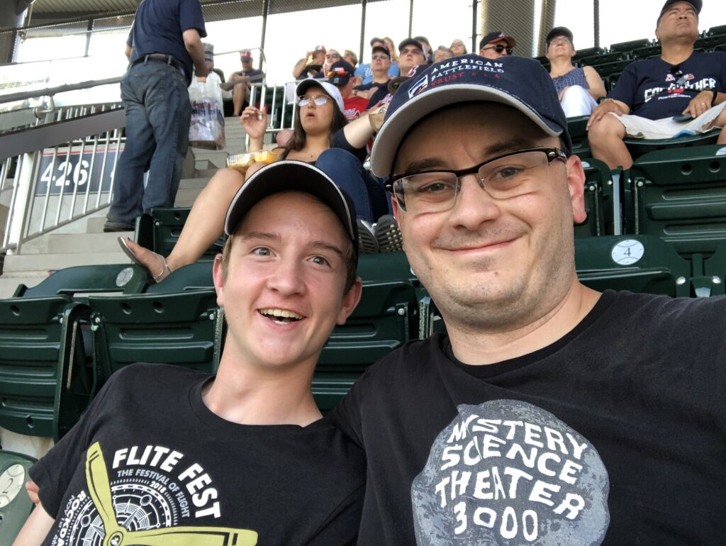
We had a great time! And with former Orioles Kevin Gausman pitching, and Nick Markakis in left field for the Braves, it was almost like seeing my guys. Sadly, the home team was thrashed that night, 14-4.
A couple of happy guys at the ball game. – Photo by the author
After the game, we made the drive back to Chattanooga. There was one more day in town for me to revisit an old favorite, and see a couple of new places, too.
This was going to be an exciting day. My nephew and I were going to check a lot of battlefields off the list. We got up early (no small task for a teenager) and got on the road before 9:30am.
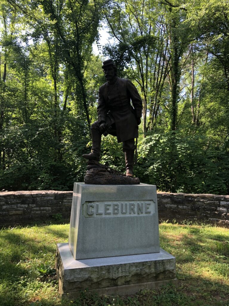
Battle of Ringgold Gap – Civil War Battlefield #109
Not too far down the road, we came to our first stop, the Battle of Ringgold Gap. While not considered part of the Atlanta Campaign, this was right along our route, and I’d never visited before.
The story here is that Maj. Gen. Patrick Cleburne’s men fought for over 5 hours as a rear guard after the Confederate army was forced off of Missionary Ridge outside of Chattanooga. The Union attack here was not well executed, and Grant made the call not to pursue beyond the gap, returning his troops to the defenses of Chattanooga.
Patrick Cleburne is the Confederate hero of the battle. – Photo by the author
We checked out another of the New York monuments – very much like the one at Wauhatchie the day before. It was a little off the beaten path, so that was pretty cool. The main visitor focus for this battlefield is on the small “pocket park” that was built by the Civilian Conservation Corps back during the Great Depression. It’s a parking area with a few markers and picnic tables right off of US-41.
There are a lot of these “pocket parks” along the route to Atlanta. These maps they have are pretty cool. – Photo by the author
The gap itself has clearly been widened over the years to make room for I-75, but you can see that even in its natural state it would have been quite substantial in late 1863.
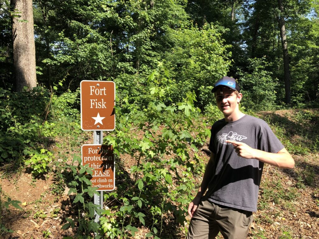
First Battle of Dalton – Civil War Battlefield #110
I just had to take my nephew here. – Photo by the author
There’s a trail near the parking area that leads a little farther up the ridge to the site of Fort Fisk – perhaps named for some distant relative of his? The surprise of seeing that sign definitely put a smile on his face. A nice memory to be sure.
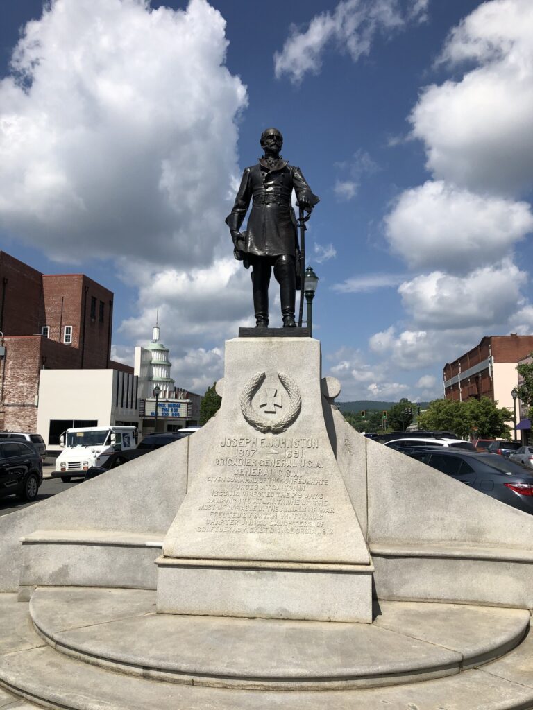
Second Battle of Dalton – Civil War Battlefield #111
The field of the Second Battle of Dalton seems to have been obliterated by modern development. I had a hard time finding any markers for it, and even a couple of the visitors centers and museums in town were unable to direct me to anything concrete.
There is a statue of Joseph E. Johnston in downtown Dalton, but no trace of the second battle fought here. – Photo by the author
That said, my nephew and I got to spend a little time driving around the town, and it seems like a pretty nice place.
Battle of Rocky Face Ridge – Civil War Battlefield #112
I know that a park has since been established north of Dalton to help preserve some of the history of the Battle of Rocky Face Ridge, but that did not exist at the time of my visit. My nephew and I took a look at the southern portion of the field, in Dug Gap.
There is a small parking area there and a few markers and waysides to give the visitor a little bit of the story. From there, we walked on a short trail up to the ridge and saw some of the rock formations and cliffs. It was a very peaceful spot.
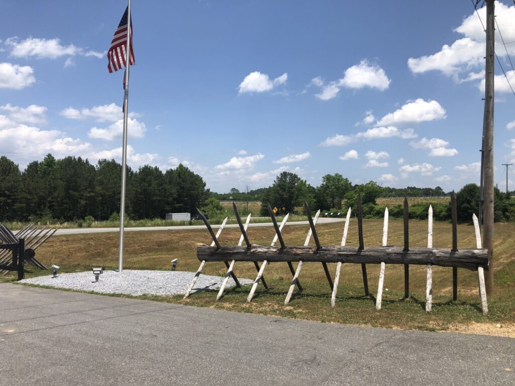
Battle of Resaca – Civil War Battlefield #113
We hit the first of our disappointments for the day at the next stop: the Battle of Resaca. There is a nice park here preserving part of the Union section of the battlefield, but it is only open Friday – Sunday. Of course, we were visiting on a Tuesday.
Chevaux de frise guard the modern entrance to the Resaca battlefield park. – Photo by the author
We were able to park just outside the gate, and see a couple of markers that were nearby, but neither of us wanted to press our luck exploring any farther. One thing that I really liked was the reproduction chevaux de frise that stand right next to the gate. At least there won’t be any cavalry attacks here!
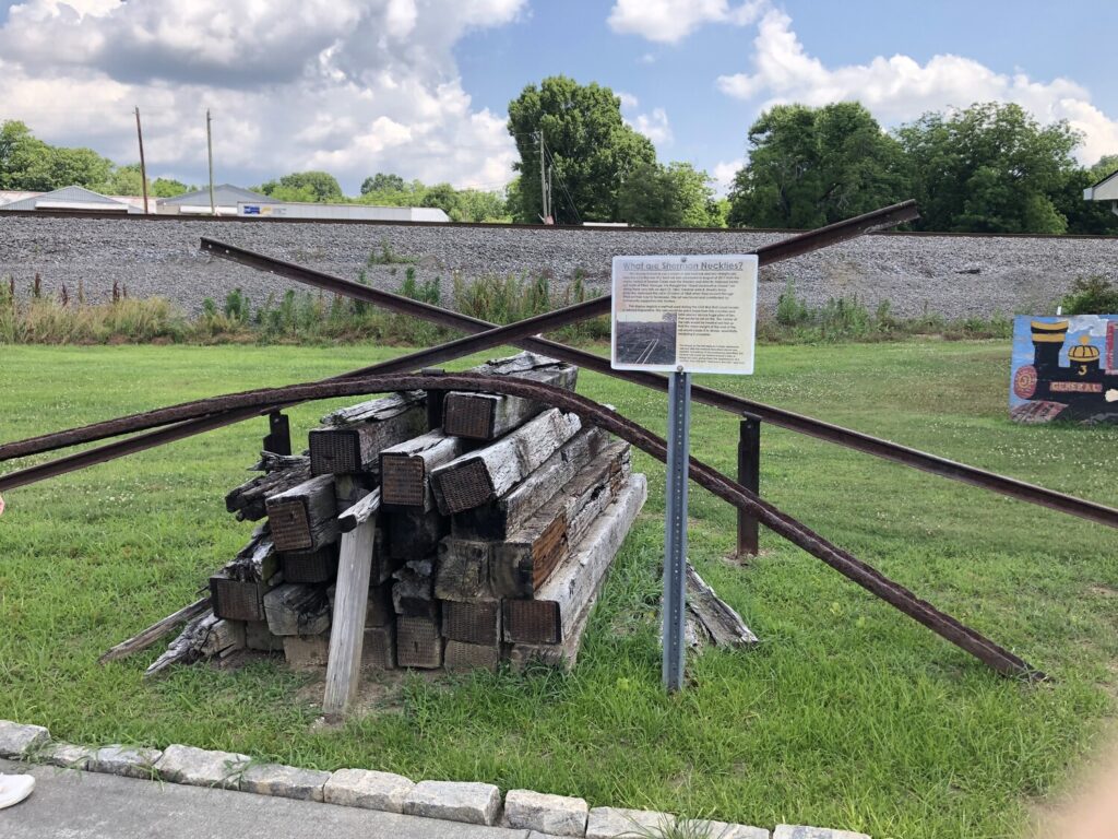
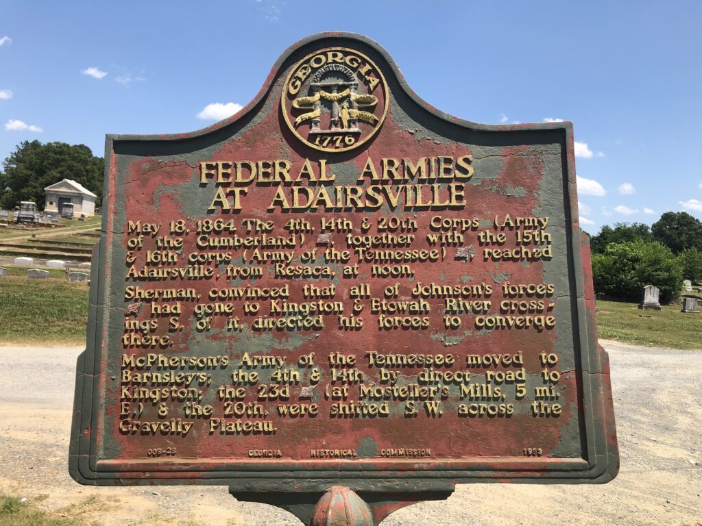
Battle of Adairsville – Civil War Battlefield #114
There isn’t much going on at the site of the Battle of Adairsville. In truth – none of the battles of this campaign produced the kind of fighting and casualties that one would expect from major Civil War battles. This campaign was really a master class in maneuver given by Maj. Gen. William T. Sherman.
One of the markers at Adairsville. – Photo by the author
We were able to find a few, kind of rough-looking, roadside markers near a cemetery in town, but that was about it.
Battle of Allatoona – Civil War Battlefield #115
There have been a lot of changes to the field of the Battle of Allatoona since 1864. The most obvious one hits you as soon as you park your car and see the huge earthen dam that holds back the artificially-created Lake Allatoona. That means that a part of this field is now underwater. The day we were there featured plenty of activity going on, with people walking along the trails and taking out their boats.
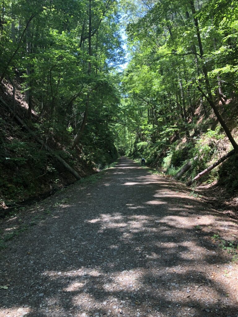
Like so many of the battlefields we are seeing on this trip, the reason it came to be was all about the railroad. The Western and Atlantic Railroad cut right through a gap here, and that narrow channel through the mountain still exists. The railroad has been converted to a walking path, and about half way down the trail, there is a set of stairs leading up the side to the star fort which commanded the approaches here.
This trail lies where the railroad once came through. – Photo by the author
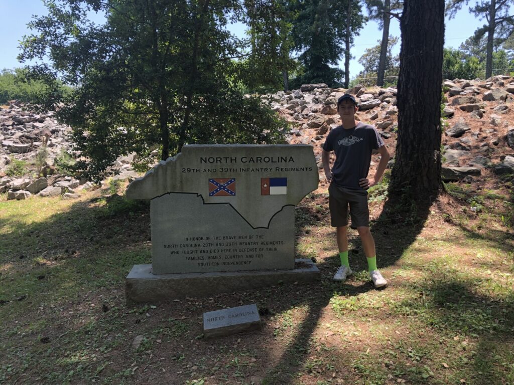
Apart from the remains of the fort, there are several waysides and even a few monuments – the coolest of which are stone markers that commemorate the different States that supplied men for this fight. I couldn’t resist having my nephew pose with the North Carolina one, since that is where he grew up. Sadly, there was no Maryland monument.
My nephew poses with the monument to North Carolina troops at Allatoona. – Photo by the author
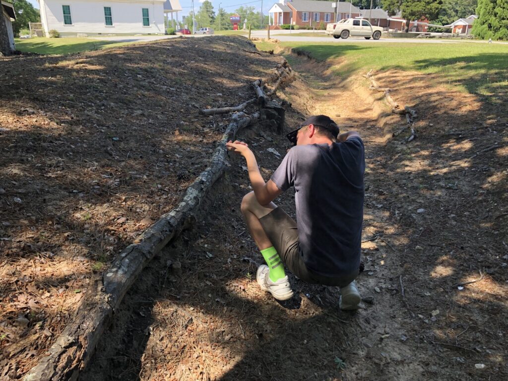
Battle of New Hope Church – Civil War Battlefield #116
The church from the Battle of New Hope Church still exists, and while there is another of the “pocket parks” here, I get the sense that the congregation takes a certain amount of pride in the field. There are worm fences and even some earthworks here, and they were in pretty good shape.
My nephew tries out the defenses at New Hope Church. – Photo by the author
As we get closer to Atlanta, less and less land is preserved in the sprawl of the modern metropolis. Only small little landmarks are left in the wake of countless new neighborhoods. That’s the story here as well.
Battle of Dallas – Civil War Battlefield #117
I’ll be honest – I was very confused by the Battle of Dallas. And it isn’t like this is my first time on a battlefield. There are plenty of markers scattered around town, but the places that they seem to label as being part of the defensive lines don’t seem all that defensible to me. Maybe the terrain has changed in the last 150+ years with the massive growth of Atlanta?
I found these isolated signs, in the midst of new development, difficult to follow. – Photo by the author
This feels like the kind of place that I would need to study a lot, and come back with some period maps to try to get my head around it. I just wasn’t able to grasp it on the field.
I will add: the best wayside that I found was over behind the Chamber of Commerce building.
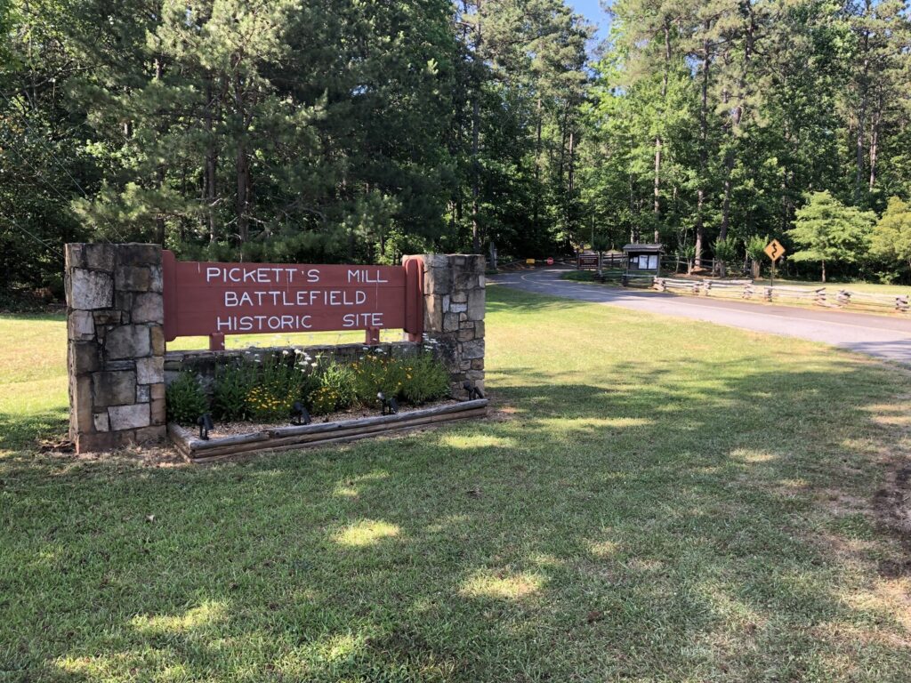
Battle of Pickett’s Mill – Civil War Battlefield #118
The Battle of Pickett’s Mill has been partially preserved as a Georgia State Park, but like Resaca, it wasn’t open on the day I can through. It’s a shame, because it seems like it may be pretty solidly interpreted. For now, my nephew and I had to settle for the marker in the small parking spot out front.
Pickett’s Mill was closed. Bummer! – Photo by the author
Battle of Marietta – Civil War Battlefield #119
I was initially confused by the Battle of Marietta. It turns out that this was really a series of smaller actions that occurred around the area rather than one concerted fight. We visited the site of Gilgal Church, which had some cool reconstructed earthworks.
Field fortifications at Gilglal Church. – Photo by the author
11 battlefields was a fine number for one day. As it was starting to get late, we decided to head back to Chattanooga and resume closer to Atlanta in the morning. There would be a few surprises coming for us – mostly pleasant ones.
I arrived in Chattanooga by mid-morning, and met up with my nephew and brother-in-law. They joined me for the rest of the day of battlefield exploration.
Battle of Davis’ Crossroads – Civil War Battlefield #107
Our first stop was the farthest outside of town – well into northwest Georgia, in fact: the Battle of Davis’ Crossroads. It took quite a while to drive out to that fairly rural area from Chattanooga.
The fighting here was a prelude to Chickamauga, with the Confederates attempting to bottle up the Union forces in the mountain cove to the south. The Federals avoided the trap, and held off the Confederates, with neither side gaining a clear victory.
At the crossroads itself these days, there isn’t much more than a small restaurant – the Pigeon Mountain Grill. We back-tracked a bit to a small pull-off about a mile east of the crossroads where there were a fewwaysidemarkers from the American Battlefield Trust. They were in ROUGH shape and almost unreadable during our visit.
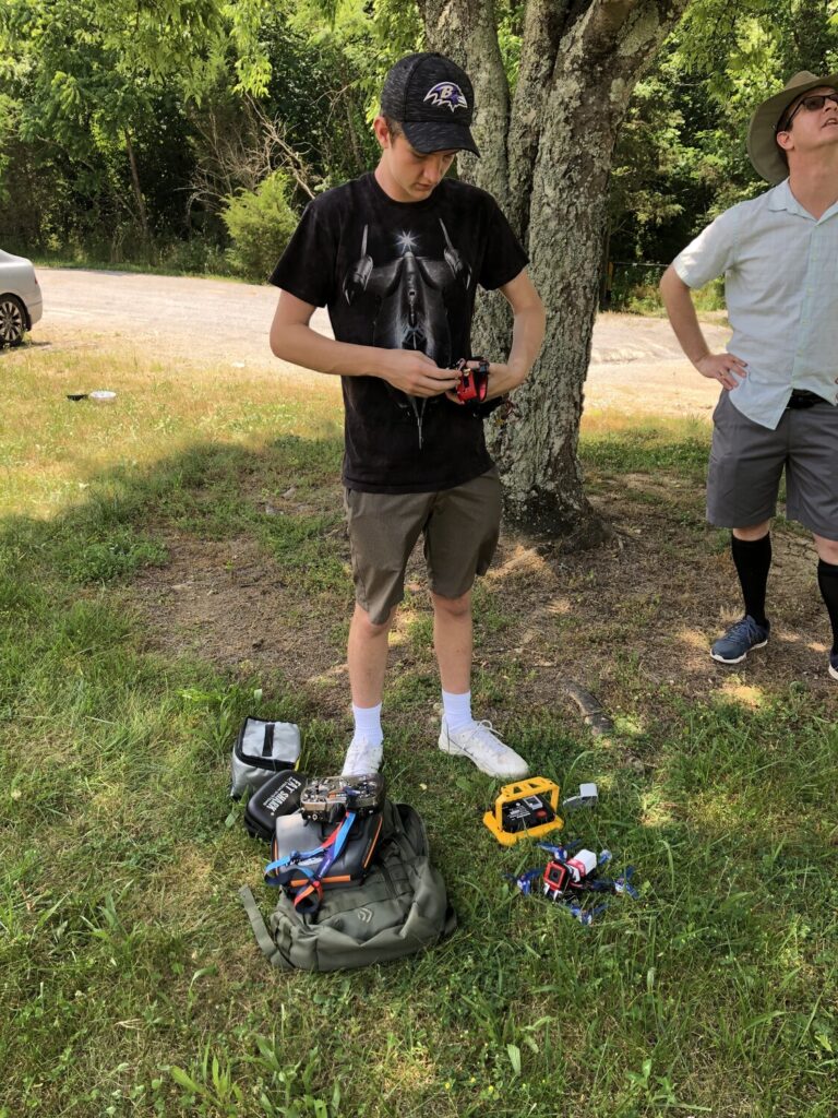
Trying to get the drone in the air. – Photo by the author
My nephew brought along his drone and put it up a few times to get an aerial perspective of the field – something that I’d never attempted before. Sadly, his GoPro was not cooperating and we didn’t get any usable footage.
Battle of Wauhatchie – Civil War Battlefield #108
We packed up the equipment and made our way back toward town. Our next stop at the site of the Battle of Wauhatchie is one I’d been looking forward to seeing for quite a long time. The Federal troops who fought here were from the XI and XII Corps and had been part of the Army of the Potomac just a few months before. George Sears Greene, hero of Culp’s Hill at Gettysburg was still commanding his brigade here. Finally, some familiar faces!
This was a surprise night attack against the Confederate defenses of Lookout Mountain that succeeded in driving the rebels away and clearing a path for resupplying the encircled Union forces in the city of Chattanooga. The establishment of this “cracker line” meant that the Confederate hopes of re-taking the city were over.
Our first stop was the parking lot behind the nearby Walmart. I had read that this spot had the best view of the whole field, and boy was that true. The entire valley below was the battlefield, with Greene’s men holding a position at center-right.
The view of the Wauhatchie Valley from the Walmart parking lot. – Photo by the author
After taking in the spectacular views of Lookout Mountain from this side, we drove over toward the mountain, behind the McDonald’s and Hardee’s, and took the quick hike up to where the XI Corps New York Monument was – there were plenty of familiar names on that one, from Carl Schurz to Wlodzimierz Krzyzanowski. That was a really cool experience actually – checking out a monument that almost no one goes to just steps from I-24.
My nephew and I examining the XI Corps New York Monument at Wauhatchie. – Photo by my brother-in-law, Jonathan Fisk
Once we were back at the car, we headed toward the southern end of the field, where Greene’s brigade had fought. There was a small monument to them there in the front yard of a light industrial building.
Lookout Mountain and Point Park
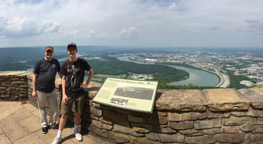
On my first trip to Chattanooga, I never actually got up onto Lookout Mountain. I had heard that the view from Point Park in particular is the greatest of the Civil War-related views. I really wanted to get up there, and luckily the guys were enthusiastic, too.
This is where the NPS memorializes the Battle of Lookout Mountain – or the “Battle Above the Clouds”. We took in the sights near the entrance – including the wide open vista of the city of Chattanooga – and all I can say is that it was absolutely incredible. The photos I took don’t do it justice at all.
My nephew and his dad, posing in front of Chattanooga. – Photo by the author
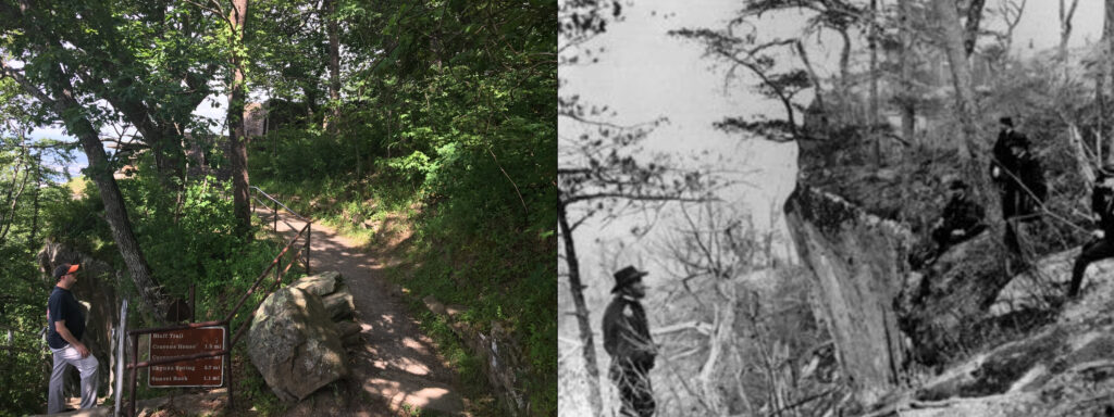
We continued down the northern slope and got to the site of the Ochs Memorial Museum, and Roper’s Rock. Everyone who visited here during the Civil War wanted to get their photo taken, and I was no exception of course.
My nephew and I as close to Roper’s Rock as we were allowed. Moccasin Bend is in the background. – Photo by my brother-in-law, Jonathan Fisk
A little farther down, my nephew indulged my nerdiness and got a photo of me near the spot where Maj. Gen. Ulysses S. Grant also posed with his staff back in 1863. The angle isn’t quite right, but you can see some of the same rock formations.
My attempt at re-creating Grant’s pose on Lookout Mountain – Photo by my nephew
My first trip to Lookout Mountain was absolutely incredible. Truly a bucket list kind of thing. I’m lucky to have been able to share the experience.
Chattanooga National Cemetery
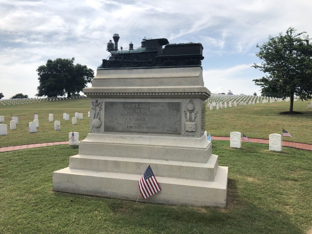
Since it was Memorial Day, there was no better way to commemorate the occasion than with a stop at the Chattanooga National Cemetery. I’m happy to report that it was quite crowded there when we arrived around 4:30pm. I’m so used to seeing people use the holiday as an excuse to go to the beach, and it was somewhat uplifting to see so many others paying their respects to our departed veterans.
Monument to Andrews’ Raiders in Chattanooga National Cemetery. – Photo by the author
The main focal point of the cemetery – at least from a Civil War perspective – is the graves of several of Andrews’ Raiders. These men captured a Confederate locomotive, The General, and attempted to tear up the Western and Atlantic Railroad as they drove from Atlanta toward Chattanooga. The mission ended with many of the men being captured and executed by the rebels as spies. There was even an old Disney movie made about the event.
The next day would have the real fun start: my nephew and I would re-trace the route of the Atlanta Campaign!
I had taken a week of vacation to go visit some family in Tennessee, and of course my favorite thing to do on a trip is visit battlefields – especially ones that I hadn’t visited before. For this trip, the main focus would be to attempt to see all the battlefields of the Atlanta Campaign, and while I was driving, to stop at a few fields that I had missed before in Virginia and eastern Tennessee. This “part 1” post covers my drive from the Baltimore area to Chattanooga.
Battle of Cloyd’s Mountain – Civil War Battlefield #103
Located just north of Dublin, VA. There is a small pull-off along the west side of VA-100 that has a few monuments and markers. The field here is quite pretty – with rolling terrain and fields leading all the way up to the mountains.
The view of the field from right off VA-100. – Photo by the author
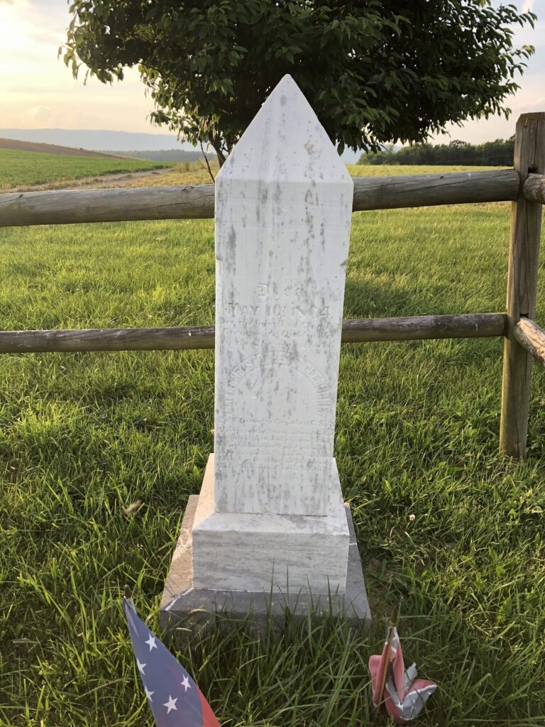
Confederates were overwhelmed in this fight, and the Union troops succeeded in destroying their target: a railroad bridge carrying the Virginia & Tennessee Railroad. A relatively small engagement, the Battle of Cloyd’s Mountain is most notable for who participated. On the Confederate side, Brig. Gen. Albert Jenkins was mortally wounded here and captured by Union forces. He would die from his wounds less than 2 weeks later. Patrick Cleburne’s brother, Capt. Christopher Cleburne, was also mortally wounded and buried on the field.
The grave of Capt. Christopher Cleburne. – Photo by the author
A very small Confederate force under the command of Maj. Gen. John C. Breckinridge fought a holding action for two days against a Union force while facing more than 4-to-1 odds. Eventually, they were undone by a lack of ammunition and were able to retreat through the mountains as night fell. Union troops occupied the area and caused quite a panic among the citizens.
There is a small wayside that does a good job explaining the action and some human interest stories related to the fighting. It is located in a small pull-off along US-11 east of town where it crosses the Holston River.
I continued on my way and made it as far as Knoxville, TN before finding a hotel for the night.
Battle of Campbell Station – Civil War Battlefield #105
In the morning, I made my way down the road to visit the site of the Battle of Campbell’s Station. This battlefield is sadly not very well-preserved nor interpreted.
There is a wayside in Founder’s Park that talks about the battle. It seems like it was a pretty minor holding action to keep the Confederates at-bay as the Union forces filed into the defenses of Knoxville.
Nothing exists of the fort today – in fact it was basically on the site of the modern Fort Sanders Regional Medical Center in Knoxville. There are a few markers about the fort and battle just east of the hospital campus along S 17th Street. The area is now rather built-up and primarily residential, but it is easy to see how holding the top of this ridge would have been fairly dominating.
Looking to the north from the top of the ridge near Fort Sanders. The Confederates would have been attacking toward the camera here. – Photo by the author
Confederate troops under Lt. Gen. James Longstreet attempted a bayonet charge against the Union defenses here and were repulsed with heavy losses. Knoxville would remain under Federal control.
With these visits concluded, there were only a few more hours in the car until I would arrive in Chattanooga to start the real fun.
Chattanooga Campaign – Civil War Battlefield #11 First Battle of Chattanooga – Civil War Battlefield #12 Second Battle of Chattanooga – Civil War Battlefield #13 Battle of Chickamauga – Civil War Battlefield #14
It’s hard to believe that it has been over 20 years since I visited my first battlefields in the western theatre, and it all happened somewhat accidentally.
A few friends and I had planned a trip to see Dave Brubeck perform in Knoxville, TN – I had been a fan of his music since high school, and the chance to see him live was too much to pass up. One of my close friends grew up just outside Knoxville, so the plan was to stay with his parents, see some sights, and go to the show. It turned out to be a really great trip – and yes Brubeck was incredible.
One of the things that my friend wanted to do while we were down south was to drive down to Huntsville, AL to visit the US Space and Rocket Center. I had never been, and I have always enjoyed the Air and Space Museum in Washington, DC, so I agreed – mainly because they have a Saturn V rocket, and I had never seen one in person.
I wasn’t nearly as much of a Civil War nerd at the time as I am now. Living in the Baltimore area all my life, I had been to the major NPS sites that my family knew about that were close to home: Gettysburg, Manassas, Antietam, and Harper’s Ferry. We had also taken a few road trips when I was a kid to places like Hampton Roads and Charleston. I had been to a total of 10 battlefields so far, and had very happy memories of tramping around Gettysburg, but at that point in my life, I didn’t really understand the full scope of the war, let alone the idea that there were battles that happened that didn’t become national parks later.
I took only one photo on that first trip to Chickamauga – I was so confused by what that acorn was all about! – Photo by the author
For whatever reason, though, I noticed that our route was going to take us past Chattanooga, and I was able to convince my friends to take the long way through town to be able visit Chickamauga. I drove past Missionary Ridge and saw the prominence of Lookout Mountain for the first time. When we finally got to Chickamauga, we didn’t stop at the visitors center. We didn’t do the actual driving tour. I had NO idea about how the battle was fought, or the personalities involved. I was, frankly, a little lost. I only knew the broad strokes of Gettysburg and that was it as far as Civil War knowledge went for me at the time. In fact, I would say that I didn’t really learn anything during our brief drive-through tour of Chickamauga, but it was still my first time in Chattanooga, and I still count these as my first visits to these fields, because they did begin to open my eyes to the idea of just how much I didn’t yet know.
I’ve since been able to return to Chattanooga three times – even bringing my family along, too. The stories of those trips are coming soon. Through the Internet, I’ve been able to discover so many books and resources to learn more about the conflicts that happened there, and I now consider Chickmauga to be my second-favorite battlefield, right behind Gettysburg. Those mountains and valleys straddling the TN / GA border will always hold special memories for me.
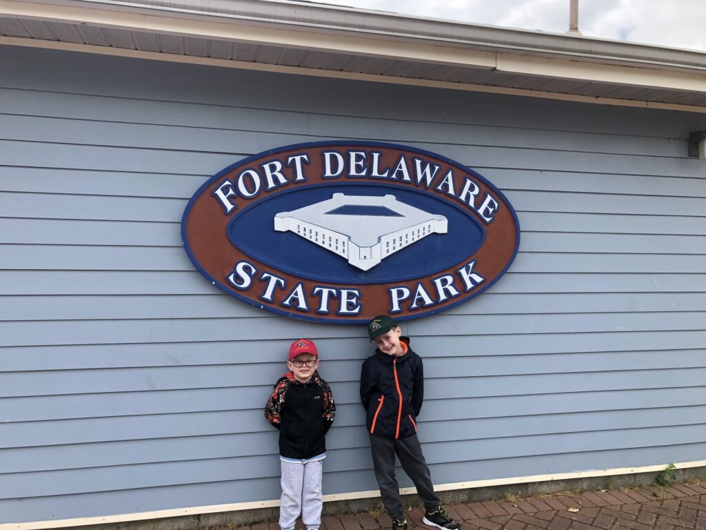
Even before I moved to Delaware, I had my eye on a visit to what I had heard was an excellent mid-19th century, Third System fort that sits on a small island in the middle of the Delaware River, appropriately named Fort Delaware. Back on May 25, 2019, my boys and I made our first trip over to Pea Patch Island to take in the sites of this wonderful old defensive structure. We have since returned a few more times – it’s a really nice experience.
Entry to the fort is from a small gift shop in Delaware City. – Photo by the author
Today, the island and fort are contained within Fort Delaware State Park, and park staff engage in living history presentations on the island as if it was 1864. Most everyone on the island is “in-character” demonstrating various aspects of life in a coastal fortification turned prison during the Civil War.
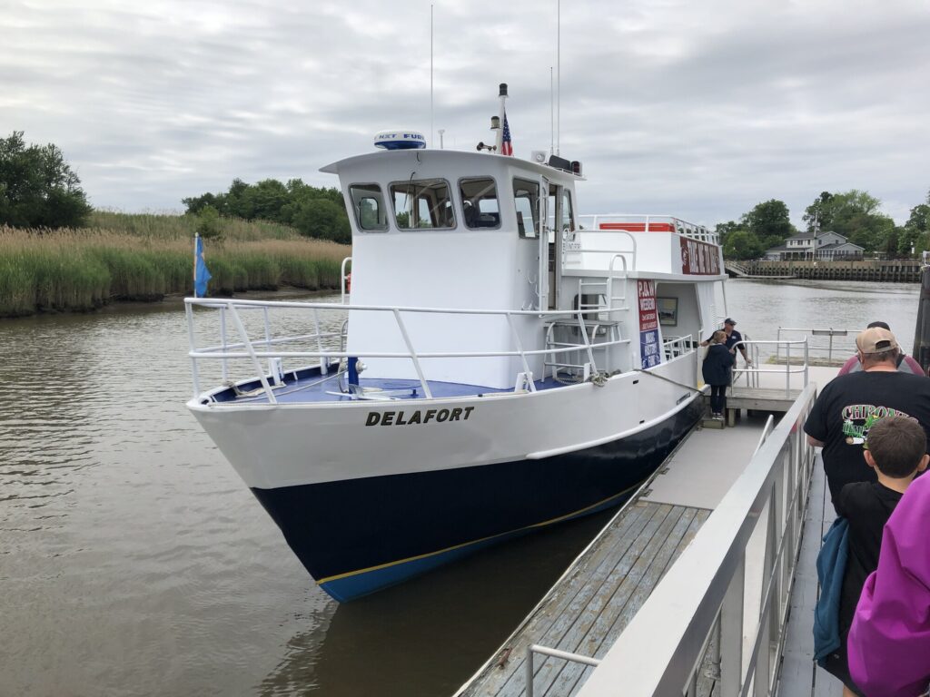
Since the fort is located on an island, the only access is by ferry boat from Delaware City. It also operates seasonally, shutting down visitor access between October and April. We bought our timed tickets in advance online, but I think it is also possible to get walk-up tickets from the gift shop. After a quick stop at the restroom, we were ready to board the Delafort for the 10-minute ride over to the park.
The Delafort is the ferry that runs from Delaware City, to Pea Patch Island, to Fort Mott, NJ, and back. – Photo by the author
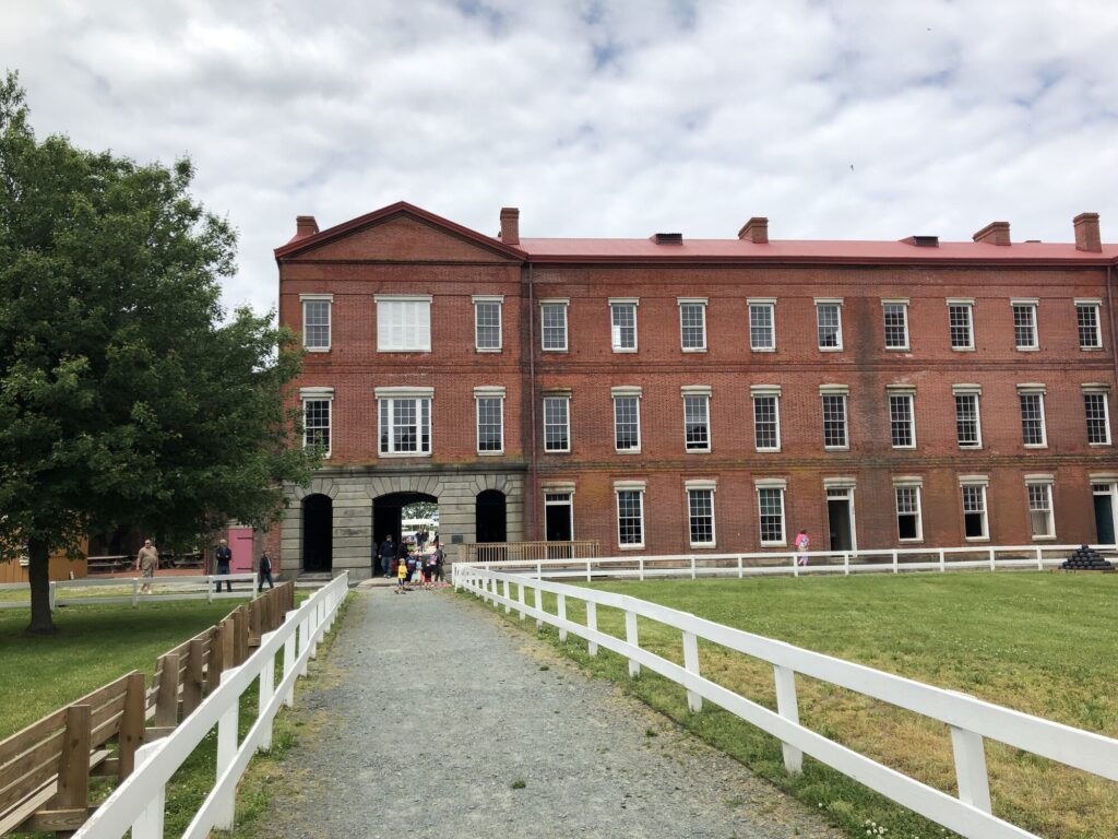
Once the ferry docks on the island, a tram takes visitors across the marshy part of the island over toward the historical fort. An audio presentation during the ride talks about some of the history of the island, as well as describing some of the wildlife that can be seen in the marsh as you go by. Eventually, as you make the transition to dry land, the massive fort comes into view.
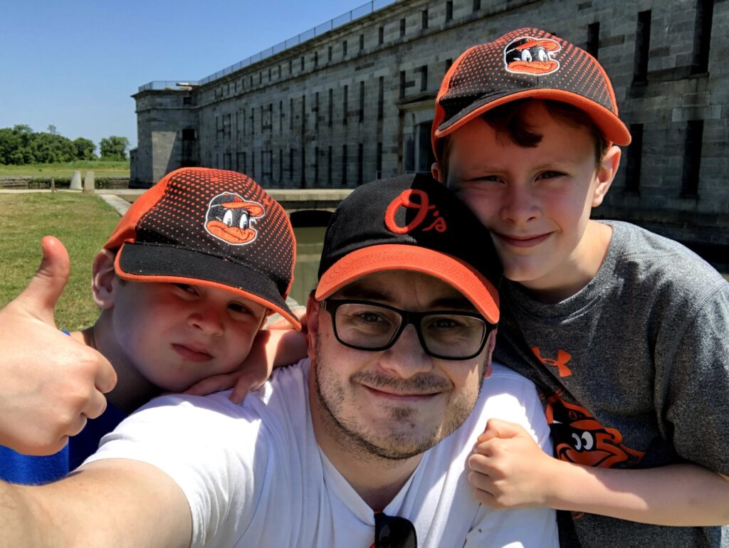
My crew at the sally port. – Photo by the author
Built with the intention of defending Wilmington and Philadelphia from naval attack, the fort was completed in 1859 – just in time to be garrisoned at the outbreak of the Civil War. Like many of the Third System forts, Fort Delaware went through a series of Endicott conversions in the late 1890s to install larger caliber guns in huge concrete emplacements. The remains of the Endicott batteries can be seen on the south side of the island near the modern restrooms, and immediately to the right as you enter the fort. These days, the concrete structures serve mainly as bat habitats.
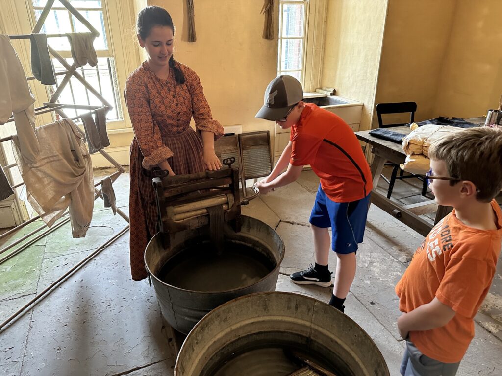
One of the Third System-era structures within the fort houses a small museum and shows what mess, quartermaster, and medical facilities were like. – Photo by the authorOfficers serving at the fort brought their families along. Here my boys learn about how laundry was done before the electric washing machine. – Photo by the author
Every time we have gone, the interpretation of life at the fort has been wonderful. The staff does an excellent job of making the place feel alive as you tour through the various areas within the fort. Favorites for us have been the laundry, mess hall, and blacksmith shop.
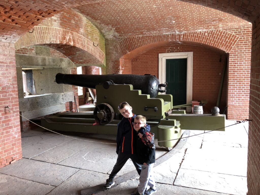
But this was a fort after all, so the real draw is the artillery! Sadly, there isn’t much here in the way of guns, and I believe that what they do have are reproductions. They do a LOT of artillery demonstrations here and it’s generally not safe to do those with weapons that are over 150 years old at this point. A favorite memory for me is from our first visit, when the boys were able to man one of the guns themselves and participate in a firing drill.
My boys with one of the big seacoast guns. – Photo by the author
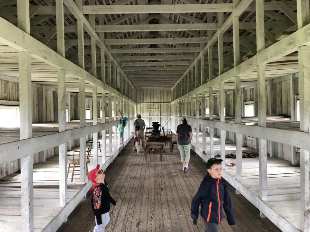
As cool as the guns and casemates are, none of the fort’s defenses were ever tested by an enemy in any era. The main Civil War story here is of the island’s use as a prison camp. Thousands of captured Confederates were confined here. Many died, and there were even a few daring escapes that took place. At the height of it, there were dozens of prison barracks built outside of the fort walls for enlisted men. Captured officers were generally kept within the fort itself. The park has rebuilt one of the barracks from a set of original plans to give visitors a feel for what the conditions would have been like, but it doesn’t do justice to the scale of the prison population that was kept here.
The view inside the rebuilt prison barracks. – Photo by the author
As a fort nerd, I really enjoy going to Fort Delaware. Between the ferry ride and the in-character interpretation of the place, each visit is a true experience. And the fort is in terrific shape – so many of the Third System forts have been messed with over the years – with some becoming almost unrecognizable after going through Endicott conversions. Seeing one that is still at its original height and with many of the interior structures still intact is a real treat. I can’t wait to plan my next visit in the spring.
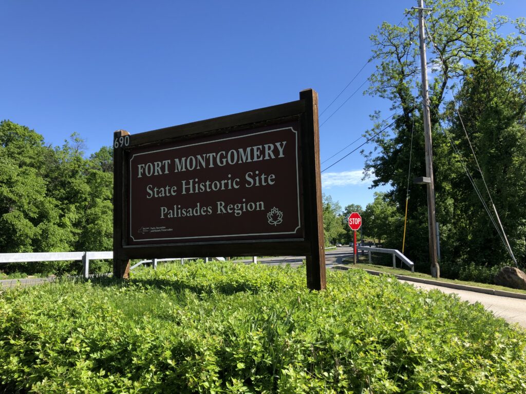
The sign at the entrance to Fort Montgomery State Historic Site. – Photo by the author
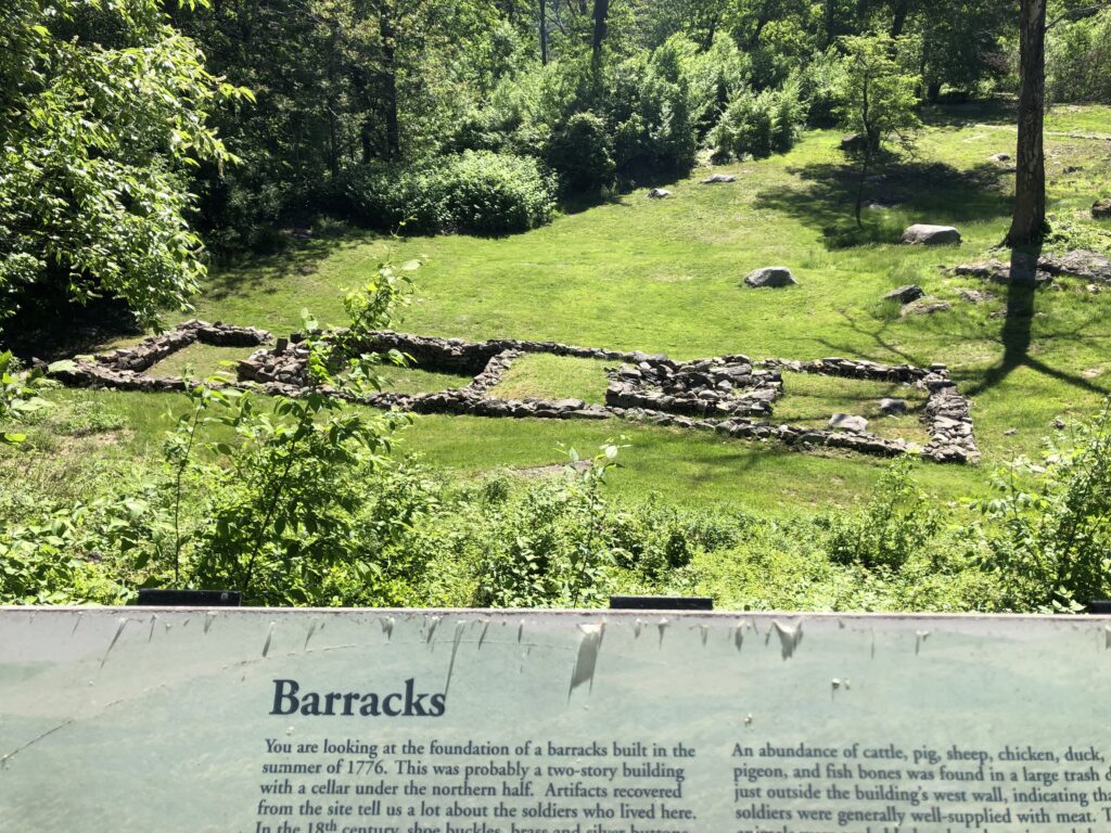
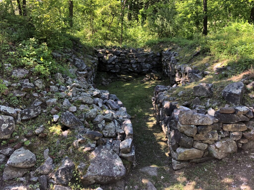
Built to defend a chain that was stretched across the Hudson River to prevent the British Navy from sailing upstream, the fort was still under construction in the fall of 1777. It was defended by a small garrison and by the mutually-supporting fort that was built on the south side of Poplopen Creek, Fort Clinton. The British attacked both forts on October 6, 1777. Since Fort Montgomery was still unfinished at that point, it was particularly vulnerable. The American forces were overwhelmed, and both forts fell with heavy casualties taken by the Continentals – mostly as prisoners.
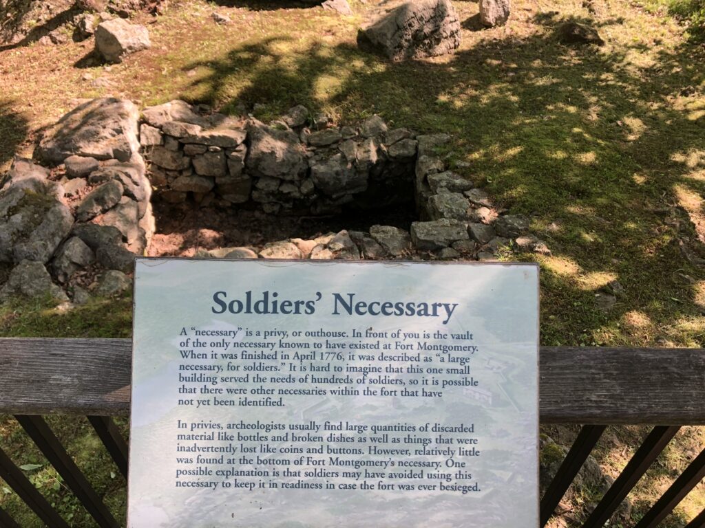
Ruins of a barracks that once housed soldiers at the fort. – Photo by the authorThe “Necessary” – as you might imply from the name – was the 18th century version of toilets. – Photo by the authorMore ruins – this time of the fort’s powder magazine. This was central to the soldiers’ ability to defend themselves. – Photo by the author
Today, the site is preserved as a New York State Historic Site, and like Stony Point, affords the visitor lovely views up and down the Hudson River Valley. There are plenty of ruins of foundations of many of the fort buildings, but its somewhat difficult to get a sense for what the fort was like just from that. It is very clear that a lot of archaeological work has been done in recent decades to get to this point, but the site doesn’t read as a “fort” to the modern visitor without a lot of imagination. It also doesn’t help that modern US Route 9W cuts a path directly through the original footprint of the fort.
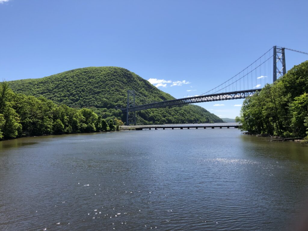
The view to the southeast of Bear Mountain Bridge and “Anthony’s Nose” is quite lovely. There is plenty to interest nature-lovers here, as well. – Photo by the author
There were 3 artillery pieces (a 32-pounder, 16-pounder, and 3-pounder) displayed at one point along the walking tour of the fort, but they are unfortunately all reproductions. When I visited, the museum was closed, so I can’t say whether that would have helped with the interpretation. Sadly, it’s sister Fort Clinton was largely erased from the landscape in order to make way for the Bear Mountain Bridge and US-202. I’ve heard that there may be some remnants still within Bear Mountain State Park, but I did not explore myself.
All in all, the site is well-interpreted, and has a lot to offer in terms of archaeology and natural beauty, but the uninitiated may have difficulty piecing everything together from what is left here.
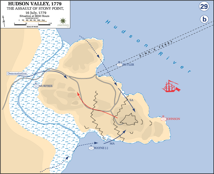
The next battlefield I visited on my New York trip was the Battle of Stony Point – and what a field it is!
It was here that I first learned of my now-favorite Revolutionary War figure: Brig. Gen. Anthony “Mad Anthony” Wayne. Using the same type of tactics that had been used by the British against his own forces in the 1777 Battle of Paoli, Brig. Gen. Wayne launched a midnight surprise attack, against a fully-manned British fortification atop steep cliffs, located on a peninsula. The only approaches were through swamps. In order to ensure that the surprise was complete, and that there were no accidental warning shots fired, Wayne ordered his troops to make the attack with unloaded weapons. The Continental Corps of Light Infantry would only use bayonets in the assault.
Map of the successful American attack against the British Position at Stony Point. – Map from the United States Military Academy History Department
The plan worked to perfection. The British were completely caught off-guard and Wayne’s troops executed a double-envelopment and took the fort and hundreds of prisoners.
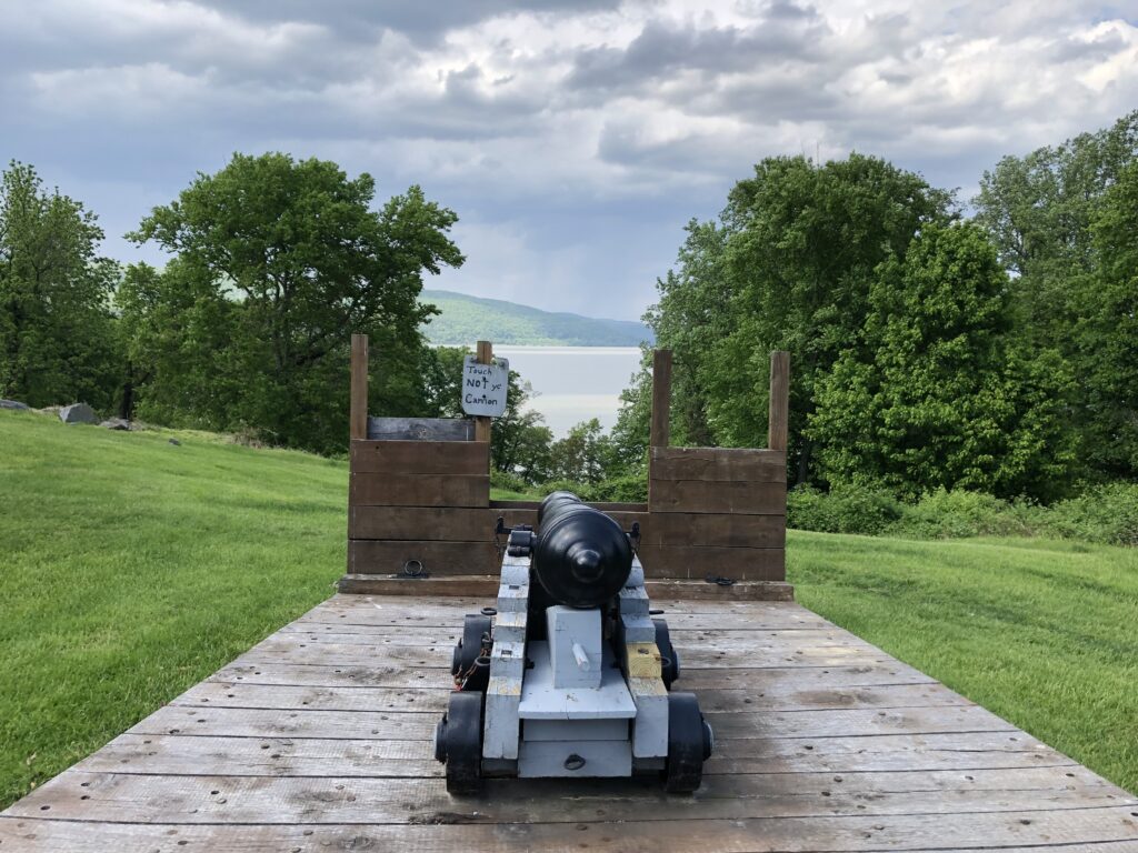
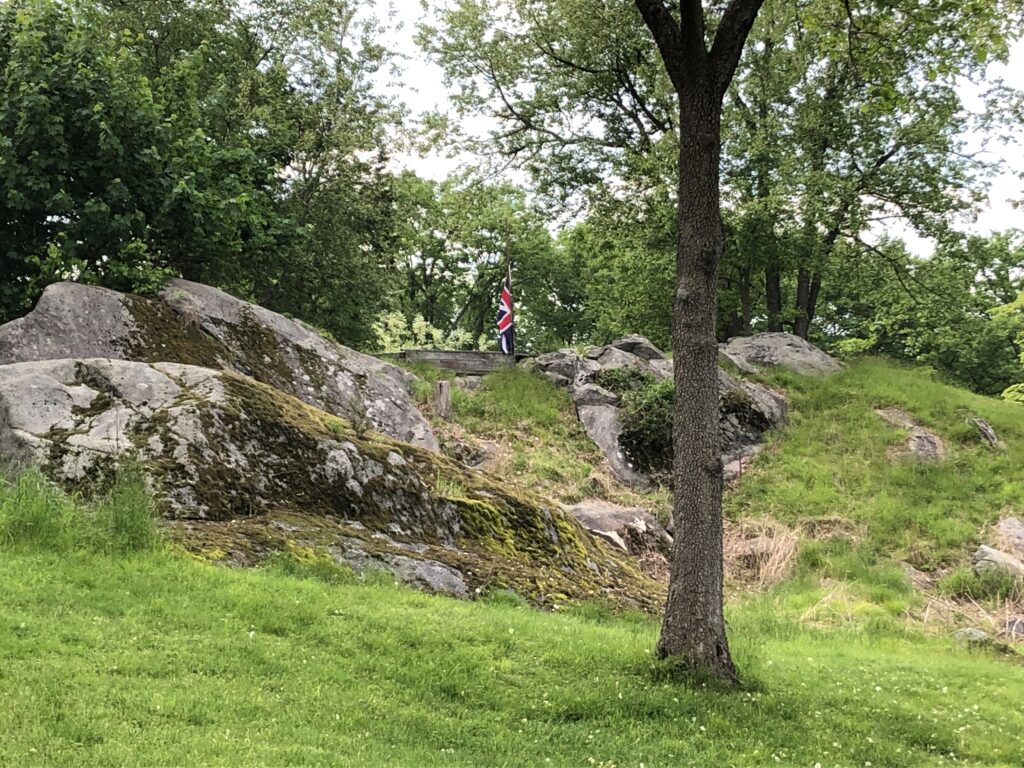
Today, the field has been made into a really lovely New York State Park. It seems pretty well-preserved to me (at least when compared with other Rev War battlefields, which all seem to be neighborhoods or shopping districts these days). There are several interpretive markers that do a great job of telling the story, and even a few artillery pieces.
A lone cannon points up-river at Stony Point. – Photo by the authorThe center of what was once the British fort on Stony Point. The terrain on the top of this peninsula is really unique with multiple rock outcroppings. – Photo by the author
I’m not primarily a Revolutionary War nerd, but the Battle of Stony Point really prompted a lot of interest from me. It doesn’t get the big headlines like Valley Forge, Saratoga, Yorktown, or even Brandywine, but its story is every bit as worthy.
Regular readers will know that my first history-nerd love is the American Civil War, but when I’m traveling through an area, I’m happy to explore all the history that place has to offer. It’s a great way to learn new things and expand your horizons. And it’s really fun when you can find new connections in history that you never knew about.
That’s what happened as I drove through Pennsylvania on the way to the site of the Battle of Minisink.
An aqueduct designed by John A. Roebling – Photo by the author
My route took me across the Delaware River at the town of Lackawaxen, PA. The one-lane vehicle bridge that I drove across began its life as a suspension aqueduct that carried the Delaware & Hudson Canal traffic across the river, cutting down transit times and removing a bottleneck that kept the canal competitive with upstart railroads in the mid 19th century. The structure was designed by John A. Roebling, the great engineer who is most famous for designing the Brooklyn Bridge. His son, Washington A. Roebling – who supervised the completion of that project after his father’s death – had served as a staff officer during the Civil War for another great engineer: Brig. Gen. Gouverneur K. Warren. Like I always say: history is absolutely EVERYWHERE.
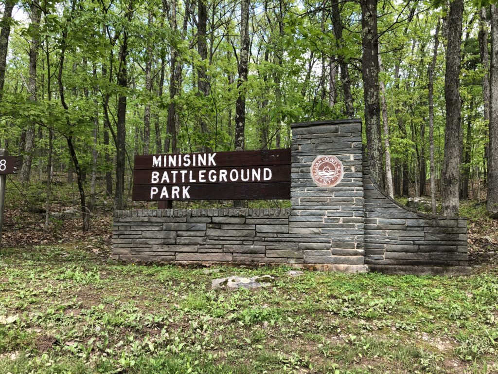
This sign greets visitors at the entrance to Minisink Battleground Park. – Photo by the author
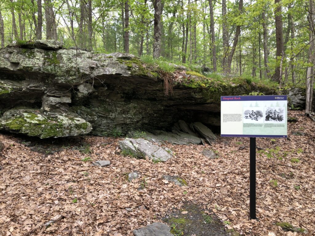
The history that I was actually trying to find was just up the hill from the crossing on the New York side of the river. The site of the Battle of Minisink is now a county park and seems to be fairly well-preserved. It consists of a wooded hilltop with a small interpretive shelter and several monuments and markers. This was a relatively minor skirmish in the course of the war – only about 200 total combatants were involved – but it was comparatively bloody. The British forces overwhelmed and surrounded the small colonial militia force that attempted to hold out. Those who weren’t able to flee were not afforded the luxury of becoming prisoners.
Hospital Rock – the wounded militia who attempted to shelter here after their lines collapsed were all slaughtered by the British. – Photo by the author
One of the markers I read on the field mentioned that there was a monument to the battle in nearby Goshen, NY – which happens to be one of my favorite towns in this part of the country because of its connection to the 124th NY who fought on Houck’s Ridge at Gettysburg. I figured that a Revolutionary monument was also probably worthy of a visit. Especially because according to the markers, at least some of the dead from this field were buried underneath it.
Monument to the Battle of Minisink in Goshen, NY. – Photo by the author
And while I’m in Goshen, I have to re-visit their lovely monument to the 124th NY “Orange Blossoms” regiment, who took extremely heavy losses in the Triangular Field at Gettysburg on July 2, 1863.
Monument to the 124th NY – Photo by the author
Despite the occasional rain shower I encountered during the day, it was an excellent leg of my New York trip. Stumbling onto historical connections that I never knew existed is one of the most satisfying feelings, and it’s why I’ll always look forward to stopping for every roadside historical marker I come across.
In April of 2019, I did something that I had never done before: I planned a multi-day battlefield stomping tour of West Virginia, southwestern Virginia, and eastern Tennessee that would take me to some of the most remote places I had visited on my own. It was scary and exciting all at the same time. I spent weeks studying Google Maps and laying out the perfect route. I booked hotel rooms. Finally, after work on the Wednesday before Easter, I started the journey west.
My plan was to be checked in to the Wingate in Bridgeport, WV that night, but I had a stop that I wanted to make along the way.
Battle of Moorefield – Civil War Battlefield #83
Deviating from my route a bit, I turned north on US Route 220, and found a wayside marker for the Battle of Moorefield. This cavalry fight took place in the gorgeous mountain valley here, and the rolling terrain would have made for some seemingly good defensive positions. The action flowed south toward the town from this spot, but I’m glad that I took the time to take in this picturesque view.
Even if you aren’t interested in battlefields, the drive through the rolling valleys of Harding County, WV is absolutely lovely. – Photo by the Author
Day 1
After a good night’s rest, I woke up early, grabbed some breakfast in the hotel lobby, and hit the road for a great day of exploring. I knew this day would be the trickiest of the trip, as several of the stops that I had planned were up in the mountains, in the middle of the National Radio Quiet Zone (NRQZ) – where my cell phone would definitely not work. If I ran into some kind of problem, I’d have a hard time getting help.
Battle of Philippi – Civil War Battlefield #84
Appropriately, my day started at the first land battle of the Civil War – no, it wasn’t Manassas – it was the Battle of Philippi. There is a nice park along the Tygart Valley River here with flags, markers, and monuments – some of which aren’t Civil War-related. There is also a covered bridge here, which factored in the battle, although it has clearly been modified to handle modern automotive traffic.
The view of the Tygart Valley River from Blue and Gray Park in Philippi. – Photo by the Author
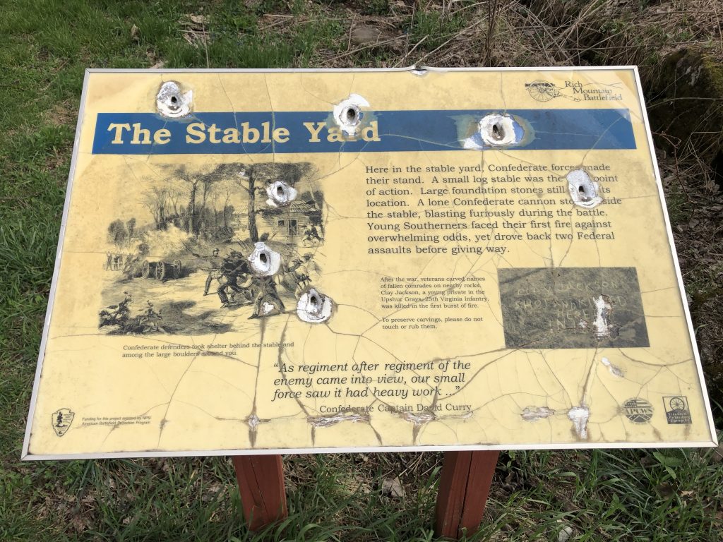
Battle of Rich Mountain – Civil War Battlefield #85
I took a bit of a winding route from Philippi so that I could approach Rich Mountain from the west, much like the Union army did during the battle. My understanding is that this road – which follows the original trace of the Staunton-Parkersburg Turnpike – has since been paved, but at the time I visited, it was gravel all the way up to the summit. Once I was at the top, the first thing I noticed was how serene it was. Speaking as someone who has lived in suburbs all his life, it is shockingly quiet in the mountains of West Virginia.
There is something of a joke among Civil War nerds that a common question that tourists ask is something like this: “If a battle happened here, why aren’t there any bullet holes in the monuments?” (The second question is “Why do these battles always happen in National Parks?”) Well, I can tell you, at Rich Mountain nearlyeverymarker has bullet damage in it (though I doubt it was caused in the 19th century). To be honest, I got a little nervous reading these tablets that had clearly taken rounds fired from behind where I was standing.
In West Virginia, the monuments really do have bullet holes in them! – Photo by the Author
There is a local preservation group that seems to spearhead the acquisition and care of the battlefield land, but they have their work cut out for them given the state of the signs and markers when I visited. The American Battlefield Trust has also helped with securing land at the site.
Even with the rough condition, there are adequate waysides at the top of the mountain to understand what happened during the battle. Most notably, this is the battle that (rightly or wrongly) gave George McClellan the chance to make a name for himself, and basically catapulted him into the command of the Union army. I’d argue that William Rosecrans was actually the critical personality at this battle. Definitely worthy of a visit – this one is a hidden gem of the Civil War.
Battle of Cheat Mountain – Civil War Battlefield #86
A short drive to the southeast from Rich Mountain put me inside the NRQZ. My cell phone would be without a signal for the next 4 hours as I drove up and down the mountains.
My next stop was the Battle of Cheat Mountain, now contained within Monongahela National Forest. There was a short drive up a gravel mountain road right off of US Route 250, approaching the site of Cheat Summit Fort (also known as Fort Milroy) from the east. Even though there were 20th century strip mining operations in the area, the terrain immediately around the fort is still pretty well-preserved, and it is another amazingly quiet spot. There is an observation platform near the middle of the fort, and even some preserved earthworks. Plenty of waysides and markers tell the story. From the sound of things, this was an extremely remote and miserable place to be for the Union soldiers in the early days of the Civil War, with snowfalls occurring even in August.
Battle of Greenbrier River – Civil War Battlefield #87
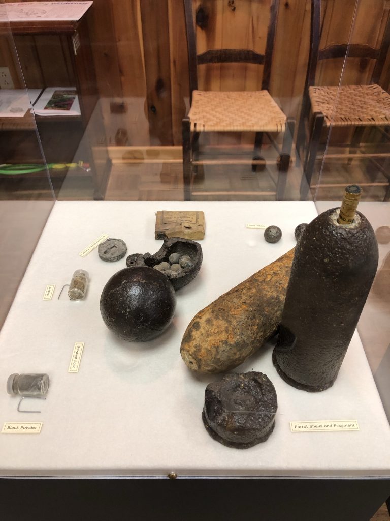
Down in the valley to the east of Cheat Mountain, is the modern day town of Bartow, WV, site of the Battle of Greenbrier River in the fall of 1861. The US Forest Service ranger station on the east side of the town has a small museum with information about the local wildlife as well as some historical displays about the Battle of Greenbrier River, as well as the Battles of Cheat Mountain and Camp Allegheny, including a few artifacts. Outside, a wayside marker describes some cavalry action that took place in the area later in the war.
Some of the artifacts on display at the Greenbrier Ranger Station. – Photo by the Author
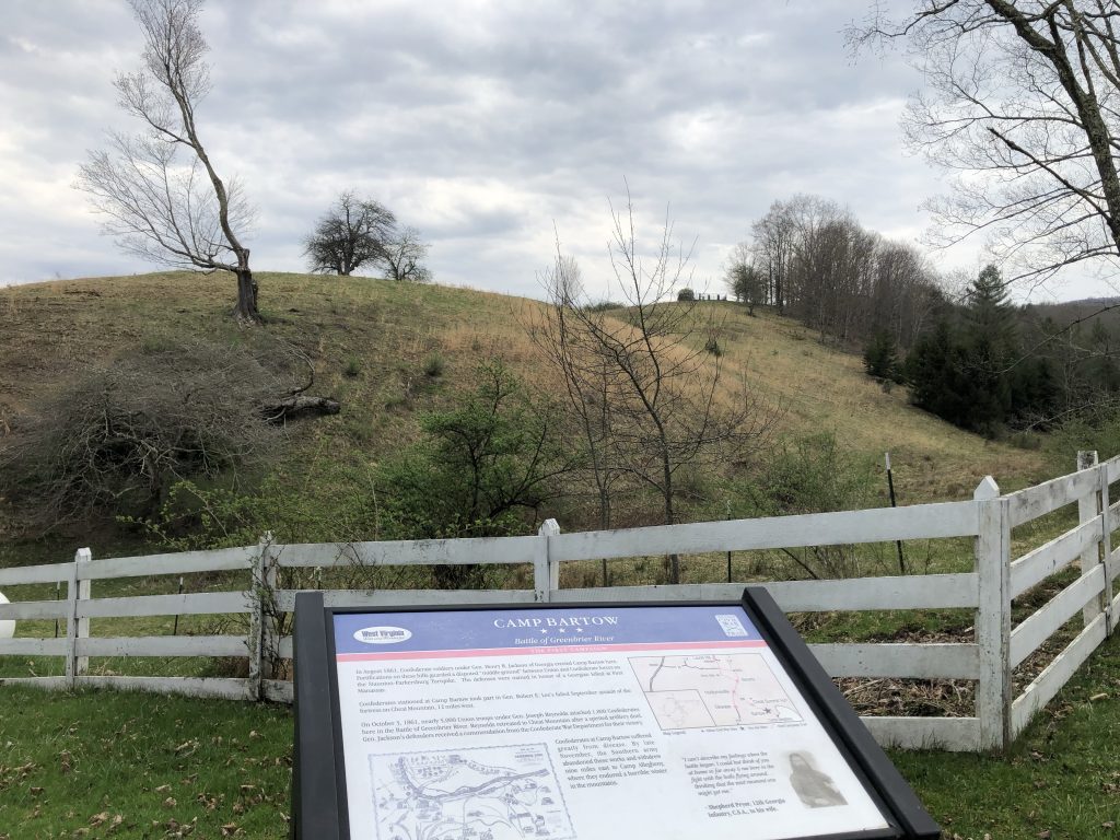
Continuing along US Route 250, and crossing over the east fork of the Greenbrier River, you can find the site of the Confederate Camp Bartow a short distance to the east. A nice wayside there discusses the failed Union “reconnaissance-in-force” that attempted to dislodge the Confederates and that we now recognize as the Battle of Greenbrier River.
The Confederate Camp Bartow was on this hill. – Photo by the Author
Battle of Camp Allegheny – Civil War Battlefield #88
One of the great pieces of information I got from the ranger at the Bartow Forest Service station was that the best approach to the site of the Battle of Camp Allegheny was from the east. A dirt road splits off from US Route 250 immediately before you hit the Virginia state line, and that would be the smoothest way for me to reach the top of the mountain. There is a small area to pull off right at the start of that road so that the couple of waysides and markers talking about Camp Allegheny can be viewed.
The dirt road up to the “Top of Allegheny” was rough. Probably the scariest road I’ve ever been on. It is a single lane, dirt road, twisting up the side of a mountain. It is full of massive potholes that you have to carefully avoid (especially when you’re in a 2009 Honda Civic with very low ground clearance), and absolutely nothing like guardrails. It was a bumpy and potentially dangerous ride, but I was not going to pass up the chance to visit this site!
At the top, I pulled into the small Forest Service parking area just as a slight drizzle started. I took some time to examine the wayside there and then fired up the video camera on my iPhone to capture my impressions.
The site of the historical fort is out in the field you see toward the end of the video. That is all private property today. Once again, this was an extremely peaceful and quiet place. And the fact that you have to take a single-lane dirt road to get there, and that there wasn’t a prayer that you’d get a cell signal (thanks to the NRQZ) really made it feel like you were stepping back into 1861. This one stop was definitely the emotional high point of the trip. I am SO glad I did it.
It became clear that there was no good way down the mountain to the west, so in order to head to my next stop, I’d have to retrace my steps back to Bartow.
Green Bank Observatory and Science Center – A Brief Interlude
At Bartow, I turned south, and drove along the Potomac Highlands Trail until I reached the town of Green Bank, WV.
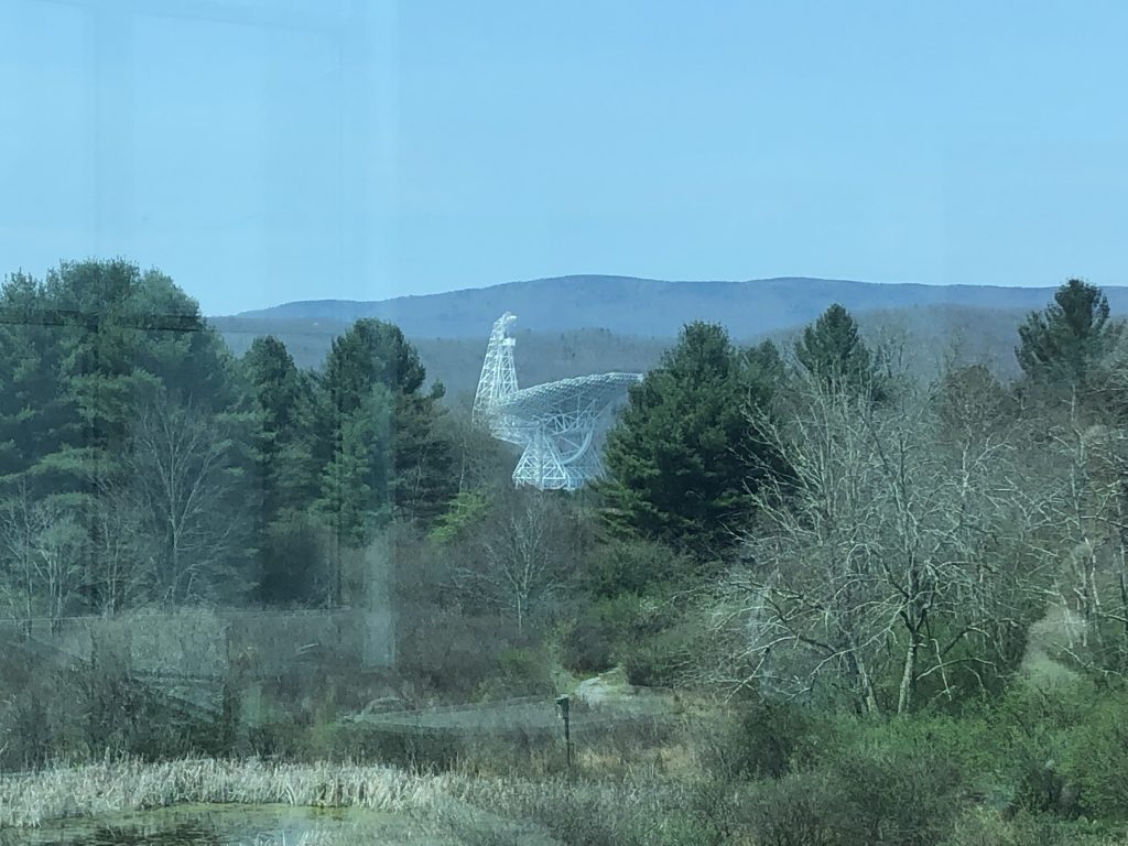
The largest of the Green Bank radio telescopes as viewed from the museum. – Photo by the Author
This very unique town is host to the Green Bank Observatory and Science Center. Here, massive radio telescopes listen for signals from the distant universe – something that is only possible inside the NRQZ. Radio transmissions are extremely restricted in town. Residents aren’t allowed to run wi-fi access points, nor use microwave ovens in their homes. The radio telescopes are situated relatively far from public roads, and only diesel-engine vehicles are allowed to take visitors close enough for tours as even the radio noise from a spark plug is enough to ruin their experiments.
I grabbed lunch at the Starlight Café within the museum – seemingly the only restaurant in town – and had a chance to check out the exhibits and pick up a few souvenirs for the boys. Since there are no radio transmissions allowed in the area, I also was able to catch a photo of a rare historical artifact.
An ancient artifact from a simpler time. – Photo by the Author
Battle of Droop Mountain – Civil War Battlefield #89
Heading farther to the south and west, I was eventually able to see signal bars on my iPhone again as I approached my next stop, the Battle of Droop Mountain. A roadside marker along the way confirmed that I was on the right track.
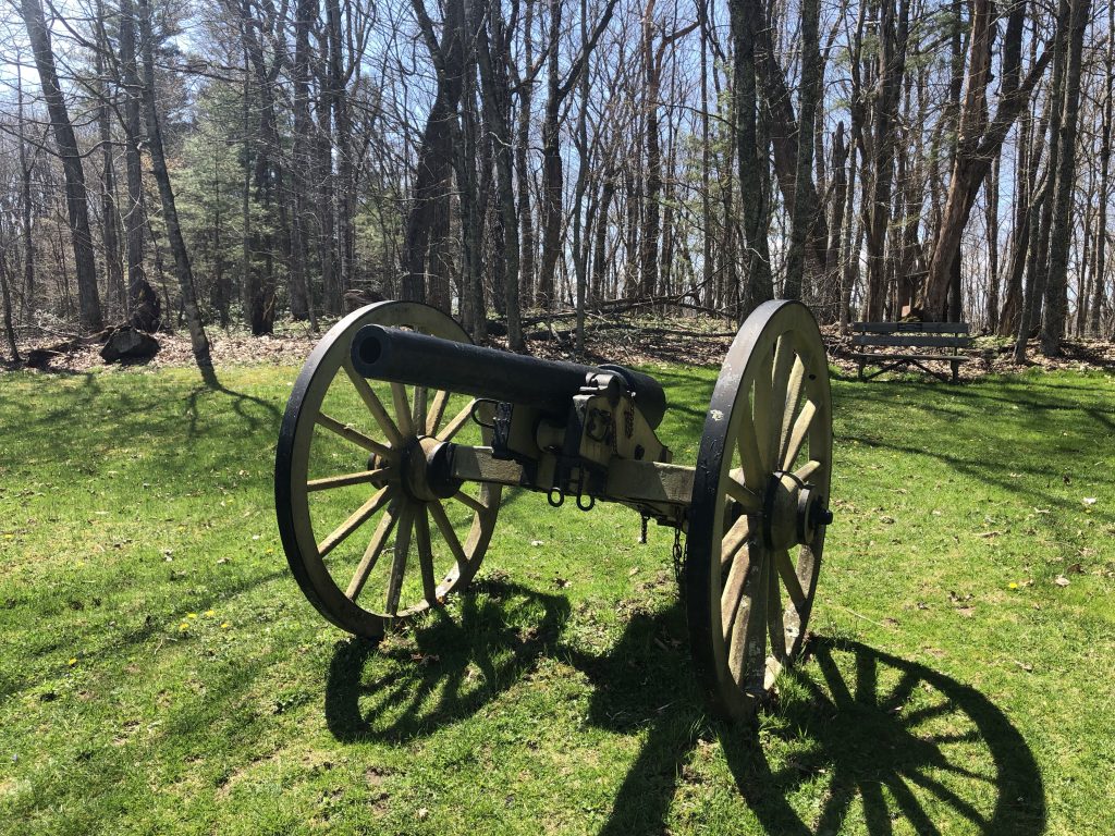
Now a West Virginia State Park, this battlefield has been very well-preserved and has several markers and even a fewmonuments. Near the parking lot, I had my first artillery sighting of the trip – although it was a replica 10-pounder Parrott Rifle.
The first artillery sighting of the trip – a fake 10-pounder Parrott at Droop Mountain. – Photo by the Author
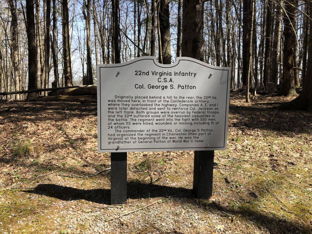
Many units have individual markers like this one to the 22nd Virginia Infantry that are placed along the main tour road. Col. George S. Patton, grandfather of the famous WWII general, commanded this particular regiment at Droop Mountain.
The grandfather of famed WWII General George Patton commanded a Virginia regiment at Droop Mountain. – Photo by the Author
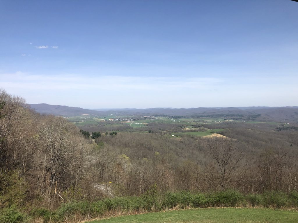
The true highlight of this field is the distinctive observation tower located on the far eastern slope of the mountain. The views up the valley toward the town of Hillsboro, WV are magnificent. Trust me when I say that the photos I took don’t do it justice.
The views alone are enough to justify a visit to Droop Mountain. – Photo by the Author
Battle of Carnifex Ferry – Civil War Battlefield #90
My next leg took me deeper into West Virginia and weaving through the mountains that were clearly coal country. I passed several old industrial sites, and small towns on my way to the West Virginia State Park that preserves the Battle of Carnifex Ferry.
Like Droop Mountain, the fact that this is a state park means that it is pretty well-preserved, and therearenumerousmarkers to explain what took place here. I think my favorite aspect of this park was the numerous warnings – on their website, as well as on signs around the park – that you should stay on marked trails because of the high risk of unexploded ordnance STILL being in the ground here after more than 150 years.
One such trail leads along the side of the mountain to stunning views of the Gauley River valley below. Once again, the images you get from a camera just can’t capture the feeling of being there yourself.
There are beautiful views of the Gauley River from the Carnifex Ferry State Park. – Photo by the Author
Battle of Kessler’s Cross Lanes – Civil War Battlefield #91
Just north of Carnifex Ferry is a much smaller engagement: the Battle of Kessler’s Cross Lanes. Today, this site is little more than an intersection. There are somemarkers near the local volunteer fire station, as well as a wayside at the local gas station that explain more about what happened here.
The battlefield at Kessler’s Cross Lanes. – Photo by the Author
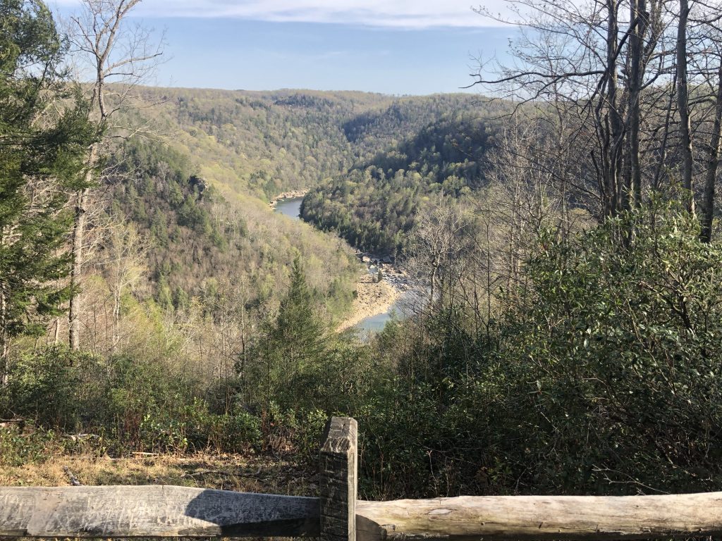
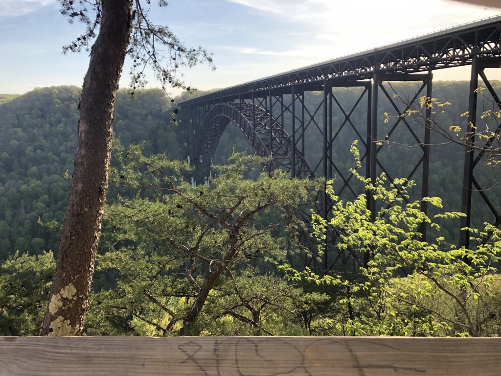
New River Gorge Bridge – Another Brief Interlude
I was done with battlefields for the day, but I still needed to make it to my hotel for the night, which was booked for Princeton, WV. I made my way to US Route 19 and headed south.
Along the way, I knew I would need to pass over the New River Gorge Bridge – one of the tallest and longest single-arch bridges in the world. Now, I am very acrophobic, but I’ve never really had a problem with bridges, so I wasn’t worried about having to drive over this thing, but I made a critical mistake: I pulled over at the NPS New River Gorge visitor’s center to get a view of this engineering marvel first.
The incredibly impressive New River Gorge Bridge. – Photo by the Author
The bridge is on a scale that I can’t even describe. It spans the gorge 867 feet above the river – high enough to fit the Washington Monument and 2 Statues of Liberty stacked on top for good measure, underneath the arch, with 20 feet to spare. I was blown away by how massive it was. This would easily be the tallest structure I had ever been on. After I collected myself, I was able to white-knuckle it across, and I swear that I felt absolutely EVERY slight sway and bump my car made along the road deck.
Obviously, I survived. 🙂
Day 2
Got an early start from the Microtel Inn in Princeton, WV. The first order of business was to check out downtown Princeton, and then see how many other sites I could hit in Tennessee and Virginia.
Battle of Princeton Court House – Civil War Battlefield #92
I parked near the court house and explored a little bit. Sadly, I could only find one wayside marker that mentioned the Battle of Princeton Court House. It talks about some fighting happening near the court house itself. There is a military museum across the square, but it wasn’t open during my visit. It is very hard to get a sense of the fighting here, as the area appears to have been built up in the years since, and I suspect that much of the terrain has been altered.
With my visit to Princeton, I have now seen every official Civil War battlefield in West Virginia, so that’s a pretty cool milestone.
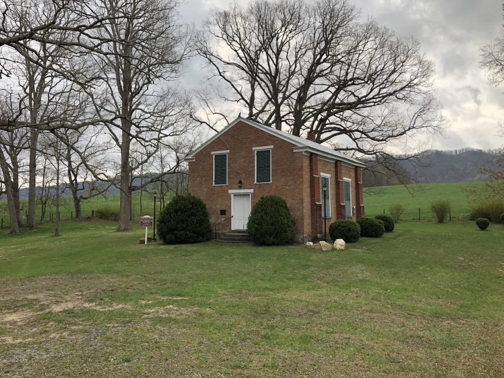
Battle of Cove Mountain – Civil War Battlefield #93
Heading south on Interstate 77, I crossed into Virginia, and before long I was in the outskirts of Wytheville, VA on my way to the site of the Battle of Cove Mountain.
The terrain here is very pretty. As the name suggests, the field sits in the valley of a horseshoe-shaped mountain formation – only opening up on the western edge. The valley is full of farms among the rolling hills, and is quite pretty to drive through.
Fighting seems to have happened down the valley near the open end, but that is mostly an educated guess on my part. The few markers I was able to find are short on details. The old brick church here became a temporary hospital, and is still used on special occasions by a local congregation in Wytheville.
The Crockett’s Cove Presbyterian Church is still used on special occasions by a local congregation from Wytheville, VA. – Photo by the Author
After a few moments of reflection at the church, I got back in the car and decided to go southwest. There was a threat of storms, and I decided to try to maximize my trip by going to the farthest battlefield I could and then working my way back home, hitting more sites along the way. I crossed into Tennessee, and was delighted to get WDVX back on my radio once again.
Battle of Fair Garden – Civil War Battlefield #94
Almost to Knoxville, I found that the Battle of Fair Garden is yet another engagement that is very hard to picture because of the changes to the terrain that have occurred over time. There is a very good wayside on the grounds of Walters State Community College, Sevierville, but I believe that the all the “landmark” buildings of this battlefield are gone.
Battle of Dandridge – Civil War Battlefield #95
There were a few incidents of fighting in Dandridge, and there area fewmarkers that at least make mention of them. The official Battle of Dandridge happened on January 17, 1863. The Bradford-Hynds House – used by both Union and Confederate officers as a headquarters at different points – still stands downtown. That downtown area sits in something of a bowl-like depression geographically, and my best guess is that the fighting happened up at the rim.
The Bradford-Hynds House was used as a headquarters by officers of both sides during and after the battle. – Photo by the Author
Battle of Mossy Creek – Civil War Battlefield #96
At the time that I visited, the bridge over Mossy Creek was out, so I had to take a bit of a circuitous route to reach the Battle of Mossy Creek. The field has been overtaken by a baseball diamond, an industrial park, and – appropriately – a National Guard facility that has a few historical markers and waysides near its entrance. Given all the construction, I have to imagine that the terrain isn’t what it was in the 19th century.
Battle of Bean’s Station – Civil War Battlefield #97
I had gotten a tip that while the field of the Battle of Bean’s Station no longer existed, you could get a good view of the area from an overlook on Clinch Mountain along US Route 25E. There is even a marker there that mentions the fighting. It was very overcast and rainy on the day that I visited, so I didn’t get the greatest experience myself. I have since learned that there may be other markers and waysides closer to the shoreline.
Unfortunately, the battlefield no longer exists because it is underwater now. When the TVA built the Cherokee Hydroelectric Dam, they flooded the area where the action took place.
The Bean’s Station battlefield is sadly now under the TVA’s Cherokee Reservoir. A nearby overlook on Clinch Mountain offers a nice view of the area. – Photo by the Author
Battle of Bull’s Gap – Civil War Battlefield #98
Thanks to another tip, I was directed to the Bull’s Gap Railroad Museum as a source of information about the Battle of Bull’s Gap. It turned out to be great advice. I had a lovely conversation with Bill (who seems to run the museum) and his brother. They regaled me with tales of their Civil War ancestors and their actions in the area. History can have such an impact in places like this.
Bill was nice enough to direct me toward the gap, which seems to have been where the combat action was, but I couldn’t find a single marker anywhere in the area.
A view of Bull’s Gap from the northwest. – Photo by the Author
Battle of Blue Springs – Civil War Battlefield #99
Another place where I believe the terrain has changed, and there were a few different actions at different times in the area of the Battle of Blue Springs, so I couldn’t get a good sense of how things unfolded exactly on the ground. There is a wayside marker in the local Food Country parking lot, and another roadside one nearby.
Battle of Blountville – Civil War Battlefield #100
My 100th battlefield! What an incredible milestone in my journey!
There are many historicalwaysides, markers, and even a memorial describing some of the action along the main street in town. I was able to park my car and just walk along the street reading as I went. Blountville is clearly very proud of its history.
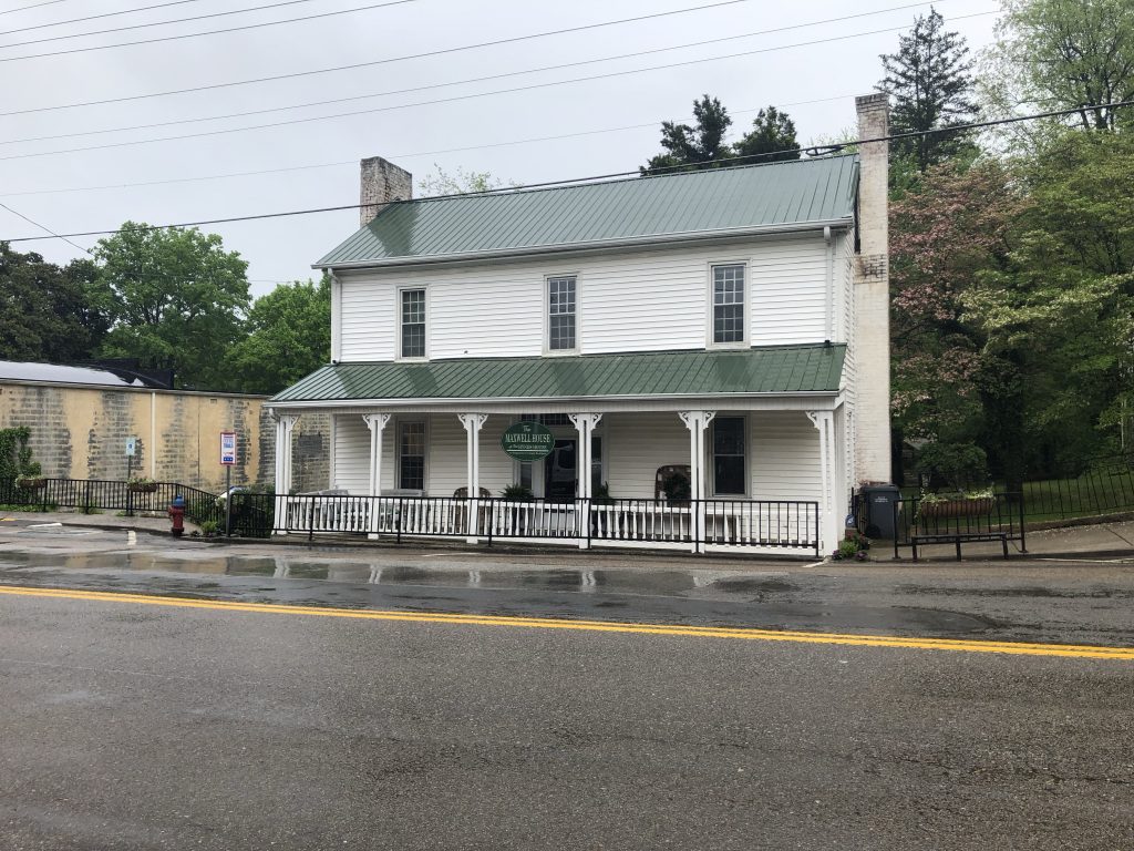
During my walk, I learned that part of the town – including the court house – burned due to artillery fire from the Battle of Blountville. One of the things that I didn’t expect to find was the original bell from the town court house, which the plaque identified as having been forged in my native Maryland.
Unexpected discovery: the original bell from the Blountville Court House was forged in my native Maryland. – Photo by the Author
After I’d had enough exploring, I made my way back to the car and continued east on Interstate 81, crossing back into Virginia. I was well on my way home, but I hoped to hit just one more town before I ran out of daylight.
Second Battle of Saltville – Civil War Battlefield #101
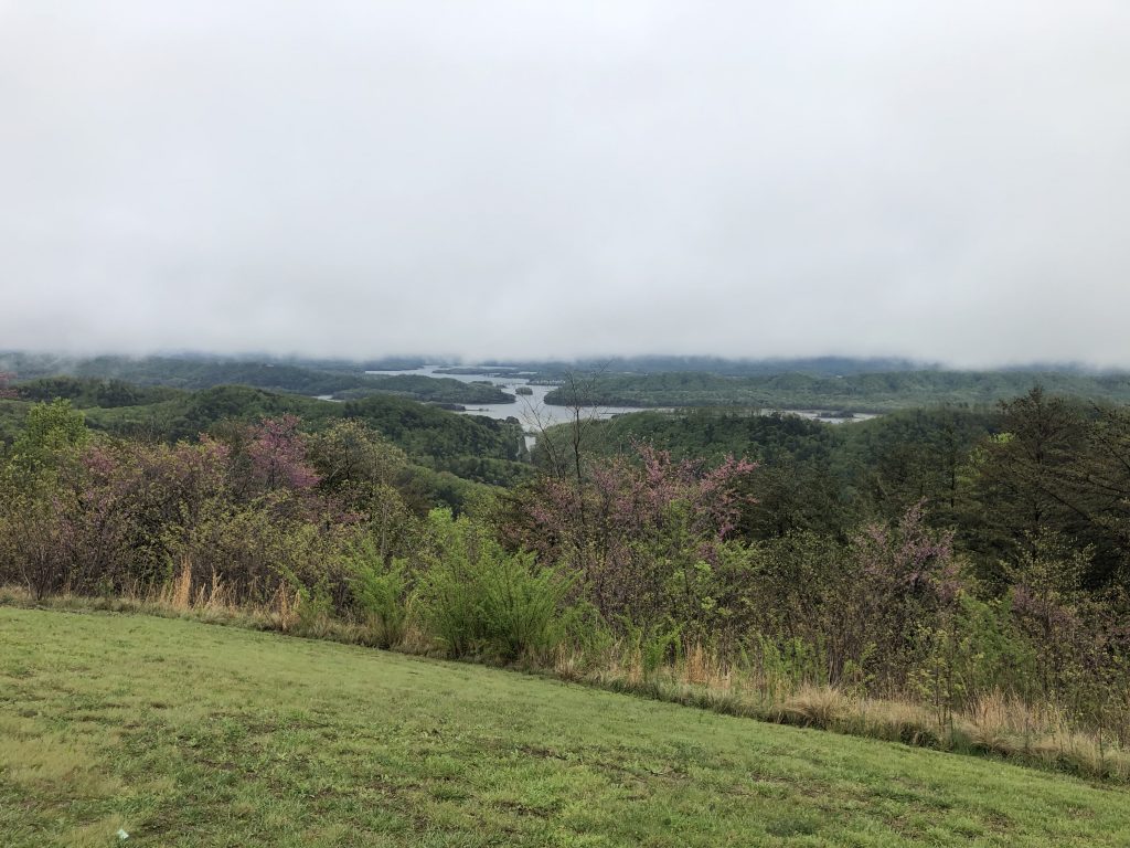
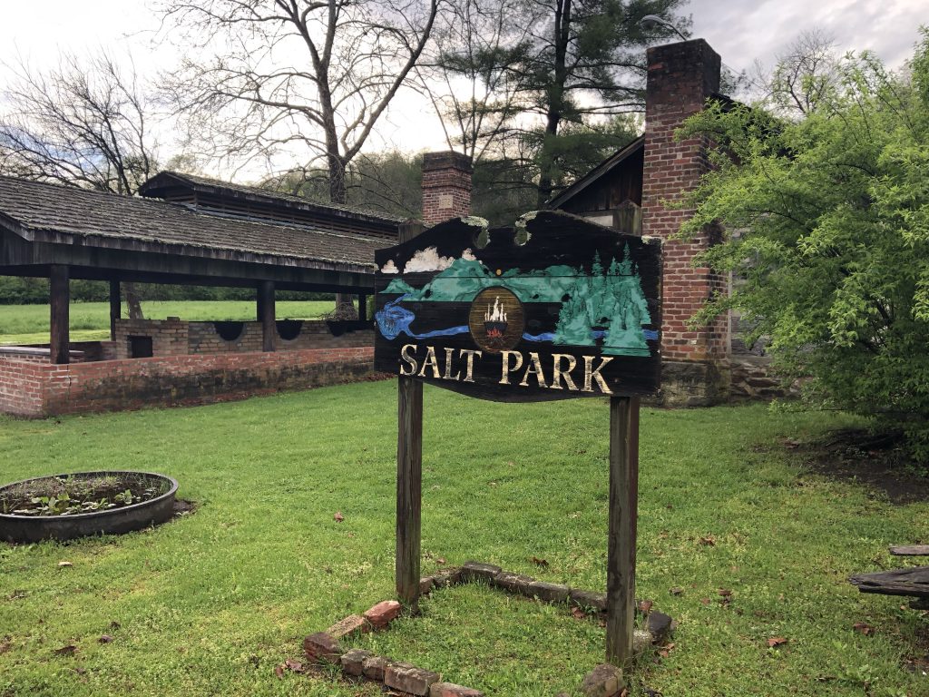
The aptly-named Saltville, VA had a key role to play in the Civil War. This was the Confederacy’s main source of salt – especially toward the end of the war – and it was vital to keep those supplies coming as salt was used as a preservative for the food that was feeding the army. As much as the Confederates wanted to defend this place, the Union wanted to disrupt and destroy these operations. Two official battles were fought here, and because of the way I came into town, I passed by the site of the Second Battle of Saltville first.
Salt Park is along the road southwest of town, and has a very cool display of equipment that would have been used in the production of salt in the 19th century, and gives something of an idea what the salt works would have been like. In addition, they also host a couple of wayside markers that discuss the battle. The hills where the Confederates had their defensive positions set up are visible from here, and they look quite imposing.
This small park with examples of equipment that was used in the process of making salt in the 19th century is located near the site of the Second Battle of Saltville. – Photo by the Author
First Battle of Saltville – Civil War Battlefield #102
The best place to experience this field from is a small park on the hill overlooking where Cedar Creek runs into the Holston River. The Confederate defenses were posted on this hill. A very good wayside marker tells the story here, but this is also one of those fields where you can almost see what happened as soon as you look out from this defensive position. The Union forces – mostly consisting of United States Colored Cavalry Troops – were slaughtered by the vengeful Confederate defenders.
A view of the battlefield from a small park overlooking the north branch of the Holston River. – Photo by the Author