Battlefield Visits, Revolutionary War Edition: The Battle of Brandywine

A couple of weeks ago, the boys and I went up to Brandywine Battlefield State Park because they were opening their season with a celebration of the 343rd birthday of Pennsylvania. There were going to be living history demonstrations, and free admission – can’t beat that!

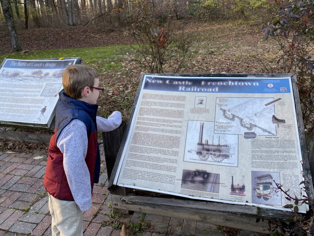
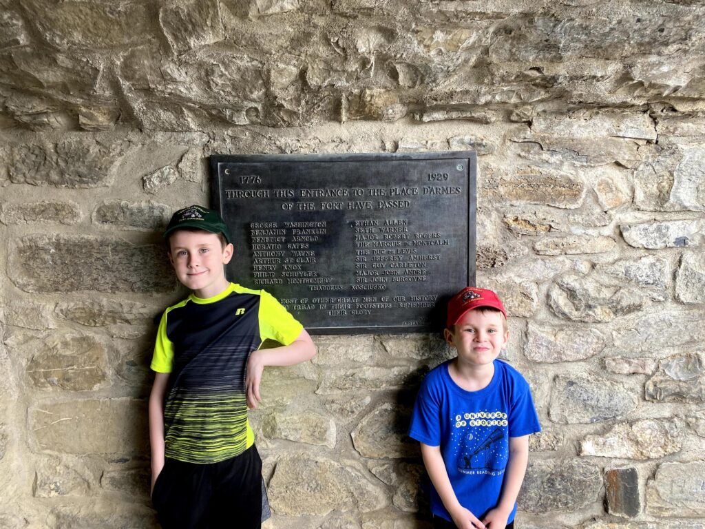
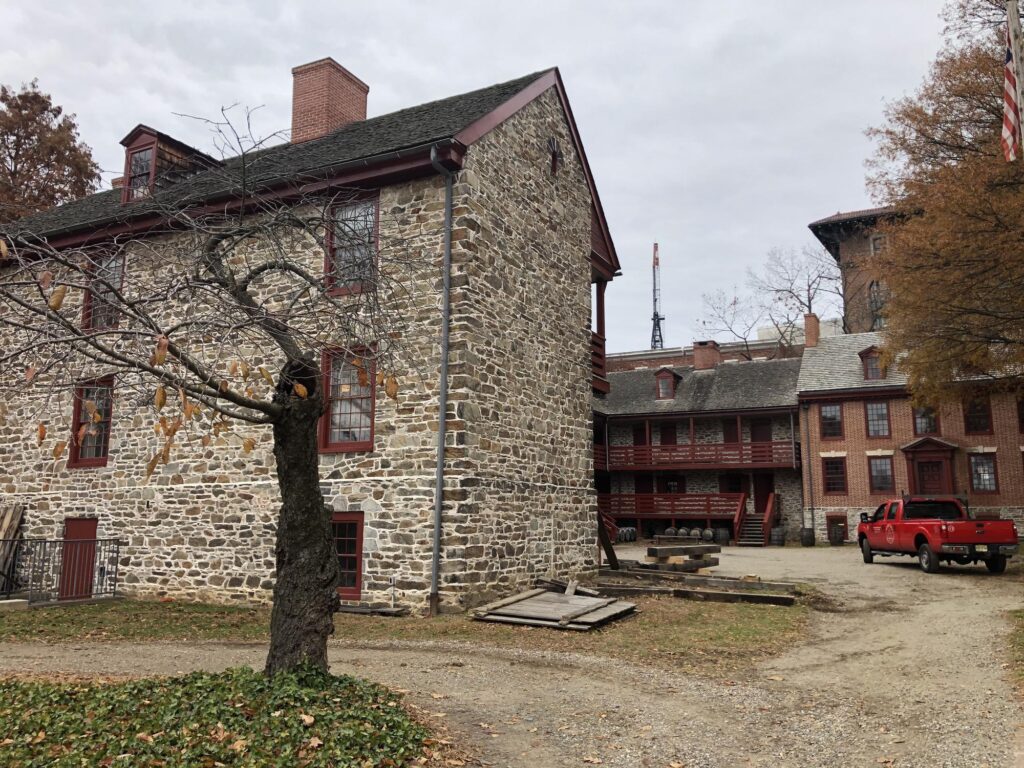
We’ve been to Brandywine a few times before, but we’ve only just visited the park – which does hold the house that George Washington used as his headquarters during the battle – but I’ve never actually been out on the field where the fighting of the Battle of Brandywine actually happened. These days, most of it is either neighborhoods, or still privately-held farm land. That seems to be slowly changing with organizations like the American Battlefield Trust picking up more property there and setting up some interpretation.

It took us about an hour to drive up, and along the way I had John read a battle overview out loud from one of my books. We discussed what was going on with the war at the time, and I let the boys look at a few maps, too. I think it really helped with getting them engaged in what we were about to see.

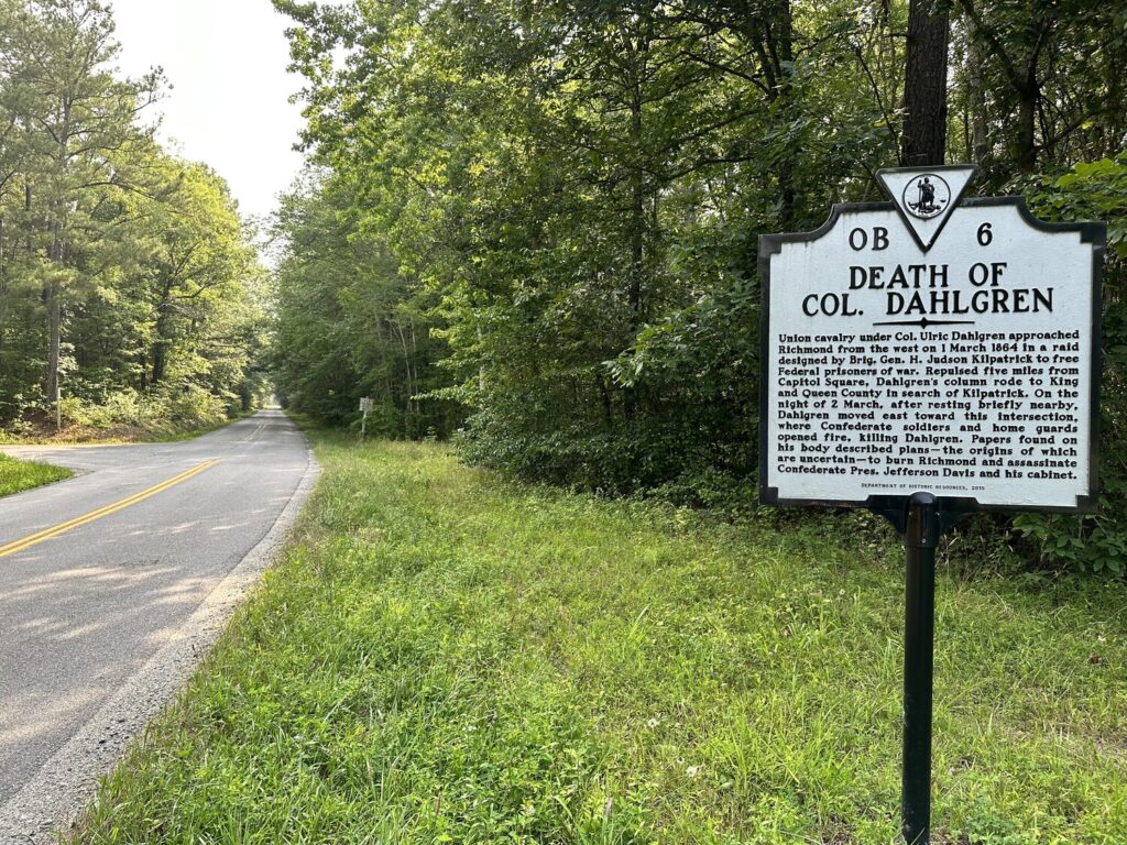
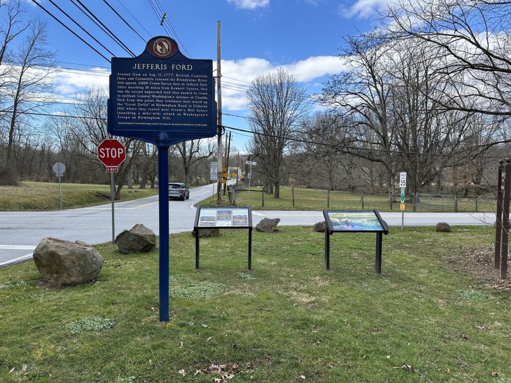
We started our tour at Jefferis’ Ford where Gen. Sir William Howe’s British troops crossed the Brandywine and started the move to turn the American right flank. I had to explain to the boys what a ford was – maybe we need to play more Oregon Trail. Seeing the boys get a little spark as I explained that the British marched right along this road we were standing next to – that’s the reason I love doing things like this with them. There are a few cool markers down there – including two relatively new ones that I was able to add to the HMDB!

The view of Jefferis' Ford. - <i>Photo by the author</i>
The view of Jefferis’ Ford. – Photo by the author

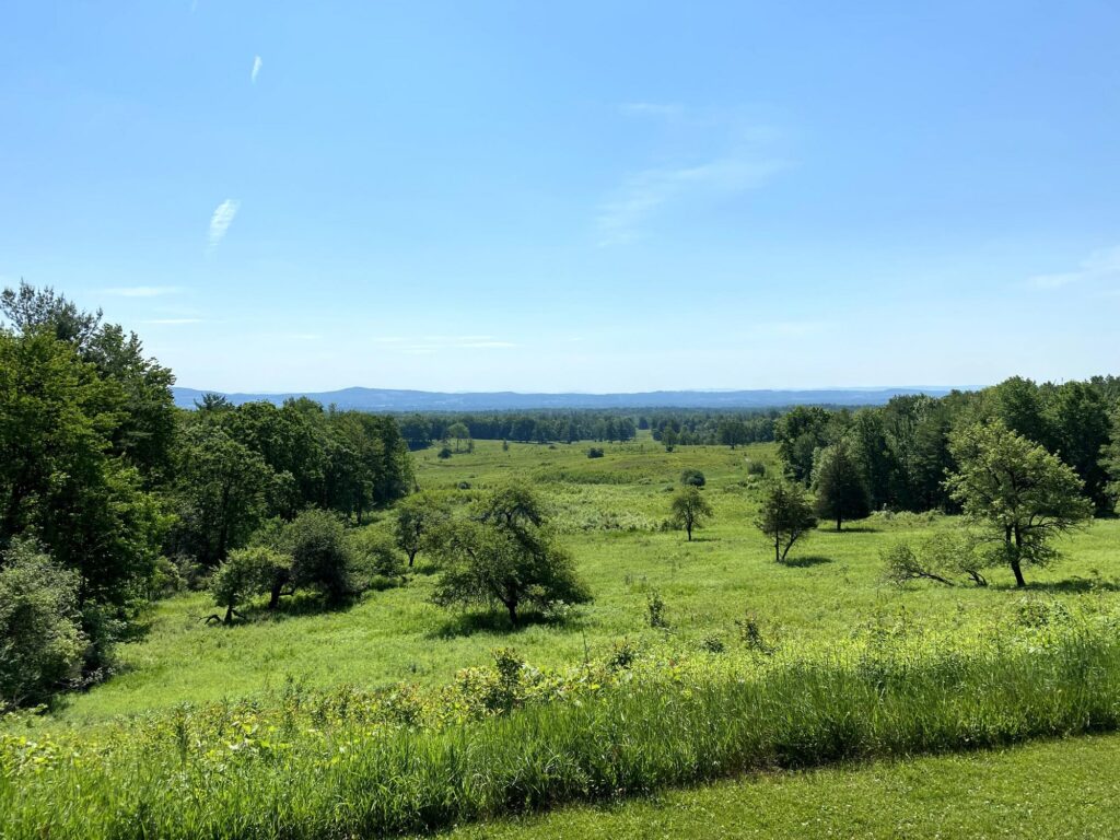
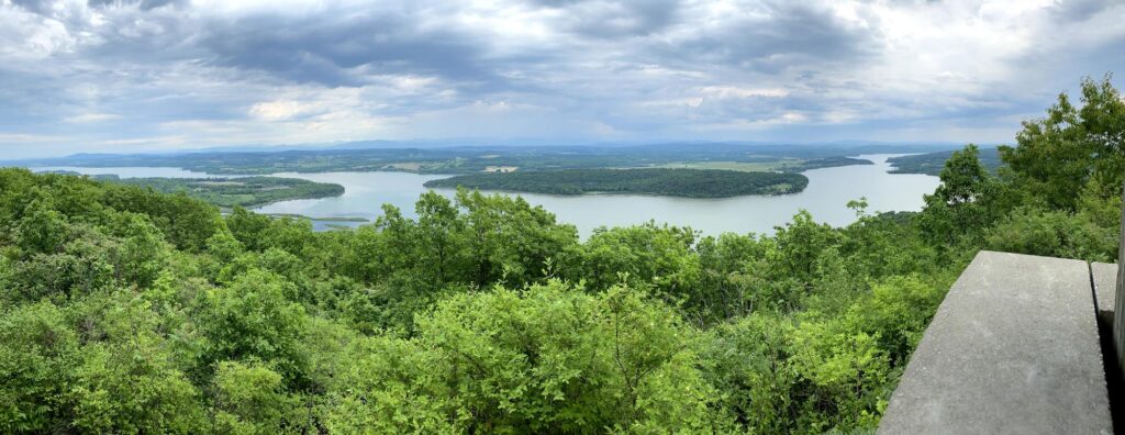
Continuing on, we followed the route of the British and made our way to Osborne’s Hill where we got out to see the view and imagine the battle lines forming for the assault. Luckily for the Americans, Howe gave his men some time to rest after their all-day march, so there was some time for a defense to be put up. It wouldn’t be enough, though.

Our next stop was at the Birmingham Lafayette Cemetery where we saw some more monuments, as well as the Friends Meeting House. Across the street at the Birmingham Hill Preserve, we got to add another new marker.

The Lafayette Memorial near Sandy Hollow. - <i>Photo by the author</i>
The Lafayette Memorial near Sandy Hollow. – Photo by the author

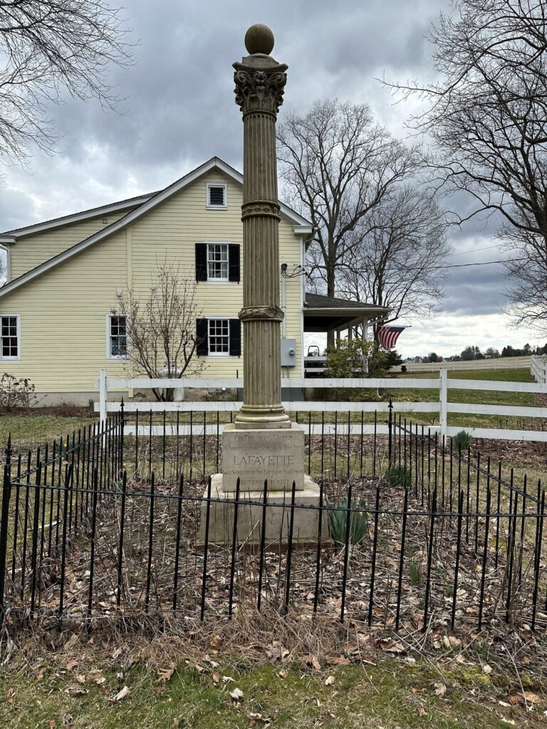
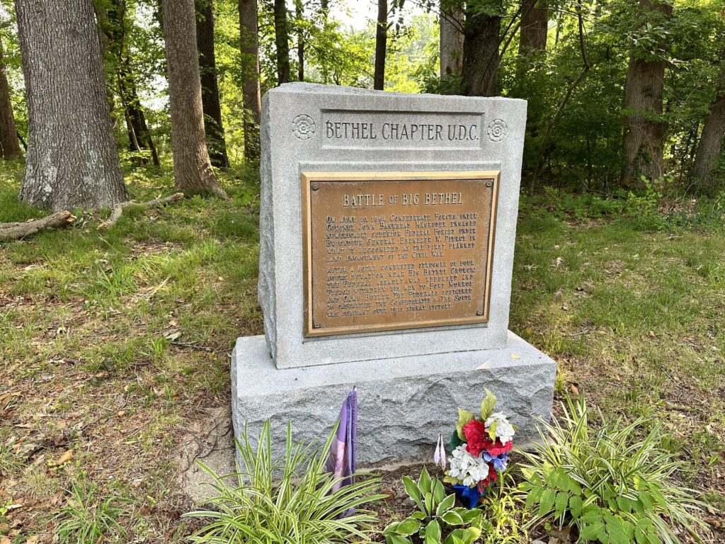
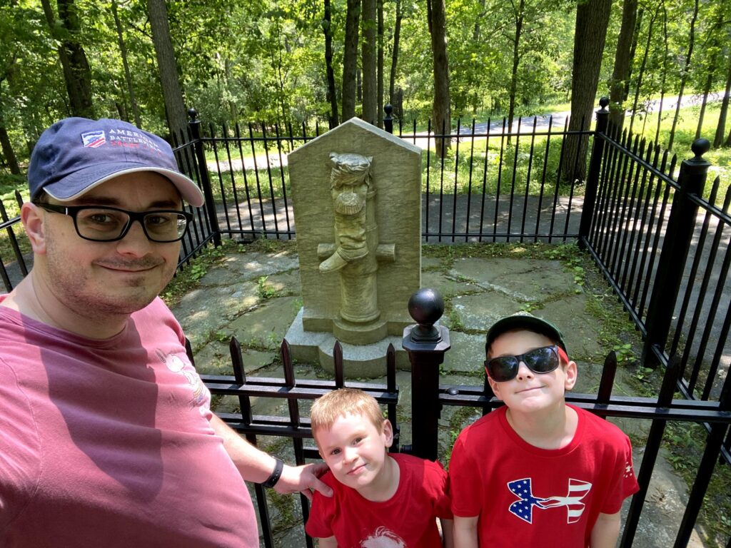
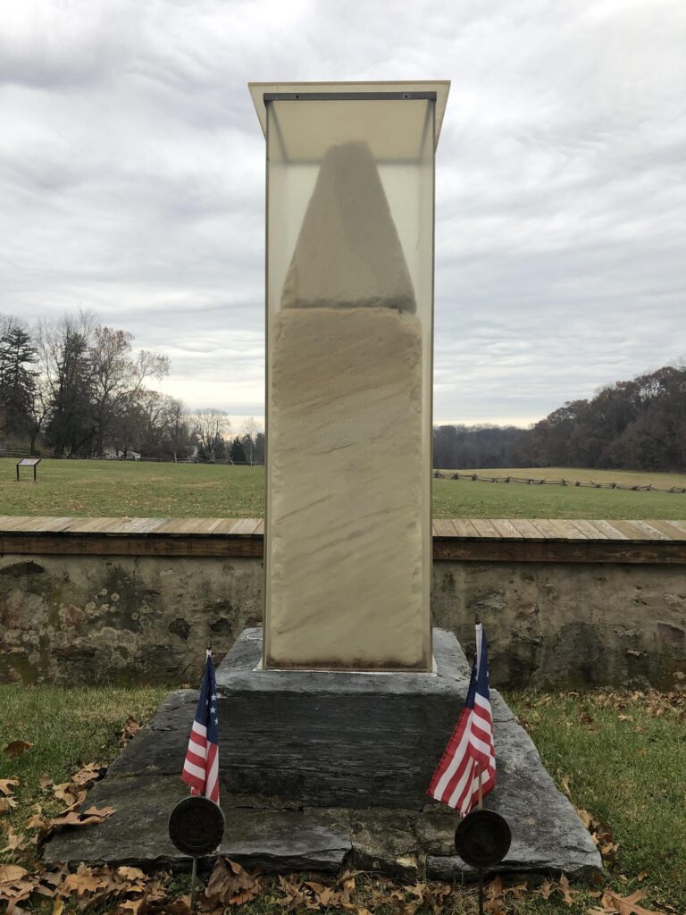
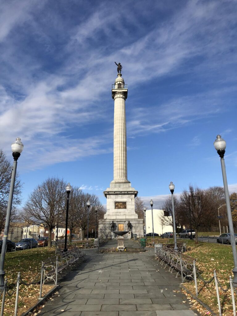
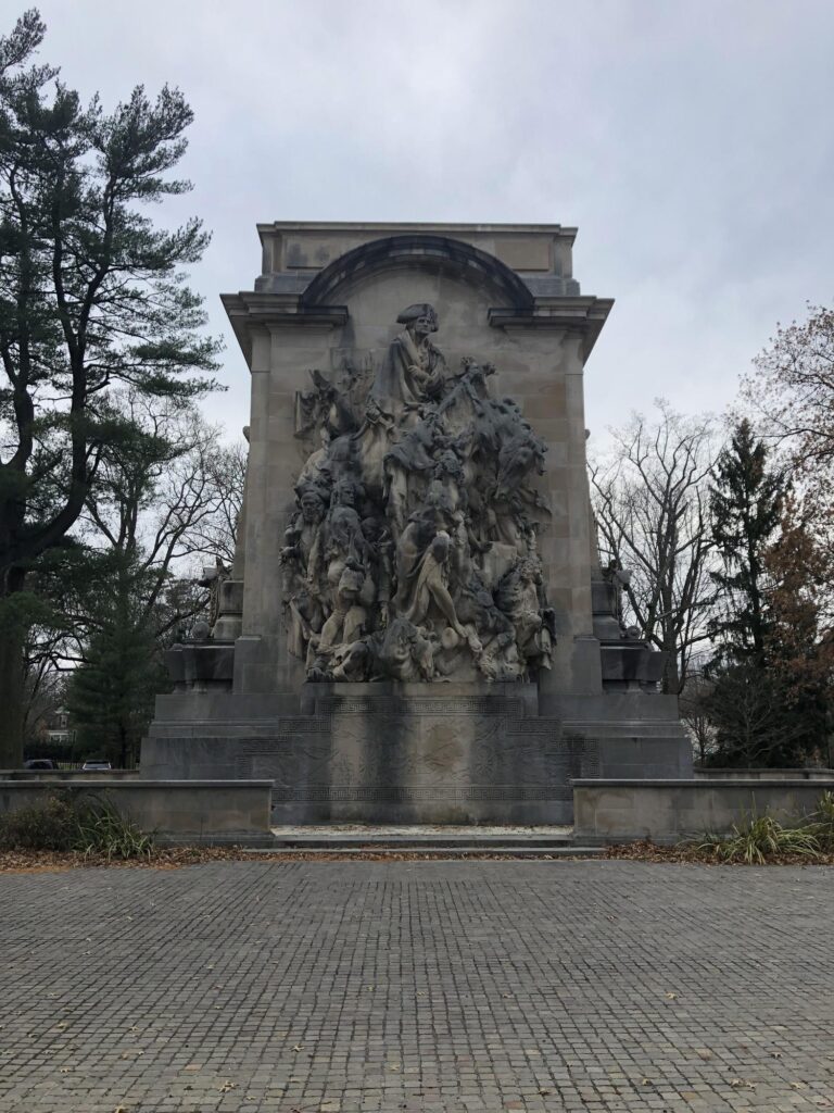
My most exciting monument addition of the day came next: The Lafayette Memorial near the site of his wounding. This has been here since 1895 – how had it not been added to the database yet? Lafayette came back to visit the site after the battle and spoke fondly of his experiences there, despite the wound.

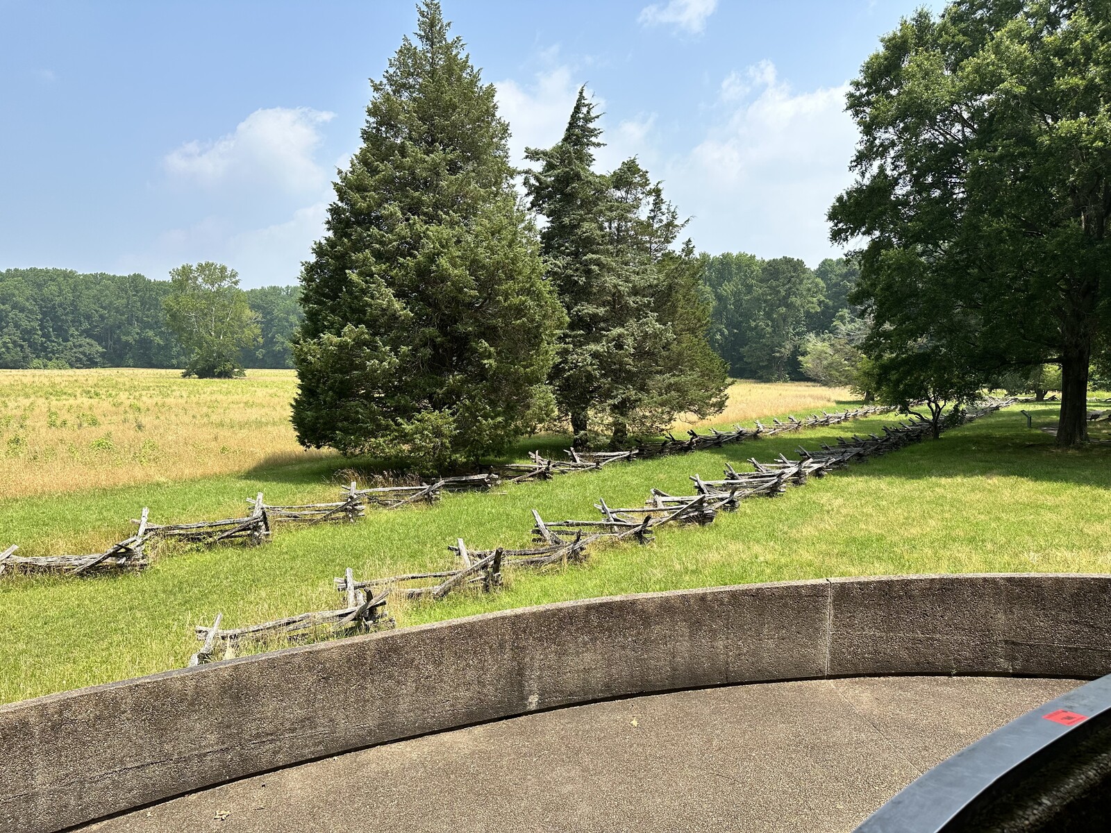
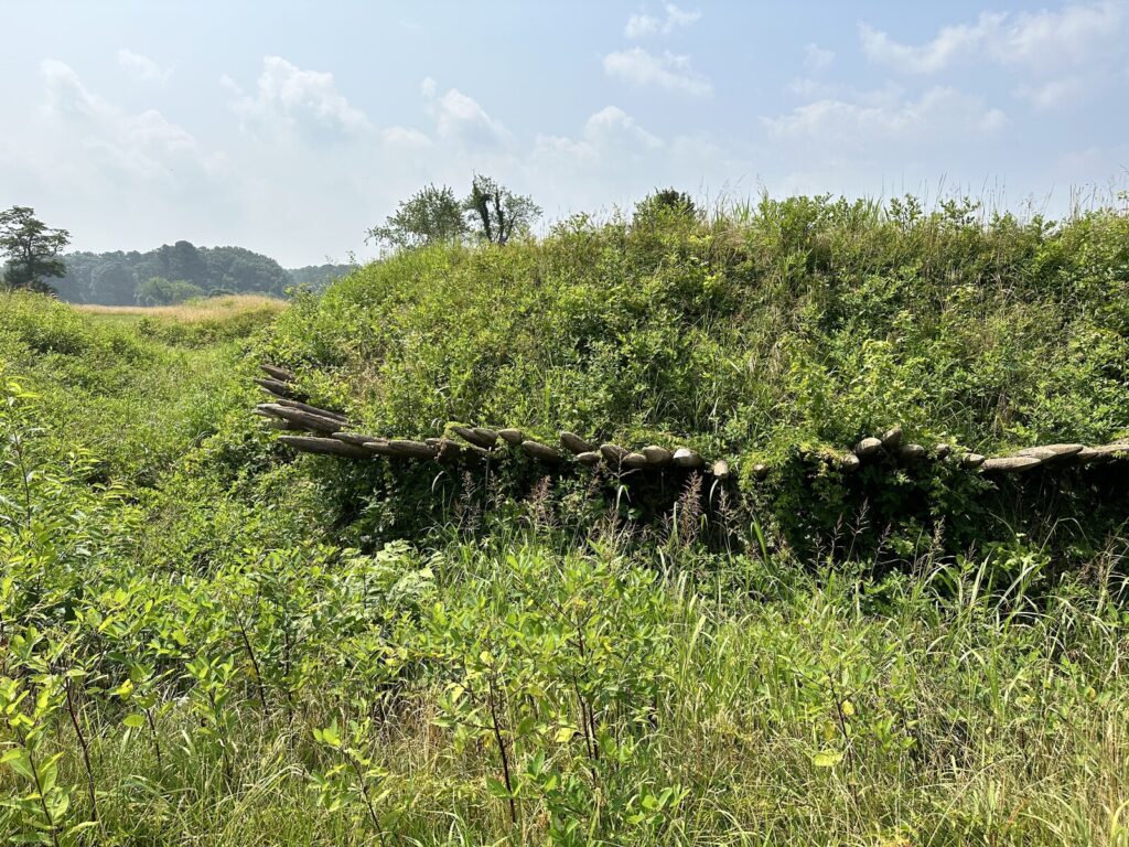
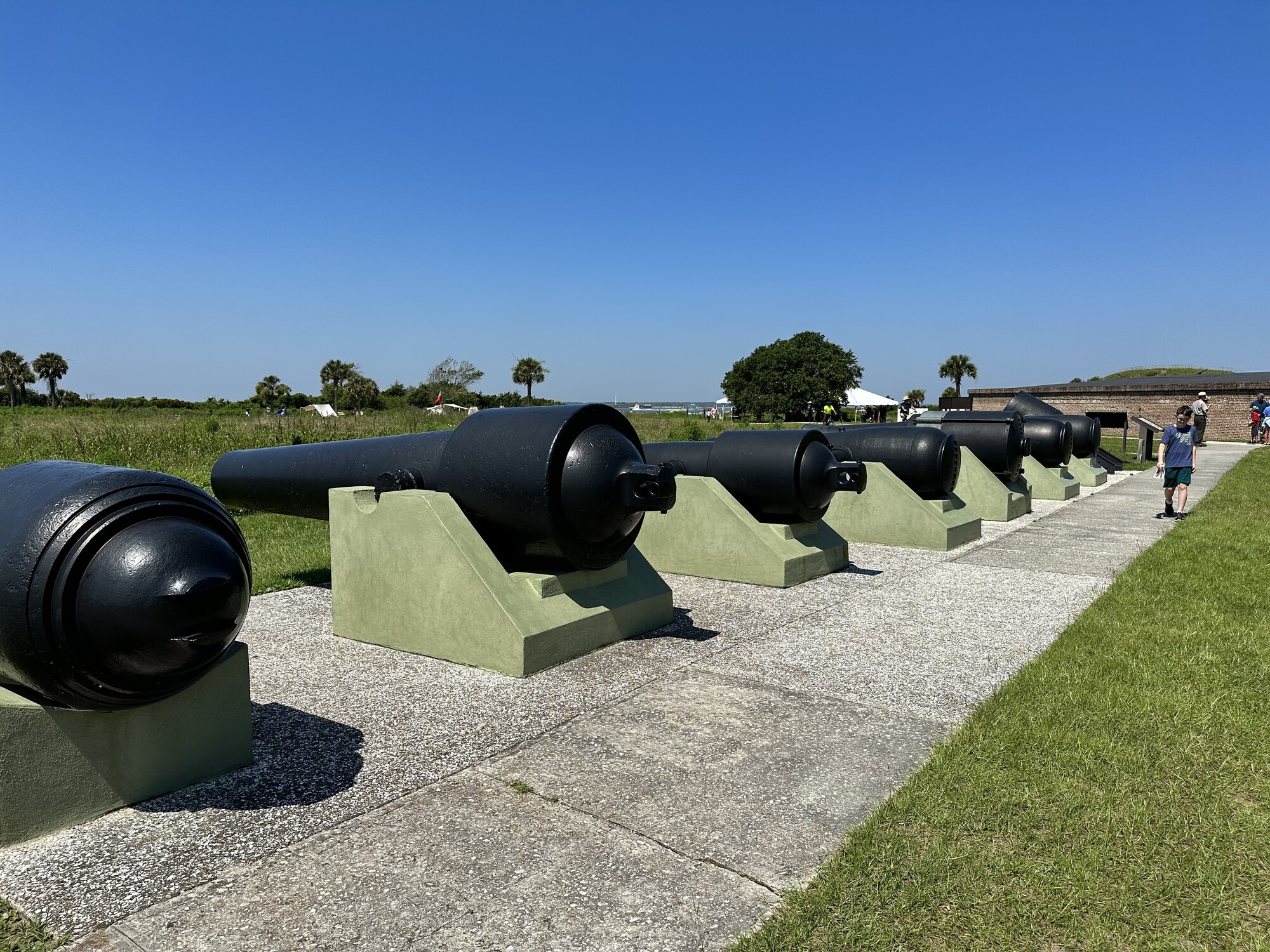
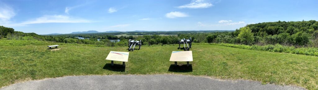
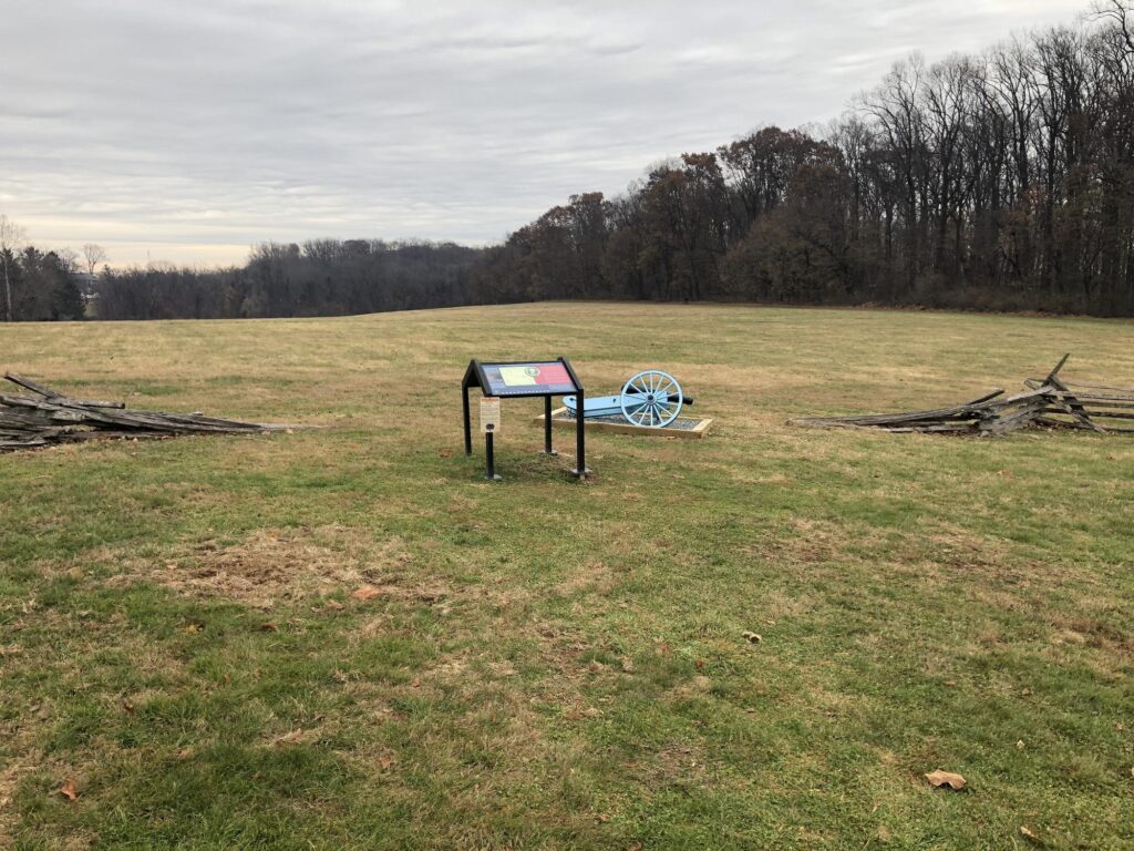
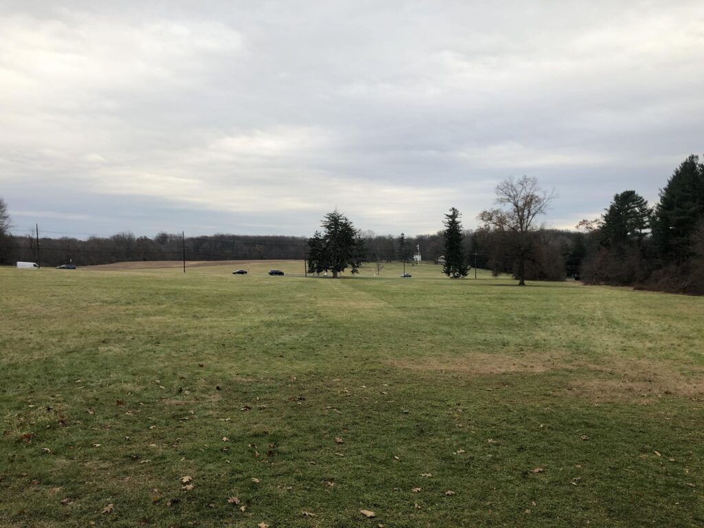
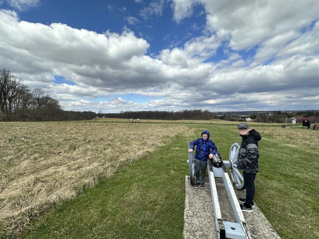
Around the corner from there, we came to the Sandy Hollow Heritage Park. This park preserves the American right flank, and I have to say – the position seems remarkably defensible. I’m going to have to do some deeper reading on the Battle of Brandywine, because I have no idea how this position could have fallen – especially with some artillery support.

My crew mans a very fake wooden 3-pounder at Sandy Hollow. - <i>Photo by the author</i>
My crew mans a very fake wooden 3-pounder at Sandy Hollow. – Photo by the author

It was a quick drive over to the crossroads of Dillworthtown and past the site of the British camp after the battle. Maj. Gen. Nathaniel Greene’s last line of defense was also in this area, allowing the American army to escape mostly intact. This was the second-largest battle of the Revolution and I don’t think it gets the attention it deserves – probably because the preservation of the field is so spotty. Maybe that will get better.

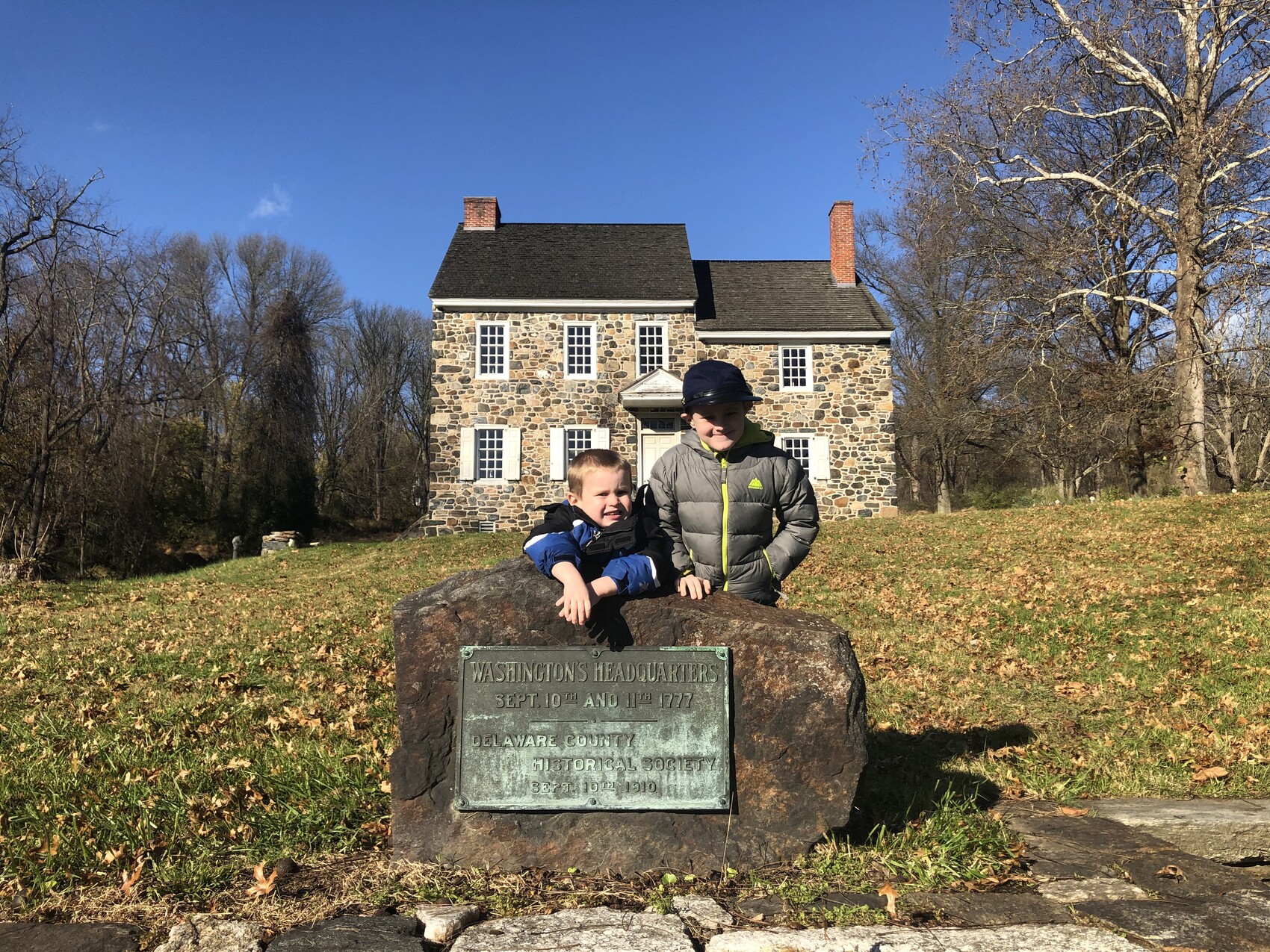
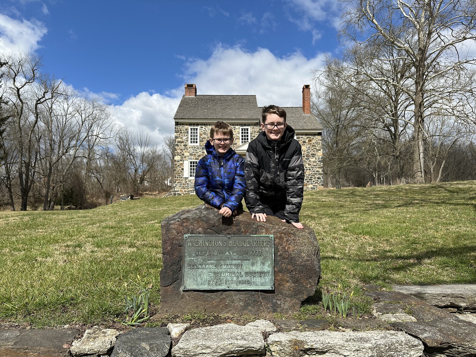
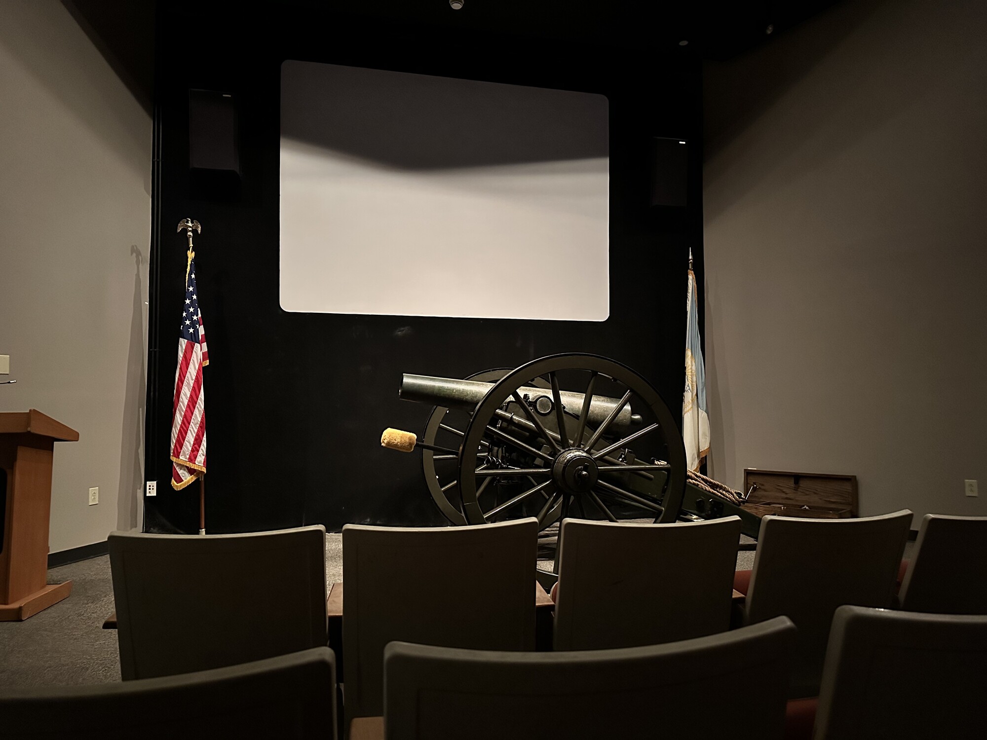
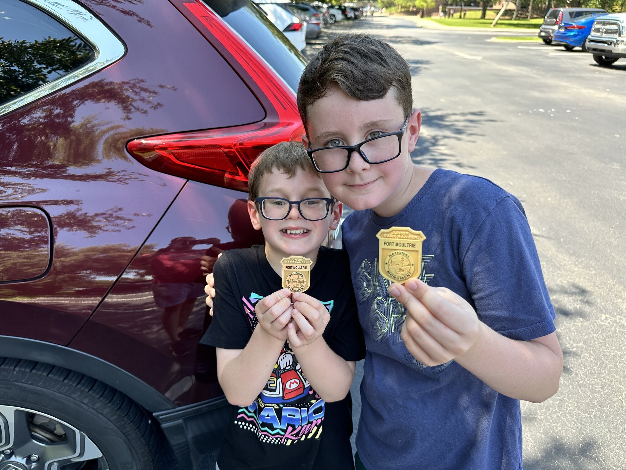
After our tour of the field, we stopped at the park visitors center and checked out the museum and their cool 20-minute film. Isaac in particular told me that the movie helped him understand things a bit better. We got a quick photo at the Benjamin Ring House to re-create one we had taken a few years ago (and we added another surprising historical marker in the process).

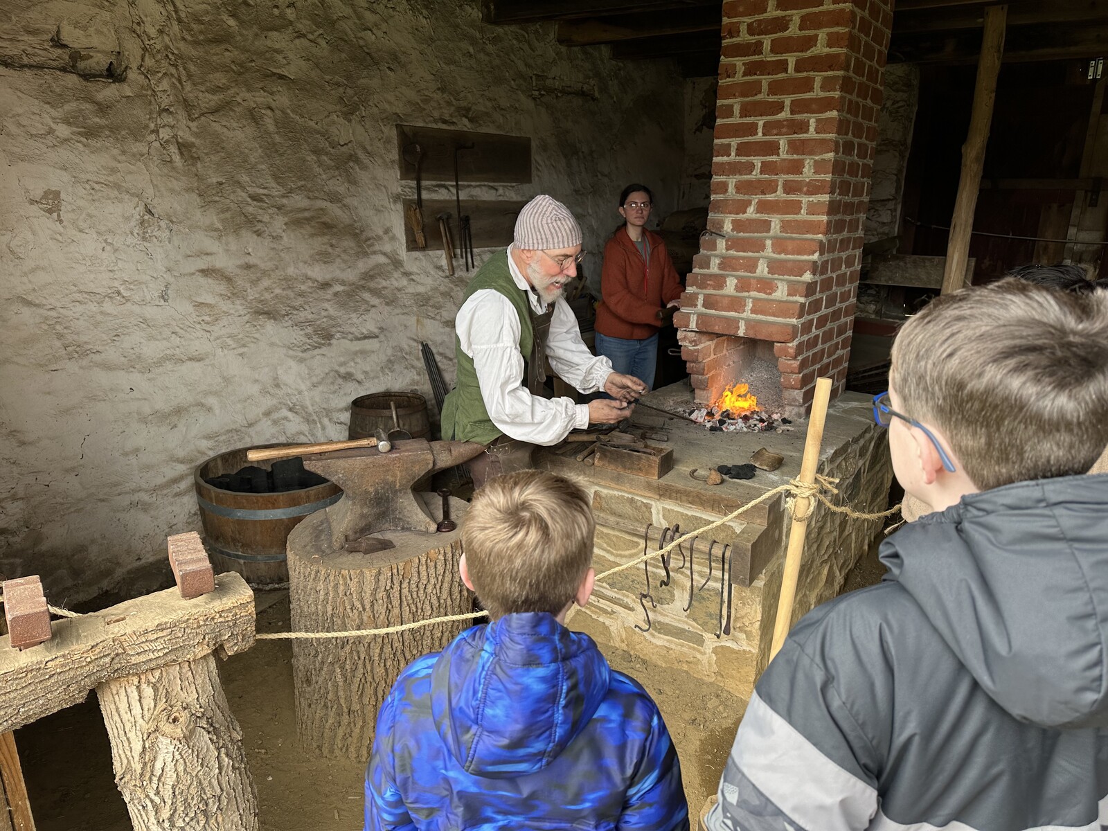
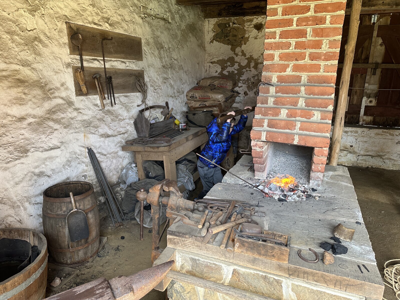
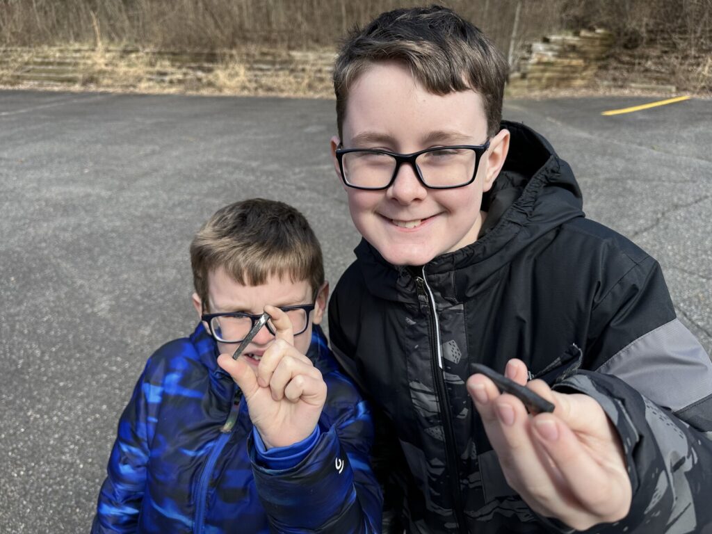
Then, it was living history time! Over at the Gilpin House, there were interpreters discussing surveying, cooking, and weapons, but we gravitated to the blacksmith demo. The boys even got to participate by working the bellows and stoking the fire up to around 2000 degrees so the blacksmith could show how nails were made in the 18th century. For their efforts, the boys got to keep two of the nails they helped make. They were both really proud of them.

The boys with the nails that they helped make. Very cool! - <i>Photo by the author</i>
The boys with the nails that they helped make. Very cool! – Photo by the author

It was a really great outing. With just a couple of hours, we got to see, experience, and learn so much. I’m glad that we went, and that we went a little off the beaten path as well. I’m hopeful that the boys will treasure these memories as much as I do.

Battlefield Visits, Epic Man Trip Edition – Part 6: Colonial National Historical Park

From my travels, June 29, 2023.

Battle of Big Bethel – Civil War Battlefield #174

Since it occurred on June 10, 1861, some people consider the Battle of Big Bethel to be the first “real” land battle of the Civil War; that all the actions that came before were merely “skirmishes.” I don’t fall into this camp. For me, the Battle of Philippi (which I visited as battlefield #84 for me, all the way back in April of 2019) holds that title.

One of the monuments at the Big Bethel Park. - <i>Photo by the author</i>
One of the monuments at the Big Bethel Park. – Photo by the author

Either way, this was an early foray up the peninsula by a small Union force from Fort Monroe that was halted by some well-placed Confederate defenses. The rebels repelled multiple attacks and put up some counterattacks of their own, causing the Federal troops to retreat back to the safety of the fort. Union losses were 76 men in total – including some who were caught in an incident of friendly fire. As this was still early in the war, the Union 3rd NY infantry was still wearing their original gray militia uniforms. Men of the 7th NY mistook them for flanking rebels and opened fire, wounding dozens of their compatriots.

Today, almost none of the battlefield is still left. It is now neighborhoods – including housing for nearby Joint Base Langley/Eustis – and a large chunk has been covered by the modern Big Bethel Reservoir. There is a small park on the south side of the reservoir – maybe an acre or two – that has *14* monuments and markers on it! One of the most densely marked fields I’ve ever seen.

Colonial National Historical Park – Yorktown

Yorktown. There’s obviously Revolutionary War history here, but also some Civil War (which I’ll touch on in a minute).

We saw the film here, went through their nice museum (that included original tents used by George Washington!) and toured the field. Between this and Saratoga, we’ve now seen two British surrender sites. We also did the Junior Ranger program here.

Siege of Yorktown – Civil War Battlefield #175

Maj. Gen. George McClellan wanted to capture Richmond, and rather than assaulting “overland” (as Grant would successfully do 2 years later), he opted for a mostly naval approach. He landed his army at Fort Monroe and marched north along the peninsula.

The Confederates had converted some of the old British earthworks from the Revolutionary War and extended them to cover the ground from the York to the James River. When McClellan arrived, he became concerned about the fortifications here (and also paranoid that he was somehow outnumbered) so he spent weeks amassing the largest collection of siege artillery that had ever been assembled in America up to that point. The Siege of Yorktown was on. By the time he was ready to attack though, the few Confederates that were here had fallen back to a new line near Williamsburg. McClellan had given them plenty of time to prepare.

Some of the fortifications at Yorktown were re-used by the Confederates. - <i>Photo by the author</i>
Some of the fortifications at Yorktown were re-used by the Confederates. – Photo by the author

The NPS doesn’t do much to interpret the Civil War actions here – they focus on the Revolutionary War. If you ask at the front desk, they can give you an additional pamphlet that discusses the Civil War actions at various stops along their normal tour route.

Colonial National Historical Park – Jamestowne

Jamestowne. Very cool to see the actual spot of the first permanent English colony in America. The museum here had a lot of relics that were found during archaeological digs in the past few decades. They have learned enough through that process that they’ve begun reconstructing the site as it would have originally appeared, though some of the original site has been eroded away by the James River.

In addition to the usual Junior Ranger program, the boys got to get their hands dirty making some pottery with a ranger. The decking across the wetlands also made for some good nature exposure. John spotted a baby turtle down in the marsh.

Battle of Williamsburg – Civil War Battlefield #176

Moving forward from Yorktown, the Union army attacked the Confederate defenses here at Williamsburg on May 5, 1862. In back-and-forth fighting, no conclusive advantage was gained. The Confederates pulled back toward Richmond overnight.

A Confederate monument at Fort Magruder. - <i>Photo by the author</i>
A Confederate monument at Fort Magruder. – Photo by the author

The site of Fort Magruder at the Battle of Williamsburg – including what look like some of the earthworks – is preserved, but the fenced-in area has plenty of “No Trespassing” signs. We were able to get some photos from the fence line.

Battle of Eltham’s Landing – Civil War Battlefield #177

While half of McClellan’s army attacked the Confederate fortifications at Williamsburg, Brig. Gen. William B. Franklin’s division was sent by boat up the York River to Eltham’s Landing in an attempt to get in behind the rebel lines. Confederate Gen. Joseph E. Johnston had troops in place to watch for such a move and was able to attack with John Bell Hood’s brigade the day after the Union troops landed. The Federals fell back toward the landing, and the gunboats that had escorted their landing fleet were able to provide covering fire. The rebels disengaged, and the Federals didn’t follow them. The Battle of Eltham’s Landing was another inconclusive fight.

Today, there is a wayside and a small parking area near the heart of the battlefield.

The Confederates approached the Battle of Eltham's Landing along this road. - <i>Photo by the author</i>
The Confederates approached the Battle of Eltham’s Landing along this road. – Photo by the author

Battle of Walkerton – Civil War Battlefield #178

In the spring of 1864, Union horsemen under Brig. Gen. H. Judson “Kill-Cavalry” Kilpatrick attempted a raid into Richmond with the hopes of freeing several Union prisoners held at the Belle Isle prison. The attempt failed because Col. Ulric Dahlgren’s men were unable to swing around Richmond and attack from the rear.

The marker at the site of Col. Dahlgren's death. - <i>Photo by the author</i>
The marker at the site of Col. Dahlgren’s death. – Photo by the author

As his men tried to find their way north again, they were attacked by elements of the 9th VA cavalry here at the Battle of Walkerton. Several of them were captured, and Col. Dahlgren (son of the Father of American Naval Ordnance, RADM John A. Dahlgren) was killed. Confederates alleged that they found papers on the young Dahlgren’s corpse that ordered him to burn Richmond and assassinate Confederate President Jefferson Davis. The Lincoln administration denied the authenticity of these orders, but the entire “Dahlgren Affair” remains a point of some controversy to this day.

There is a single, lonely marker at the site where Col. Dahlgren was killed to commemorate this small, but quite consequential fight.


After 6 days visiting dozens of battlefields and historic sites across 3 states, that’s a wrap for our “Epic Man Trip”!

We stopped at my brother’s new house in Aquia Harbor, VA and had dinner with his family, before we made our way back home to Delaware later that night. It was an awesome trip.

Battlefield Visits, Epic Man Trip Edition – Part 2: Sites Around Charleston

From my travels, June 25, 2023.

We were all set to spend a few days in Charleston, so we spent the first day going around town to a few different historical sites.

Fort Moultrie

We started our morning at Fort Moultrie. This is a very cool NPS site that covers the history of coastal fortification from the Revolutionary War through WWII. Each face of the fort is interpreted as a different era. It’s a pretty cool idea.

I think my crew most enjoyed the WWII-era Harbor Control Station, with it’s control tower and underground radio room. There were awesome views from the top of the tower of the entrance to the harbor – including over to Fort Sumter and Morris Island (not to get too ahead of myself).

The boys were also able to earn their first Junior Ranger badges of the “Man Trip” here. The ranger who helped us with that also gave us the packets and badges for our next stop, as it was not staffed on the day we visited.

Charles Pinckney National Historic Site

There isn’t a lot of historical interpretation going on at Charles Pinckney National Historic Site without the visitors center open, nor any NPS personnel of any kind, which is a shame.

The house that is here now is also not the original structure, and the story of the enslaved people who actually worked the fields is fairly weakly presented. Most of the property that was at one time a plantation is now neighborhoods.

Still, they have some nice nature paths (though the boys were a little freaked-out by warnings of venomous snakes, ticks, and fire ants). We saw rice and indigo growing – two crops that Pinckney had raised on the plantation.

The boys were able to get their Junior Ranger badges by filling in some blanks with our own research.

Battle of Simmon’s Bluff – Civil War Battlefield #162

Strap in, folks. The Battle of Simmon’s Bluff is a weird one.

Disrupting supply lines was a major theme of many Civil War operations. Perhaps cutting some of the rail lines into Charleston would cause the city to fall. That was the thinking from the US commanders in the summer of 1862.

Here at Simmon’s Bluff, a single Union regiment, the 55th PA, boarded a transport ship and – escorted by a single US Navy gunboat – steamed up the Wadmalaw River, landing at Yonges Island. Their objective was to attempt to wreck the Charleston & Savannah Railroad. During their march toward that objective, they came upon a Confederate camp that was not well guarded. The surprised rebels fled in panic and the Federal troops raided and burned the now-empty camp site. Apparently satisfied with their handiwork, they turned around, returned to their boat, and left.

There were NO casualties here at all. The attackers’ objective was not achieved even though there doesn’t appear to have been ANY defense mounted. It’s a…Union victory? There are no monuments. No markers. No road-side signs. You’d never know that anything ever happened here. I can’t find any maps of the “action” or the Confederate camp in the Official Records – the only way that I found out the location was to look at the CWSAC maps and poke around the general area they described.

The closest thing to a marker at Simmon's Bluff is a road sign. - <i>Photo by my son, John</i>
The closest thing to a marker at Simmon’s Bluff is a road sign. – Photo by my son, John

I’m really scratching my head and struggling to figure out how this was ever labelled as an “official” “battle” of the Civil War.

Battle of Grimball’s Landing – Civil War Battlefield #163

A small Union force was landed here as a distraction during the main attack on Fort Wagner at the mouth of Charleston Harbor. This “demonstration” attack was the Battle of Grimball’s Landing. Both failed. The Confederates were well-entrenched around Charleston.

The marker for the Battle of Grimball's Landing. - <i>Photo by the author</i>
The marker for the Battle of Grimball’s Landing. – Photo by the author

One bright spot is that the rebels were not able to get around behind the Union forces to cut them off from an escape route because of the brave defense mounted by the 54th Massachusetts Infantry (of “Glory” fame). This was their first battle action and they performed very well.

There is a small monument here – mostly to the 54th MA – in front of the Seashore Farmers Lodge Museum. Not much else to see.

Battle of Secessionville – Civil War Battlefield #164

Believe it or not, the name of the town here pre-dates the Civil War. I believe it had something to do with a familial split of some sort.

One of the markers at the Fort Lamar site. - <i>Photo by the author</i>
One of the markers at the Fort Lamar site. – Photo by the author

Regardless, the Battle of Secessionville was one of the first attempts by the Union army to re-take Charleston by land. A set of clumsy, ill-planned, and uncoordinated attacks were easily repulsed by the strong Confederate fortifications – most notably Fort Lamar – here amongst the swamp land. The Union commander, Brig. Gen. Henry Benham, attempted to deflect criticism of the blunder by trying to claim that he didn’t “attack” but merely conducted a “reconnaissance in force.” I don’t think anyone believes that.

Finding the earthworks of Fort Lamar requires a little bit more imagination than usual. - <i>Photo by the author</i>
Finding the earthworks of Fort Lamar requires a little bit more imagination than usual. – Photo by the author

There is a small park here, and a friends group of some kind who seems to care for the fort, but the interpretation requires A LOT of imagination. There’s only one section of earthworks left that looks anything like earthworks. One thing that’s easy to see is how impossible this position was to attack because of the narrow approach through the wetlands.

Angel Oak

Since we were on the southwest side of town anyway, we might as well stop by and see the Angel Oak – a massive oak tree that is estimated to be as many as 400 years old. It’s pretty incredible to be in the presence of a living thing that has stood that long.

A wide angle view of the Angel Oak. - <i>Photo by the author</i>
A wide angle view of the Angel Oak. – Photo by the author

After a busy day running around to different sites on the outskirts of Charleston, it was nice to get some pizza near our hotel and hang out by the pool. The next day would bring some really awesome activities.

Chilling out in the hotel pool. - <i>Photo by the author</i>
Chilling out in the hotel pool. – Photo by the author

Iron Hill Park

From my travels, December 4, 2022.

It’s been on my radar for a while to check out this small park that has some interesting historical connections. As we were on our way home from visiting family in Newark, DE, we decided to make a quick stop to check it out.

The main attraction that day was the dog park, which was wooded, but not very well maintained it seemed. There were just a few other dogs there, and our dog, Sallie seemed to enjoy herself. It was our first time taking her to any kind of off-leash area like that, so I don’t think any of us knew what to expect.

Isaac was my historical marker buddy. Everyone else wanted to stay in the warm car. - <i>Photo by the author</i>
Isaac was my historical marker buddy. Everyone else wanted to stay in the warm car. – Photo by the author

Farther up the hill, there is a collection of wayside markers discussing the geologic history of DelMarVa, the Pencader Hundred, the Battle of Cooch’s Bridge & the Philadelphia Campaign, the historic iron mining operations here (hence, the name of the hill), and Isaac’s favorite: the New Castle & Frenchtown Railroad. He insisted on reading the entire marker out loud by himself. It was actually really nice (if not a bit cold that day).

Prior to the Battle of Cooch’s Bridge, Gen. George Washington and other officers observed the British landing at Elkton, MD from atop this hill. Some fighting also took place along the slopes.

New England Road Trip, Part 3: Minute Man National Historical Park

From my travels, August 6, 2021.

For our last full day in the Boston area, we decided to have a special breakfast in a town that has some special significance for the boys’ family. We drove into Waltham, and had a lovely breakfast at Wilson’s Diner.

It was a real treat to eat at the wonderfully old-fashioned Wilson's Diner. - <i>Photo by the author</i>
It was a real treat to eat at the wonderfully old-fashioned Wilson’s Diner. – Photo by the author

As we walked back to the car, we passed by several historical markers in the town square – none of which had yet been added to the HMDB. I took a ton of photos so that I could add them later. It’s always a nice feeling to be able to contribute in that way unexpectedly.

One of the monuments that I was able to add to the HMDB in Waltham. - <i>Photo by the author</i>
One of the monuments that I was able to add to the HMDB in Waltham. – Photo by the author

Waltham is where “Nene’s” father grew up. Her grandfather, Arthur A. Hansen, was a decorated WWI hero, and later Mayor of Waltham. “Nene” took us around town to the site of various houses that she knew had been in the family at one point or another. Eventually, we made our way to Mount Feake Cemetery where Mayor Hansen is buried. We visited his gravesite and enjoyed the view of the Charles River and the old watch factory on the far side.

The boys pose with their "Nene" by the grave of their 2x Great Grandfather. - <i>Photo by the author</i>
The boys pose with their “Nene” by the grave of their 2x Great Grandfather. – Photo by the author

It was soon time for more Revolutionary War history, and we drove over to Lexington where we visited the small museum and the famous green itself where the Battles of Lexington and Concord began. This was another event that the boys had learned about in school, so it was nice to make it more “real” for them.

Posing with their flags at one of the monuments on Lexington Green. - <i>Photo by the author</i>
Posing with their flags at one of the monuments on Lexington Green. – Photo by the author

For the Concord portion of the fighting, we made our way over to Minute Man National Historical Park. We were able to see their museum, and pick up Junior Ranger books at a table out front. One of the volunteers there was nice enough to give me the badges and “deputize” me to award them once the books were complete so we wouldn’t have to double-back. That was a very nice thing.

We drove the tour route, stopping at the Hartwell Tavern so the boys could do the activites there and see some of what the Battle Road was like. Two of the rangers there were very nice and engaged with the boys. Eventually, we made it all the way to Concord, and the boys and I strolled down the trail to the Old North Bridge, admiring the monuments and hearing stories from one of the volunteers who was stationed there.

The boys with the Minute Man monument at the Old North Bridge in Concord. - <i>Photo by the author</i>
The boys with the Minute Man monument at the Old North Bridge in Concord. – Photo by the author

That evening, the boys finished their Junior Ranger activities back at the hotel before we drove a short distance to New Hampshire – passing through the town of Chelmsford where “Nene” had grown up – to have dinner with her brother Artie and several other family members. It was a sweet reunion for them, and a nice introduction for my boys.

"Nene" and her brother pose with my boys after dinner. - <i>Photo by the author</i>
“Nene” and her brother pose with my boys after dinner. – Photo by the author

New England Road Trip, Part 2: Boston

From my travels, August 5, 2021.

We got up and had a nice breakfast at the hotel. It was raining, but we decided to take our chances and roll downtown.

The first stop I wanted to take the boys to was the old Out of Town News near Harvard. Of course, this meant that I had to explain the concept of a newsstand to them, but I also got to share the story of how Microsoft had been started there. It wasn’t the best experience since it was still raining, and there wasn’t anywhere great to park, but it was some history that is more on the nerdy side.

Microcenter is always a hit with my crew. - <i>Photo by Karen Michener</i>
Microcenter is always a hit with my crew. – Photo by Karen Michener

From there, we stopped over at the Cambridge Microcenter – always a favorite store for us. And to be at the one where the MIT folks shop was a treat. It was fun to browse around there, and we were even able to pick up some inexpensive oversized golf umbrellas while we were there. Who would have guessed?

I then took the boys by MIT. Due to COVID-19, we couldn’t really go in any of the buildings, but we were allowed to check out their extremely nerdy bookstore. I especially liked their rather creative “MIT” t-shirts, but they didn’t carry them in the boys’ sizes. Bummer. Both boys were able to pick out postcards that they sent back to their mom – something of a tradition for us now.

One of the nerdiest t-shirts imaginable at the MIT bookstore. - <i>Photo by the author</i>
One of the nerdiest t-shirts imaginable at the MIT bookstore. – Photo by the author

Moving back into history nerd mode, we drove over to the Charlestown Navy Yard to see the NPS Visitors Center there and pick up Junior Ranger books for Boston National Historical Park. There we were able to see and learn a little about the Battle of Bunker Hill. Sadly, the WWII-era Fletcher-class Destroyer USS Cassin Young (DD-793) was closed due to the rain (maybe there is concern about the decks being too slippery?)

But it wasn’t a complete waste. After passing through security, we were able to go aboard the USS Constitution – the oldest commissioned warship still afloat in the world. It was very cool to be able to explore her and speak with the sailors who keep her in such good shape while sharing her history with the public.

The boys pose with "Nene" in front of the USS <i>Constitution</i>. - <i>Photo by the author</i>
The boys pose with “Nene” in front of the USS Constitution. – Photo by the author

We crossed over into Boston and drove by the Old North Church, and made our way to Faneuil Hall for a late lunch. “Nene” was able to find “fried clams with bellies” that she was very excited about – it was a taste of home for her.

Around the corner, we were able to visit the Old State House, and the site of the Boston Massacre in front of it, which the boys had been reading about in school. It isn’t quite how you picture it since modern-day Boston is certainly more built-up than it was during 1770.

The boys at the site of the Boston Massacre. - <i>Photo by the author</i>
The boys at the site of the Boston Massacre. – Photo by the author

On our way out of town, we drove around Boston Common (and especially to see the monument to the 54th MA) and even got to see Fenway Park. The rest of the evening was spent hanging out at the hotel – including finishing up those Junior Ranger books – and then having dinner at the Burlington Mall food court. There would be more to do in the morning.

Battlefield Visits, Revolutionary War Edition: Saratoga

From my travels, June 6, 2021.

The day after we visited Fort Ticonderoga, we got to see the site of a British surrender during the Revolutionary War: Saratoga National Historical Park.

At the time of our visit, the visitors center was closed for renovations, so we had to settle for a picnic table on the back porch staffed by NPS volunteers. They were very helpful in getting us oriented, including give our crew maps and Junior Ranger books. My brother and his girls had never done a Junior Ranger program before, so it was fun to be able to do that together – even if it did bring out a little bit of competition between all of us. 🙂

The scenery at Saratoga is unbelievable. - <i>Photo by the author</i>
The scenery at Saratoga is unbelievable. – Photo by the author

After a little bit of discussion, we planned our route: a truncated version of the standard auto tour.

  • Stop 1: Freeman Farm Overlook – The views here were awesome.
  • Stop 2: Neilson Farm – A helpful volunteer was manning the house here and helped orient us.
  • Stop 3: American River Fortifications – Really incredible views here.
  • Stop 6: Balcarres Redoubt
  • Stop 7: Breymann’s Redoubt – The “Boot Monument” was the highlight here.
  • Stop 9: The Great Redoubt – If you can believe it – even more incredible views!
The boys and I posing in front of the "Boot Monument" commemorating he-who-shall-not-be-named. - <i>Photo by the author</i>
The boys and I posing in front of the “Boot Monument” commemorating he-who-shall-not-be-named. – Photo by the author

There were two Revolutionary War battles that took place here only a few weeks apart: the Battle of Freeman’s Farm, and the Battle of Bemis Heights.

It seems that this park – like Kennesaw Mountain – gets used mainly for the hiking and biking trails, though it was certainly not as crowded as Kennesaw was during our time there.

We lingered a while at Stop 9, using the picnic tables to finish working on our Junior Ranger books. The kids all had a good time with that, and we rewarded at the end with a very cool wooden badge.

View of the Hudson River valley from Stop 9. Just lovely. - <i>Photo by the author</i>
View of the Hudson River valley from Stop 9. Just lovely. – Photo by the author

We continued south to one more historical stop on our road trip.

Battlefield Visits, Revolutionary War Edition: Fort Ticonderoga

From my travels, June 5, 2021.

Since my brother had moved to upstate New York, and had done a little of his own history tourism, he invited me to join him and his girls on a trip through some of the historical sites north of him. We coordinated on an itinerary and set a date.

Our first stop was going to be the farthest north that my boys had ever been: Fort Ticonderoga. This was going to be a first visit for all of us except for my brother, so I wasn’t quite sure what to expect, but it was a really beautiful place. After a few hours in the car, we arrived just in time for a really well done artillery demonstration.

These redcoats put on a pretty good artillery demo. - <i>Photo by the author</i>
These redcoats put on a pretty good artillery demo. – Photo by the author

While the fort and scenery are beautiful, it has a less-than-successful history. It seems that no one – not the French, British, nor Americans – was ever able to really defend the place from attack. It changed hands constantly almost from the time it was built. Part of the issue is that the fort is dominated by nearby Mt. Defiance.

My favorite photo from Fort Ticonderoga shows Mt. Defiance on the right and some cool artillery. - <i>Photo by the author</i>
My favorite photo from Fort Ticonderoga shows Mt. Defiance on the right and some cool artillery. – Photo by the author

The fort has quite a collection of French and British artillery dating from the 1730s – 1750s at various spots around the structure. The barracks-turned-museum also holds some pretty cool artifacts and is well put together.

#FortSelfie! My crew poses with the parade ground in the background. - <i>Photo by the author</i>
#FortSelfie! My crew poses with the parade ground in the background. – Photo by the author

One of the coolest parts for me was the plaque at the entrance to the fort that lists all the famous historical figures whose footsteps you are about to walk in. I just had to get a photo of my guys rubbing shoulders with these greats.

Impressive company for my boys! - <i>Photo by the author</i>
Impressive company for my boys! – Photo by the author

After a few hours, we had seen all that we could, and my brother suggested heading over to Mt. Defiance to get the perspective from there. It was a long road up to the top – and I appreciated the cell tower up there – a mixing of history with modernity. The view was very impressive, and a small shelter at the summit had a few waysides to give more context for the actions that took place around Ticonderoga.

The view from Mt. Defiance. Ticonderoga is on the left, and those mountains in the distance are in Vermont. - <i>Photo by the author</i>
The view from Mt. Defiance. Ticonderoga is on the left, and those mountains in the distance are in Vermont. – Photo by the author

It was a great start to an awesome weekend road trip with more historical nerdery to come!

Battlefield Visits, Revolutionary War Edition: The Battle of Quinton’s Bridge

From my travels, September 7, 2020.

This was a quick drive-through as our family was on our way back from visiting the beach in Stone Harbor, NJ. Because of traffic, we took a different route than normal, and ended up crossing over the modern bridge at the site.

There is a roadside marker here describing the action of the Battle of Quinton’s Bridge, but the ground is all private property, and I didn’t have a safe place to pull off and even take my own photo. While the field is probably mostly intact, I have to imagine that the approaches are somewhat different than they were in 1778.

Battlefield Visits, Revolutionary War Edition: The Ten Crucial Days (and more!)

From my travels, November 27, 2019.

Back in 2019, I was invited by my brother to spend Thanksgiving with his family in New York. Since I had the Wednesday before off of work, I thought I’d make a day of it and hit a few interesting historical sites along the way. I left the house around 8:30am and started north.

Battle of Paoli

I titled this post as being about the Ten Crucial Days, and Paoli is not part of that campaign, but it was along my route and I had wanted to visit for a while. A few months before, I had learned about how “Mad” Anthony Wayne had been inspired by the sneak attack tactics that the British had used against him at Paoli and repeated those at Stony Point.

The monument to the 53 American soldiers who are buried here.  The monument itself is over 200 years old, so it is being preserved. - <i>Photo by the author</i>
The monument to the 53 American soldiers who are buried here. The monument itself is over 200 years old, so it is being preserved. – Photo by the author

Despite the fact that there are baseball diamonds and tennis courts on part of the property, the field of the Battle of Paoli is well preserved by a small park. There are numerous monuments to the action that took place here, as well as a good number of waysides that help the visitor to understand. There is even a re-creation of the fence line and disabled artillery piece that factored so heavily here. This is a place that deserves to be visited.

Looking toward the site of the American encampment, past the disabled artillery piece. - <i>Photo by the author</i>
Looking toward the site of the American encampment, past the disabled artillery piece. – Photo by the author

Old Barracks Museum / Trenton, NJ

Modern Trenton looks nothing like it did in the winter of 1776-1777. Only a few small pieces of that time remain. One of those is the Old Barracks Museum. Dating from 1758, this structure was built by the British to house troops during the French and Indian War. It is the only one that is left of five similar structures that were built across the colonies.

The Old Barracks Museum was a highlight of this roadtrip. - <i>Photo by the author</i>
The Old Barracks Museum was a highlight of this roadtrip. – Photo by the author

I took a tour – I was the only member of my “group” that day – and it was very informative. The tour guides dress in period clothing and even adopt something of a character. In addition to showing you through the different rooms of the structure, they emphasize its use as a hospital, and highlight the successful smallpox inoculation program that was carried out. There is also a good museum here with some exhibits about the Battle of Trenton.

The main part of the fighting in Trenton happened in two parts – both areas are not far from the barracks. There is a large monument at the top of the hill where the American artillery was placed, but that neighborhood is a little rough and run down. I feel like the monument has seen better days, sadly.

The Trenton Battle Monument - complete with plywood door. Kind of sad. - <i>Photo by the author</i>
The Trenton Battle Monument – complete with plywood door. Kind of sad. – Photo by the author

The second battle that took place here – the Battle of Assunpink Creek – took place toward the bottom of the hill. There’s a small park there, but it’s hard to get a sense of the action because of all the modern construction.

Battle of Princeton

A short distance north of Trenton is the town of Princeton. The Battle of Princeton was arguably the climax of the Ten Crucial Days.

A view of the field at Princeton, from the Colonnade Monument. - <i>Photo by the author</i>
A view of the field at Princeton, from the Colonnade Monument. – Photo by the author

The field itself is small, and there are a few waysides, but they barely mention the battle action. The museum was closed during my visit – perhaps that would have helped. The monuments here are mainly to Brig. Gen. Hugh Mercer who was mortally-wounded here. I also took the opportunity to go up into town, where the impressive Princeton Battle Monument dominates the town square.

The Princeton Battle Monument - <i>Photo by the author</i>
The Princeton Battle Monument – Photo by the author

It was here in Princeton that my trip took a turn from “history nerd” to “regular nerd”. There was plenty of history still left to see on my journey north, but it would take a decidedly more modern and technological character from here on out. And that’s a story for the next post.