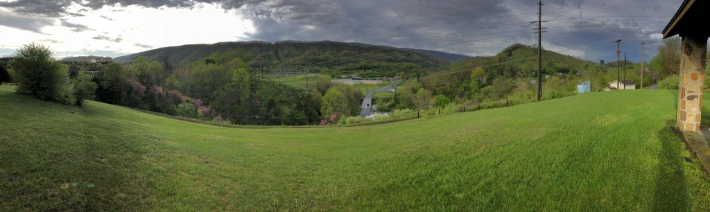
Chattanooga Campaign – Civil War Battlefield #11 First Battle of Chattanooga – Civil War Battlefield #12 Second Battle of Chattanooga – Civil War Battlefield #13 Battle of Chickamauga – Civil War Battlefield #14
It’s hard to believe that it has been over 20 years since I visited my first battlefields in the western theatre, and it all happened somewhat accidentally.
A few friends and I had planned a trip to see Dave Brubeck perform in Knoxville, TN – I had been a fan of his music since high school, and the chance to see him live was too much to pass up. One of my close friends grew up just outside Knoxville, so the plan was to stay with his parents, see some sights, and go to the show. It turned out to be a really great trip – and yes Brubeck was incredible.
One of the things that my friend wanted to do while we were down south was to drive down to Huntsville, AL to visit the US Space and Rocket Center. I had never been, and I have always enjoyed the Air and Space Museum in Washington, DC, so I agreed – mainly because they have a Saturn V rocket, and I had never seen one in person.
I wasn’t nearly as much of a Civil War nerd at the time as I am now. Living in the Baltimore area all my life, I had been to the major NPS sites that my family knew about that were close to home: Gettysburg, Manassas, Antietam, and Harper’s Ferry. We had also taken a few road trips when I was a kid to places like Hampton Roads and Charleston. I had been to a total of 10 battlefields so far, and had very happy memories of tramping around Gettysburg, but at that point in my life, I didn’t really understand the full scope of the war, let alone the idea that there were battles that happened that didn’t become national parks later.
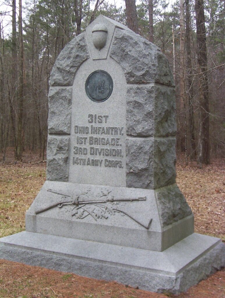
I took only one photo on that first trip to Chickamauga – I was so confused by what that acorn was all about! – Photo by the author
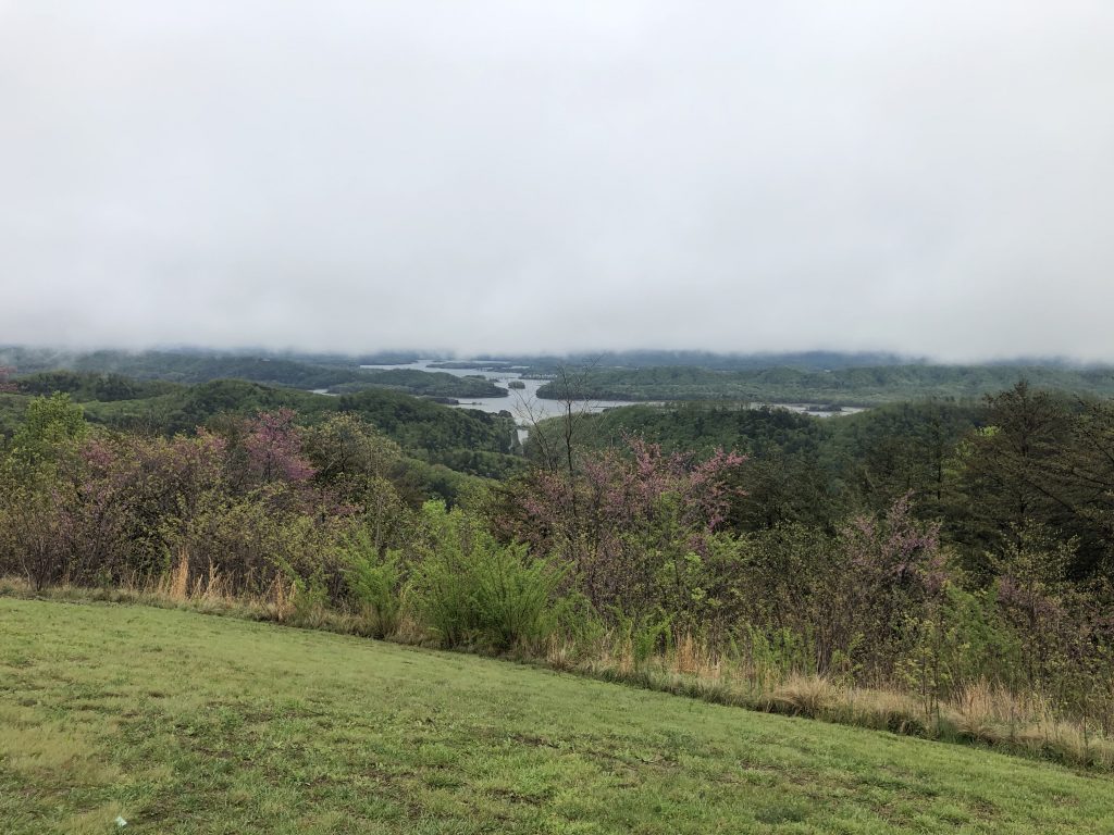
For whatever reason, though, I noticed that our route was going to take us past Chattanooga, and I was able to convince my friends to take the long way through town to be able visit Chickamauga. I drove past Missionary Ridge and saw the prominence of Lookout Mountain for the first time. When we finally got to Chickamauga, we didn’t stop at the visitors center. We didn’t do the actual driving tour. I had NO idea about how the battle was fought, or the personalities involved. I was, frankly, a little lost. I only knew the broad strokes of Gettysburg and that was it as far as Civil War knowledge went for me at the time. In fact, I would say that I didn’t really learn anything during our brief drive-through tour of Chickamauga, but it was still my first time in Chattanooga, and I still count these as my first visits to these fields, because they did begin to open my eyes to the idea of just how much I didn’t yet know.
I’ve since been able to return to Chattanooga three times – even bringing my family along, too. The stories of those trips are coming soon. Through the Internet, I’ve been able to discover so many books and resources to learn more about the conflicts that happened there, and I now consider Chickmauga to be my second-favorite battlefield, right behind Gettysburg. Those mountains and valleys straddling the TN / GA border will always hold special memories for me.
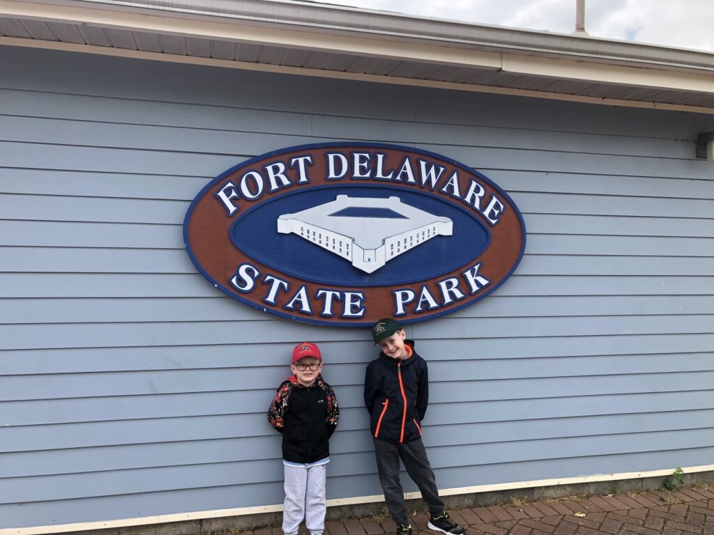
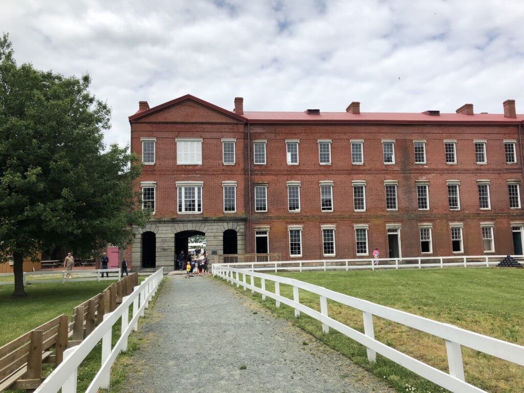
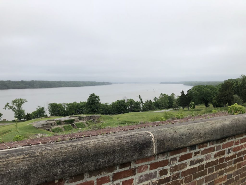
Even before I moved to Delaware, I had my eye on a visit to what I had heard was an excellent mid-19th century, Third System fort that sits on a small island in the middle of the Delaware River, appropriately named Fort Delaware. Back on May 25, 2019, my boys and I made our first trip over to Pea Patch Island to take in the sites of this wonderful old defensive structure. We have since returned a few more times – it’s a really nice experience.
Entry to the fort is from a small gift shop in Delaware City. – Photo by the author
Today, the island and fort are contained within Fort Delaware State Park, and park staff engage in living history presentations on the island as if it was 1864. Most everyone on the island is “in-character” demonstrating various aspects of life in a coastal fortification turned prison during the Civil War.
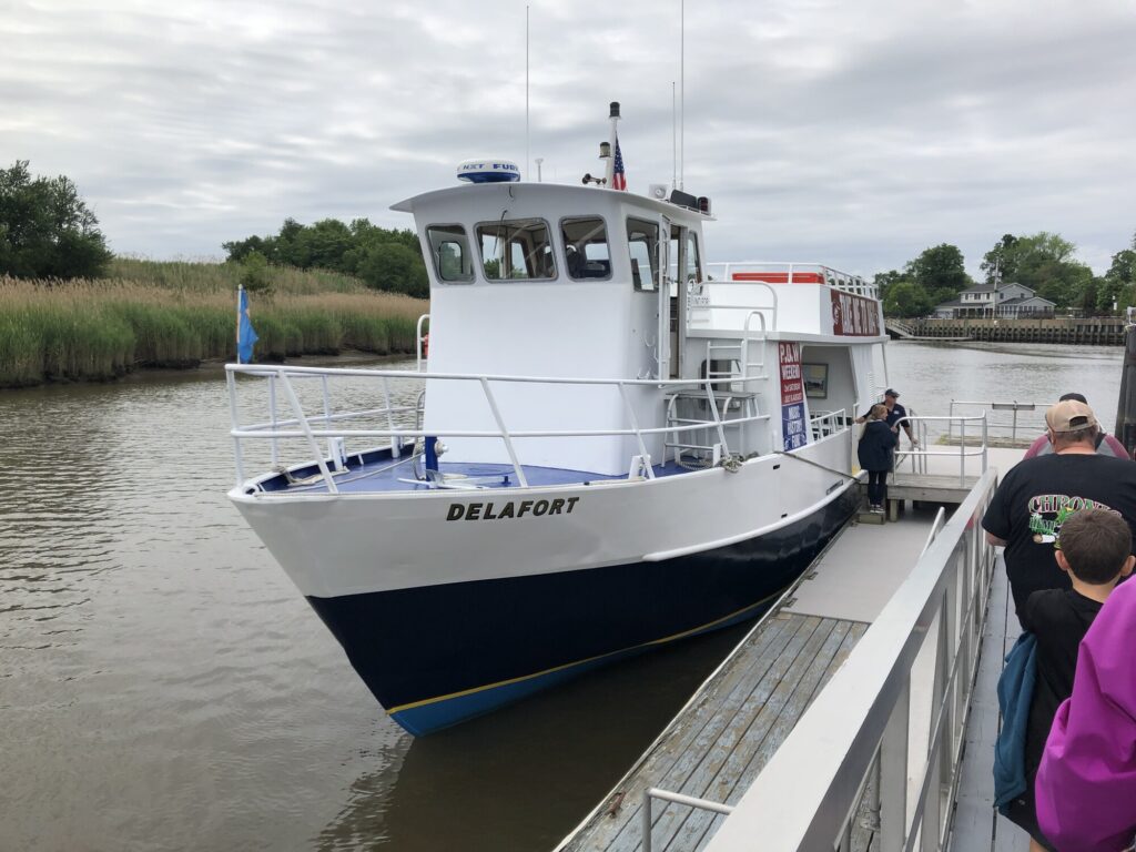
Since the fort is located on an island, the only access is by ferry boat from Delaware City. It also operates seasonally, shutting down visitor access between October and April. We bought our timed tickets in advance online, but I think it is also possible to get walk-up tickets from the gift shop. After a quick stop at the restroom, we were ready to board the Delafort for the 10-minute ride over to the park.
The Delafort is the ferry that runs from Delaware City, to Pea Patch Island, to Fort Mott, NJ, and back. – Photo by the author
Once the ferry docks on the island, a tram takes visitors across the marshy part of the island over toward the historical fort. An audio presentation during the ride talks about some of the history of the island, as well as describing some of the wildlife that can be seen in the marsh as you go by. Eventually, as you make the transition to dry land, the massive fort comes into view.
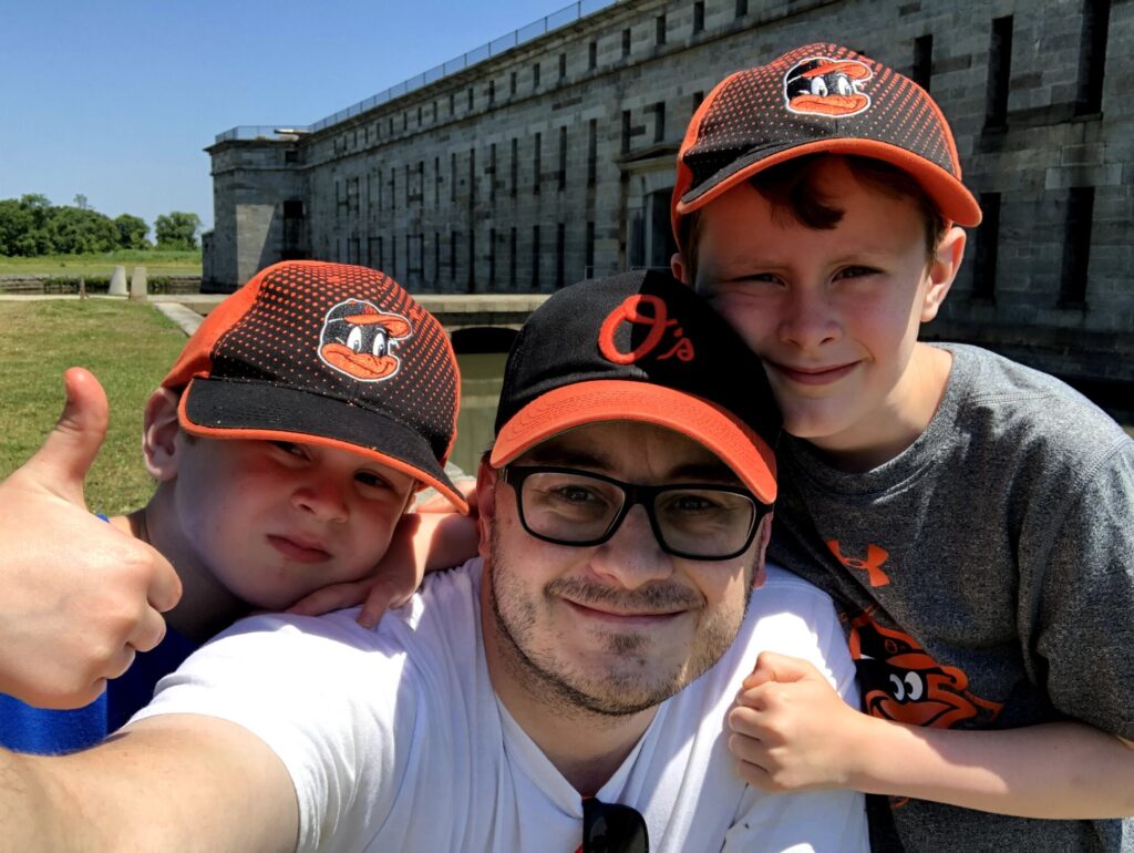
My crew at the sally port. – Photo by the author
Built with the intention of defending Wilmington and Philadelphia from naval attack, the fort was completed in 1859 – just in time to be garrisoned at the outbreak of the Civil War. Like many of the Third System forts, Fort Delaware went through a series of Endicott conversions in the late 1890s to install larger caliber guns in huge concrete emplacements. The remains of the Endicott batteries can be seen on the south side of the island near the modern restrooms, and immediately to the right as you enter the fort. These days, the concrete structures serve mainly as bat habitats.
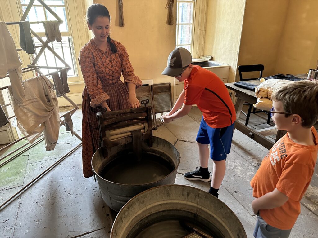
One of the Third System-era structures within the fort houses a small museum and shows what mess, quartermaster, and medical facilities were like. – Photo by the authorOfficers serving at the fort brought their families along. Here my boys learn about how laundry was done before the electric washing machine. – Photo by the author
Every time we have gone, the interpretation of life at the fort has been wonderful. The staff does an excellent job of making the place feel alive as you tour through the various areas within the fort. Favorites for us have been the laundry, mess hall, and blacksmith shop.
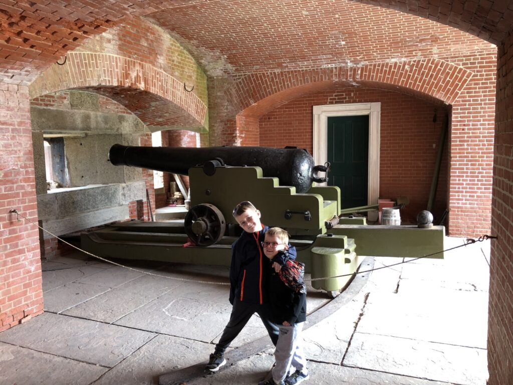
But this was a fort after all, so the real draw is the artillery! Sadly, there isn’t much here in the way of guns, and I believe that what they do have are reproductions. They do a LOT of artillery demonstrations here and it’s generally not safe to do those with weapons that are over 150 years old at this point. A favorite memory for me is from our first visit, when the boys were able to man one of the guns themselves and participate in a firing drill.
My boys with one of the big seacoast guns. – Photo by the author
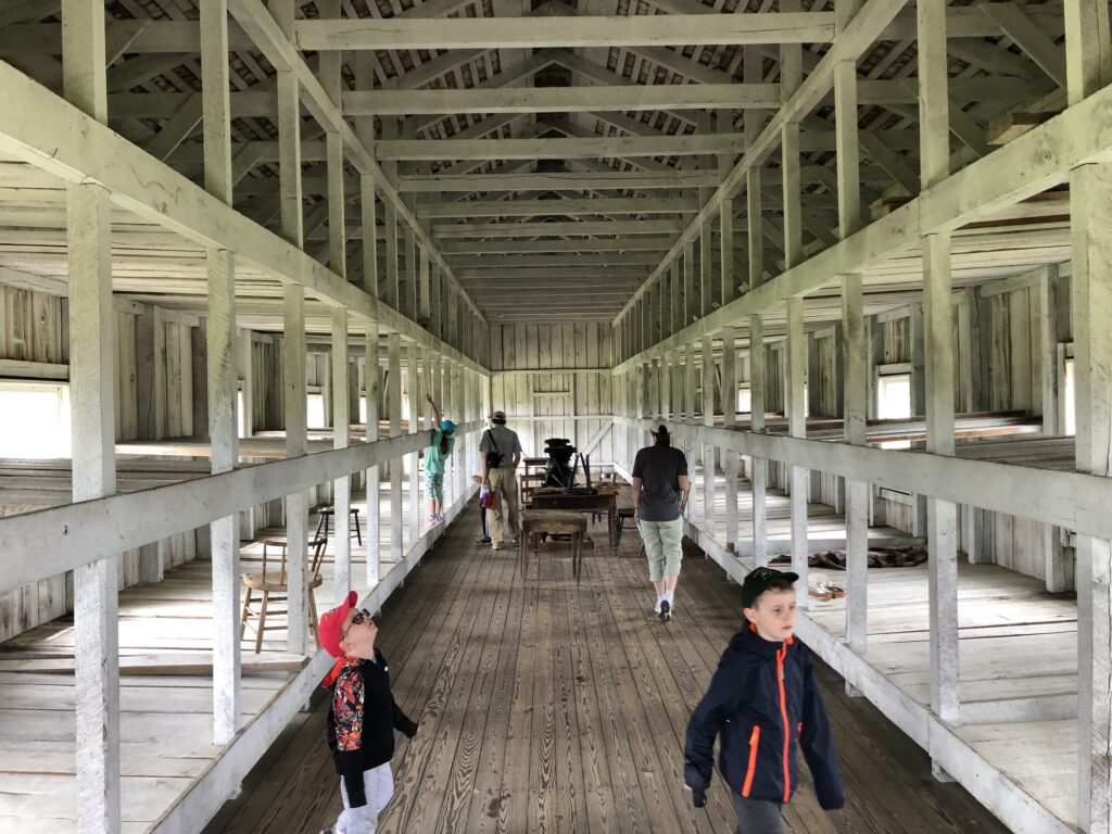
As cool as the guns and casemates are, none of the fort’s defenses were ever tested by an enemy in any era. The main Civil War story here is of the island’s use as a prison camp. Thousands of captured Confederates were confined here. Many died, and there were even a few daring escapes that took place. At the height of it, there were dozens of prison barracks built outside of the fort walls for enlisted men. Captured officers were generally kept within the fort itself. The park has rebuilt one of the barracks from a set of original plans to give visitors a feel for what the conditions would have been like, but it doesn’t do justice to the scale of the prison population that was kept here.
The view inside the rebuilt prison barracks. – Photo by the author
As a fort nerd, I really enjoy going to Fort Delaware. Between the ferry ride and the in-character interpretation of the place, each visit is a true experience. And the fort is in terrific shape – so many of the Third System forts have been messed with over the years – with some becoming almost unrecognizable after going through Endicott conversions. Seeing one that is still at its original height and with many of the interior structures still intact is a real treat. I can’t wait to plan my next visit in the spring.
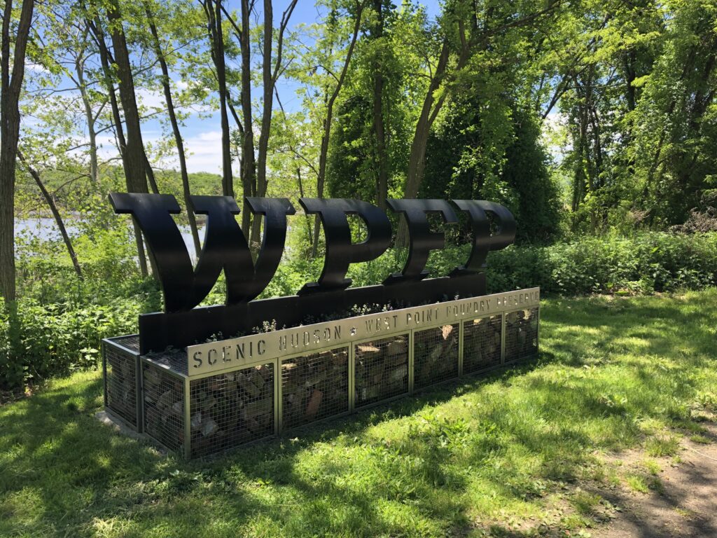
Longtime readers will know that I’m something of an artillery nerd, so while I’m “in the neighborhood” I can’t pass up the chance to see where the West Point Foundry was located. This 19th century industrial site manufactured a number of metal goods, but most notably the Parrott Rifle, invented by, and named for, West Point Foundry Superintendent Robert Parker Parrott.
The sign at the entrance to the “West Point Foundry Preserve” – Photo by the author
The old foundry grounds have been made into a public park – part historic site and part nature preserve. There is also a pretty cool multimedia tour that can be accessed on-site from a smartphone. I took advantage of that tour during my visit.
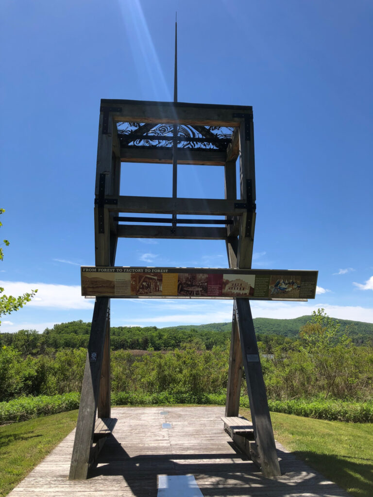
The first thing to visit here is a reconstruction of the old artillery testing rig down near the Hudson River. New artillery pieces were tested by firing projectiles across the river toward Storm King Mountain at the very northern end of the United States Military Academy grounds.
New artillery pieces were test-fired here. – Photo by the author
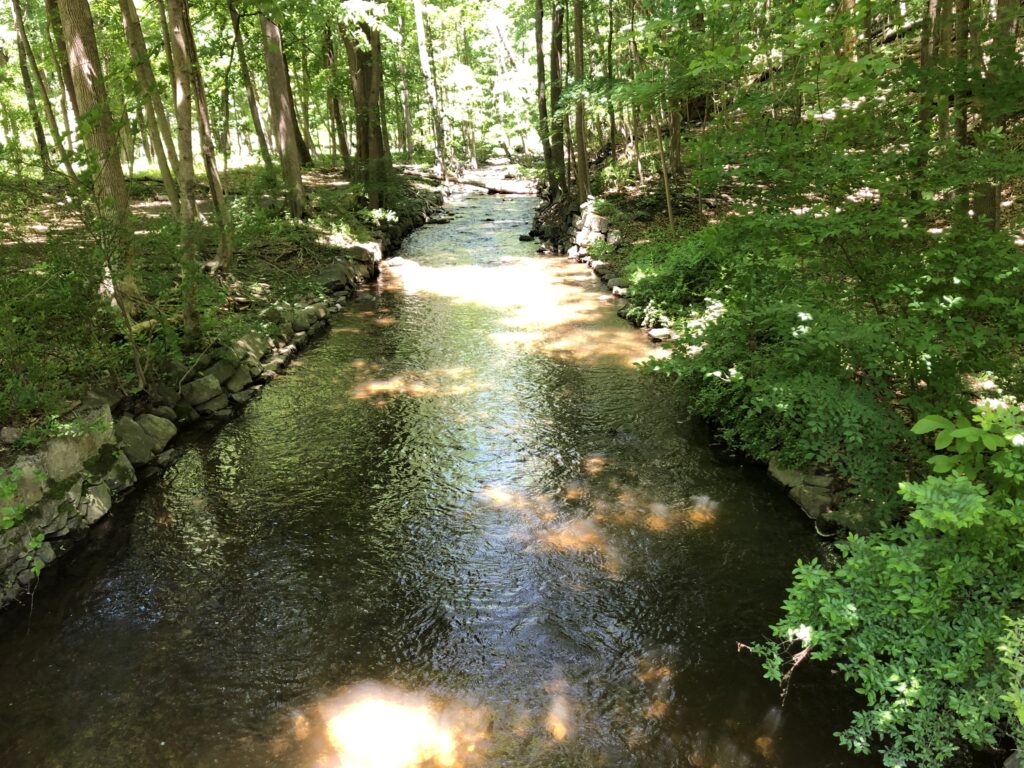
I only saw a few other people while I was there – it is quite a serene setting, so the park works well even if you’re only looking for a quiet time in the woods. The waterway that powered the factory is still here – the aptly-named Foundry Brook – and it provides just enough white noise as you stroll along the path of the old railway bed that ran among the various buildings here.
Foundry Brook still flows through the site. – Photo by the author
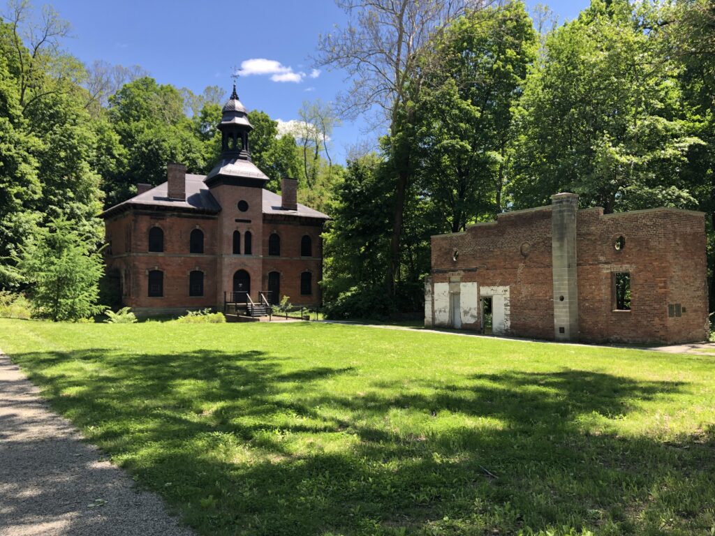
There are several ruins remaining from the days of the foundry. The most notable and prominent is the old 1865 Office Building that was constructed during the height of the site’s productivity. While there are some walls still standing, most of what is left here are building foundations. Even with the multimedia tour and the few wayside markers along the way, you need to use a fair bit of imagination to envision what the place must have been like when it was a major producer of iron goods. Mother Nature has done a good job of reclaiming the land.
The 1865 Office Building at West Point Foundry – Photo by the author
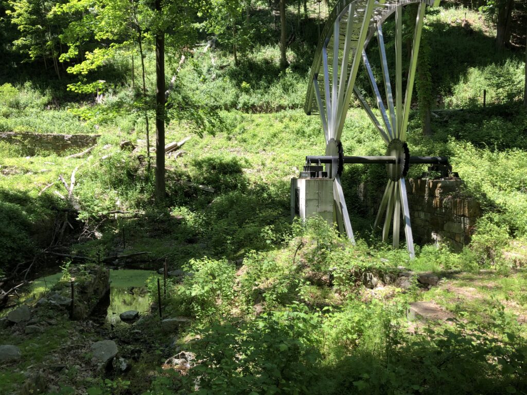
The imagination is assisted a bit by the inclusion of a reproduction of part of the old Boring Mill wheel – mainly so the visitor can get a sense of the scale of the thing. This is the part of the factory that made artillery production possible – it carved out the barrel of the guns and allowed for rifling to be done.
The new “Boring Mill Wheel” helps with the visitor’s vision of what the foundry was like in the mid 19th century. – Photo by the author
I really enjoyed my time at the preserve. There are so many aspects to Civil War history that can be explored – it’s so much more than battlefields.
In April of 2019, I did something that I had never done before: I planned a multi-day battlefield stomping tour of West Virginia, southwestern Virginia, and eastern Tennessee that would take me to some of the most remote places I had visited on my own. It was scary and exciting all at the same time. I spent weeks studying Google Maps and laying out the perfect route. I booked hotel rooms. Finally, after work on the Wednesday before Easter, I started the journey west.
My plan was to be checked in to the Wingate in Bridgeport, WV that night, but I had a stop that I wanted to make along the way.
Battle of Moorefield – Civil War Battlefield #83
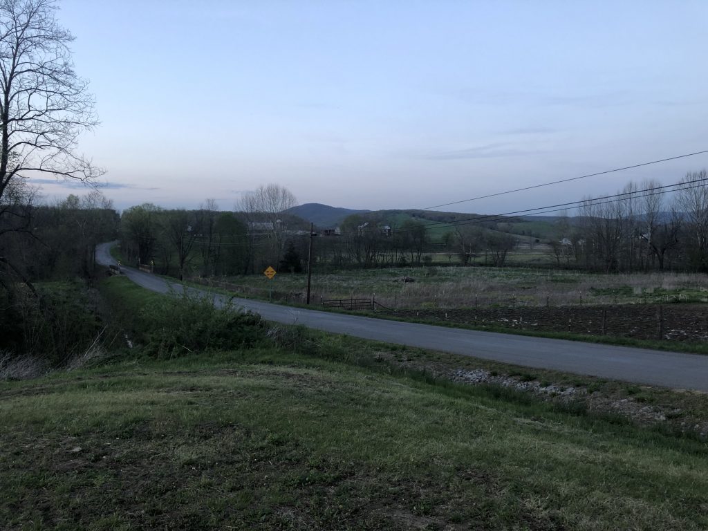
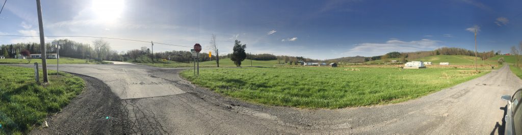
Deviating from my route a bit, I turned north on US Route 220, and found a wayside marker for the Battle of Moorefield. This cavalry fight took place in the gorgeous mountain valley here, and the rolling terrain would have made for some seemingly good defensive positions. The action flowed south toward the town from this spot, but I’m glad that I took the time to take in this picturesque view.
Even if you aren’t interested in battlefields, the drive through the rolling valleys of Harding County, WV is absolutely lovely. – Photo by the Author
Day 1
After a good night’s rest, I woke up early, grabbed some breakfast in the hotel lobby, and hit the road for a great day of exploring. I knew this day would be the trickiest of the trip, as several of the stops that I had planned were up in the mountains, in the middle of the National Radio Quiet Zone (NRQZ) – where my cell phone would definitely not work. If I ran into some kind of problem, I’d have a hard time getting help.
Battle of Philippi – Civil War Battlefield #84
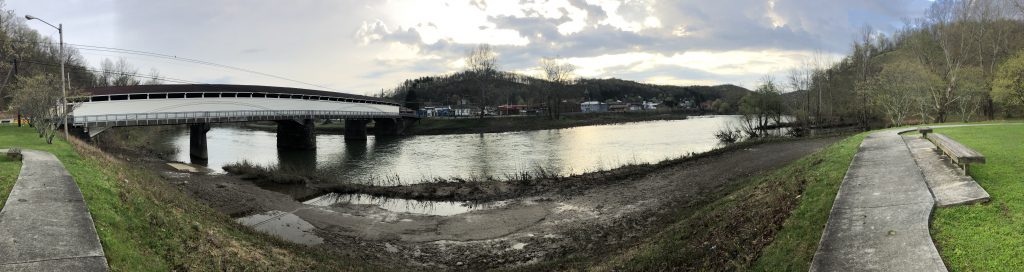
Appropriately, my day started at the first land battle of the Civil War – no, it wasn’t Manassas – it was the Battle of Philippi. There is a nice park along the Tygart Valley River here with flags, markers, and monuments – some of which aren’t Civil War-related. There is also a covered bridge here, which factored in the battle, although it has clearly been modified to handle modern automotive traffic.
The view of the Tygart Valley River from Blue and Gray Park in Philippi. – Photo by the Author
Battle of Rich Mountain – Civil War Battlefield #85
I took a bit of a winding route from Philippi so that I could approach Rich Mountain from the west, much like the Union army did during the battle. My understanding is that this road – which follows the original trace of the Staunton-Parkersburg Turnpike – has since been paved, but at the time I visited, it was gravel all the way up to the summit. Once I was at the top, the first thing I noticed was how serene it was. Speaking as someone who has lived in suburbs all his life, it is shockingly quiet in the mountains of West Virginia.
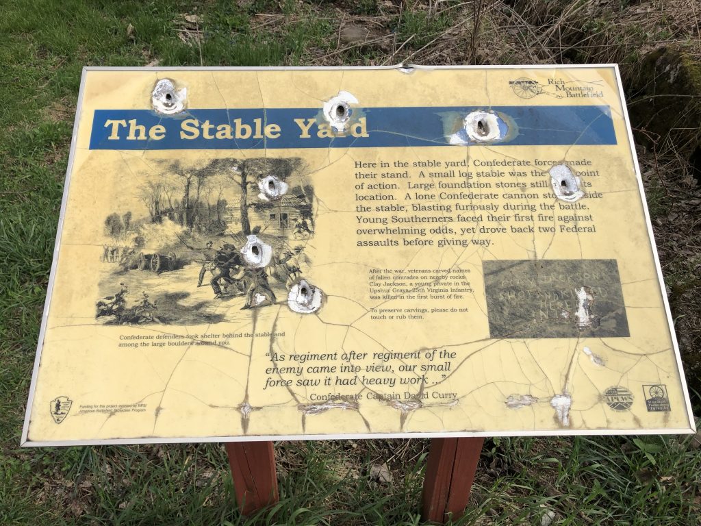
There is something of a joke among Civil War nerds that a common question that tourists ask is something like this: “If a battle happened here, why aren’t there any bullet holes in the monuments?” (The second question is “Why do these battles always happen in National Parks?”) Well, I can tell you, at Rich Mountain nearlyeverymarker has bullet damage in it (though I doubt it was caused in the 19th century). To be honest, I got a little nervous reading these tablets that had clearly taken rounds fired from behind where I was standing.
In West Virginia, the monuments really do have bullet holes in them! – Photo by the Author
There is a local preservation group that seems to spearhead the acquisition and care of the battlefield land, but they have their work cut out for them given the state of the signs and markers when I visited. The American Battlefield Trust has also helped with securing land at the site.
Even with the rough condition, there are adequate waysides at the top of the mountain to understand what happened during the battle. Most notably, this is the battle that (rightly or wrongly) gave George McClellan the chance to make a name for himself, and basically catapulted him into the command of the Union army. I’d argue that William Rosecrans was actually the critical personality at this battle. Definitely worthy of a visit – this one is a hidden gem of the Civil War.
Battle of Cheat Mountain – Civil War Battlefield #86
A short drive to the southeast from Rich Mountain put me inside the NRQZ. My cell phone would be without a signal for the next 4 hours as I drove up and down the mountains.
My next stop was the Battle of Cheat Mountain, now contained within Monongahela National Forest. There was a short drive up a gravel mountain road right off of US Route 250, approaching the site of Cheat Summit Fort (also known as Fort Milroy) from the east. Even though there were 20th century strip mining operations in the area, the terrain immediately around the fort is still pretty well-preserved, and it is another amazingly quiet spot. There is an observation platform near the middle of the fort, and even some preserved earthworks. Plenty of waysides and markers tell the story. From the sound of things, this was an extremely remote and miserable place to be for the Union soldiers in the early days of the Civil War, with snowfalls occurring even in August.
Battle of Greenbrier River – Civil War Battlefield #87
Down in the valley to the east of Cheat Mountain, is the modern day town of Bartow, WV, site of the Battle of Greenbrier River in the fall of 1861. The US Forest Service ranger station on the east side of the town has a small museum with information about the local wildlife as well as some historical displays about the Battle of Greenbrier River, as well as the Battles of Cheat Mountain and Camp Allegheny, including a few artifacts. Outside, a wayside marker describes some cavalry action that took place in the area later in the war.
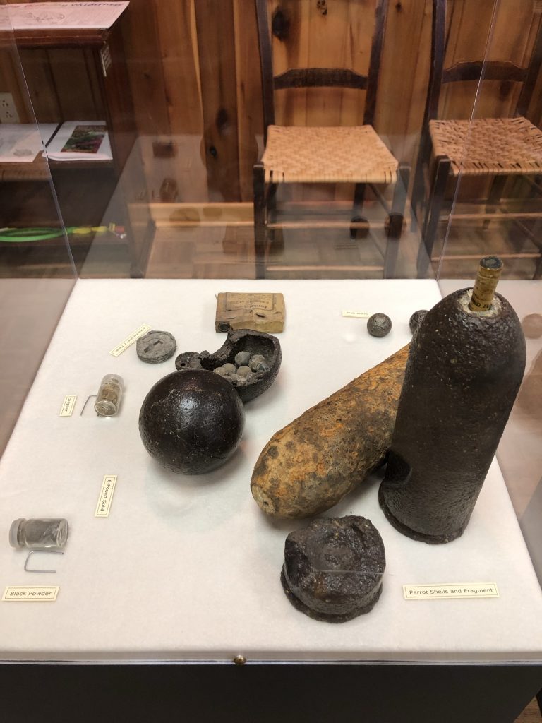
Some of the artifacts on display at the Greenbrier Ranger Station. – Photo by the Author
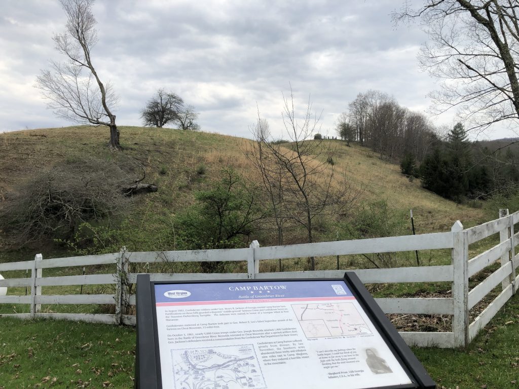
Continuing along US Route 250, and crossing over the east fork of the Greenbrier River, you can find the site of the Confederate Camp Bartow a short distance to the east. A nice wayside there discusses the failed Union “reconnaissance-in-force” that attempted to dislodge the Confederates and that we now recognize as the Battle of Greenbrier River.
The Confederate Camp Bartow was on this hill. – Photo by the Author
Battle of Camp Allegheny – Civil War Battlefield #88
One of the great pieces of information I got from the ranger at the Bartow Forest Service station was that the best approach to the site of the Battle of Camp Allegheny was from the east. A dirt road splits off from US Route 250 immediately before you hit the Virginia state line, and that would be the smoothest way for me to reach the top of the mountain. There is a small area to pull off right at the start of that road so that the couple of waysides and markers talking about Camp Allegheny can be viewed.
The dirt road up to the “Top of Allegheny” was rough. Probably the scariest road I’ve ever been on. It is a single lane, dirt road, twisting up the side of a mountain. It is full of massive potholes that you have to carefully avoid (especially when you’re in a 2009 Honda Civic with very low ground clearance), and absolutely nothing like guardrails. It was a bumpy and potentially dangerous ride, but I was not going to pass up the chance to visit this site!
At the top, I pulled into the small Forest Service parking area just as a slight drizzle started. I took some time to examine the wayside there and then fired up the video camera on my iPhone to capture my impressions.
The site of the historical fort is out in the field you see toward the end of the video. That is all private property today. Once again, this was an extremely peaceful and quiet place. And the fact that you have to take a single-lane dirt road to get there, and that there wasn’t a prayer that you’d get a cell signal (thanks to the NRQZ) really made it feel like you were stepping back into 1861. This one stop was definitely the emotional high point of the trip. I am SO glad I did it.
It became clear that there was no good way down the mountain to the west, so in order to head to my next stop, I’d have to retrace my steps back to Bartow.
Green Bank Observatory and Science Center – A Brief Interlude
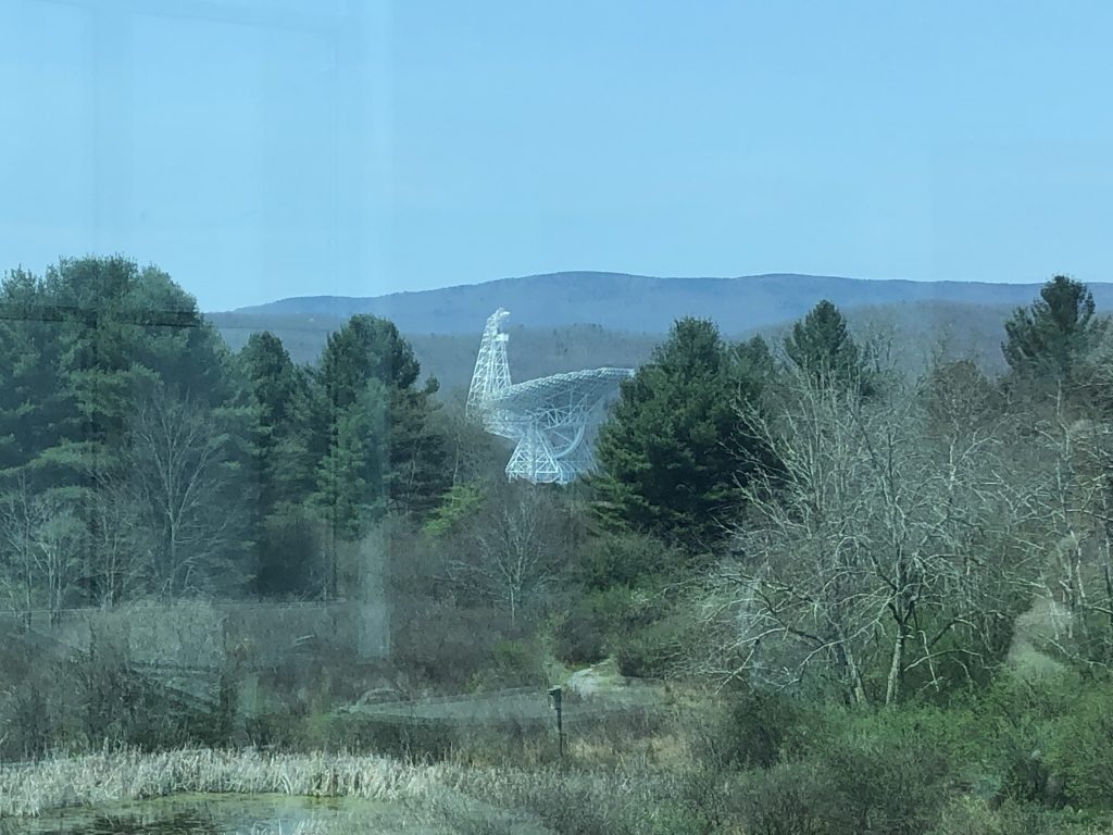
At Bartow, I turned south, and drove along the Potomac Highlands Trail until I reached the town of Green Bank, WV.
The largest of the Green Bank radio telescopes as viewed from the museum. – Photo by the Author
This very unique town is host to the Green Bank Observatory and Science Center. Here, massive radio telescopes listen for signals from the distant universe – something that is only possible inside the NRQZ. Radio transmissions are extremely restricted in town. Residents aren’t allowed to run wi-fi access points, nor use microwave ovens in their homes. The radio telescopes are situated relatively far from public roads, and only diesel-engine vehicles are allowed to take visitors close enough for tours as even the radio noise from a spark plug is enough to ruin their experiments.
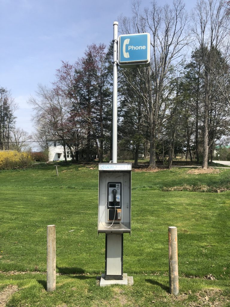
I grabbed lunch at the Starlight Café within the museum – seemingly the only restaurant in town – and had a chance to check out the exhibits and pick up a few souvenirs for the boys. Since there are no radio transmissions allowed in the area, I also was able to catch a photo of a rare historical artifact.
An ancient artifact from a simpler time. – Photo by the Author
Battle of Droop Mountain – Civil War Battlefield #89
Heading farther to the south and west, I was eventually able to see signal bars on my iPhone again as I approached my next stop, the Battle of Droop Mountain. A roadside marker along the way confirmed that I was on the right track.
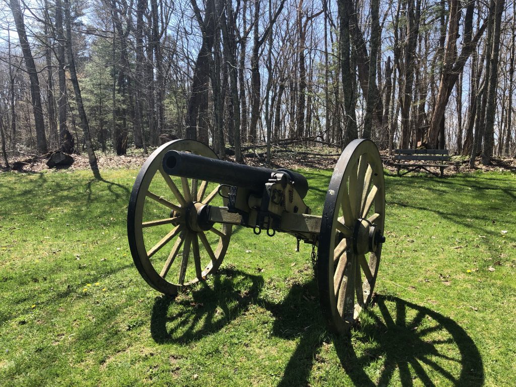
Now a West Virginia State Park, this battlefield has been very well-preserved and has several markers and even a fewmonuments. Near the parking lot, I had my first artillery sighting of the trip – although it was a replica 10-pounder Parrott Rifle.
The first artillery sighting of the trip – a fake 10-pounder Parrott at Droop Mountain. – Photo by the Author
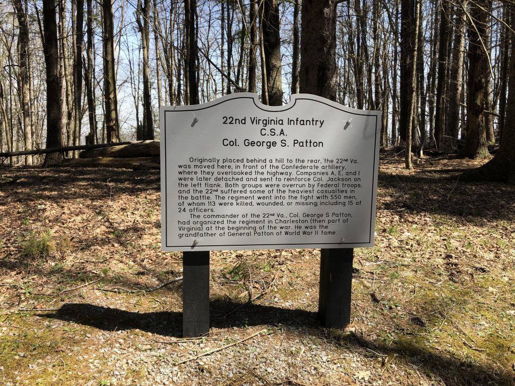
Many units have individual markers like this one to the 22nd Virginia Infantry that are placed along the main tour road. Col. George S. Patton, grandfather of the famous WWII general, commanded this particular regiment at Droop Mountain.
The grandfather of famed WWII General George Patton commanded a Virginia regiment at Droop Mountain. – Photo by the Author
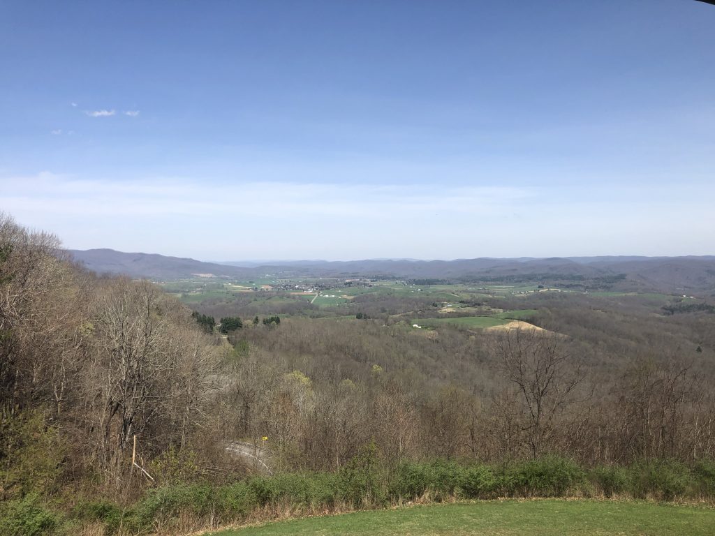
The true highlight of this field is the distinctive observation tower located on the far eastern slope of the mountain. The views up the valley toward the town of Hillsboro, WV are magnificent. Trust me when I say that the photos I took don’t do it justice.
The views alone are enough to justify a visit to Droop Mountain. – Photo by the Author
Battle of Carnifex Ferry – Civil War Battlefield #90
My next leg took me deeper into West Virginia and weaving through the mountains that were clearly coal country. I passed several old industrial sites, and small towns on my way to the West Virginia State Park that preserves the Battle of Carnifex Ferry.
Like Droop Mountain, the fact that this is a state park means that it is pretty well-preserved, and therearenumerousmarkers to explain what took place here. I think my favorite aspect of this park was the numerous warnings – on their website, as well as on signs around the park – that you should stay on marked trails because of the high risk of unexploded ordnance STILL being in the ground here after more than 150 years.
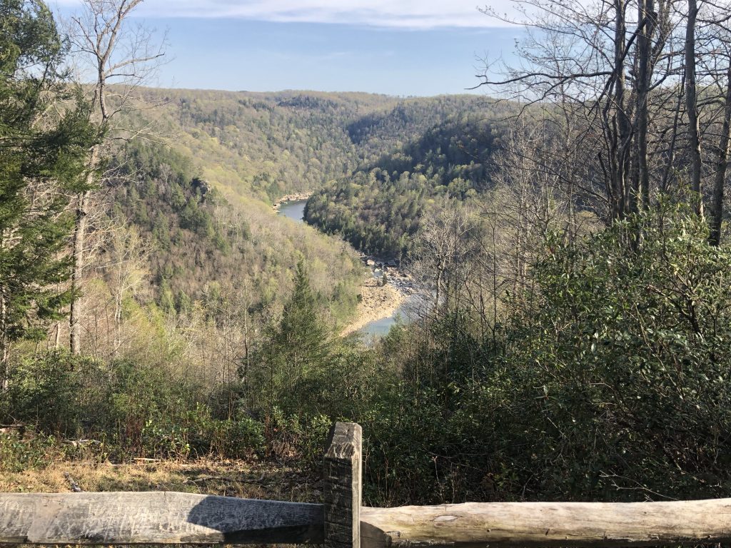
One such trail leads along the side of the mountain to stunning views of the Gauley River valley below. Once again, the images you get from a camera just can’t capture the feeling of being there yourself.
There are beautiful views of the Gauley River from the Carnifex Ferry State Park. – Photo by the Author
Battle of Kessler’s Cross Lanes – Civil War Battlefield #91
Just north of Carnifex Ferry is a much smaller engagement: the Battle of Kessler’s Cross Lanes. Today, this site is little more than an intersection. There are somemarkers near the local volunteer fire station, as well as a wayside at the local gas station that explain more about what happened here.
The battlefield at Kessler’s Cross Lanes. – Photo by the Author
New River Gorge Bridge – Another Brief Interlude
I was done with battlefields for the day, but I still needed to make it to my hotel for the night, which was booked for Princeton, WV. I made my way to US Route 19 and headed south.
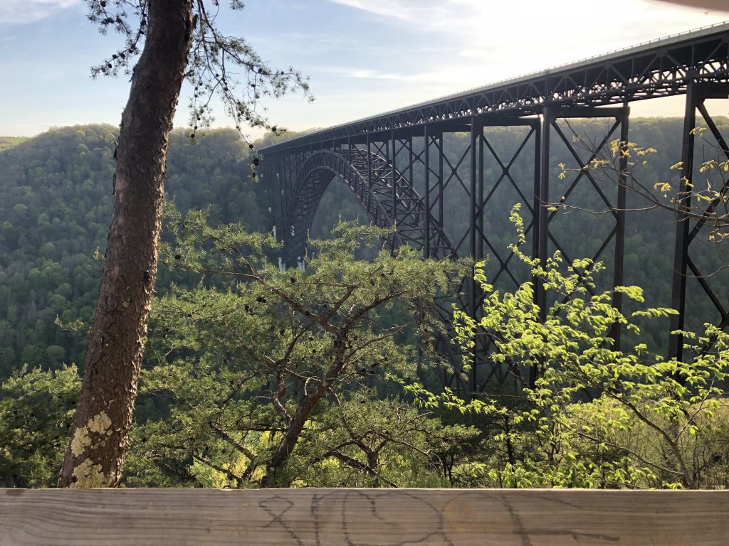
Along the way, I knew I would need to pass over the New River Gorge Bridge – one of the tallest and longest single-arch bridges in the world. Now, I am very acrophobic, but I’ve never really had a problem with bridges, so I wasn’t worried about having to drive over this thing, but I made a critical mistake: I pulled over at the NPS New River Gorge visitor’s center to get a view of this engineering marvel first.
The incredibly impressive New River Gorge Bridge. – Photo by the Author
The bridge is on a scale that I can’t even describe. It spans the gorge 867 feet above the river – high enough to fit the Washington Monument and 2 Statues of Liberty stacked on top for good measure, underneath the arch, with 20 feet to spare. I was blown away by how massive it was. This would easily be the tallest structure I had ever been on. After I collected myself, I was able to white-knuckle it across, and I swear that I felt absolutely EVERY slight sway and bump my car made along the road deck.
Obviously, I survived. 🙂
Day 2
Got an early start from the Microtel Inn in Princeton, WV. The first order of business was to check out downtown Princeton, and then see how many other sites I could hit in Tennessee and Virginia.
Battle of Princeton Court House – Civil War Battlefield #92
I parked near the court house and explored a little bit. Sadly, I could only find one wayside marker that mentioned the Battle of Princeton Court House. It talks about some fighting happening near the court house itself. There is a military museum across the square, but it wasn’t open during my visit. It is very hard to get a sense of the fighting here, as the area appears to have been built up in the years since, and I suspect that much of the terrain has been altered.
With my visit to Princeton, I have now seen every official Civil War battlefield in West Virginia, so that’s a pretty cool milestone.
Battle of Cove Mountain – Civil War Battlefield #93
Heading south on Interstate 77, I crossed into Virginia, and before long I was in the outskirts of Wytheville, VA on my way to the site of the Battle of Cove Mountain.
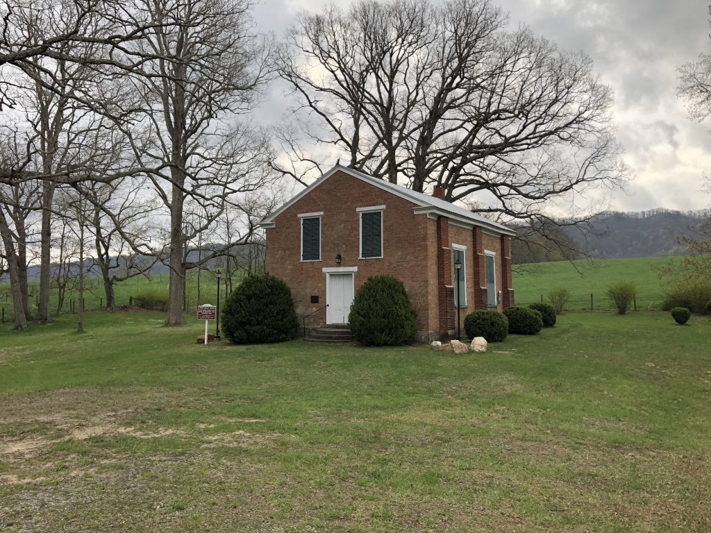
The terrain here is very pretty. As the name suggests, the field sits in the valley of a horseshoe-shaped mountain formation – only opening up on the western edge. The valley is full of farms among the rolling hills, and is quite pretty to drive through.
Fighting seems to have happened down the valley near the open end, but that is mostly an educated guess on my part. The few markers I was able to find are short on details. The old brick church here became a temporary hospital, and is still used on special occasions by a local congregation in Wytheville.
The Crockett’s Cove Presbyterian Church is still used on special occasions by a local congregation from Wytheville, VA. – Photo by the Author
After a few moments of reflection at the church, I got back in the car and decided to go southwest. There was a threat of storms, and I decided to try to maximize my trip by going to the farthest battlefield I could and then working my way back home, hitting more sites along the way. I crossed into Tennessee, and was delighted to get WDVX back on my radio once again.
Battle of Fair Garden – Civil War Battlefield #94
Almost to Knoxville, I found that the Battle of Fair Garden is yet another engagement that is very hard to picture because of the changes to the terrain that have occurred over time. There is a very good wayside on the grounds of Walters State Community College, Sevierville, but I believe that the all the “landmark” buildings of this battlefield are gone.
Battle of Dandridge – Civil War Battlefield #95
There were a few incidents of fighting in Dandridge, and there area fewmarkers that at least make mention of them. The official Battle of Dandridge happened on January 17, 1863. The Bradford-Hynds House – used by both Union and Confederate officers as a headquarters at different points – still stands downtown. That downtown area sits in something of a bowl-like depression geographically, and my best guess is that the fighting happened up at the rim.
The Bradford-Hynds House was used as a headquarters by officers of both sides during and after the battle. – Photo by the Author
Battle of Mossy Creek – Civil War Battlefield #96
At the time that I visited, the bridge over Mossy Creek was out, so I had to take a bit of a circuitous route to reach the Battle of Mossy Creek. The field has been overtaken by a baseball diamond, an industrial park, and – appropriately – a National Guard facility that has a few historical markers and waysides near its entrance. Given all the construction, I have to imagine that the terrain isn’t what it was in the 19th century.
Battle of Bean’s Station – Civil War Battlefield #97
I had gotten a tip that while the field of the Battle of Bean’s Station no longer existed, you could get a good view of the area from an overlook on Clinch Mountain along US Route 25E. There is even a marker there that mentions the fighting. It was very overcast and rainy on the day that I visited, so I didn’t get the greatest experience myself. I have since learned that there may be other markers and waysides closer to the shoreline.
Unfortunately, the battlefield no longer exists because it is underwater now. When the TVA built the Cherokee Hydroelectric Dam, they flooded the area where the action took place.
The Bean’s Station battlefield is sadly now under the TVA’s Cherokee Reservoir. A nearby overlook on Clinch Mountain offers a nice view of the area. – Photo by the Author
Battle of Bull’s Gap – Civil War Battlefield #98
Thanks to another tip, I was directed to the Bull’s Gap Railroad Museum as a source of information about the Battle of Bull’s Gap. It turned out to be great advice. I had a lovely conversation with Bill (who seems to run the museum) and his brother. They regaled me with tales of their Civil War ancestors and their actions in the area. History can have such an impact in places like this.
Bill was nice enough to direct me toward the gap, which seems to have been where the combat action was, but I couldn’t find a single marker anywhere in the area.
A view of Bull’s Gap from the northwest. – Photo by the Author
Battle of Blue Springs – Civil War Battlefield #99
Another place where I believe the terrain has changed, and there were a few different actions at different times in the area of the Battle of Blue Springs, so I couldn’t get a good sense of how things unfolded exactly on the ground. There is a wayside marker in the local Food Country parking lot, and another roadside one nearby.
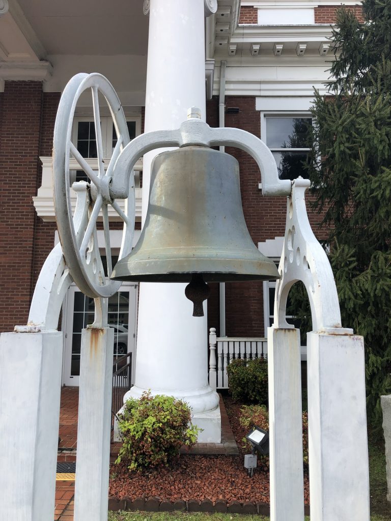
Battle of Blountville – Civil War Battlefield #100
My 100th battlefield! What an incredible milestone in my journey!
There are many historicalwaysides, markers, and even a memorial describing some of the action along the main street in town. I was able to park my car and just walk along the street reading as I went. Blountville is clearly very proud of its history.
During my walk, I learned that part of the town – including the court house – burned due to artillery fire from the Battle of Blountville. One of the things that I didn’t expect to find was the original bell from the town court house, which the plaque identified as having been forged in my native Maryland.
Unexpected discovery: the original bell from the Blountville Court House was forged in my native Maryland. – Photo by the Author
After I’d had enough exploring, I made my way back to the car and continued east on Interstate 81, crossing back into Virginia. I was well on my way home, but I hoped to hit just one more town before I ran out of daylight.
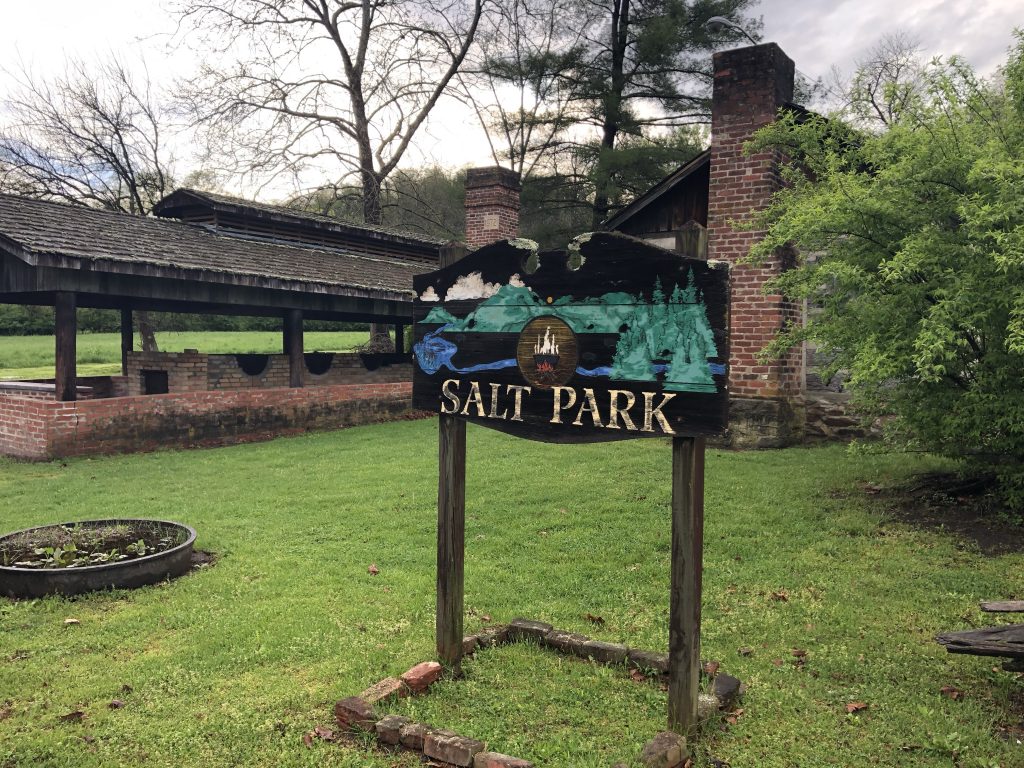
Second Battle of Saltville – Civil War Battlefield #101
The aptly-named Saltville, VA had a key role to play in the Civil War. This was the Confederacy’s main source of salt – especially toward the end of the war – and it was vital to keep those supplies coming as salt was used as a preservative for the food that was feeding the army. As much as the Confederates wanted to defend this place, the Union wanted to disrupt and destroy these operations. Two official battles were fought here, and because of the way I came into town, I passed by the site of the Second Battle of Saltville first.
Salt Park is along the road southwest of town, and has a very cool display of equipment that would have been used in the production of salt in the 19th century, and gives something of an idea what the salt works would have been like. In addition, they also host a couple of wayside markers that discuss the battle. The hills where the Confederates had their defensive positions set up are visible from here, and they look quite imposing.
This small park with examples of equipment that was used in the process of making salt in the 19th century is located near the site of the Second Battle of Saltville. – Photo by the Author
First Battle of Saltville – Civil War Battlefield #102
The best place to experience this field from is a small park on the hill overlooking where Cedar Creek runs into the Holston River. The Confederate defenses were posted on this hill. A very good wayside marker tells the story here, but this is also one of those fields where you can almost see what happened as soon as you look out from this defensive position. The Union forces – mostly consisting of United States Colored Cavalry Troops – were slaughtered by the vengeful Confederate defenders.
A view of the battlefield from a small park overlooking the north branch of the Holston River. – Photo by the Author
Back in February of 2019, I took a day to explore some of the battlefields that I hadn’t yet visited in Northern and Central VA. I put together a route on Google Maps, hopped in the car, and spent the day on the road. This post consists of my edited notes on each field from that day.
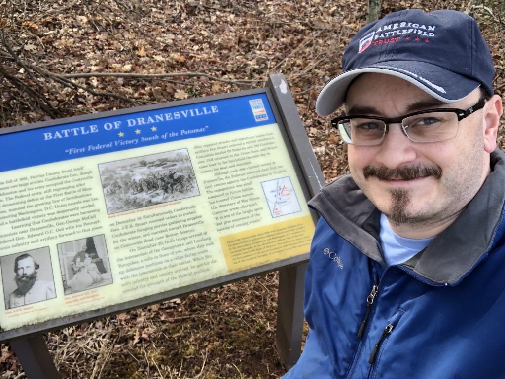
Battle of Dranesville – Civil War Battlefield #74
The action of the Battle of Dranesville took place around the intersection of VA Route 7 with Reston Ave. & Georgetown Pike. There is a marker on Georgetown Pike, and a wayside not too far away. There is also another wayside at the Dranesville Tavern Park about a mile to the west. The terrain seems to favor the Union position, as it appears they were elevated. The armies came through this area during many campaigns, as indicated by other markers in the vicinity.
A #SignSelfie with the Civil War Trails wayside at the Dranesville Tavern. – Photo by the Author
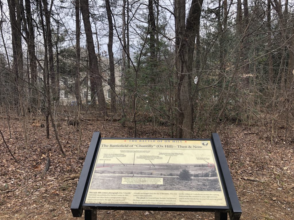
Battle of Chantilly (or Ox Hill) – Civil War Battlefield #75
A small portion of the field exists as Ox Hill Battlefield Park. Most of the area has become modern shopping and housing complexes. The push to save this field in the 1990s is what sparked the modern battlefield preservation movement, so this place is doubly significant for a battlefield nerd like me. The park is quite nice, with a walking path and 9 different waysides describing the action of the battle. Markers exist for the deaths of Brig. Gen. Isaac Stevens and Maj. Gen. Philip Kearny, but only Stevens’ is accurately placed. Gen. Kearny was likely killed in what is now the middle of Monument Drive.
A wayside describes the historic landscape as modern housing is visible through the thin veil of trees at Ox Hill. – Photo by the Author
Battle of Blackburn’s Ford – Civil War Battlefield #76
This fight was a relatively small one immediately preceding the First Battle of Bull Run. There are a couple of wayside markers talking about the action in the parking lot for the Bull Run-Occoquan Trail along Centreville Road. Just up the hill to the south, in a CVS parking lot, is a series of markers that discuss the Wilmer McLean plantation.
Battle of Manassas Station Operations – Civil War Battlefield #77
This most oddly-named battle was really a series of smaller raids by Maj. Gen. Thomas J. “Stonewall” Jackson along the Orange and Alexandria Railroad. There is a wayside in downtown Manassas, on the north side of the railroad tracks near the station.
First Battle of Auburn – Civil War Battlefield #78
There is a marker for the location of Stuart’s Bivouac, and that’s about it. I was in the process of exploring this battlefield – pulled over on the side of the road with my flashers on to get my own photo of the above marker – when a lady pulled by slowly and rolled down her window to ask if I needed help. I’ll leave the answer to that question as an exercise for the reader. 😉
Second Battle of Auburn (or Coffee Hill) – Civil War Battlefield #79
I’m really not sure why this is even considered to be a separate battle from the First Battle of Auburn. It took place the next day, in the same vicinity, and involved basically the same combatants. Nevertheless, there are some nice markers talking about it near Cedar Run.
The view looking toward Coffee Hill, across Cedar Run, from the area where the Second Battle of Auburn historical markers are today. – Photo by the Author
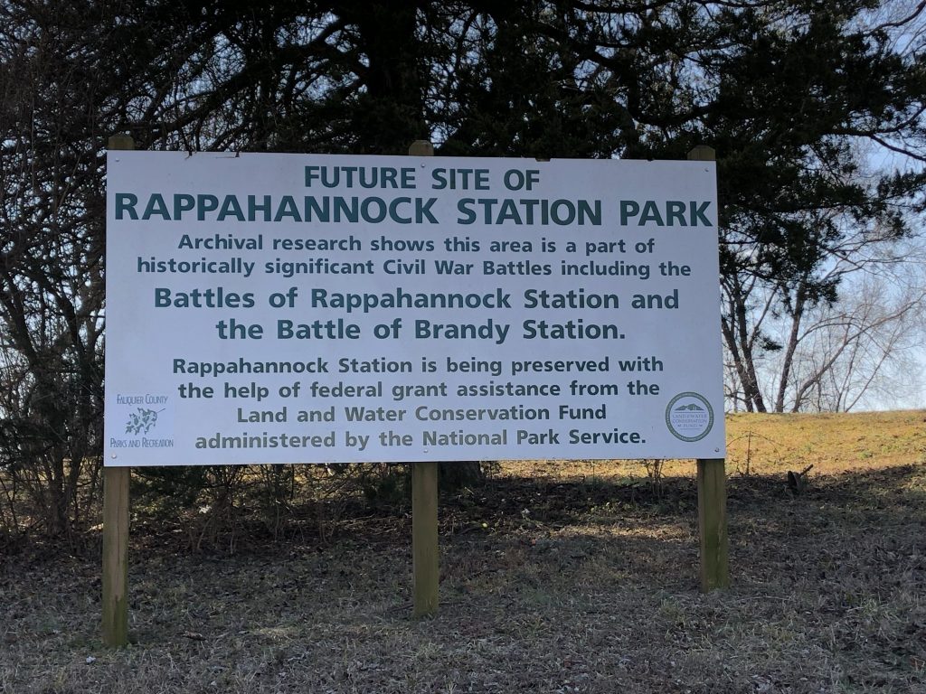
Second Battle of Rappahannock Station – Civil War Battlefield #80
A small park is coming at Rappahannock Station. Some hope for the future? – Photo by the Author
First Battle of Rappahannock Station – Civil War Battlefield #81
From the Rappahannock Station Park, it was a quick drive across the river to the intersection of Business Route 15, and US Route 15/29, which period maps seem to indicate was the center of the action for the First Battle of Rappahannock Station. There are no markers there that I could find, even though there is a good-size gravel pull-off along the side of a major road.
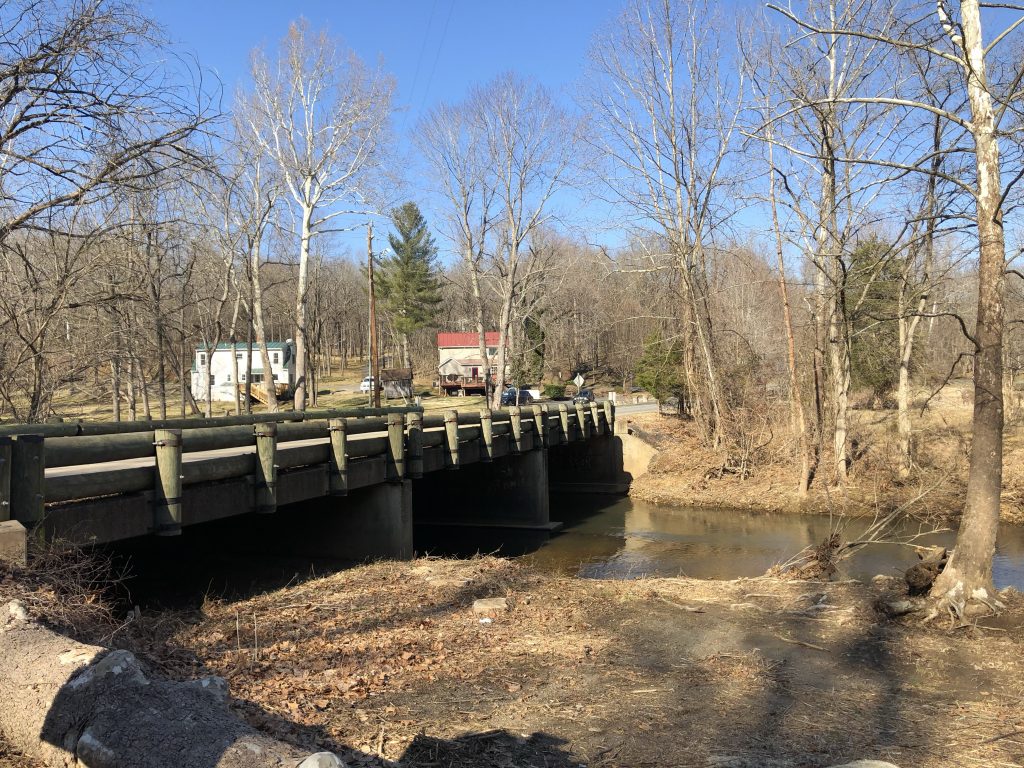
Battle of Kelly’s Ford – Civil War Battlefield #82
A short distance away from Rappahannock Station lies the site of Kelly’s Ford. A battle here in March of 1863 was the main attraction for me this day, but the river crossing was also used by Union troops later at the Battle of Brandy Station. There are nicewaysides near the modern-day bridge over the ford. There also appears to be a marker at the spot where “The Gallant Pelham Fell”, but it was back a trail that was marked as being an active hunting area, so I decided not to risk it on my own.
One of the nice things about the place where I work is that we usually get extra time off around Thanksgiving – normally the day before. Most years it ends up being a free day for me with no other responsibilities, so that means that it’s an excellent time to do some battlefield stomping! Back in the fall of 2018, it specifically meant that I got to visit a few battlefields in the area of Eastern West Virginia that I’d never been to before. This post is made up of my edited notes from that day.
Battle of Shepherdstown (or Boteler’s Ford) – Civil War Battlefield #68
The battlefield is right along the Potomac River. There are a few of the large, metal Antietam / South Mountain / Harper’s Ferry-style wayside markers that tell the story pretty well.
The terrain is the story (isn’t that always the case with these battlefields?). High cliffs along a river. There’s one gap, so obviously that’s where the attack was made. There are also some old cement mill ruins there. It was reasonably serene on this day.
The central part of the Shepherdstown Battlefield. – Photo by the Author
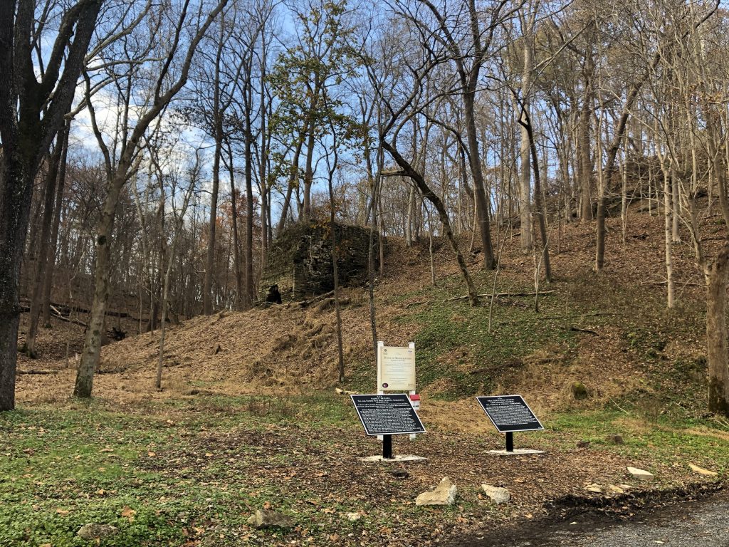
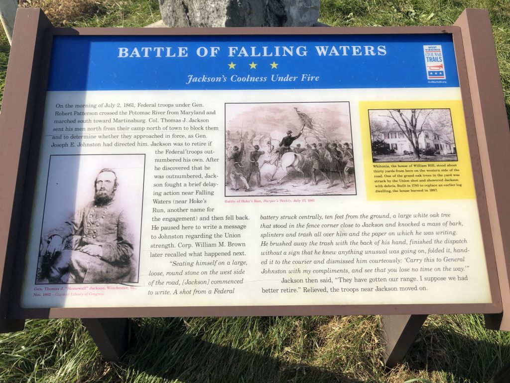
Battle of Hoke’s Run (or Falling Waters or Hainesville) – Civil War Battlefield #69
One of the many waysides that describe the action of the Battle of Hoke’s Run. – Photo by the Author
This battlefield was marked better than I thought it would be. I was able to find a few waysides on the Historical Marker Database, and they tell a thorough story. There’s some “Stonewall” Jackson lore at this field, so that must be why so much attention has been paid here. Terrain seems like it hasn’t changed *too* much, but the Valley Pike (modern-day US Rt. 11) is clearly more built-up than it was during 1861.
Battle of Smithfield Crossing – Civil War Battlefield #70
The fighting at this battlefield seems to have occurred about where WV Rt. 51 crosses Opequon Creek. There are no markers of any kind that I could locate – not even a good place to pull over at the site. Sadly, it was one of the rare battlefields that I couldn’t do much with.
Battle of Summit Point – Civil War Battlefield #71
Now the Locust Hill Golf Course and surrounding neighborhood, there is little remaining of the Battle of Summit Point. It seems to me that the fighting was centered around what is now the 12th hole of the golf course. There are apparently some monuments or markers around, but I couldn’t find them during my visit.
John Brown’s Hanging Site
Not a *battlefield* per se, but any #CivilWarNerd worth his salt has to visit this site that was part of the story leading up to our bloodiest conflict.
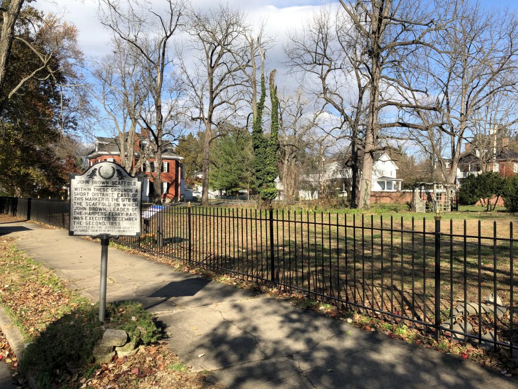
The spot where John Brown was executed for murder, inciting a slave insurrection, and treason against the State of Virginia is now located in someone’s yard in the middle of a Charlestown, WV neighborhood. During the Civil War, this part of Virginia would break off and rejoin the Union as a new State of West Virginia, but in 1859 there was still some slaveholding interest here.
It seems like the story is that this area was completely open at the time the gallows were constructed, but the local militia commander later built his house on this spot on purpose. Talk about holding a grudge! There is a nice wayside marker and roadside tablet here. Part of me wonders if having this infamous event happen in your yard increases or decreases your property value.
John Brown was executed here, in what is now someone’s yard in a typical suburban neighborhood. – Photo by the Author
Battle of Berryville – Civil War Battlefield #72
I found a marker for the Battle of Berryville just outside of the local elementary school. There has been a lot of construction in this area, so I wonder about the effect that had on the terrain. The roads and approaches seem to be mostly undisturbed, though. This was a fairly minor battle that set the stage for the Third Battle of Winchester.
The Confederates attacked and then retreated along this road, off in the direction of Winchester. – Photo by the Author
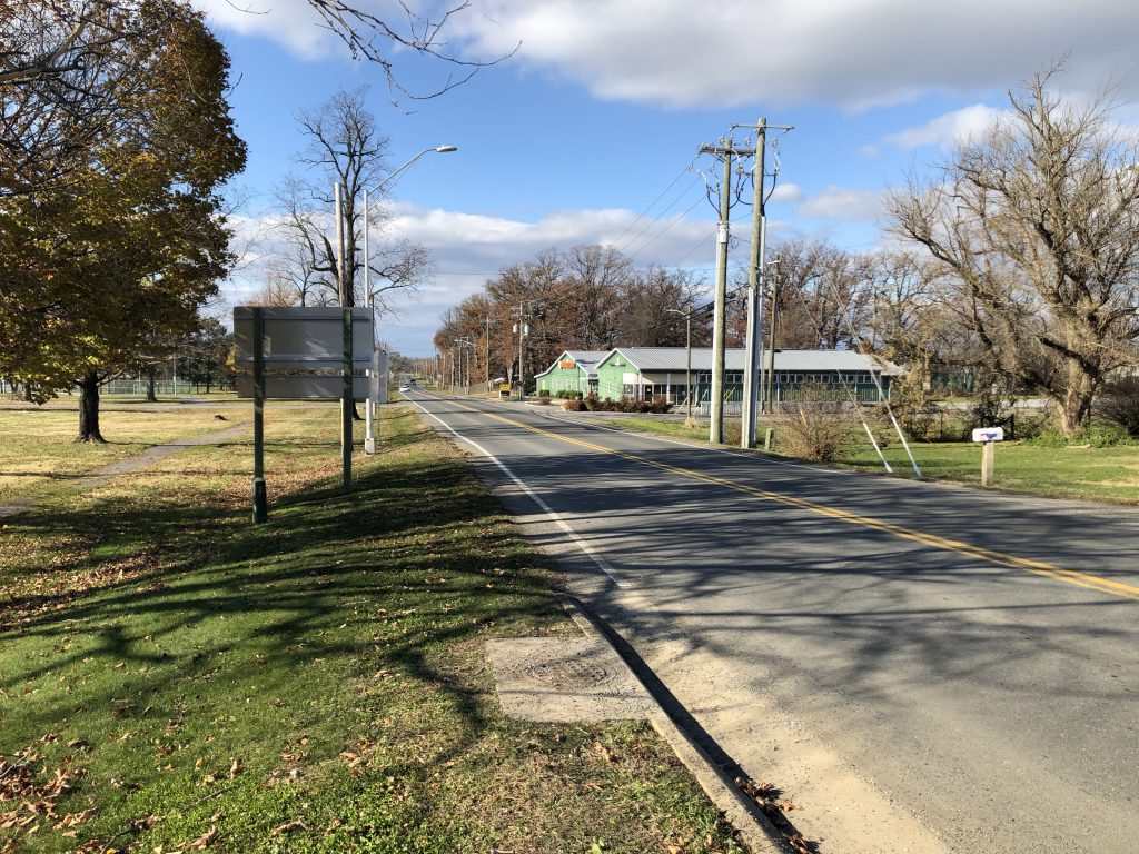
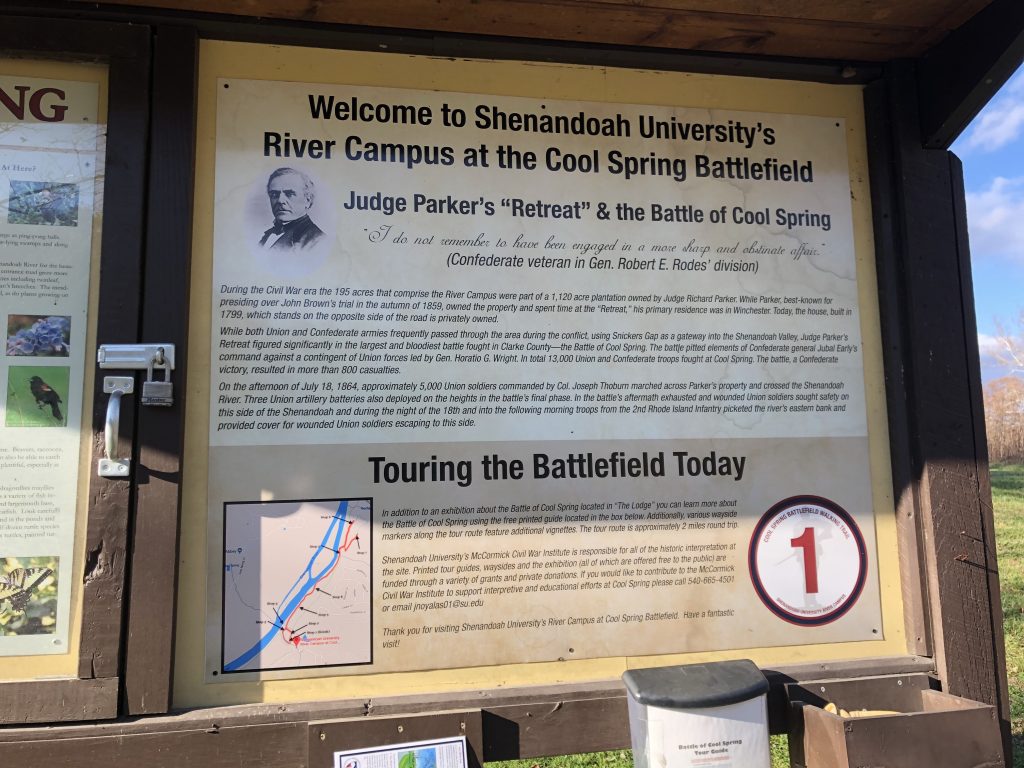
Battle of Cool Spring – Civil War Battlefield #73
Back in 2013, Shenandoah University took over ownership of the Union side of the battlefield (it was formerly a golf course) and they are doing their best to rehab it. They had a walking trail with some interpretive markers in place when I visited. Across the Shenandoah River – where the fighting actually happened – is also well-preserved, though not quite as accessible to the public, since that property is owned by the Holy Cross Abbey. I think that there are tours given in the springtime, so it may be worth another visit for that event.
Shenandoah University has really adopted the Cool Spring Battlefield. The walking tour they have laid out here is pretty good. – Photo by the Author
During the Civil War, the Shenandoah Valley was both the breadbasket of the Confederacy, as well as a key transportation corridor used by both sides for their respective invasions. There was almost constant conflict in the region for the duration of the war, and large areas destroyed in actions like “The Burning”. A few summers ago, I toured many of the battlefields in this very important theatre of the war.
Battle of McDowell – Civil War Battlefield #60
Approaching from the east (in the Harrisonburg area), I lost cell service as soon as I hit the mountains. Such is life in the National Radio Quiet Zone. There is a cool overlook on top of one of the ridges along Rt. 250 that talks about a Confederate fort and earthworks there under Gen. Edward “Allegheny” Johnson. Very nice views and a few interpretive markers.
The view really is lovely from the rest stop. – Photo by the Author
Just before the town of McDowell, the Civil War Trust has a small parking lot with markers showing the start of the trail they laid out on their property on Sitlington’s Hill. The signs mention a blueblaze trail, but I couldn’t find any blazes. Combined with the fact that it had just rained, was approaching dusk, and I had no cell phone service, I decided not to venture up the hill. The town was nice, though, and I was able to see the house that Stonewall Jackson used as a headquarters during the Battle of McDowell.
Battle of Cross Keys – Civil War Battlefield #61
A relatively small fight during Stonewall Jackson’s 1862 Shenandoah Valley campaign, Cross Keys is not far to the southeast from Harrisonburg. There’s a wayside marker – a series of them actually – near the cemetery on Battlefield Road. The terrain is very rolling. The Union line was more-or-less along modern Cross Keys Road, and the view to the southeast of the mountains was beautiful. The southern peak of Massanutten Mountain was clearly visible from here.
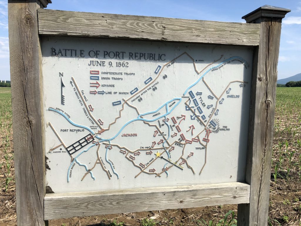
Battle of Port Republic – Civil War Battlefield #62
I love these metal map signs that can be found at several of the battlefields in the Shenandoah Valley. – Photo by the Author
Just after the Battle of Cross Keys, the action of Jackson’s Valley Campaign moved farther to the southeast at the Battle of Port Republic. Naturally, we continued there on our tour, too.
Initially, I had some trouble finding the battlefield itself. There is a set of markers near “The Coaling” east of town. The battle took place mainly between that spot and the town. The terrain was basically flat farm fields that are bordered on the north by the south branch of the Shenandoah River.
Battle of Piedmont – Civil War Battlefield #63
More rolling terrain at this battlefield. It is fairly difficult to get a sense for where the lines were. But there are a few markers, and one wayside in the parking lot of the local community center that includes a map.
Battle of Waynesboro – Civil War Battlefield #64
This battlefield – the site of the last fighting in the Shenandoah Valley – has been entirely overtaken by the modern development of the town. I found one marker on W. Main Street near the Masonic Lodge, but there are no waysides here, so there are no maps to orient you to where the action took place.
Battle of New Market – Civil War Battlefield #65
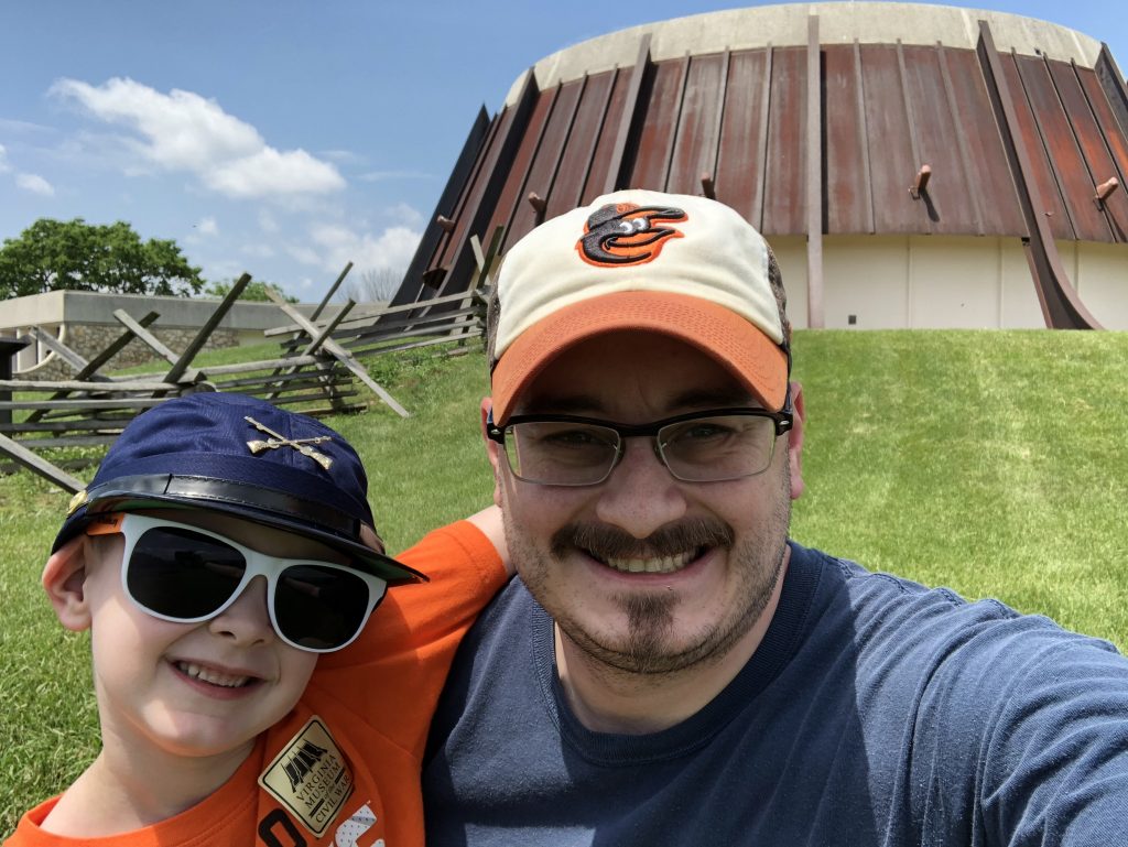
The VMI-run Virginia Museum of the Civil War was fairly sparse during our visit. I got the impression that they were in the midst of re-arranging the exhibits. It’s nice to see them involved at the battle where the most famous aspect is the charge of their cadets. There is a sizeable collection of small arms downstairs which is probably the main attraction. $10 admission seemed a little steep for what it is, though my son was free. He really wanted to get a hat, so I bought him a super-FARBy, cotton kepi with (*UGH*) crossed rifles in the gift shop. It’ll be a fun souvenir for him, nonetheless.
The field itself is small. There is a trail that takes you along the path of the VMI cadets’ attack, and a few reproduction artillery pieces. There’s also a spot where you can get a nice view of the north fork of the Shenandoah River.
My son and I at the Virginia Museum of the Civil War. He really wanted that hat. – Photo by the Author
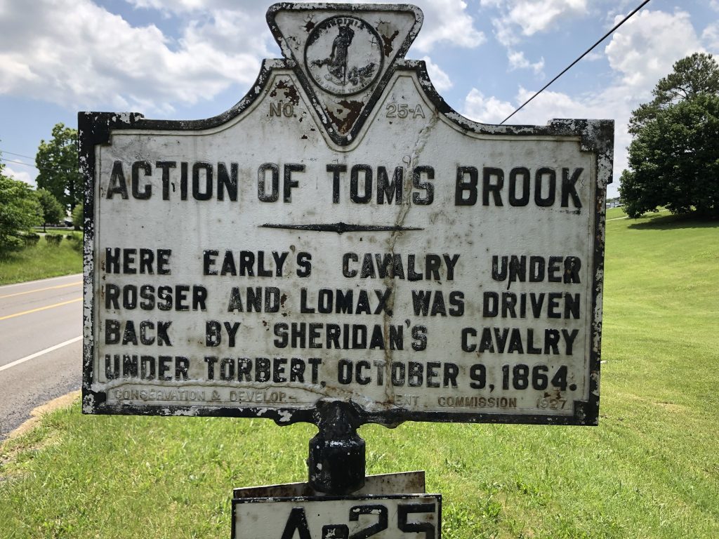
Battle of Tom’s Brook – Civil War Battlefield #66
You’ve gotta love a good roadside marker. – Photo by the Author
There’s a marker for the Battle of Tom’s Brook along Route 11 in the town where the action took place, and a nice wayside that is deep in the nearby Shenandoah County Park near a storm water pond. A large patch of woods there means that the Valley Pike can’t be viewed from the wayside, so it’s a little hard to really see and appreciate the terrain. Some imagination is required.
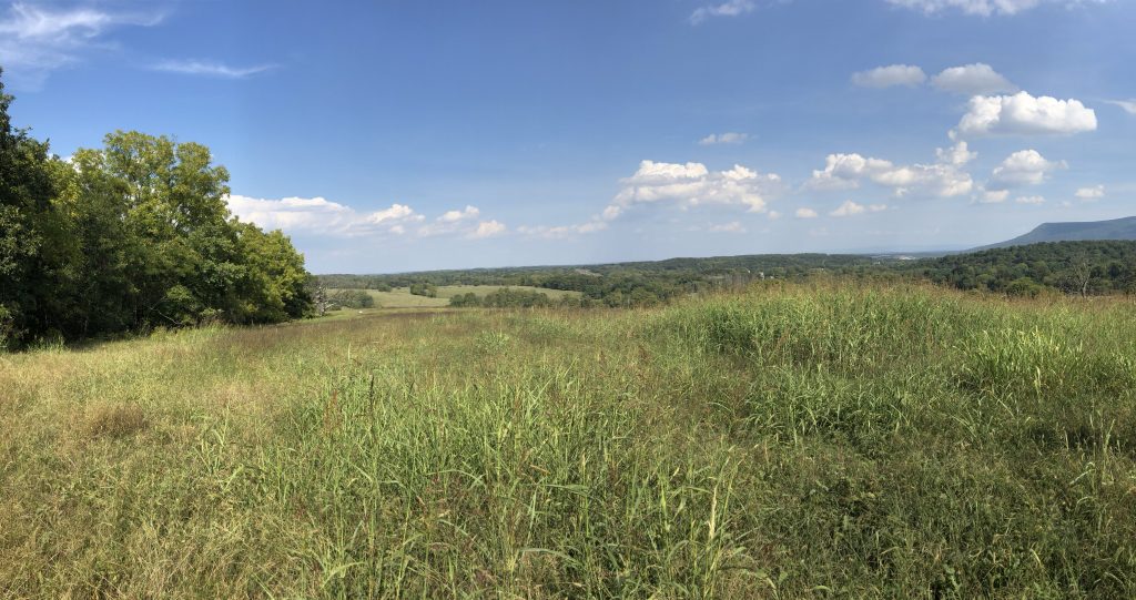
Battle of Fisher’s Hill – Civil War Battlefield #67
There are a few markers along Route 11, but that’s not all. A totally separate section of the battlefield – Ramseur’s Hill – has been preserved on the northwest side of I-81. There are a few waysides and a walking trail there. During my initial trip, I didn’t get out to explore too much, as my son was already pretty burned-out on battlefields for the day, but I was lucky enough to come back for a special tour that was given on the 155th anniversary of the Battle of Fisher’s Hill, and the views are amazing from the top of the hill.
From the top of Ramseur’s Hill looking roughly northeast. Another amazing vista. – Photo by the Author
When Virginia seceded at the start of the Civil War, it put the US Capitol right on the border with the rebel forces. There were immediate efforts to secure at least some portion of the southern shore of the Potomac river, and the Federal City became one of the most highly-fortified places in the world. There are still some remnants of those wartime earthworks, but you have to know where to look. Luckily, there is an NPS unit for that: The Civil War Defenses of Washington.
A couple years ago, I took a day trip through two of the more famous ones – mostly so that I could visit the site of the only Civil War battle to take place in the District of Columbia.
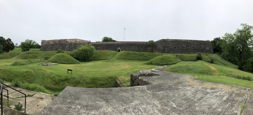
Fort Washington
Directly south of the city, in Maryland, this transitional second / third system fort was meant to defend against naval attacks coming up the Potomac river.
Fort Washington looms over the Potomac river. – Photo by the Author
The terrain here is a little steep (like the $10 NPS entrance fee), and combined with the fort itself makes for some impressive view sheds. The grounds are in good shape, and they are interpreted fairly well, but there was never any “action” here, so there’s no really story to grab visitors’ attention. In addition to the main fort, there are a few Endicott-era batteries, too.
The view upriver from the top of the fort. Note the Endicott batteries closer to the shoreline. – Photo by the Author
Being located within the DC suburbs, and without a clear “battle” story to tell, the fort seems to get used more as a general purpose park by locals. I noticed a few families on the grounds with picnic lunches during my visit.
Battle of Fort Stevens – Civil War Battlefield #59
The Battle of Fort Stevens is the only Civil War battle to take place in DC. In the years since the war, there has been a great expansion of the city, and what was once an open field that the Confederates attempted to attack across, is now a neighborhood with shops and even some taller buildings.
Only a small section of Fort Stevens has been preserved / reconstructed. Modern development continues. – Photo by the Author
What is here of the fort is largely a reconstruction with more durable materials. Where there were wooden pilings and gun platforms, there are now reproductions made of poured concrete. And because of the modern development that has taken place, only the western portion of the fort has been retained.
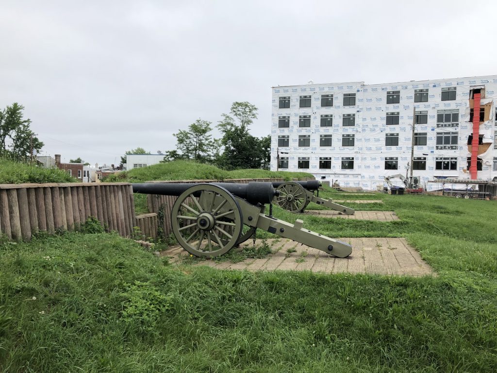
There are a few markers, and a pair of 30-Pounder Parrotts to represent the heavy artillery that once stood guard here, but the site doesn’t feel at all how it would have in 1864 when President Lincoln came under fire here.
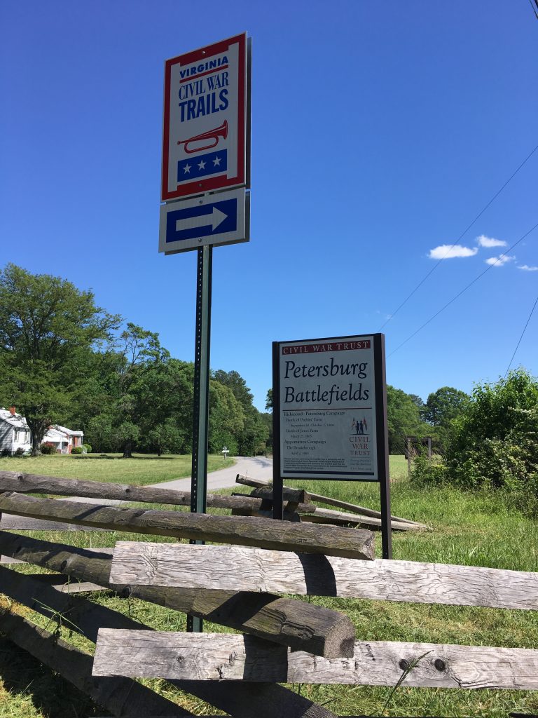
I’ve written before about a business trip I took to Raleigh, NC back in 2017. What I didn’t include in that post is the stops that I made on the way home to Maryland. I made the most of that travel day by visiting more than a dozen Civil War sites along the way from Raleigh to Petersburg. I packed a lot of adventure in to that day.
Bennett Place
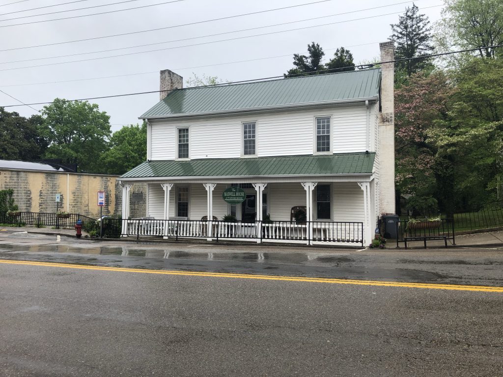
I left my hotel and headed over to the site of the largest Confederate surrender of the war – and the first that I’d ever visited. I arrived at around 10am. The retired lady working at the front desk was very personable and knowledgeable – we hit it off immediately. She showed my around the visitors center, started their orientation movie for me, and then gave me a tour of the grounds. It’s a pretty nicely-kept place. The house itself, while not the original (it burned in 1921) is an exact duplicate that was moved from a farm 4 miles away. I’m told that it’s a good example of a 19th century middle class southern homestead. Overall, it was a very cool experience.
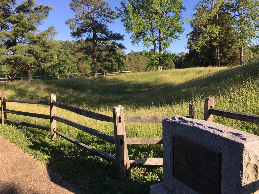
Battle of Dinwiddie Court House – Civil War Battlefield #42
After a couple hours in the car, I was ready to start the Petersburg area tour. The first stop that I made on the trip north was at this small battlefield that was basically just a precursor to the Battle of Five Forks. There are a few monuments and markers in front of the titular court house, but not much else.
Battle of Five Forks – Civil War Battlefield #43
This was a battlefield that I had been anticipating visiting for quite some time. Not only is this the place where Maj. General George Pickett’s Confederate division collapsed – forcing the rebels to abandon Petersburg – but Brig. General Joshua L. Chamberlain played a major role in the breakthrough as well.
The famous Five Forks intersection. – Photo by the Author
There is a satellite visitors center for Petersburg National Battlefield here, but it is quite small. The field itself is also small and frankly feels kind of barren. There are a couple monuments at the intersection, and a few waysides there and at the Confederate left flank to tell the story of the attack.
Battle of White Oak Road – Civil War Battlefield #44
Battle of Boydton Plank Road – Civil War Battlefield #45
Taking White Oak Road east, I arrived at the intersection with the old Boydton Plank Road – now modern US-1. This was the center of the fighting at the Battle of Boydton Plank Road. There is a roadside marker near the intersection, but I didn’t find much else.
Battle of Lewis’ Farm – Civil War Battlefield #46
Officially, this action is referred to as the Battle of Lewis’ Farm, but the roadside marker here calls it the “Quaker Road Engagement”. A lot of Civil War battles have at least two names, and it seems like they can get especially confusing around Petersburg. The field on the east side of the road seems to be well-preserved farmland, but there is 20th century housing on the west side. Brig. General Chamberlain received his final wound of the war here.
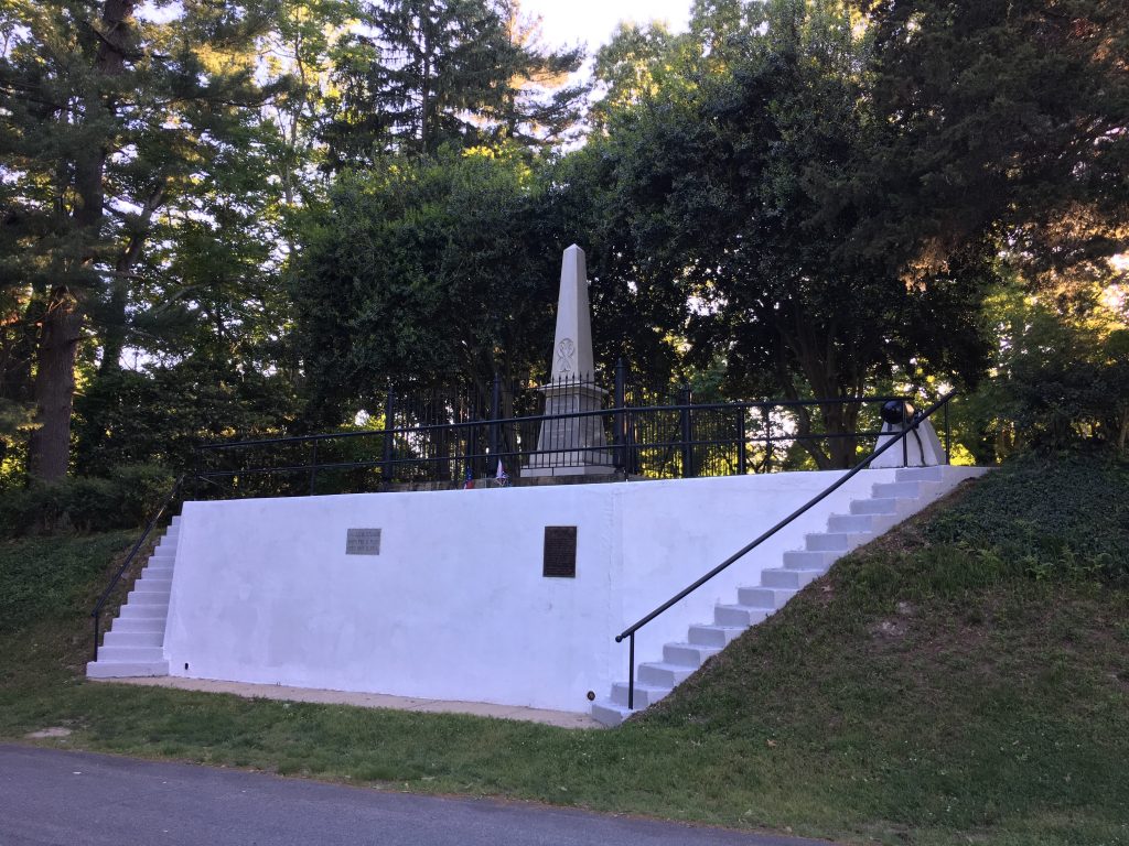
Third Battle of Petersburg – Civil War Battlefield #47
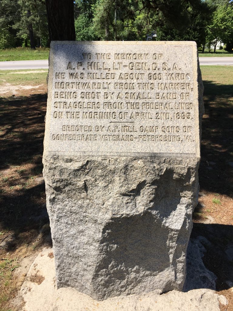
The final breakthrough of the Confederate line at Petersburg, the Third Battle of Petersburg was a full-blown disaster for the Confederates. Aside from the fact that the loss forced the abandonment of their entire Petersburg line, it also claimed the life of one of their senior corps commanders: Lt. General A.P. Hill.
This monument marks the spot where Lt. General Ambrose Powell Hill was killed during the Third Battle of Petersburg – just a week before General Lee surrendered at Appomattox. – Photo by the Author
Battle of Peebles’ Farm – Civil War Battlefield #48
The Civil War Trust has laid out an interpretive trail here at the Battle of Peebles’ Farm that leads up toward the Pamplin Historical Park property. I didn’t walk the full trail (nor visit Pamplin) on this trip, but I feel like both would be worth doing. There are a few waysides here to help explain the fighting.
Several pieces of the Petersburg battlefields have been saved by the Civil War Trust over the years. Signs like this one at Peebles’ Farm are frequently seen along the roads here. – Photo by the Author
Battle of Hatcher’s Run – Civil War Battlefield #49
Several hundred acres of the field at the Battle of Hatcher’s Run have been saved over the years by the Civil War Trust. They have a small parking lot and some wayside markers that provide a jumping-off point for a trail.
Battle of Globe Tavern – Civil War Battlefield #50
Part of the fight for the Weldon Railroad, there are some good waysides here at the Battle of Globe Tavern. Also, Fort Wadsworth was quite large, and pretty intact. This site is part of the regular tour route for Petersburg National Battlefield, so it may see slightly more visitation than some of the other sites I visited.
First Battle of Petersburg – Civil War Battlefield #51
Maj. General Benjamin Butler’s attempt to take Petersburg ended rather quickly in the summer of 1864. It would take a prolonged siege – and far more troops than Butler had on hand – to get the job done.
Battle of Jerusalem Plank Road – Civil War Battlefield #52
Petersburg National Battlefield: Eastern Front Section
My next stop was the really awesome Petersburg National Battlefield Visitors Center. It’s a really nice (if not a little dated) facility, with a nice array of artillery pieces out front. Highlights were a Wiard gun, a Whitworth, and a 30-Pounder Parrott. Inside the museum, there is lovely Revere Copper Co. Napoleon on display.
There is an impressive collection of artillery in front of the Eastern Front visitors center. – Photo by the Author
The “Battery 5” area behind the visitors center was also quite cool – most especially the site of the “Dictator” siege mortar that rests on a trail a short distance to the north.
After picking up a tour brochure, I started on the auto tour route, which goes along a one-way road headed south. Stop #3 – Confederate Battery #9 – was particularly interesting in the way that the park has it preserved and interpreted.
Battle of Fort Stedman – Civil War Battlefield #53
Within the Eastern Front section of Petersburg National Battlefield, the Battle of Fort Stedman is Stop 5 on the official auto tour. The fort itself is fairly well-preserved, and there is a trail over to where the Confederate position was. Only a few hundred yards separated the lines at this point. While Lee’s attack against this position met with initial success, the Confederates were forced back before noon. It would be the last purely offensive attack that Lee’s Army of Northern Virginia every made.
Second Battle of Petersburg – Civil War Battlefield #54
Lt. General Ulysses S. Grant had beaten Lee and the Army of Northern Virginia in the race to Petersburg, but there was still a small Confederate defense force that had turned back Butler’s attack about a week earlier. The Union assaults didn’t go off well, and the fortifications the rebels had built along the Dimmock line were substantial, so when Lee’s reinforcements arrived, the fight became futile. The Union failure to break the line here brought on the Siege of Petersburg.
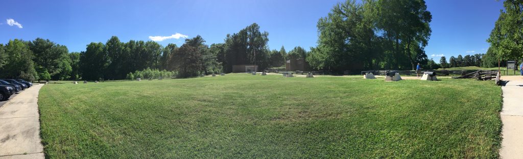
Battle of The Crater – Civil War Battlefield #55
At the southern end of the Eastern Front auto tour route is the highlight of Petersburg, in my opinion: The Battle of The Crater.
The remains of the Crater. – Photo by the Author
This was a very cool, bucket-list kind of experience. What is left of the crater today is much smaller than I had imagined. Once the battle was over, the area returned to being used as farmland, and over the years, the once-massive hole in the earth had been gradually filled in. The entrance to the mine has been re-created, and there are some cool waysides that explain the event for visitors. The biggest surprise to me was just how short the mine tunnel was. The Union and Confederate lines were VERY close to each other in this sector.
Battle of Yellow Tavern – Civil War Battlefield #56
My last stop as I headed home was north of Richmond. The Battle of Yellow Tavern is most famous as the place where the Confederate cavalry lost its most famous commander: James Ewell Brown Stuart.
This monument marks the spot where Maj. General J.E.B. Stuart was mortally wounded. He would die the day after the battle. – Photo by the Author
Today, the battlefield has been consumed by the modern US-1 / I-95 corridor. The original Yellow Tavern has been replaced by gas stations, restaurants, and some neighborhoods. Within one of those residential areas, Civil War nerds can find a monument marking the spot where J.E.B. Stuart was mortally wounded. He was taken to Richmond, died the next day, and was buried in Hollywood Cemetery.
Three years ago today, I took my boys on a day trip to Northern Virginia to check out some battlefields that we’d never seen before. It turned out to be a really cool experience and set many of our road trip traditions. Let’s dive in to the battlefields!
Battle of Aldie – Civil War Battlefield #34
One of the gaping holes in my list of battlefields had been the three cavalry actions that led up to the Battle of Gettysburg, so they were the fields I wanted to see most on this trip. Aldie was the first of these small battles, and I wrote a post about it a few years ago.
Aldie is a VERY small town. There is a cool-looking mill there, though it was closed when we visited. The fighting took place west of town, and there are markers and waysides there that do a good job of explaining the action.
Battle of Middleburg – Civil War Battlefield #35
The second of those closely-clustered, pre-Gettysburg cavalry engagements, the Battle of Middleburg has also been covered before on this blog.
The town itself is quite nice. In fact, it is the kind of place where you pass polo fields on the way in. The center of town has a few boutique-type shops and restaurants. It really seems like the kind of place that you could have as a destination with your significant other.
On the downside, I couldn’t find any signs discussing the battle action. It turns out of course that I just wasn’t looking in the right place. I’ll be making a return trip to the area one of these days.
Battle of Upperville – Civil War Battlefield #36
The third and largest of the cavalry engagements I wanted to see was the Battle of Upperville.
The fighting took place east of the town in a large, bowl-like area. It’s quite pretty there. The Goose Creek bridge is well-preserved and serves as the visual hallmark of the battlefield. A small park on Vineyard Hill has a wayside explaining the action and a great view.
Battle of Thoroughfare Gap – Civil War Battlefield #37
There is not much here – a few roadside markers sit beside State Route 55 near the Broad Run Post Office and across the highway from the Chapman’s Mill ruins.
Battle of Buckland Mills – Civil War Battlefield #38
Not much of the field for the Battle of Buckland Mills is accessible though the Civil War Trust bought up some land here. It appears to be in a decent state of preservation. A small portion of the mill town still exists as well.
There is a marker explaining the battle along a small road right off of US 15 / 29 near Manassas. George Armstrong Custer fought here, which seems to account for at least some interest among history buffs.
Battle of Bristoe Station – Civil War Battlefield #39
The largest and best-preserved of the fields I saw that day was for the Battle of Bristoe Station. This was one of those forgotten battles (along with Mine Run) that took place in the autumn after Gettysburg. This offensive movement by the Confederates resulted in a small Union victory.
A park has been created out of the preserved land and it appears to be well-used by the community. There is also an audio tour that can be followed from your cell phone, and it really helps to explain Bristoe Station and the other area actions that led up to it. Since that first trip, I’ve been back to Bristoe Station a couple times and it is always nice.